
Washington County Ohio Land for Sale
State Route 26, Marietta, OH | Lat/Lng: 39.5194, -81.2507
$300,000
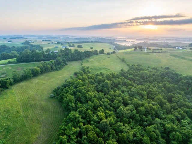
76 ac.
05/14/2026
ACTIVE

Description
Washington County Ohio Land for Sale
Call Buckeye Land Pro Tyler Haessly at 740-525-4582 to schedule your showing!
Land for Sale in Ohio
For Sale: 76 Acres, 0 State Route 26, Marietta, Ohio 45750
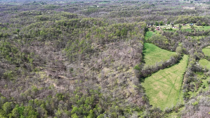
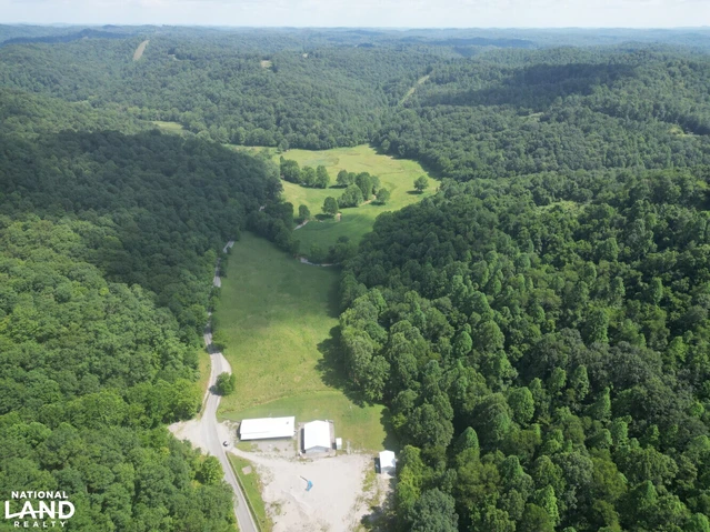
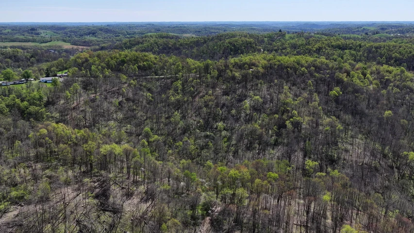
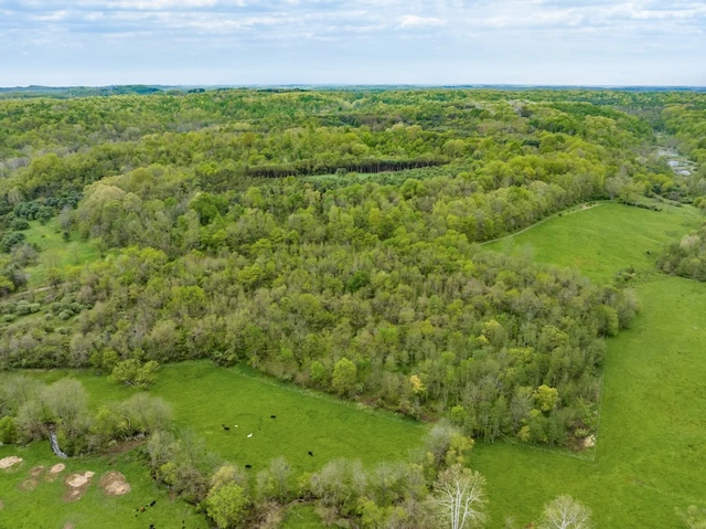
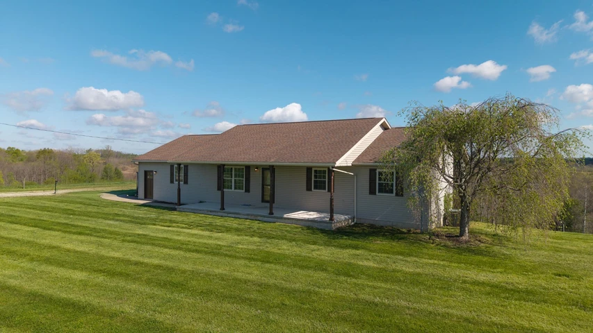
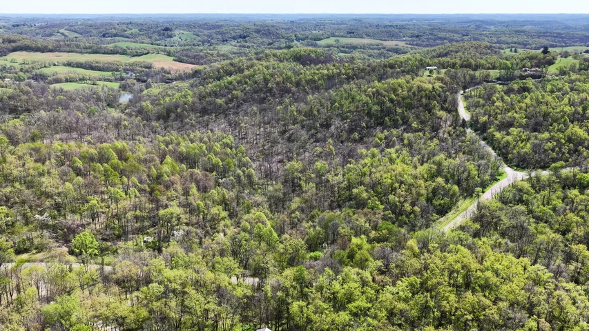
Call Ohio Land Pro Tyler Haessly today at 740-525-4582 for your own private showing. This 76-acre tract in Washington County, Ohio sits directly on the boundary of Wayne National Forest, Ohios only national forest, and what that means for a serious buyer is simple: you are purchasing a private base camp with hundreds of thousands of acres of undisturbed public hunting ground as your permanent backyard. The property runs along State Route 26 in the heart of the Marietta Unit, with paved road frontage giving you clean, reliable access every season of the year. Marietta, the county seat and oldest settlement in the Northwest Territory, is just 20 minutes south on SR 26, putting full services, Marietta Memorial Hospital, hardware, and farm supply within a short drive. From Columbus, Pittsburgh, or Parkersburg, you are looking at no more than 2.5 to 3 hours to your gate. The hunting infrastructure on this ground is already in place and operational. Established food plots run through the flat bench areas, giving deer a destination they return to daily. Blinds and stands are positioned throughout the property, and a network of cut trail systems connects the ridges and creek bottoms so you can access every part of this ground quietly and efficiently. Wayne National Forest deer and turkey bed in the public timber and push through these food plots and travel corridors every single day of the season, from the opener through the late season. You are not hunting 76 acres when you own this property. You are working the private edge of an ecosystem with no ceiling on public-land backing and no neighbors putting pressure on the animals from behind you. When your hunt is done and you want to build, this ground is ready for that too. Electric is available at the road, city water service is available, and the flat benches that anchor the food plots also represent the most buildable terrain on the property. Put your cabin or home exactly where you want it, with a food plot in front of you and national forest stretching out behind you. That combination does not exist at most properties in southeast Ohio at any price. After opening morning or a day on the water, the Muskingum River is only 20 minutes south for bass, saugeye, and catfish, and the Little Muskingum River, which flows directly through the Wayne National Forest corridor along SR 26, is 15 minutes from your door for paddling and fishing. Wayne National Forest trail systems give you riding and hiking access across the entire Marietta Unit, making this property a hub for every outdoor pursuit this region offers. Properties on the Wayne National Forest boundary with this combination of hunting infrastructure, building-ready utilities, and paved access do not reach the market on a regular basis. Give Ohio Land Pro Tyler Haessly a call today at 740-525-4582 for more details about this exceptional property and to schedule your private tour.
Ohio Land for Sale Details:
76 acres total (4 parcels)
Wayne National Forest boundary (Marietta Unit, SR 26 Covered Bridge Scenic Byway)
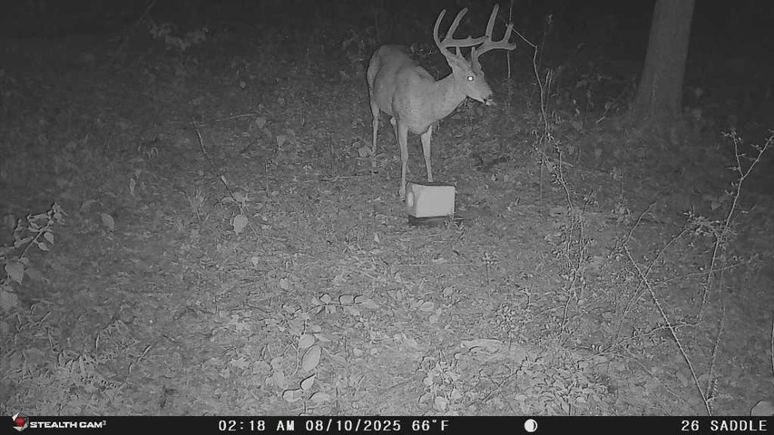
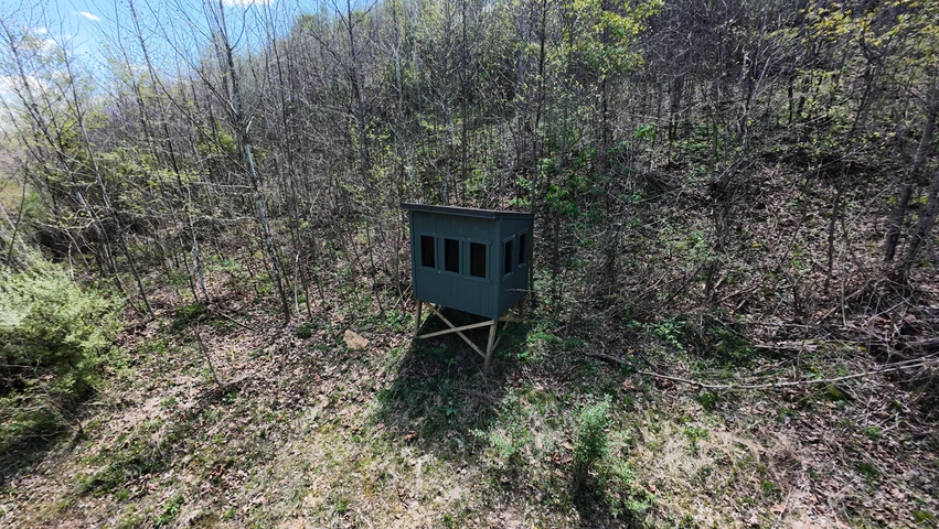
Established food plots on interior flat bench areas
Blinds and stands in place throughout the property
Interior trail systems cut for access to ridges and creek bottoms
Creek/drainage corridor through the property
Electric available at road; city water available
Paved State Route 26 road frontage
Parcel #s: 21006958400, 220071453000, 170063491000, 170062692000
Township: Range 7, Township 4, Section 1 (Washington County)
School district: TBD
Coordinates: 39.5194, -81.25075
Annual taxes: $108.24 (primary parcel; TBD for additional parcels)
Local Attractions:
Wayne National Forest, Marietta Unit (SR 26 Covered Bridge Scenic Byway): on property boundary, 64,000+ acres of public hunting, hiking, and fishing
Little Muskingum River (Wayne NF): 15 min, paddling and fishing
Muskingum River / Muskingum River State Park: 20 min south, bass/saugeye/catfish, public boat launches
AEP ReCreation Land (Appalachian Hills Wildlife Area): 45 min, 30,000 acres public hunting with permit
Blue Rock State Park, Blue Rock, OH: 50 min, reservoir fishing and camping
Burr Oak State Park, Glouster, OH: 65 min, lodge, Appalachian-feel reservoir with hiking trails
Showings STRICTLY by appointment only
Licensed Agent MUST be present for all showings
All information deemed reliable but not guaranteed
Listing Agent:
Name: Tyler Haessly Phone: 740-525-4582
Details
County: Washington
Zipcode: 45750
Property Type One: Recreational Property
Property Type Two: Residential Property
Property Type Three: Hunting Land
Brokerage: Buckeye Land Sales
Brokerage Link: www.buckeyelandsales.com

Buckeye Sales
Buckeye Land Sales
(866) 341-5263
By clicking the button, you agree to our Terms of Use and Privacy Policy.


Nearby Listings
Guernsey County, OH

$1,100,000 - 71 ac.
Muskingum County, OH
$219,000 - 19 ac.
Belmont County, OH
$140,000 - 23 ac.
Doddridge County, WV
No Price - 9974 ac.
Belmont County, OH
$275,000 - 53 ac.
Muskingum County, OH
$849,999 - 139 ac.
Morgan County, OH
$1,275,000 - 150 ac.
Belmont County, OH
$99,900 - 16 ac.
Morgan County, OH
$925,000 - 225 ac.
Athens County, OH
$700,000 - 7 ac.