
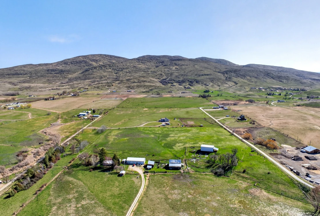
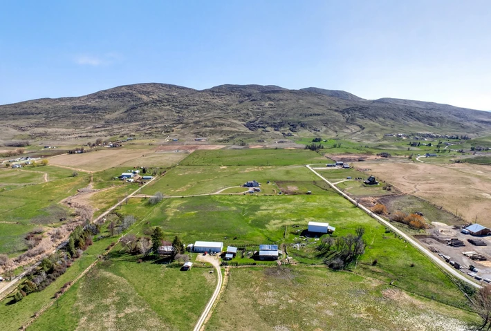
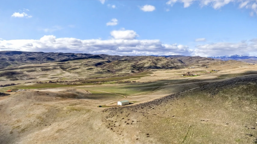
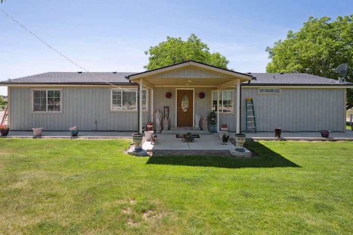
Sweet, ID – 11.65 acres of Opportunity
TBD Sweet Ola Highway, Sweet, ID | Lat/Lng: 43.9676, -116.3254
$400,000
11.65 ac.
03/24/2026
ACTIVE
Description
Enjoy peaceful rural country living on 11.65 acres with a potential building permit, pending Gem County approval of the ag lot split in progress. This spacious property features a hay barn ideal for agricultural use or storage.
Land
Level acreage with water rights provides open space, wide views, and flexibility for a future homesite, livestock, or small-scale farming, with plenty of room to create your ideal rural setup.
Improvements
An existing hay barn adds practical infrastructure, offering covered space for equipment, feed, or seasonal needs.
Recreation
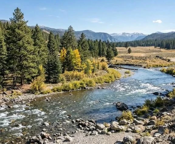
The Sweet, Idaho area and its surrounding countryside offer a wealth of outdoor recreation, from ATV riding, off-road adventures, and snowmobiling in the winter to family-friendly parks, playgrounds, and sports fields in nearby communities, along with abundant opportunities for hunting deer, elk, turkey, and upland game across the rural landscape. This region is ideal for those who enjoy quiet, rural outdoor recreation, with quick access to rivers, reservoirs, forests, and open land for water activities and all types of outdoor adventures, making it perfect for both adventurous outdoor enthusiasts and families alike.
Nearby outdoor and recreational areas:
Payette River Fishing, whitewater rafting, kayaking, and tubing; popular for trout and smallmouth bass
Boise National Forest Hiking, camping, and hunting
Black Canyon Reservoir Boating, swimming, and picnicking; scenic spot for summer outings
Cascade Reservoir (further northeast) Fishing, boating, and camping
Region & Climate
The area around Sweet, Idaho has a semi-arid, high-desert climate with hot, dry summers (often in the upper 80s90F range) and cold winters with occasional snow, while spring brings the most rain and fall stays mild and dry; overall, it gets relatively little precipitation and plenty of sunshine, so the weather feels mostly dry year-round with noticeable seasonal temperature swings.
History
Sweet, Idaho and the surrounding area began as seasonal land used by the Shoshone and Northern Paiute before settlers arrived in the mid-1800s, drawn by the nearby Payette River and open grazing land; while nearby Pearl, Idaho briefly boomed during the gold rush, Sweet itself developed as a stable ranching and farming community, a character it has maintained into the present day, remaining a quiet, sparsely populated rural area supported by agriculture and closely tied to small service towns like Emmett, Idaho and Horseshoe Bend, Idaho.
Location
The property is located in Sweet, Idaho, a quiet rural area in Gem County approximately 10 miles northeast of Emmett, Idaho, surrounded by open countryside and agricultural land; while it offers privacy and a remote setting, it remains within reasonable driving distance of larger communities including Star, Eagle, Boise, and Nampa (all roughly 3045 miles away) for shopping, healthcare, and services, with the nearest major airport being Boise Airport, providing convenient regional and national travel access.
Details
County: Gem
Zipcode: 83670
Property Type One: Residential Property
Property Type Two: Undeveloped Land
Brokerage: Hayden Outdoors Real Estate
Brokerage Link: https://www.haydenoutdoors.com/agents/austin-callison/

Austin Callison
Hayden Outdoors Real Estate
(208) 870-1757
By clicking the button, you agree to our Terms of Use and Privacy Policy.


Nearby Listings
Boise County, ID
$3,500 - 20 ac.
Washington County, ID

$7,950,000 - 4079 ac.
Gem County, ID

$2,300,000 - 48 ac.
Washington County, ID
$1,395,000 - 381 ac.
Canyon County, ID

$22,500,000 - 450 ac.
Boise County, ID

$4,980,000 - 858 ac.
Gem County, ID

$2,245,000 - 480 ac.
Canyon County, ID
$950,000 - 5 ac.
Ada County, ID

$2,400,000 - 10 ac.
Ada County, ID
$4,180,000 - 3 ac.