

Napoleon Point Hunting Club
Highway 10, Watson, AR | Lat/Lng: 33.8007, -91.1654
$899,000
2525 ac.
08/08/2026
ACTIVE
Description
1 of 12 shares offered for equity-ownership in Napoleon Point Hunting Club.
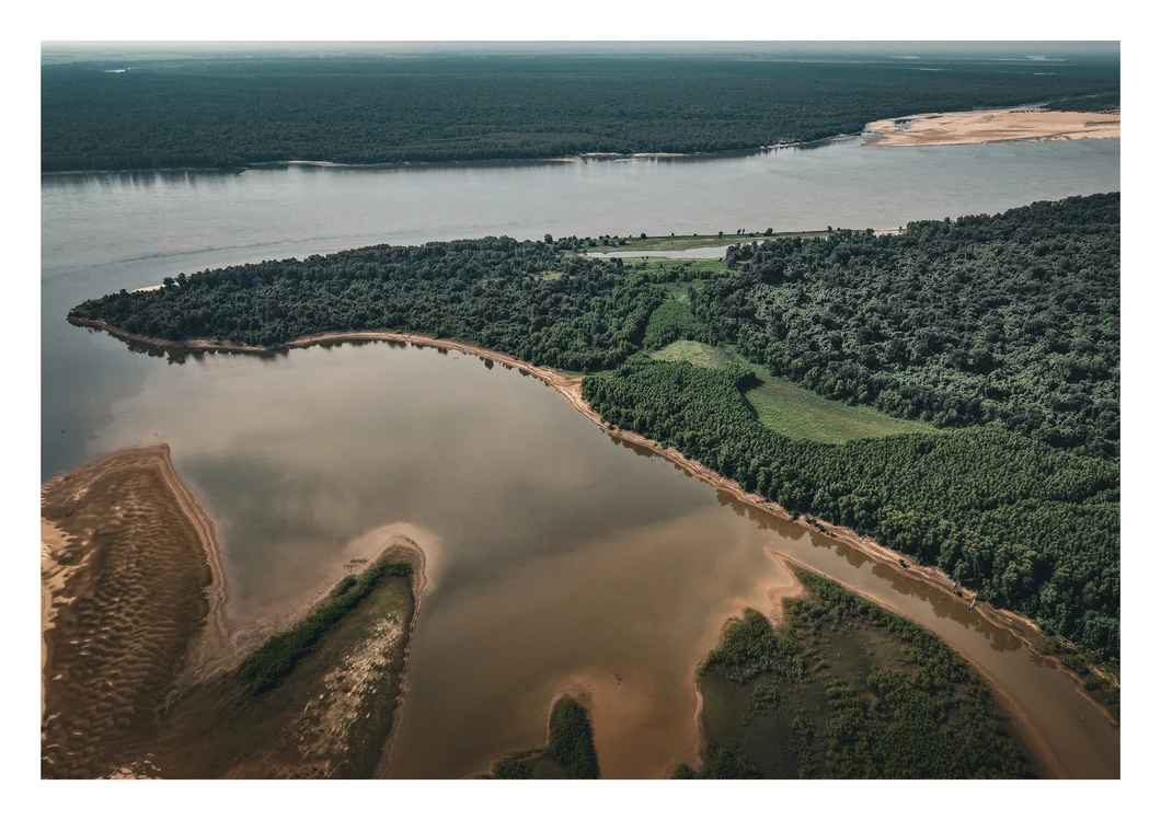
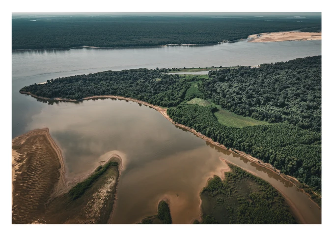
Napoleon Point Hunting Club is a place in the Delta Region, inside the Mississippi River Levee, in southeast Arkansas where the Arkansas River finishes a journey of more than 1,400 miles out of the Colorado Rockies and gives itself over to the Mississippi. This is deep country and one of only a handful of spots in North America where two great rivers become one.
For the better part of the twentieth century, this country belonged to Anderson-Tully — the storied Memphis timber company that, since the 1890s, built its name on the great bottomland hardwood forests along the Mississippi River. Anderson-Tully didn’t just harvest timber here; the company managed it, protected it, and in doing so preserved one of the last truly intact wild landscapes left in the Mississippi Delta. Napoleon Point’s 2,525 acres is part of an expansive timberland tract, previously known as The Conservation League, a long-standing, organized hunting club, which leased the land from Anderson-Tully.
Land like this doesn’t exist in isolation — it exists in the company it keeps. Napoleon Point sits shoulder to shoulder with some of the most storied and exclusive hunting clubs in the Mississippi River corridor: Big Island, Yancopin, Ozark, Catfish Point, Caulk Island, and Merigold — names whispered with reverence among serious sportsmen across the Delta and region. Together with these neighbors, Napoleon Point is anchored by three miles of Arkansas River on the eastern boundary and joined to a wild landscape of more than 25,000 contiguous acres of managed timber and hunting land, an unbroken corridor of habitat few properties anywhere in the country can claim as a next-door neighbor.
The whitetails here are legendary, built on generations of genetics, nutrition, and careful management that produce genuine trophy deer, year after year. Here wild turkey are abundant with gobblers strutting in the big timber and food plots each spring. The ground sits beneath the great funnel of the Mississippi Flyway, where each fall and winter mallards, gadwall, wood ducks, teal, and other duck species follow the White, Arkansas, and Mississippi Rivers to feed and rest in the areas river-bottom sloughs, oxbow lakes, and surrounding crop fields.
EQUITY-OWNERSHIP OPPORTUNITY - SHARES and DUES
• 1 of 12 shares offered for purchase
• Share offered for $899,000
• Annual dues are $6,250 per share
LOCATION - INSIDE THE MISSISSIPPI RIVER LEVEE
• Desha County, Arkansas
• 5828 Great River Road, Watson, AR 71674
• 33.80066° N, 91.16541° W
LAND DESCRIPTION - ACREAGE and WATER FEATURES
• 2,525 +/- Total Acres
2,357+/- in Timberland
60 +/- in Wildlife Food Plots
60 +/- in Wetland Units
36 +/- in Roads and Trails
12 +/- in Building Sites and Lots
• 3 miles of Arkansas River Frontage
• 1.25 miles of Ozark Lake Frontage
• 1 mile of Callie Lake Frontage
• 2 wetland units improved for water control to provide duck hunting habitat
TROPHY WHITETAIL DEER HUNTING
• Excellent population with proven hunter success history
• 26 premium Muddy® elevated box hunting blinds
• Members draw for hunting stands per each hunt
• 26 managed wildlife food plots (60 +/- total acres)
• Managed under DMAP suggested protocols
WILD TURKEY HUNTING
• Excellent population with proven hunter success history
• Excellent nesting habitat throughout property
• Hunting opportunities on a diverse bottomland landscape of big timberland, road corridors, and wildlife food plots
DUCK HUNTING
• 2 wetland units comrpised mainly of cypress, willows, and aquatic vegetation total roughly 60 acres are in development to provide stable duck hunting habitat
• Duck hunting is available on Ozark Lake and Callie Lake
• Depending on water levels the property can offer between 150 and 250 acres of duck hunting habitat
FISHING
• Ozark Lake, Callie Lake, Arkansas River and Mississippi River offer a variety of fishing opportunities for bass, crappie, catfish, and bream
ACCESS
• Private and gated access off the Mississippi River levee
• Over 25 miles of outstanding road and trail system throughout the property
BUILDINGS and CABIN SITES
• Structural improvements include a cooking pavilion, storage building, and shop facility with meeting room, bathroom, walk-in cooler, and area organized to process game
• Each ownership share includes a lot on Lake Ozark for custom cabin construction
EQUIPMENT
• 2 tractors and implements including bush-hogs, discs, seeders, and other equipment
Details
County: Desha
Zipcode: 71674
Property Type One: Recreational Property
Property Type Two: Hunting Land
Property Type Three: Riverfront Property
Brokerage: Myers Cobb Realtors
Brokerage Link: myerscobbrealtors.com/land-for-sale

Chuck Myers
Myers Cobb Realtors
(901) 830-5836
By clicking the button, you agree to our Terms of Use and Privacy Policy.


Nearby Listings
Coahoma County, MS
$445,450 - 78 ac.
Desha County, AR
$1,350,000 - 213 ac.
Washington County, MS

$535,000 - 66 ac.
Bolivar County, MS

$415,000 - 7700 ac.
Arkansas County, AR
$675,000 - 134 ac.
Desha County, AR

$873,875 - 345 ac.
Drew County, AR

$541,400 - 169 ac.
Desha County, AR
$1,100,000 - 149 ac.
Drew County, AR

$4,200,000 - 502 ac.
Sunflower County, MS
$465,000 - 15 ac.