

Coastal Development Investment
Full Stringer Ct, Port O'Connor, TX | Lat/Lng: 28.4284, -96.4481
$6,870,000
41 ac.
07/07/2026
ACTIVE
Description
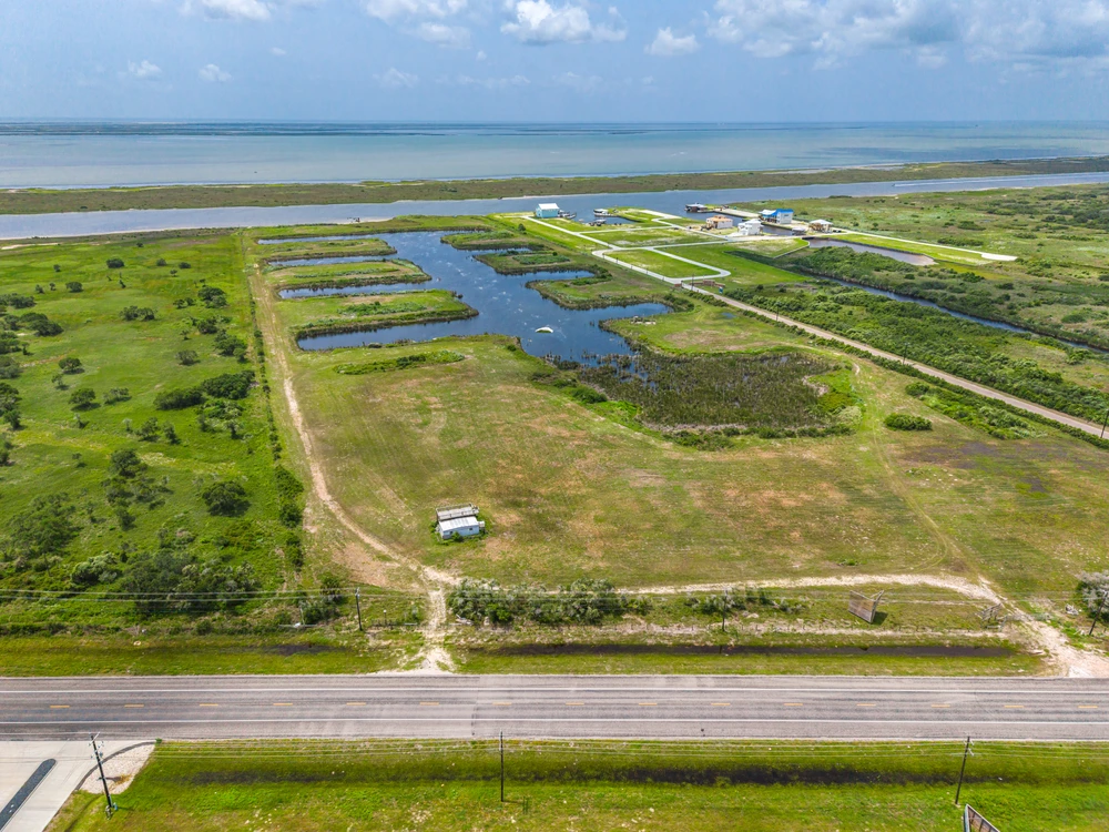
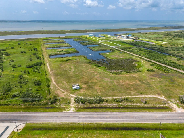
This offering represents a rare opportunity to develop a large-scale marina and waterfront destination in one of the most supply-constrained coastal markets on the Texas coast. With a defined site plan, completed engineering, and federal permits already secured, the project is positioned for immediate execution by an investor or development group. Ideally situated within the city limits of Port O’Connor, Texas, the property benefits from access to municipal utilities and public infrastructure while offering immediate connectivity to Highway 185 and the Gulf Intracoastal Waterway, providing exceptional accessibility by both land and water. Unlike many coastal development sites, the property's location within the city limits eliminates many of the infrastructure challenges commonly associated with large-scale waterfront projects.
Development Overview:
The project encompasses more than 40 acres planned for a fully integrated marina and waterfront development. The master plan supports a cohesive mixed-use destination centered around marine access and long-term coastal demand, featuring:
-A marina basin with organized piers and slip systems
-Internal roadways and structured lot layouts
-Dedicated areas for marina operations, storage, and support services
-Flexibility for future commercial, hospitality, or residential components
The scale and configuration of the property allows for the creation of a true destination asset rather than a smaller, fragmented marina project.
Permitting & Entitlements:
One of the project's most significant advantages is the extensive permitting already in place. The property includes a U.S. Army Corps of Engineers permit authorizing:
-Marina basin construction
-Dredging and excavation activities
-Bulkhead and shoreline improvements
-Direct connectivity to the Gulf Intracoastal Waterway
These approvals materially reduce entitlement risk and significantly shorten the timeline to construction, addressing one of the largest challenges associated with coastal development.
Engineering & Infrastructure:
Substantial engineering and pre-development planning have already been completed, creating a clear path toward construction and operation. Completed work includes:
-Bulkhead and canal engineering with established elevations and cross-sections
-Detailed dredging plans for marina basin development
-Engineered pier and slip layouts designed for efficient marina operations
-Utility planning and infrastructure routing, with access to municipal utilities and public infrastructure already available within the City of Port O'Connor
This level of preparation, combined with existing city utility access, reduces development uncertainty and allows an investor to focus on execution rather than early-stage planning, infrastructure installation, and design.
Environmental & Mitigation:
Environmental considerations have been proactively addressed through a comprehensive mitigation strategy associated with the development. This includes:
-Approved shoreline and habitat mitigation plans
-Integration with surrounding coastal systems and the GIWW
-Defined construction and environmental monitoring procedures
From an investment perspective, these measures remove a substantial layer of uncertainty commonly associated with waterfront projects.
Market Opportunity:
Port O'Connor continues to stand out as one of the strongest and most consistent coastal markets in Texas, supported by:
-Direct access to offshore fishing and the Gulf Intracoastal Waterway
-Immediate access to Highway 185, providing efficient connectivity to Victoria and the broader Texas Gulf Coast
-Access to municipal utilities and public services within the Port O'Connor city limits
-A loyal base of repeat boaters and seasonal visitors
-Limited availability of modern marina infrastructure
Demand for secure boat storage, slips, and marina-related services continues to exceed existing supply, creating a compelling long-term market opportunity.
Investment Profile:
The development supports multiple potential revenue streams, including:
-Marina slips and operational income
-Dry storage and stack storage facilities
-Marine service, retail, and hospitality uses
-Residential or short-term rental development opportunities
The site plan also supports phased development, allowing for the potential generation of early revenue while future phases are completed over time.
Strategic Positioning:
Opportunities of this scale with completed planning, engineering, and federal permitting are exceptionally limited along the Texas coast. This offering combines:
-An approved marina layout
-Federal permits already secured
-Advanced engineering and infrastructure planning
-Access to municipal utilities, Highway 185, and the Gulf Intracoastal Waterway
-Strong underlying coastal market demand
Buyer shall independently verify all information contained in this write-up and any attached materials. Seller and Broker make no representations or warranties, express or implied, as to the accuracy or completeness of the information provided.
Details
County: Calhoun
Zipcode: 77982
Property Type One: Beachfront Property
Property Type Two: Waterfront Property
Brokerage: Republic Ranches, LLC
Brokerage Link: www.RepublicRanches.com

Republic LLC
Republic Ranches, LLC
(888) 726-2481
By clicking the button, you agree to our Terms of Use and Privacy Policy.


Nearby Listings
Calhoun County, TX

$99,900 - 1 ac.
Calhoun County, TX

$1,600,000 - 199 ac.
Victoria County, TX
$92,500 - 10 ac.
Calhoun County, TX
$3,800,000 - 1089 ac.
Jackson County, TX
$16,900 - 0 ac.
Refugio County, TX

$2,399,999 - 220 ac.
Calhoun County, TX
$499,000 - 0 ac.
Calhoun County, TX

$938,100 - 159 ac.
Matagorda County, TX

$625,000 - 6 ac.
Jackson County, TX
$1,975,000 - 250 ac.