
The Tipton Ranch
TBD CR 279, Breckenridge, TX | Lat/Lng: 32.9018, -99.0557
$898,265
146 ac.
09/10/2025
ACTIVE

Description
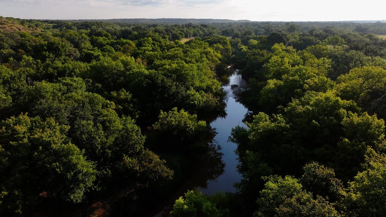
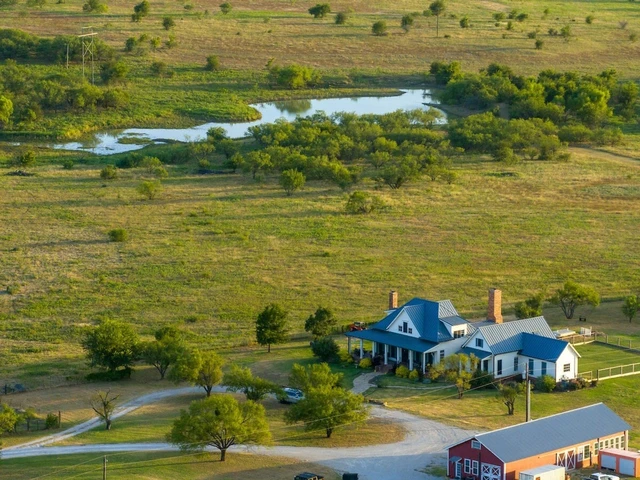
The Tipton Ranch spans approximately 146 acres in the highly sought-after far northwest corner of Stephens County, Texas, nestled along the scenic Clear Fork River. This remarkable property offers a distinctive blend of features that cater to various interests. It is divided by a county road, resulting in two distinct sections.
The northern side is characterized by level terrain, cultivated land, and beautiful riverfront access, while the southern section boasts deep draws, mature trees, and a diverse range of elevations. At the heart of the ranch lies a well-sized cultivated field currently thriving with Johnson grass, which holds significant potential for transformation into a stunning display of sunflowers and winter wheat. A second field is located in the northeast corner, which, though currently showing signs of mesquite regrowth, can be revitalized according to the new owner's specifications. An old house dating back to the 1940s stands just off the river, reflecting the property's rich history. While the home may no longer be salvageable, its timber could be repurposed to create a new cabin that honors its legacy. This area is serviced with electricity and features an old water well with a windmill, enhancing its rustic charm.
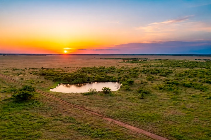
The Clear Fork River defines the northern boundary of the ranch, featuring steep banks behind the home, yet providing a small shoal on the western border for convenient access to the water. This river is renowned for its fishing opportunities and offers a delightful setting for family gatherings, enhanced by abundant local wildlife, including turkeys. This landscape is adorned with majestic elm and pecan trees, contributing to one of the most picturesque vistas in the county. The Tipton Ranch's southern portion offers a contrasting allure, characterized by rugged elevations along the western boundary and bottomland fringed by a deep draw featuring large, shady live oak trees. As one approaches the southern end of the Tipton Ranch, the terrain levels off into a bull mesquite plateau, rich with dense native grasses. Although there are no existing ponds on the property, the deep draw traversing its length presents an excellent opportunity for a new owner to consider constructing a pond in this prime location. The Tipton Ranch is a unique property, making it an excellent choice for any outdoor enthusiast looking for a diverse and captivating landscape.
AGENT COMMENTS: As an enthusiastic outdoorsman from the area, I can confidently say this property is truly special for Stephens County. Management-minded landowners surround the Tipton Ranch, and the fishing along the Clear Fork is exceptional. There are a few crucial items to note: approximately 7,180 feet of new fencing needs to be constructed along the western boundary line. Additionally, while the old home may be unappealing to some, the pricing fairly reflects these considerations.
-- IMPROVEMENTS --
Roads ~ Two tract dirt roads and ATV trails through the property
Fences ~ 1 pasture; east & south fencing is in good condition; fence along the eastern boundary (+/- 7,180 ft) and along the county road does not exist
Electricity ~ Electricity pole to the old home
Water well~ There is an old water well by the home; condition unknown; water wells in the area
-- WATER, COVER & TERRAIN --
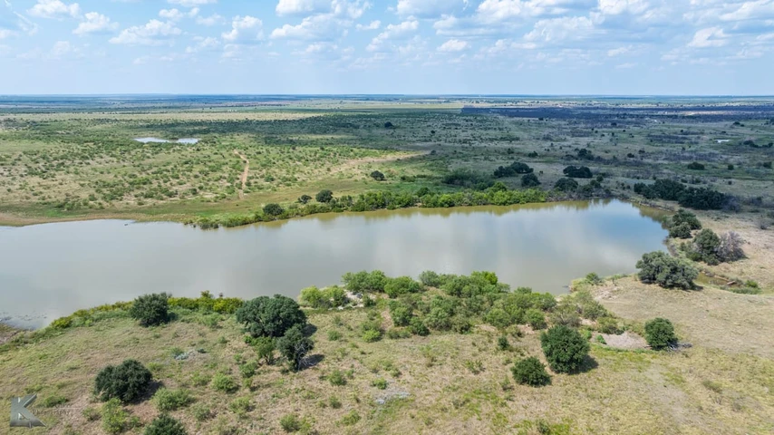
Surface Water ~ 903 ft of Clear Fork River frontage; deep draw through the middle of the property
Water Wells ~ Neighbors on both sides have water wells by the river
Tree Cover ~ Bull Mesquite, Live Oak, Elm, Ash, Juniper, Pecan
Underbrush ~ Heavy underbrush; Elbowbush, Skunkbush Sumac, Bumelia
Elevation ~ 50 ft of elevation; 1,190 ft at the highest point and 1,140 ft at the lowest point
Grasses ~ Native grass; Side-Oak Grama, Little Bluestem, Winter Rye
Grazing ~ Currently being gazed, but with no cattle lease; capacity one animal to 28 acres
-- HUNTING & RECREATION --
Wildlife ~ Whitetail Deer, duck, dove, hogs, turkey, varmint
Hunting Pressure ~ Great neighbors; Low hunting pressure
Blinds & Feeders ~ No blinds or feeders on the property
Land ~ Heavy wooded; several deep draws, steep elevation
Native Grasses ~ Thick stands, excellent bedding, ideal seeds for wildlife
Cultivation ~ +/- 20 acres cultivation; currently in Johnson Grass
Soil ~ Clearfork Silty Loam, Truce Fine Sandy Loam, Thruber Clay Loam, Bonti-Exray-Truce Complex
-- MINERALS & WIND --
Mineral Rights ~ No owned Oil & Gas minerals will convey
O&G Production ~ No active production; 1 - 2" Natural Gas Pipeline on north side; 1 - 3" Natural Gas Pipeline on south side; Targa Midstream Services
Wind Rights ~ 100% wind rights convey
Wind Production ~ No windmill farms in sight
-- ACCESS & DISTANCES --
Road Frontage ~ +/- 968 ft of CR 279 frontage; 2.8 miles west of HWY 183
Nearby Towns ~ 7 miles S of Woodson, 14 miles NW of Breckenridge
Major Cities ~ 99 miles W of Fort Worth, 52 miles E of Abilene, 188 miles E of Midland
Airports ~ 16 miles N or Stephens County Airport, 115 miles W of DFW
Listing Agent: Travis Patterson 254-246-5266
Details
County: Stephens
Zipcode: 76424
Property Type One: Ranches
Property Type Two: Recreational Property
Property Type Three: Hunting Land
Brokerage: Campbell Farm & Ranch
Brokerage Link: www.CFRLand.com
Apn: R17187

Travis Patterson
Campbell Farm & Ranch
(254) 246-5266
By clicking the button, you agree to our Terms of Use and Privacy Policy.


Nearby Listings
Palo Pinto County, TX

$49,985,000 - 5888 ac.
Palo Pinto County, TX

$18,395,000 - 736 ac.
Young County, TX
$128,100 - 10 ac.
Stephens County, TX

$1,850,000 - 160 ac.
Throckmorton County, TX
$6,036,800 - 1232 ac.
Young County, TX
$795,000 - 46 ac.
Stephens County, TX

$180,000 - 21 ac.
Young County, TX
$1,850,000 - 162 ac.
Young County, TX

$595,000 - 3 ac.
Stephens County, TX
$9,900,000 - 1065 ac.