

579.9±Ac Of High Yield Farmland With Irrigation For Cotton, Soybeans, Corn,
PC 326 and 300, Helena, AR | Lat/Lng: 34.5246, -90.6751
$4,349,550
579.9 ac.
09/03/2026
ACTIVE
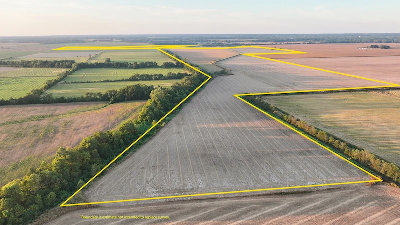
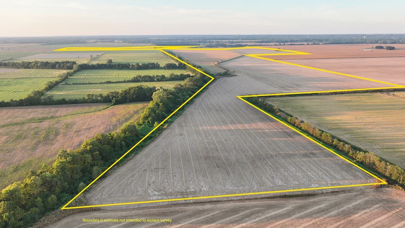
Description
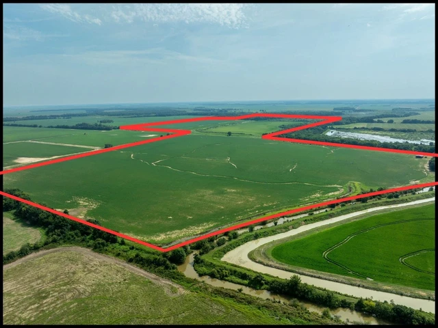
Highly rated soils and extensive irrigation highlight this +/-579.9-acre multi-crop farm. This farm combines extremely high-quality soils (NCCPI Avg: 79/100), extensive irrigation, leveled acreage, effective surface drainage, and convenient access to multiple crop delivery points, with an excellent basis history. Currently, the farm is leased by an experienced tenant who has made substantial improvements to its agricultural infrastructure and keeps it in great working order. For buyers seeking irrigated farmland in the Delta, it is nearly impossible to improve on this farm. The farms soil profile is one of its greatest strengths- and is something that cannot be fabricated. The best farmland contains soils with particle-size distributions that support consistent production of multiple crops by providing strong internal drainage and nutrient-carrying capacity. Soils rated above 70 are rare in Eastern Arkansas, but not here. This farm averages nearly 80 on the NCCPI scale and is capable of growing a multitude of crops, such as corn, cotton, soybeans, peanuts, and rice, across different areas of the farm. Irrigation is a key to high and consistent yields in the Delta. The farm includes +/- 463 irrigated acres, powered by 8 wells. A center pivot services 90 acres, while the balance is irrigated using furrows or flood irrigation on leveled land. Irrigation provides consistent yields in dry weather and is essential for earning top returns from farmland investments in the mid-south. Leveled acreage improves both irrigation efficiency and field management. Leveling allows water to move more evenly across a field, can reduce irrigation time, and supports more consistent crop production. Together, the leveled acreage, pivot, and wells maximize the return from this farms amazing soils. This farms location helps maximize its income. Close to multiple delivery points located on the Mississippi River, delivering commodities from the field to locations with some of the Mid Souths best basis (the difference in cash and futures prices) is easy. Multiple delivery points are within 10 miles of the property, giving the operator delivery options and pricing strength. Combine all these factors together and the grower and owner can maximize the sales price of their crops. Surface drainage further supports the farms productive capacity. Effective drainage helps reduce standing water, improves field access, and protects crops during periods of heavy rainfall. The property benefits from established field drainage and maintained drainage infrastructure designed to move surface water efficiently. This drainage complements the farms soils and irrigation system, strengthening its overall agricultural utility. Quality road access supports efficient farm operations. Internal road networks and access to public roads ensure dependable access for farm equipment, input deliveries, crop removal, and routine field management. The farm also features a +/-1,064 sq. ft. home with a +/-3,600 sq. ft. shop. The home is currently under a lease agreement and can provide additional income to the new owner. The shop is well-kept and roomy for equipment repairs, storage, or additional revenue if leased. An experienced farmer currently operates the property under a lease extending for at least two additional years. The existing arrangement provides continuity of management while preserving time for a purchaser to plan for future operations. The tenant has also made substantial improvements to the property that will become the landowners property at the end of the current lease term, subject to the lease terms. Buyers should review the complete lease and improvement provisions during due diligence. This approximately 579.9-acre farm for sale in Phillips County, Arkansas, deserves consideration from agricultural operators and investors looking for productive soils, irrigation, leveled acreage, good drainage, market access, and an established tenant relationship. Contact the listing agent for additional property information, farm maps, and lease details. All acreages, cultivated acreage, irrigated acreage, leveled acreage, frontage, distances, boundaries, soil information, infrastructure locations, and other measurements are estimates and should be independently verified by the buyer. Crop yields and future agricultural performance are not guaranteed. The buyer should independently review and verify the farm lease, ownership and transfer of tenant improvements, water rights, well capacity, irrigation systems, drainage, road access, utilities, wetlands, floodplain, septic suitability, zoning, development potential, commercial use, estate use, and subdivision potential with the appropriate regulatory authorities and qualified professionals. Property is shown by appointment only.
Details
County: Phillips
Zipcode: 72342
Property Type One: Farms
Brokerage: Whitetail Properties Real Estate
Brokerage Link: https://www.whitetailproperties.com/agents/bernie-crowley

Bernie Crowley
Whitetail Properties Real Estate
(870) 338-0407
By clicking the button, you agree to our Terms of Use and Privacy Policy.


Nearby Listings
Quitman County, MS
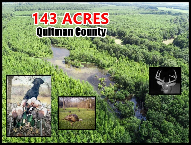
$779,000 - 143 ac.
Monroe County, AR
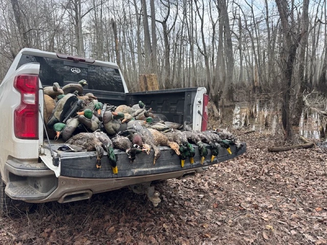
$1,175,000 - 233 ac.
Coahoma County, MS
$445,450 - 78 ac.
Phillips County, AR

$3,000,000 - 50 ac.
St. Francis County, AR
$1,495,979 - 217 ac.
Phillips County, AR
$685,000 - 160 ac.
Monroe County, AR

$7,500,000 - 715 ac.
St. Francis County, AR

$1,200,000 - 160 ac.
Coahoma County, MS
$11,550,000 - 193 ac.
St. Francis County, AR
$2,941,500 - 370 ac.