
26 Acres in the La Sal Mountains in San Juan County, UT
La Sal, UT | Lat/Lng: 38.4761, -109.2074
$384,000
26 ac.
08/11/2025
ACTIVE

Description
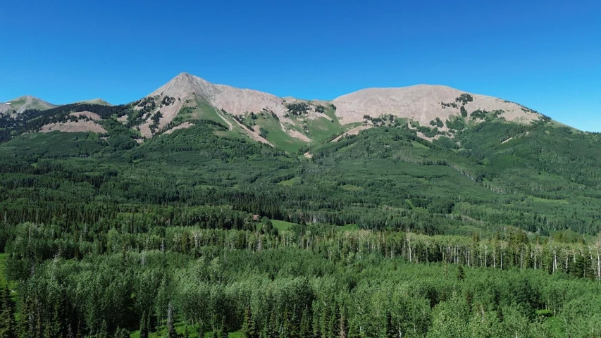
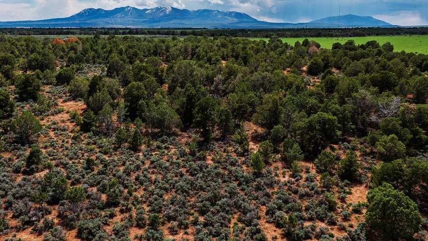
Imagine owning 26 acres of pristine alpine wilderness perched at nearly 10,000 feet in Utahs La Sal Mountainsjust 200 yards from the serene waters of Blue Lake, tucked within the vast expanse of MantiLa Sal National Forest. Here, mountain air is crisp, views stretch to horizon-tipping peaks, and solitude feels like a handcrafted invitation to breathe deeper.
Trailheads such as Geyser Pass, Squaw Spring, and Clark Lake sketch your path to adventure. Whether your calling is high-country fly fishing, alpine hiking, silent snowshoe treks, or stargazing beneath endless mountain skies, every moment unfolds with cinematic grandeur.
This land comes alive with creative possibility: imagine a remote cabin, a cluster of cozy yurts or tiny homes, or perhaps the states most unforgettable high-alpine campsite for friends, family, or guided escape. A subdivision plan into four parcels is already in motionperfect for co-ownership, future investment, or crafting a private family compound.
Access is ruggedly poetic: navigate from Moab via La Sal Loop Road, climb through Geyser Pass and Blue Lake Road, then plot your arrival with GPS, OnX Maps, County GIS tools, or satellite overlays. Plan thoughtfully; this high-alpine terrain demands preparedness and respect.
Taxes are as light as the mountain breezejust $6.23/yearmaking this not just a purchase, but a lasting stewardship of one of Utahs most majestic landscapes.
PROPERTY DETAILS
Acreage: 26.24
County: San Juan
State: Utah
Parcel ID: 27S25E072400 and 27S25E072401
Google Maps: Click here
Zoning: The San Juan County UT has new Zoning Districts Implemented. Right now the county havent decided if the specific property will be classified as AG District or Rural Recreational Support District.
Land Use / Zoning Summary: AG District / Rural Recreational Support District.
Access Notes:
- Use GPS coordinates to access. From Moab, head through the Spanish Valley to La Sal Loop Rd to Geyser Pass to Blue Lake Rd. That will take you onto the property.
- Youll pass famous trailheads such as Squaw Spring and Clark Lake Trailheads.
- From La Sal, youll take Hwy 46 to La Sal Pass that turns into Two Mile Rd. (youll pass La Sal Creek Trailhead) and head up to Dark Canyon Lake Rd and then youll veer off to Blue Lake Rd and that will take you onto the property.
LOCATION DETAILS
Center Coordinates: 38.4766911825683, -109.207302777092
Details
County: San Juan
Zipcode: 84530
Property Type One: Recreational Property
Property Type Two: Residential Property
Property Type Three: Hunting Land
Brokerage: Wilco Land
Brokerage Link: wilcolandllc.com
Apn: 27S25E072400

Miles McLaughlin
Wilco Land
(605) 299-5553
By clicking the button, you agree to our Terms of Use and Privacy Policy.


Nearby Listings
Mesa County, CO
$8,845,000 - 1954 ac.
Mesa County, CO

$3,840,000 - 640 ac.
Mesa County, CO

$960,000 - 160 ac.
Mesa County, CO

$45,000,000 - 1056 ac.
Mesa County, CO

$19,000,000 - 5794 ac.
San Juan County, UT

$120,000 - 145 ac.
Mesa County, CO

$7,500,000 - 937 ac.
Mesa County, CO
$2,280,000 - 520 ac.
Mesa County, CO
$1,760,000 - 440 ac.
San Juan County, UT
$1,587,740 - 1445 ac.