
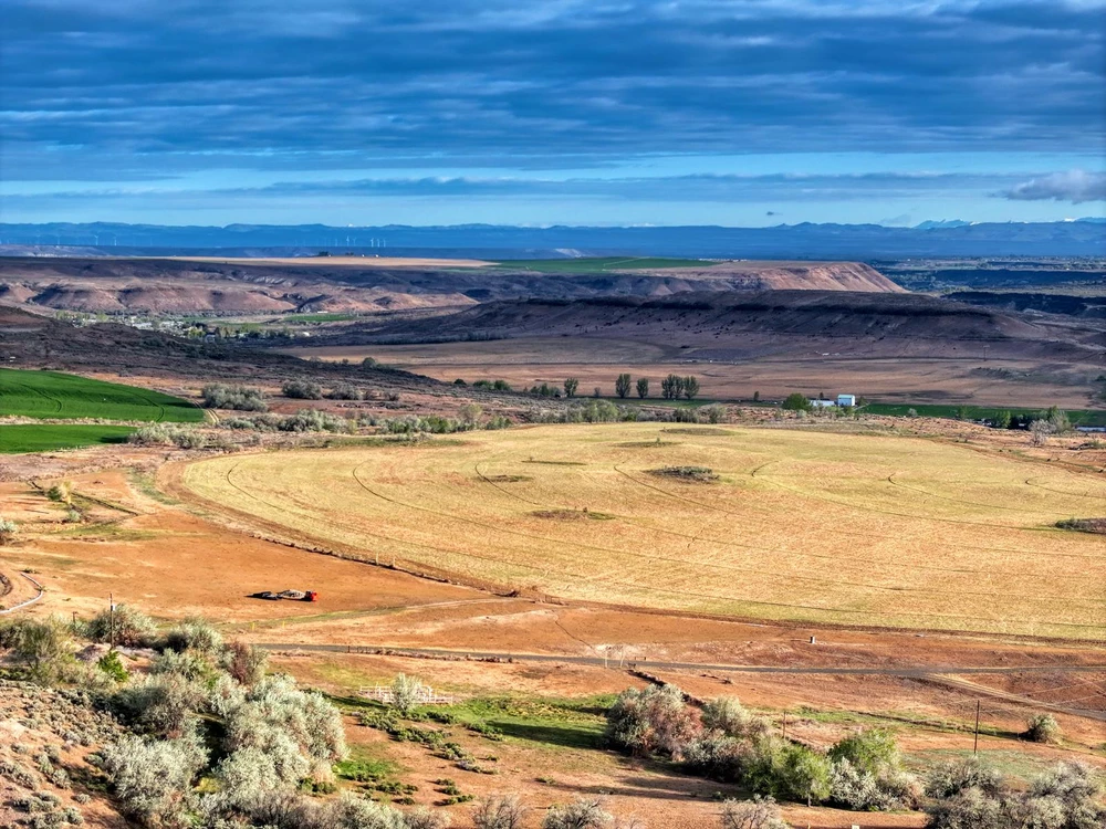
Hagerman Valley Ranch
Hagerman, ID | Lat/Lng: 42.6731, -114.8337
$3,750,000
335 ac.
05/07/2026
ACTIVE

Description
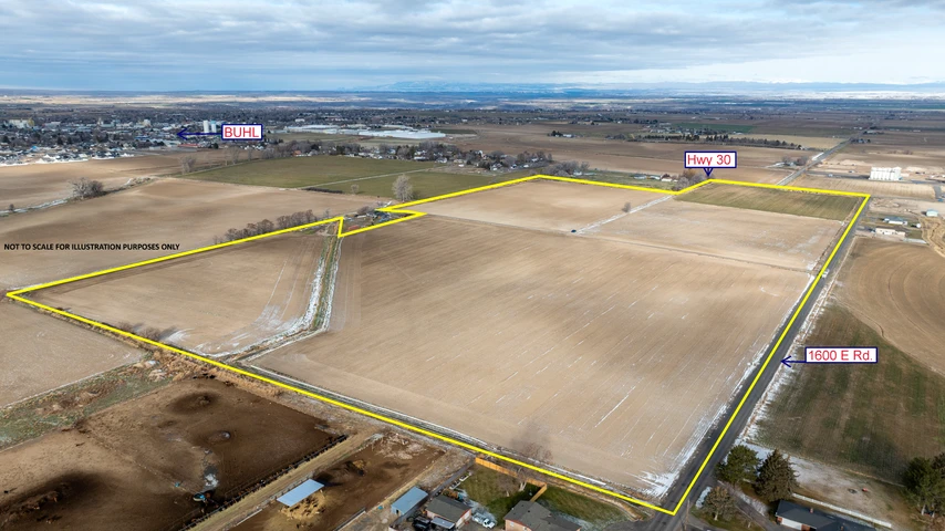
Perched above the famed Snake River in Idahos Hagerman Valley, Hagerman Valley Ranch is a 335-acre property that blends irrigated production ground with rugged canyon draws, ponds, and open views. The Ranch offers immediate enjoyment as a private river-corridor retreat, plus excellent upside to create an exceptional waterfowl property in the Hagerman Zone. With existing irrigation infrastructure, a domestic well, multiple potential building sites, and a Rural Residential zoning component along the canyon rim, the property provides flexibility for recreation, legacy ownership, and future development, subject to county approvals.
The Land
The total acreage is 335 acres across four tax parcels. The property includes a mix of irrigated and tillable ground, pasture, brushy draws, and natural drainage features that feed into the Snake River canyon environment. This diverse layout supports both agricultural use and high-quality wildlife habitat. The property adjoins an additional landlocked 40 acre BLM parcel with brushy draws and creek beds (not included in the sale).
Improvements
The property is thoughtfully improved with a Zimmatic 7-tower center pivot supported by an electric irrigation pump, along with hand-line irrigation for pasture areas. A drilled domestic well and multiple power access points add to the functionality and ease of use. The Ranch is fully fenced with additional cross fencing in place and features a dedicated livestock handling facility. A small stone outbuilding offers a practical space for storage or gathering, while private road access ensures a quiet, secluded setting with highway access.
LOCATION:
Twin Falls County, ID
Highway 30 frontage between Hagerman & Buhl
A 35-minute drive to Twin Falls and Magic Valley Regional Airport
One hour and thirty minutes to Boise, Idaho
ACREAGE:
335 acres across four tax parcels
Mix of irrigated ground, pasture, and canyon draws
Ponds and natural drainage feeding into Snake River canyon
Diverse terrain supporting agriculture and wildlife habitat
The property adjoins an additional landlocked +40 acre BLM parcel
Elevation: ~3,020 up to ~3,270
IMPROVEMENTS:
Zimmatic 7-tower center pivot with electric pump
Hand-line irrigation for pasture
Drilled domestic well and multiple power locations
Fully fenced with cross fencing and livestock handling facility
Stone outbuilding for storage or gathering
Private road access for seclusion
RECREATION & WILDLIFE:
Strong habitat for deer, waterfowl, upland birds, quail, and dove
Strong foundation for waterfowl hunting and habitat improvements
Details
County: Gooding
Zipcode: 83332
Property Type One: Ranches
Property Type Two: Recreational Property
Property Type Three: Hunting Land
Brokerage: Live Water Properties
Brokerage Link: www.livewaterproperties.com

Live Properties
Live Water Properties
(866) 230-2695
By clicking the button, you agree to our Terms of Use and Privacy Policy.


Nearby Listings
Gooding County, ID

$7,650,000 - 530 ac.
Twin Falls County, ID

$395,000 - 24 ac.
Twin Falls County, ID
$247,000 - 40 ac.
Twin Falls County, ID

$650,000 - 1 ac.
Twin Falls County, ID
$1,299,000 - 6 ac.
Gooding County, ID

$150,000 - 0 ac.
Jerome County, ID
$450,000 - 0 ac.
Lincoln County, ID

$1,400,000 - 40 ac.
Twin Falls County, ID
$1,680,000 - 75 ac.
Jerome County, ID

$316,899 - 1 ac.