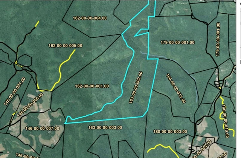
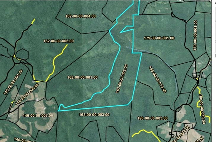
336.5± Acres – McCreary County, Kentucky
Barnett Ridge Road, Sawyer, KY | Lat/Lng: 36.9099, -84.3642
$450,000
336.5 ac.
10/09/2025
ACTIVE
Description
Timber Investment • Hunting Retreat • Development Potential
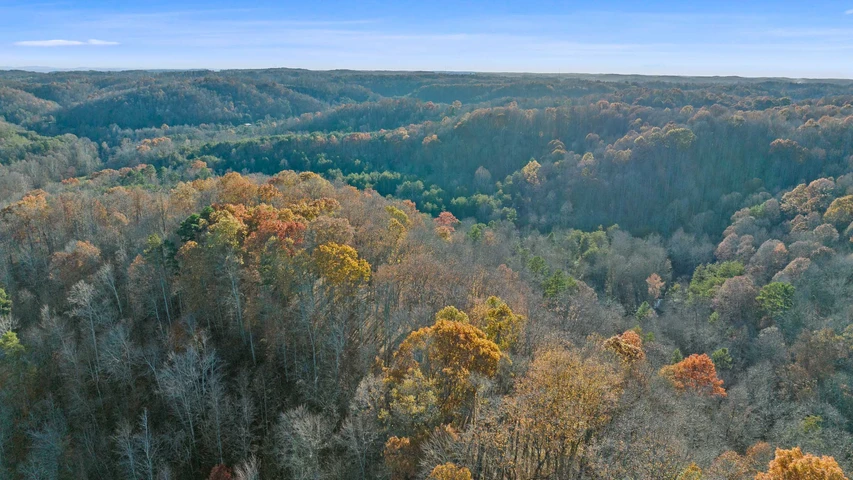
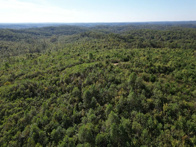
This impressive 336.5-acre timber tract lies deep in the heart of McCreary County, Kentucky, surrounded by the stunning scenery of the Daniel Boone National Forest. With Mill Creek flowing north to south through the property and Cumberland Falls State Resort Park just minutes away, this land combines valuable timber resources, seclusion, and recreational beauty—a rare opportunity for investors, outdoor enthusiasts, or developers.
Timber & Natural Features
A healthy stand of mature hardwood and softwood species covers the landscape, including white oak, hemlock, virgin pine, red oak, and maple, among others. Over half of the timber has had many years’ growth with the remainder being harvested in 2015. The property, creates both immediate harvest value and long-term investment potential. Rolling hills, ridges, and wooded hollows provide an ideal environment for deer, turkey, and small game, while clear running Mill Creek, which flows directly from the Cumberland River, adds water access and natural appeal.
Access & Location
- Access from the east via moderate, navigable terrain.
- A Forest Service “special use” permit is available for long-term access over adjacent public road easements.
- USFS Road 5250 (Barnet Ridge Road) lies nearby and can be located on public maps. Beyond the Forest Service road terminus, the tract is reached by a short hike or open-track ATV route (approx. 1,900 feet).
- Conveniently located about 25 miles from Burnside, 35 miles from Corbin, and less than 45 minutes from Somerset, KY.
- Surrounded primarily by federal forest lands, offering unmatched privacy and wilderness seclusion.
Potential Uses
- Timber Harvest & Long-Term Investment – High-value species with marketable volume.
- Private Hunting or Recreational Retreat – Excellent habitat, water features, and terrain variety.
- Development or Subdivision Potential – Ideal for eco-retreats, cabins, or off-grid living.
- Conservation or Legacy Holding – Land bordering the Daniel Boone National Forest rarely comes available at this scale.
Nearby Highlights
- Cumberland Falls, known for its world-famous moonbow, is only a short drive away.
- Easy access to hiking, kayaking, fishing, ATV trails, and other outdoor recreation throughout the region.
- Located along the Kentucky–Tennessee border, within reach of I-75 and major Kentucky cities.
Additional Information
All boundary lines, acreage, and timber data are believed accurate but not guaranteed. Prospective buyers are encouraged to conduct their own due diligence. Maps, aerials, and timber cruise reports are available.
Details
County: McCreary
Zipcode: 42634
Property Type One: Recreational Property
Property Type Two: Timberland
Property Type Three: Hunting Land
Brokerage: Land.com
Brokerage Link: https://land.com
Apn: 163-00-00-002.00


Nearby Listings
Fentress County, TN

$4,667,000 - 933 ac.
Campbell County, TN

$16,250,000 - 8128 ac.
Campbell County, TN

$8,225,000 - 4115 ac.
Scott County, TN

$1,950,000 - 1272 ac.
Scott County, TN

$1,340,938 - 813 ac.
Laurel County, KY
$855,000 - 285 ac.
Campbell County, TN

$5,575,000 - 1976 ac.
Wayne County, KY

$850,000 - 297 ac.
Laurel County, KY
$242,000 - 110 ac.
Wayne County, KY

$341,700 - 201 ac.