
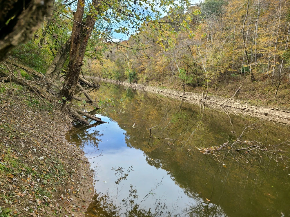
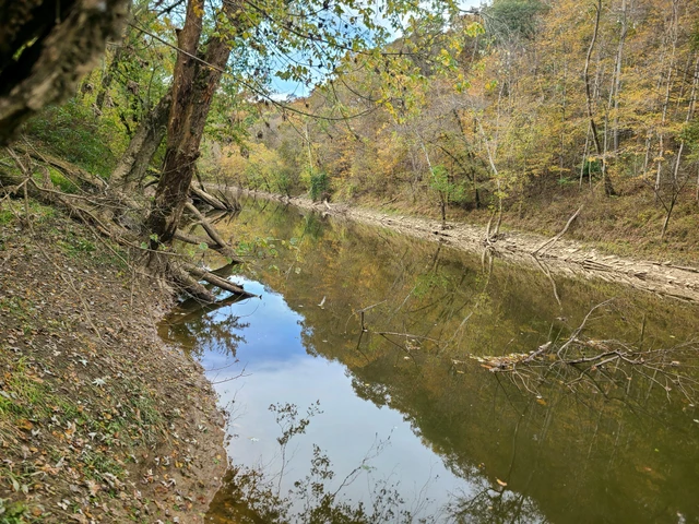
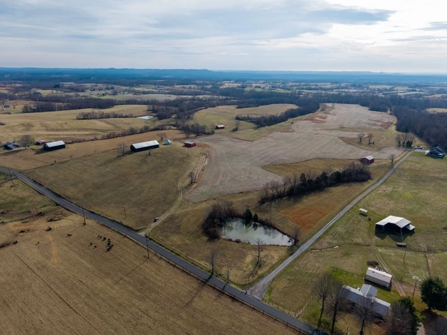
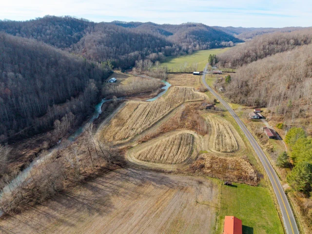
16.6373 ACRES LICKING RIVER FRONTAGE
2536 Mexico Road, Carlisle, KY | Lat/Lng: 38.3577, -83.9321
$94,000
16.74 ac.
10/09/2025
ACTIVE
Description
2536 MEXICO ROAD, CARLISLE, NICHOLAS CO., KY - 16.7363 ACRES, 1000+ FEET FRONTAGE LICKING RIVER, ADJOINS THE LICKING RIVER AND THE CLAY WILDLIFE MANAGEMENT AREA
16.7363 ACRES, MOSTLY BOTTOMLAND ACREAGE, PASTURE, HAY OR CROPLAND ACREAGE (THINK FOOD PLOTS!), 1000+ FRONTAGE ON THE LICKING RIVER (FISHING, CANOE, KAYAK, BOATING!), ADJOINS THE CLAY WILDLIFE MANAGEMENT AREA. THIS TRACT IS LOCATED ON THE WEST SIDE OF THE MEXICO ROAD, WITH CONSIDERABLE FRONTAGE ON THE WEST SIDE OF MEXICO ROAD. OFFERS A NICE "OFF-THE-GRID" HOMESITE AND THE GENTLY ROLLING ACREAGE IS WELL SUITED TO CROPLAND/ FOODPLOTS. THIS PROPERTY ADJOINS THE CLAY WILDLIFE MANAGEMENT AREA. DUE TO THE LICKING RIVER FRONTAGE, A SIGNIFICANT PORTION OF THE PROPERTY IS DESIGNATED AS SPECIAL FLOOD HAZARD AREAS (Flood Map is available for download from this website). THE PROPERTY IS A RECENTLY SURVEYED BOUNDARY.
NOTE: While the Clay Wildlife Management Area DOES NOT permit camping, this property is not a part of the Clay Wildlife Management Area and thus could be utilized for camping.
CLAY WILDLIFE MANAGEMENT AREA (information from the Department of Fish & Wildlife Resources, specifically the Clay Wildlife Management Area): Size: 8,979 Acres; Location: Nicholas, Fleming & Bath Counties. Elevation: Min. 597 feet, Max. 959 feet. Habitat consists of 10.77% open land, 88.19% forest, .30% wetland, open water: .75%.
Frequently asked question: Can the public hunt on the Clay Wildlife Management Area? The short answer is "YES!". The website specifically lists Whitetail Deer, Grouse and Quail, Pheasant, Rabbit, Upland Birds. Portions of the Clay Wildlife Management Area in Zone 3 (parts of Fleming and Bath Counties, Zone 3, permit Bear Hunting.
LICKING RIVER (information about the Licking River is from Wikipedia): The Licking River is a partly navigable 303 mile long (488 km) tributary of the Ohio River in Northeastern Kentucky. The river and it's tributaries drain much of the region of northeastern Kentucky between the watersheds of the Kentucky River to the west and the Big Sandy River to the east. The North Fork Licking River, in Pendleton County, Kentucky, is one of it's tributaries. The South Fork Licking River, in counties including Harrison County, Kentucky, is another.
The Licking River is considered by ecologists to provides a unique ecosystem in the region. The lower river is considered to be a habitat for the relatively rare native Muskellunge. The River basin supports several other fish species including: redside dace, mimic shiner, streamline chub, slender madtom, blue sucker, paddlefish and eastern sand darter. There are more than 50 species of freshwater mussels, 11 of which are endangered. The watershed provides wetland stopover habitats for about 250 species of migratory birds, an unusually high number. Several state and federal agencies, as well as private organizations such as The Nature Conservancy work to protect the diversity of this important habitat.
Details
County: Nicholas
Zipcode: 40311
Property Type One: Recreational Property
Property Type Two: Riverfront Property
Property Type Three: Waterfront Property
Brokerage: Craig A. Stanfield Real Estate & Auction Service
Brokerage Link: www.stanfieldproperty.com
Apn: 045-00-00-010.00

Craig Stanfield
Craig A. Stanfield Real Estate & Auction Service
(606) 798-2009
By clicking the button, you agree to our Terms of Use and Privacy Policy.


Nearby Listings
Scott County, KY

$3,495,000 - 203 ac.
Rowan County, KY

$32,000 - 3 ac.
Clark County, KY
Auction - 84 ac.
Harrison County, KY

$97,376 - 11 ac.
Harrison County, KY

$46,287 - 5 ac.
Brown County, OH

$499,900 - 68 ac.
Adams County, OH

$180,000 - 39 ac.
Lewis County, KY

$675,000 - 312 ac.
Lewis County, KY
$399,000 - 123 ac.
Lewis County, KY
$3,700,000 - 813 ac.