
Fox Chase Development
21 Clubhouse Drive, Monticello, KY | Lat/Lng: 36.9737, -84.6849
$4,500,000
411 ac.
03/05/2026
ACTIVE

Description
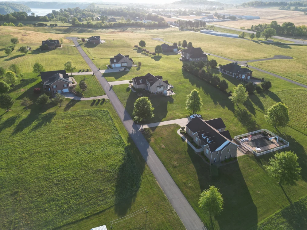
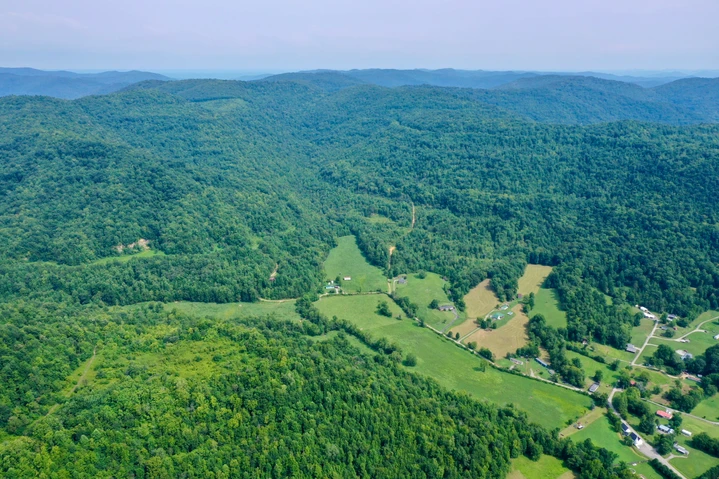
This 411-acre Lake Cumberland development is being offered as a single, turnkey acquisition, presenting a rare opportunity for an investor or developer to take control of a large-scale, partially completed project with immediate upside.
With Phase 1 already complete and infrastructure in placeincluding water, electric, and utilitiesthe next owner is uniquely positioned to accelerate lot sales and development.
Land
The ownership is seeking to sell the property in its entirety, offering a strategic advantage to the next buyer: the ability to recapture a substantial portion of the initial investment quickly through the sale of existing developed lots.
Phase 1 includes 70 fully developed, build-ready lots averaging approximately one acre each. With recent lot sales averaging over $52,000, a new owner has the opportunity to generate strong near-term cash flow. Based on current pricing, the sellout of these lots alone has the potential to return a significant percentage of the total acquisition costbefore any additional development begins on the remaining 378 acres.
This structure allows an investor to reduce basis early while maintaining full control of a large-scale development with multiple future phases already surveyed and planned.
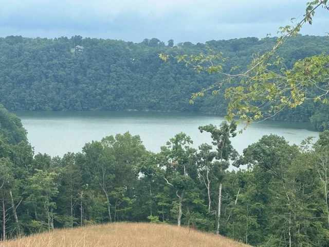
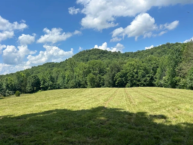
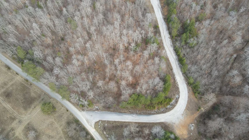
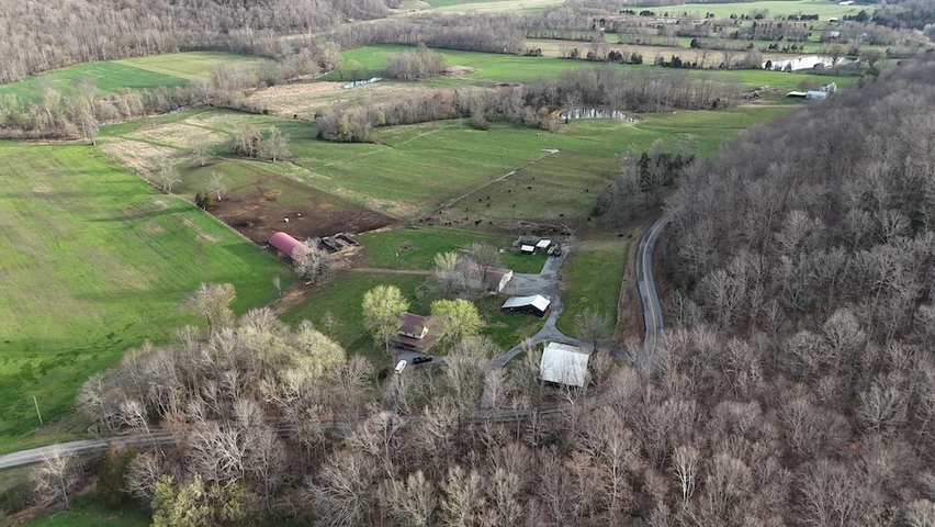
The property spans approximately 411 acres of rolling Kentucky terrain, ideally located near Lake Cumberland and just minutes from Burnside Island Golf Course, marinas, and boat ramps. A short drive from Somerset and accessed via Burnside Bridge into Bronston, the property sits in Wayne County just across the Pulaski County lineoffering both accessibility and privacy.
The site is well-suited for continued residential development, mixed-use expansion, or a master-planned community.
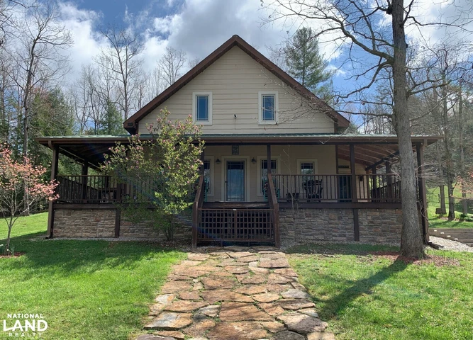
A fully functional clubhouse is already in place, featuring amenities such as a tennis court, basketball court, exercise area, dining hall, ballroom, and kitchenproviding immediate value for community use or event-driven revenue.
Improvements
70 build-ready lots with utilities and road access
Recent lot sales averaging $52,325 in 2026
2,500 feet of Highway 90 frontage
10,500 feet of Green Hills Estate Road frontage
Completed survey, including Phases 25
Clubhouse with full amenities
Utilities installed for future expansion
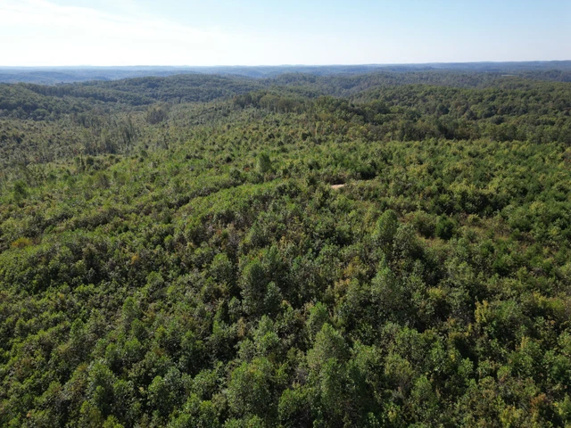
378 acres of undeveloped land ready for future phases
With substantial infrastructure already completed, the next owner can focus on marketing, lot absorption, and phased expansion, rather than upfront development costs.
Agriculture
The remaining 378 acres are currently utilized for hay production, generating approximately 500600 round bales annually. This provides ongoing income while the development is built out, helping offset holding costs during the sellout process.
Water/Mineral Rights & Natural Resources
All water and mineral rights associated with the property will convey, further enhancing long-term investment value.
General Operations
This is a rare opportunity to acquire a large-scale, partially developed lake-area community in a single transaction, with immediate income potential and substantial long-term upside. By selling existing lots individually, a new owner can quickly recover capital and reposition the remaining acreage for future phasesmaximizing overall return on investment.
70 build-ready lots with utilities and road access
Recent lot sales averaging $52,325
2,500 feet of Highway 90 frontage
10,500 feet of Green Hills Estate Road frontage
Completed survey, including Phases 25
Clubhouse with full amenities
Utilities installed for future expansion
378 acres of undeveloped land ready for future phases
With substantial infrastructure already completed, the next owner can focus on marketing, lot absorption, and phased expansion, rather than upfront development costs.
Region & Climate
The Lake Cumberland region offers a well-balanced, four-season climate that supports year-round recreation, residential appeal, and long-term livability.
Summer (JuneSeptember): Summers are warm to hot, with July as the peak month, featuring average high temperatures of approximately 8586F. While humidity levels rise during July and August, the proximity to Lake Cumberland provides a natural cooling effect and enhances the area's strong seasonal tourism appeal.
Winter (DecemberFebruary): Winters are relatively short, with cool to cold conditions. January typically sees average lows ranging from 2730F. Snowfall is moderate and seasonal, contributing to the region's scenic winter landscape without severely impacting accessibility.
Spring & Fall: These transitional seasons are particularly attractive, offering mild temperatures and vibrant natural beauty. Spring brings rapid warming and lush greenery, while autumn delivers crisp air and striking foliageboth highly desirable for residential living and tourism activity.
Precipitation: Rainfall is evenly distributed throughout the year, with slightly wetter conditions in late winter and spring. This consistent precipitation supports healthy vegetation, agricultural productivity, and the region's rolling, picturesque terrain.
History
The area surrounding Burnside, Kentucky is rich in heritage and transformation, rooted in its early role as a thriving river and rail town along the Cumberland River.
Originally, the town of Burnside was located in the valley below, where the river served as a vital transportation corridor for the lumber industry. The region prospered with multiple lumber mills, supported by an active rail system that operated continuously across a network of large bridges spanning the river.
This era of growth ultimately gave way to a pivotal moment in regional developmentthe construction of Wolf Creek Dam. Designed to generate hydroelectric power and create a major recreational resource, the dam project led to the formation of Lake Cumberland.
As the waters rose, the original town of Burnside was gradually submerged. Residents were forced to relocatemany accepting compensation and moving on, while others resisted before ultimately being displaced. A new Burnside was established on higher ground along a nearby bluff, where parts of the community still stand today.
Before the lake was fully formed, the original infrastructureincluding homes, businesses, and bridgeswas dismantled. However, remnants of the former town still exist beneath and around the lake, with visible traces of old roads, tunnels, and foundations offering a unique glimpse into the past.
In the years following the lake's creation, modern bridges were constructed to reconnect the region, replacing early, unreliable boat crossings and significantly improving accessibility. Today, Lake Cumberland stands as both a historical landmark and a cornerstone of the region's identitysupporting recreation, tourism, and economic growth.
Location
Strategically located in south-central Kentucky, the property sits along and borders Highway 90, providing excellent regional connectivity.
Approximately 8 miles southwest of Somerset, Kentucky
Approximately 15 miles east of Monticello, Kentucky
This location places the property within close proximity to key commercial hubs, while maintaining immediate access to Lake Cumberland and its surrounding recreational amenitiesmaking it ideal for residential, commercial, or mixed-use development.
Details
County: Wayne
Zipcode: 42633
Property Type One: Residential Property
Property Type Two: Lakefront Property
Property Type Three: Waterfront Property
Brokerage: Hayden Outdoors Real Estate
Brokerage Link: https://www.haydenoutdoors.com/agents/billy-hackworth/

Billy Hackworth
Hayden Outdoors Real Estate
(606) 575-0089
By clicking the button, you agree to our Terms of Use and Privacy Policy.


Nearby Listings
Clinton County, KY
$2,200,000 - 298 ac.
Adair County, KY
$225,000 - 33 ac.
McCreary County, KY
$499,000 - 6 ac.
Wayne County, KY

$850,000 - 297 ac.
Campbell County, TN
$4,650,000 - 3088 ac.
Laurel County, KY
$242,000 - 110 ac.
Russell County, KY
Auction - 7 ac.
Casey County, KY
$2,685,000 - 500 ac.
Pulaski County, KY
$399,000 - 112 ac.
Adair County, KY
$1,000,000 - 102 ac.