
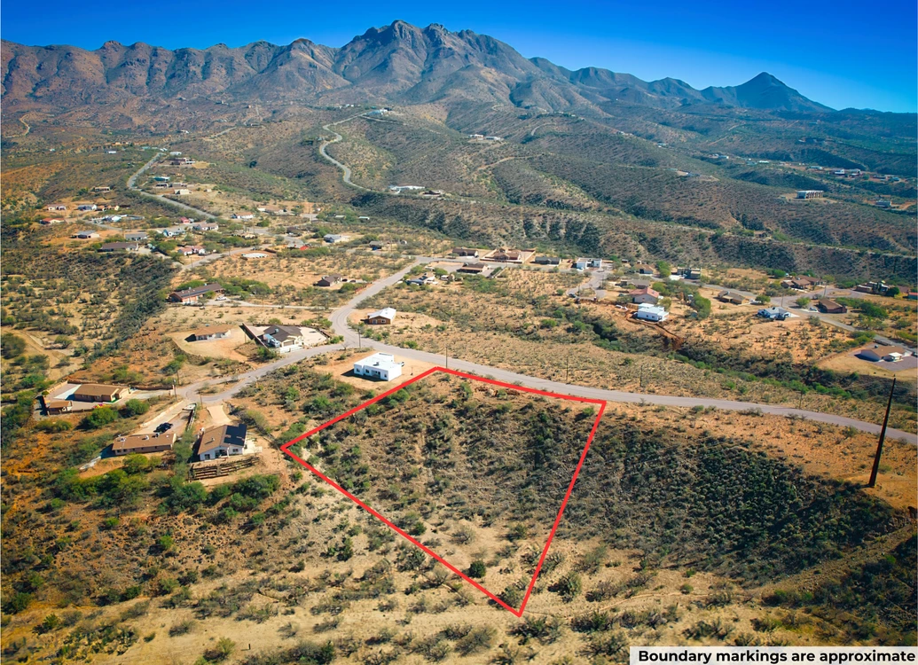
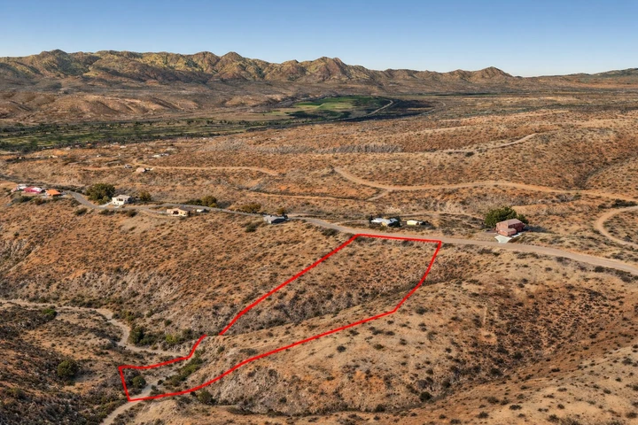
1.67 Acres With Power, Water Lines, Passed Perc Test! In Rio Rico AZ
1629 Tonina Ct, Rio Rico, AZ | Lat/Lng: 31.5376, -111.0090
$24,999
1.67 ac.
12/20/2025
ACTIVE

Description
Discover this prime 1.67-acre vacant lot offering breathtaking mountain vistas. This place provides a perfect setting for a primary residence or vacation retreat in truly stunning surroundings. Power and water lines are present at the lot line. An ideal setting for a primary residence or vacation retreat, offering breathtaking surroundings.
This lot is conveniently situated just 13 minutes from Interstate 19, ensuring effortless commuting, while Nogales is just 22 minutes away. It offers you a wide range of necessities and services including schools, hospitals, grocery stores, gas stations, Walmart, McDonalds, Dollar General, Napa auto parts, pharmacies, and regional airports. Tucson International Airport is a 48-minute drive from the property.
Choose Your Owner Financing Plan:
$4,999 down, $559/month for 45 months
$3,749 down, $539/month for 52 months
$2,499 down, $509/month for 60 months
Do you want your own custom plan? Call or text us today to discuss how much you'd like to put down.
There are NO Credit Checks. There is NO Prepayment Penalty, you can pay off the property at any time. Title is Free and Clear.
You can easily secure this property today to start enjoying everything that Arizona has to offer. Call or Text us anytime to get started or learn more.
Property Details
Address: 1629 Tonina Ct, Rio Rico, AZ, 85648
Parcel Number: 133-03-231
Legal Description: Lot 84 in Block 504 of RIO RICO RANCHETTES UNIT NO. 17, a subdivision of Santa Cruz County, Arizona, according the the map or plat of record in the Office of the County Recorder, Santa Cruz County Arizona, in Book 3 of Maps and Plats at Page 26 thereof
County: Santa Cruz
Size: 1.67 Acres
Property Survey or Plat Map: Yes (refer to documents section)
Power: Yes, along the road
Water: Water lines along the road (Provided by Rio Rico Water & Sewer: 844-367-2030)
Sewage: Would be septic - passed percolation test in December 2025 (meaning conventional septic systems are suitable)
Phone: Cell or Satellite (coverage map)
Zoning: R2 Multifamily Residential
Camping and RV: No
Mobile Homes Allowed?: No
Manufactured Homes Allowed?: No
Site Built Homes Allowed?: Yes
Minimum Square Footage: 1200 sq ft
HOA: None
Flood Zone: NW corner falls in zone A covering 0.40 acers (Refer to Land id map on our web-listing)
Wetlands: No (Refer to Land id map on our web-listing)
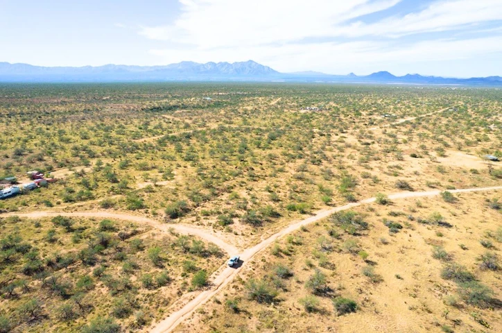
Access: Gravel road
Annual Property Taxes: $146
General Elevation: 3,456 feet
Terrain: Gentle slope downhill
Dimensions: 271 x 267 x 240 x 354 feet
Conveyance: Warranty Deed
Title: Free and Clear
Google GPS Corner Coordinates
NW: 31.5377, -111.0097
NE: 31.5381, -111.0089
SW: 31.537, -111.0089
SE: 31.5375, -111.0084
Approximate Distance to Nearby Cities & Points of Interest
13 minutes to Interstate 19
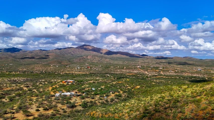
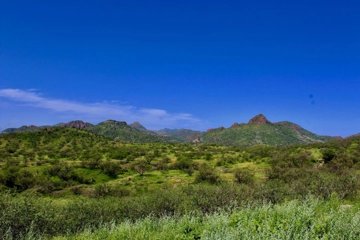
Nestled among rolling hills and wide-open desert skies, Rio Rico offers a peaceful small-town lifestyle with stunning natural beauty all around. Residents enjoy mountain views, quiet streets, and easy access to outdoor adventures like hiking and bird-watching. With its warm community feel and relaxed pace, Rio Rico is a wonderful place to call homeperfect for those looking for space, sunshine, and serenity.
12 minutes to Rio Rico: Population 21,798
22 minutes to Nogales: Population 19,965
52 minutes to Tucson: Population 554,013
36 minutes to Sahuarita: Population 37,448
48 minutes to Tucson International Airport
Points Of Interest
Coronado National Forest spans a series of sky island mountain ranges rising from the desert, offering everything from saguaro-studded lowlands to cool, forested peaks. Visitors can find diverse trails, campgrounds, and viewpoints across multiple ranger districts, making it a practical base for hiking, wildlife viewing, and scenic drives in southeastern Arizona. Its wide elevation range also means you can often experience different seasons and habitats in a single days visit.
2 hours 20 minutes to Coronado National Forest
Activities at Coronado National Forest: hiking, mountain biking, horse riding, climbing and caving, fishing, hunting, shooting, camping & RV and boating.
37 minutes to Patagonia Lake State Park
Activities at Patagonia Lake State Park: water skiing, swimming, boating, camping, fishing, hiking, walking.
Call or Text us anytime for questions or to learn more about how to purchase this property.
Details
County: Santa Cruz
Zipcode: 85648
Property Type One: Residential Property
Property Type Two: Undeveloped Land
Brokerage: Compass Land USA
Brokerage Link: www.compasslandusa.com/property
Apn: 13303231

Andrew Gaasenbeek
Compass Land USA
(313) 349-0434
By clicking the button, you agree to our Terms of Use and Privacy Policy.


Nearby Listings
Santa Cruz County, AZ

$6,500,000 - 3787 ac.
Santa Cruz County, AZ

$7,000,000 - 6066 ac.
Pima County, AZ
$199,000 - 36 ac.
Santa Cruz County, AZ

$1,270,000 - 46 ac.
Pima County, AZ
$14,999 - 2 ac.
Santa Cruz County, AZ
$225,000 - 38 ac.
Santa Cruz County, AZ

$1,850,000 - 20 ac.
Santa Cruz County, AZ
$11,997 - 4 ac.
Santa Cruz County, AZ

$80,000 - 40 ac.
Santa Cruz County, AZ

$3,250,000 - 430 ac.