
Reeves Ranch
13801 County Road CC, Memphis, TX | Lat/Lng: 34.7693, -100.6213
$6,499,000
2570 ac.
08/12/2025
ACTIVE

Description
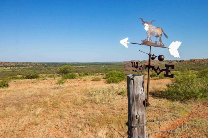
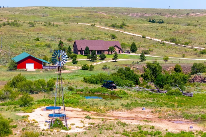
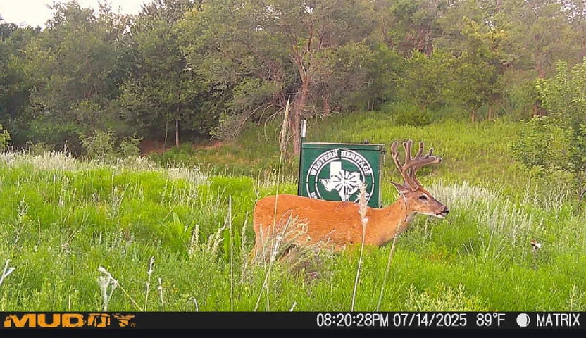
Spanning 2,570 acres in the striking red canyons along Indian Creek valley, this historic working cattle ranch offers unmatched beauty, diverse terrain, and natural springs. Located 6 miles northwest of Memphis, the ranch boasts over 2.5 miles of Indian Creek and elevations ranging from 2,200 to 2,420 feet, showcasing beautiful vistas of red clay cliffs, cedar ridges, and sheltered valleys rich in wildlife, including white-tail and mule deer, wild turkey, and ground birds. Originally part of the Doll Baby Ranch dating back to 1878, the property has been in the Reeves family since 1962 and is ideal for both grazing cattle and recreational pursuits. Native grasses and lush Bermuda thrive. Improvements include two homes, a large quonset barn, a set of working pens, solar and electric well, rural water, perimeter fencing, ranch roads, and a hunters camp with RV hookups.
Now is your chance to own a legacy property in the heart of Texas ranch country. Welcome to Reeves Ranch.
Location
The Reeves Ranch is found in the eastern Texas Panhandle, just 6 miles northwest of Memphis and 10 miles from Hedley. It is about 1.9 miles off of pavement from Highway 287.
History
In 1962, Sim Reeves and his son, Raymond Reeves, bought the ranch from the family of Larry Combest, who represented Texas in the U.S. House of Representatives from 1985 to 2003. The Reeves Family has loved, owned, and operated it ever since. The working cattle ranch was originally part of the Doll Baby Ranch, dating back to 1878. The property offers unsurpassed views, beauty, and a diversity of landscape for the region with red canyons, cedar ridges and sheltered valleys.
Water
This panhandle ranch will not disappoint with water availability, boasting natural springs along Indian Creek throughout the ranch. The Red River Authority of Texas supplies water to the houses, and an electric well located near the house supplies water to the sprinkler system for the main house yard, barn, and pens. There is also a solar well situated in the northeast section and the other various springs provide water for livestock throughout the ranch.
Land / Wildlife
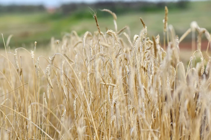
This hidden gem offers wide diversity in terrain with elevations ranging from 2200 to 2420, boasting breathtaking red canyons, cedar ridges, and creek bottoms. With a large amount of acreage including lower ground and creek bottoms, the native grasses and Bermuda are abundant, providing a generous cattle carrying capacity for this area. Cottonwoods, wild plum and grape thickets, mesquite, and some cedars on the higher elevations make up the landscape. There is also some gravel located in the southeast section of the ranch that has been sold commercially. Wildlife includes whitetail, mule deer, wild turkey, ground birds, bobcats, and coyotes.
Improvements
The ranch headquarters includes one main house that was built in 2006, near the original ranch house. The main house is three bedroom, two bath with a full length covered back porch. From the covered back porch of the main house, you can see the beautiful vista of red clay cliffs and hills and watch the sunset overlooking Indian Creek and the majority of the ranch. Both houses offer space for large gatherings, with a total of five bedrooms plus a basement. Also near the houses is 30x80 quonset barn with a 20 overhang for livestock, that also has concrete floors. The working pens equipped with snake and chute are just to the south of the barn, along with a detached garage shed for storage. The ranch includes perimeter barbwire fencing and ranch roads for access across the property. Away from the headquarters, closer to the main gate of the ranch is a hunters camp that includes RV hookups for added convenience.
Minerals
The seller does not believe they own any of the mineral interest.
Landscape
The property consists of canyons, ridges, creek bottoms and plenty of cover for wildlife. The soils here within are listed with accompanying percentages for area of interest totaling 100%:
Obaro-Quinlan (OQE) 35.02%; Burson-Aspermont (BAG) 25.87%; Lincoln loamy fine sand (Ln) 11.96%; Aspermont silty clay loam (AsC) 6.08%; Mobeetie-Tascosa complex (MTE) 5.04%; Tivoli fine sand (Tf) 4.23%; Carey loam (CaB) 2.91%; Clairemont silt loam (Ca) 2.78%; Miles fine sandy loam (MfB) 1.42%; Aspermont silty clay loam (AsB) 1.06%. Under 1%: Springer fine sandy loam (SfD); Mobeetie fine sandy loam (MrB); Miles fine sandy loam (MfC); Veal fine sandy loam (VeC); Olton clay loam (OcA); Mobeetie fine sandy loam (MrC); Guadalupe fine sandy loam (Gu); Paloduro loam (PaC).
Exclusions
Hunting blinds, game feeders, livestock feeders, equipment, personal items inside the house, including the artwork and dining room table, and other personal items on the property will be excluded from the sale.
Zoning/Easements
The property is outside of any municipality, therefore it is not zoned. All existing easements will be identified by surveyors & the title company.
Estimated Taxes
The Sellers currently qualify for an agriculture tax exemption.
Area
This parcel sits in the southeastern quadrant of Donley County, one mile north of the Donley/Hall County line.
Access
This ranch has access from County Road CC, off of Highway 287.
Details
County: Donley
Zipcode: 79245
Property Type One: Ranches
Brokerage: Triangle Realty
Brokerage Link: www.trianglerealtyllc.com

The Team
Triangle Realty
(806) 513-5022
By clicking the button, you agree to our Terms of Use and Privacy Policy.


Nearby Listings
Briscoe County, TX

$17,255,016 - 9586 ac.
Hall County, TX

$11,395,000 - 6895 ac.
Hall County, TX

$268,800 - 168 ac.
Hall County, TX

$475,824 - 198 ac.
Gray County, TX
No Price - 960 ac.
Hall County, TX
$210,000 - 150 ac.
Donley County, TX
$585,000 - 197 ac.
Donley County, TX
$14,000 - 1 ac.
Briscoe County, TX

$548,175 - 219 ac.
Childress County, TX

$5,450,000 - 1940 ac.