
Row Crop Land Tillable & CRP Farm with 97.2 High CPI– W of Stewartville, MN
10750 County Road 149 Southwest, Hayfield, MN | Lat/Lng: 43.8677, -92.6685
$1,312,840
114.16 ac.
01/16/2026
ACTIVE

Description
Row Crop & CRP Farm with High CPI – West of Stewartville, MN
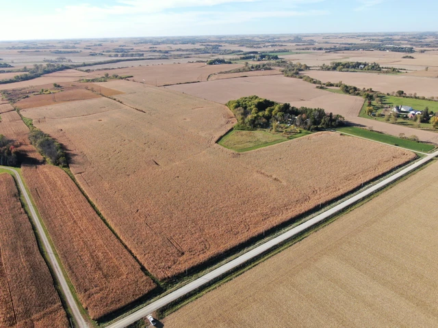
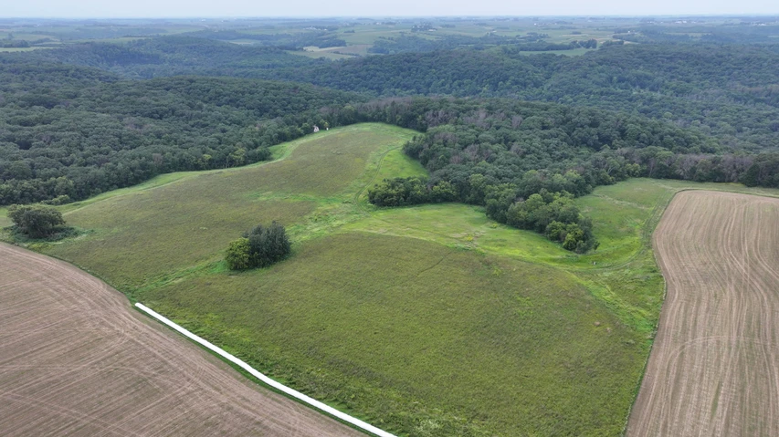
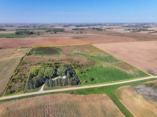
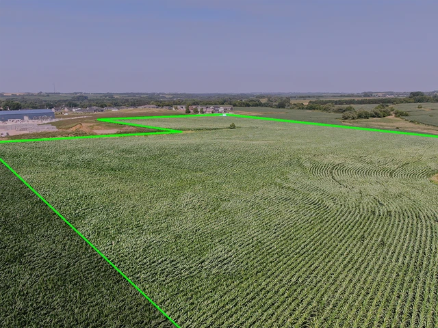
This 114.16± acre farm is located west of Stewartville, Minnesota, and south of Byron, spanning the county line between Dodge County and Olmsted County. The property consists of two parcels (40± acres and 74± acres) and offers a strong combination of tillable cropland, CRP income, and high-quality soils in a productive southeastern Minnesota farming region.
Farm Highlights
Total Acres: 114.16±
Tillable Acres (FSA): 72.27±
CRP Acres: 28.05± (contract through 2026)
Additional Acres: 13.68±
Crop Productivity Index (CPI): 97.2
Annual Property Taxes: $2,641
Two parcels: 40± acres & 74± acres
Excellent road access
Located west of Stewartville, south of Byron, MN
Cropland & Income
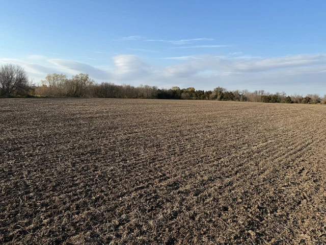
The tillable acres have historically been used for corn and soybean production. The cropland was rented at $225 per tillable acre under a year-to-year lease that concluded in 2025, offering flexibility for owner-operators or new lease arrangements.
The 28.05± CRP acres provide conservation benefits and supplemental income through the existing contract ending in 2026.
Soils & Productivity
With a CPI rating of 97.2, this farm features some of the most productive soils in southeastern Minnesota, supporting strong yield potential and long-term agricultural value.
Improvements & Notes
A 345kV AC high-voltage transmission line runs north–south along the county line through the property.
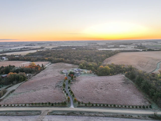
There was previously a homesite on the Dodge County (40± acre) parcel. Buyer should be aware there may be remnants such as an old cistern or foundation debris in the area near maple trees within the CRP acreage.
Property is suitable for row crop farming, conservation uses, or long-term investment, subject to zoning and permitting.
Location & Grain Market Access
The farm is conveniently located near multiple grain handling and marketing facilities, including:
Ag Partners Coop – Stewartville
Progressive Ag Center – Stewartville
CHS Inc. – Byron
Additional regional cooperatives within southeastern Minnesota
This proximity helps reduce hauling distances and supports efficient grain marketing.
Disclosure – Transmission Planning
Power system companies including Xcel Energy are in early-stage planning for the PowerOn Midwest transmission initiative. Future routing may potentially follow or parallel existing transmission corridors on or near the property. Route development is expected to begin in mid-2026. Buyers are encouraged to conduct independent due diligence.
Summary
This 114.16± acre Dodge/Olmsted County farm offers a desirable mix of high-quality tillable land, CRP income, strong productivity, and excellent access. Well-suited for producers, investors, or conservation-minded buyers seeking long-term value in Minnesota farmland.
Details
County: Olmsted
Zipcode: 55940
Property Type One: Farms
Property Type Two: Ranches
Property Type Three: Hunting Land
Brokerage: United Country Real Estate | Midwest Home & Farm Realty
Brokerage Link: https://app.wavecnct.com/jennifer.busch.realty

Jennifer Busch
United Country Real Estate | Midwest Home & Farm Realty
(507) 923-7657
By clicking the button, you agree to our Terms of Use and Privacy Policy.


Nearby Listings
Fillmore County, MN

$2,350,000 - 48 ac.
Olmsted County, MN

$6,677,574 - 343 ac.
Olmsted County, MN
$2,061,987 - 151 ac.
Olmsted County, MN
$1,600,000 - 29 ac.
Olmsted County, MN
$600,000 - 43 ac.
Fillmore County, MN
$240,000 - 38 ac.
Steele County, MN
$260,000 - 27 ac.
Dodge County, MN
$279,000 - 5 ac.
Dodge County, MN

$1,262,360 - 120 ac.
Goodhue County, MN
$570,000 - 19 ac.