Grand Isle County, Vermont Land For Sale (0 results)
Want to post your listings on AcreValue? View Listing Plans
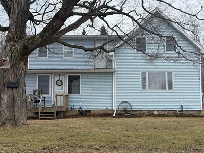
AcreValue offers multiple types of land for sale in Grand Isle County, so if you’re looking for a new ranch, farm, recreational property, hunting ground, developmental property, or land investment you’ve come to the right place. Regardless of what your needs or objectives are for your land, we have a large inventory of available parcels that are updated regularly. Therefore, it’s very likely that we have the perfect parcel that meets all the search criteria & specifications that you’ve been searching for. Additionally, because our land for sale listings are always being updated due to the frequency of land being sold or new land listings being put on the market, make sure that you are checking back with AcreValue regularly for updates. When you find the perfect land parcel and you are ready to take the next steps you can easily connect directly with the listing agent to help you facilitate your land purchase. Browse AcreValue's Vermont land for sale page to find more potential opportunities in Vermont that fit your needs. We wish you the best of luck in finding your next ranch, farm, recreational property, hunting ground, developmental property, or land investment.
We were unable to find any listings that match your criteria.
Please update the filters and try again or view related listings below.
Related Land For Sale
11/07/2024
$850,000
51.93 ac.
ACTIVE
Windham County - West Hill Road, Jamaica, VT
Introduction
The Cotswold Hill Parcels are five separate surveyed house sites located off West Hill Road in Jamaica, VT. These high elevation properties have some views toward Bromley Mountain to the west and toward Magic Mountain to the east. The views from these sites could be expanded with some tree thinning. Four of the five parcels have frontage on the newly constructed 20 foot wide access road that winds its way up the hill toward Lot 5 at the top of the subdivision. Lot 1 can be accessed directly from West Hill Road.
Location
These properties are close to three ski areas: Stratton Mountain is 7 miles away, Magic Mountain is 11 miles northeast and Bromley Mountain is 14 miles to the west. It's only a 30 minute drive to the town of Manchester where many shops and restaurants can be found. The West River is located nearby and provides a great place for fishing, swimming, and paddling. Opportunities to hike in the Green Mountain National Forest or mountain bike on trails and dirt roads are all found in the area. The properties are only two-and-a-half hours from the Boston area, New York City is four hours south, and Hartford, CT is only two hours away.
Access
The Cotswold Hill Parcels are located at 3104 West Hill Road in Jamaica, VT. From Route 30 in Jamaica, turn onto Mountain Acres Road and drive for one mile. Turn right onto West Hill Road and drive for 1/4 of a mile to the access road.
Site Description
Lot 5 is 51.93 acres and is located at the top of the subdivision. This parcel is very unique, and rarely do pieces of land like this come onto the market. Lot 5 has a private driveway that begins at Lot 4. The parcel encompasses the entire north side of the subdivision, from the bottom of the hill all the way up the access road. The views from the clearing at the top of the driveway are to the west toward Bromley Mountain, but there are also big views in the other direction looking southeast. There would be several spots to build on this parcel, but the top of the hill seems like the place to be with the ability to have unobstructed views from your new home.
05/29/2025
$1,425,000
160.56 ac.
ACTIVE
Washington County - 338 Johnson Road, Marshfield, VT
Isn’t it time to make dreams come true? This property will appeal to those dreaming of that perfect slice of Vermont. Knob Hill Farm spans 160.5 acres of certified organic farmland with stunning 360-degree views of Vermont’s rolling hills and valleys. This peaceful property includes a classic dairy barn, a welcoming farm store, and space ideal for horses or agro tourism. The four-bedroom, 3.5-bath farmhouse is filled with natural light, offering a warm and comfortable living space. The open kitchen flows into a cozy living room with a fireplace, perfect for gatherings during holidays or everyday. A wraparound porch invites quiet moments to relax, read, or watch the sunset. Located just minutes from town and close to Groton State Forest and Boulder Beach, outdoor adventures are always nearby. The Lamoille Valley Rail Trail offers scenic rides, while Montpelier's vibrant community and the ski slopes of Stowe and Sugarbush are within easy reach. Knob Hill Farm is a rare opportunity to live close to the land, with space to grow, create, and enjoy Vermont’s natural beauty. Call for your private showing soon.
Copyright © 2025 PrimeMLS. All rights reserved. All information provided by the listing agent/broker is deemed reliable but is not guaranteed and should be independently verified.
06/24/2025
$15,000,000
307 ac.
ACTIVE
Windsor County - 3147 Mount Hunger Road, Barnard, VT
Honey Hill Farm is a rare and distinguished Vermont estate, encompassing over 300 acres of pastoral beauty, panoramic mountain views, woodland trails, a pristine brook, sweeping meadows, and a spring-fed swimming pond. This singular property offers a remarkable blend of natural serenity and refined living.
The main residence has been masterfully reimagined with a full-scale renovation, marrying timeless craftsmanship with the highest standard of modern luxury. At its heart lies an expansive gourmet kitchen—designed with custom marble finishes and bespoke hood detailing—anchored by a sunlit breakfast nook that frames captivating views. Just beyond, a four season room with floor-to-ceiling glass doors dissolves the boundary between indoors and the sweeping landscape beyond.
A gracious foyer leads into the formal living area, which flows seamlessly to the richly appointed bar and billiards room, and onward to a show-stopping library. Here, exquisite millwork and tailored lighting create an atmosphere of quiet grandeur. Each bedroom suite is generously scaled, with spa-like ensuite baths offering an indulgent retreat.
An extraordinary spa features infrared and salt therapies, opening to a secluded, heated pool surrounded by nature. Modern systems discreetly ensure comfort and security, including radiant heat, central air, water purification, and a full-house backup generator.
The iconic red barn, a beloved feature of the Vermont countryside, has been fully restored. The upper level now hosts an entertaining space and fitness area, while the lower level houses a beautifully appointed guest apartment with its own kitchen, full bath, dining area, and laundry.
Privately sited behind gates and accessible by appointment only—with proof of funds required—Honey Hill Farm is not simply a property, but a legacy in the making.
06/18/2025
$298,000
5.5 ac.
ACTIVE
Orleans County - 350 Hinton Hill Rd, Westmore, VT
An exceptional opportunity to build your custom 4-bedroom home on 5.5+/- acres. This tranquil lot offers stunning views of Lake Willoughby & the surrounding mountains, located in the quiet town of Westmore, VT! The Lake views include Mount Pisgah, Mount Hor, & Wheeler Mountain & even long-range views of Jay Peak and much of the North Country. The property has a pastoral setting and has been recently surveyed. This charming property offers a nice tree-line buffer from the year-round, town maintained & plowed road. A small creek & pond dissect the two elevated pastures, both with incredible views & providing plenty of space for gardening, solar, or a small agricultural opportunity. Included in the sale is a State approved wastewater design & permit for a drilled well & 4-bedroom single family residence. New utility poles have been installed along the road frontage on Hinton Hill Rd, once connection is complete Barton Electric & Xfinity fiber will offer an easy connection to the proposed homesite (anticipated in 2025). Enjoy low carrying costs before building, as the annual taxes are estimated at less than $1,500. Currently, taxed as part of a larger parcel, this property has been formally subdivided, approved by the town, & removed from Current Use at the Seller's expense. Enjoy incredible nearby recreation Lake Willoughby boating & fishing, hiking, snowmobiling, golf, Jay Peak skiing, Kingdom Trails mountain biking the Northeast Kingdom is truly a special place!
08/28/2025
$139,000
34 ac.
ACTIVE
Caledonia County - Denio Road, Barnet, VT
The Valley View Parcels are four separate pieces of land in Barnet, Vermont. The best use for these parcels are as homesites with excellent four-season road frontage. Electricity is available on Denio Road for Parcels 1, 2, and 3. Electricity for Parcel 4 on Comerford Dam Road can be brought in from the Denio Road intersection, approximately 400 feet away. Each property has open clearings, and there are multiple options for home sites on Parcels 1, 2, and 4. Parcel 3 is suitable for one home. Views are found on each property, with Parcel 1 having winter views of the White Mountain Range. Additional views on these parcels could be opened up with additional tree thinning.
These northeast kingdom properties are situated above the Connecticut River and close to the towns of Barnet, Peachem, Groton, and St. Johnsbury, VT. Local four-season amenities are abundant. Pine Grove Park at Comerford Dam Lake, with picnic, boat launch, fishing, and swimming facilities, is 1.5 miles away. Harvey's Lake beach is six miles away, and there are three Vast trails for snowmobiling close by. Skiing at Burke Mountain, Loon Mountain, and Bretton Woods is within 30 to 40 miles. The larger town of Littleton, NH, which is the gateway to the White Mountain National Forest, is located on the other side of the river. Groton State Forest is less than 30 minutes away, and is a 26,000-Acre state forest noted for its scenic natural beauty and open land for hunting, fishing, snowmobiling, and many other outdoor recreational activities.
Interstate highway access is excellent, as the parcels are only 5.5 miles from Exit 18 off I-91. Boston, Massachusetts, and Montreal, Canada, are two and a half hours away, Hartford, Connecticut, is less than three hours away, and New York City is five hours away. Local access is provided by four-season Class III roads with extensive direct frontage on Denio and Comerford Dam Road.
This 34-acre parcel is located on Comerford Dam Road. There is a well-situated, large, open clearing with an existing driveway that would be an easy place to build a home. There are two additional cleared home sites, making this parcel an ideal family compound, or optionally, the homesites could be subdivided and sold. There is electricity approximately 400 feet from the property at the intersection of Comerford Dam Road and Denio Road. The eastern and southern views could be further opened with additional tree thinning. A year-round stream bisects the property, providing both dramatic views and wildlife viewing as animals drink from the stream. There are extensive high-quality sand deposits for on-site construction activities. This parcel is ready for your home or camp with different places to build available. Excellent road frontage, views to the southeast, with amenities and outdoor recreation nearby make this property a great piece of land to consider.
08/28/2025
$60,000
3 ac.
ACTIVE
Caledonia County - Denio Road, Barnet, VT
The Valley View Parcels are four separate pieces of land in Barnet, Vermont. The best use for these parcels are as homesites with excellent four-season road frontage. Electricity is available on Denio Road for Parcels 1, 2, and 3. Electricity for Parcel 4 on Comerford Dam Road can be brought in from the Denio Road intersection, approximately 400 feet away. Each property has open clearings, and there are multiple options for home sites on Parcels 1, 2, and 4. Parcel 3 is suitable for one home. Views are found on each property, with Parcel 1 having winter views of the White Mountain Range. Additional views on these parcels could be opened up with additional tree thinning.
These northeast kingdom properties are situated above the Connecticut River and close to the towns of Barnet, Peachem, Groton, and St. Johnsbury, VT. Local four-season amenities are abundant. Pine Grove Park at Comerford Dam Lake, with picnic, boat launch, fishing, and swimming facilities, is 1.5 miles away. Harvey's Lake beach is six miles away, and there are three Vast trails for snowmobiling close by. Skiing at Burke Mountain, Loon Mountain, and Bretton Woods is within 30 to 40 miles. The larger town of Littleton, NH, which is the gateway to the White Mountain National Forest, is located on the other side of the river. Groton State Forest is less than 30 minutes away, and is a 26,000-Acre state forest noted for its scenic natural beauty and open land for hunting, fishing, snowmobiling, and many other outdoor recreational activities.
Interstate highway access is excellent, as the parcels are only 5.5 miles from Exit 18 off I-91. Boston, Massachusetts, and Montreal, Canada, are two and a half hours away, Hartford, Connecticut, is less than three hours away, and New York City is five hours away. Local access is provided by four-season Class III roads with extensive direct frontage on Denio and Comerford Dam Road.
This three-acre parcel sits above the intersection of Denio and Comerford Dam Roads. Power is on the property, and a home could be easily built on the existing clearing with only a small driveway needed. There are excellent views to the south, making this house site an attractive and inexpensive option. This parcel is attached to Parcel 2, which, if purchased together, would make an ideal family compound. This parcel has year-round road access, a buildable homesite with views, and local amenities with outdoor recreation nearby.
09/08/2025
$261,000
130 ac.
ACTIVE
Essex County - 955 Hall Road, Lunenburg, VT
Property Overview
Located in rural Lunenburg, Vermont, this property offers the perfect blend of access to local amenities with the seclusion of Northeast Kingdom forestlands. The surrounding landscape is one of vast, undeveloped timberlands, mixed with well-maintained camps off Hall Road, which also serves as an ATV and snowmobile trail. Property highlights include:
-Standing timber value of $140,500, with a promising timber asset appreciation outlook
-Attractive forest conditions, with minimal low shrubs and regeneration creating easy walking conditions
-Developed access off Hall Road, with a built driveway (right-of-way) accessing potential camp sites
-Mostly gentle terrain with trails ready to be upgraded
Location
The forest is located in the town of Lunenburg, in the Northeast Kingdom, which borders New Hampshire and the Connecticut River. Much of the area is rural and characterized by a heavily forested landscape, with homes generally scattered, except for clusters found in small hamlets and along Neal Pond. Small farms along the Connecticut River are also prominent, contributing to the region's traditional working-land character. The landscape to the north is almost entirely forested and includes several larger timberland blocks under both private and public ownership. Neal Pond is a short distance to the south and features a public launch for fishing and boating. Lunenburg Village lies just 5.5 miles from the property via Route 2. The village offers a convenience store, post office, elementary school, and town municipal offices. The drive to the village along Pond Road passes occasional year-round homes, while the immediate Hall Road area is known for its numerous seasonal camps.
Lancaster, New Hampshire, is the closest major town, located about 10 miles east along the Connecticut and Israel Rivers. Lancaster serves as a regional hub with a vibrant downtown, offering full amenities and earning the reputation of the Gateway to the Great North Woods. The town can be found bordering the scenic, rolling mountains of the Kilkenny Range within the White Mountain National Forest. For broader regional access, Boston and Portland, Maine, are approximately a 2.5-Hour drive to the south and southeast. There are sites available for potential camp-building near the existing cleared log landing or at several other locations throughout the forest.
Access
The property can be accessed via Hall Road, which is a Class 4 town road. This is followed by a legally deeded 50-foot-wide right-of-way (Row) that provides direct access to the property, stretching approximately 1,100 feet.
Although Hall Road is not maintained by the town and is not plowed during the winter months, nearby camp owners routinely maintain the road, ensuring it remains passable. During the winter, Hall Road serves as a significant Vast snowmobile trail.
Property Description
The land is primarily characterized by gentle slopes, with some steeper sections forming a hillside that faces southwest. The elevation ranges from approximately 1,620 feet above sea level (Asl) in the east, where a log landing and potential campsite locations are found, to about 1,940 feet ASL at the height of land to the north. A small stream drains this hillside, flowing southwest and eventually forming Hall Brook, which empties into the Connecticut River to the west.
The ground conditions and slopes are favorable for timber harvesting and recreational activities, with very little difficult terrain limiting access. Some areas of the property are upland and quite dry, while other regions to the west contain more softwood timber and riparian zones, providing excellent wildlife habitat.
Forest trails, created from previous logging activities, can be found throughout the property, offering access for off-trail snowmobiling, ATV riding, hunting, and hiking. Hall Road itself serves as a Vast Snowmobile Trail during the winter months, providing access to major trails leading to points of interest in Vermont and New Hampshire. There are several potential camping sites available near the existing cleared log landing and at various points throughout the forest.
Timber Resource
Timber data in this report is based on a comprehensive timber inventory completed in June of 2023 to establish Capital Timber Value (Ctv), then grown forward two growing seasons using current FIA growth data. Thirty-six inventory points (1 plot per 3.6 forested acres) were sampled, covering a 415' x 415' grid using a 15-factor prism. Sampling statistics are 30% standard error for sawlog products and 13.7% for all products combined at the 95% confidence interval.
The timber data revealed a total sawlog volume of 481 MBF International scale (3.7 Mbf/Acre), with 2,751 pulpwood cords (21 cords/acre). The combined total commercial per-acre volume is 28.4 cords, a figure above average for the region. Stumpage values were assigned to the volumes in August 2025, producing a property-wide Capital Timber Value (Ctv) of $140,500 ($1,072/Acre). See the Timber Valuation in this report for details.
Species Composition
Hardwoods dominate the species composition, accounting for 89% of the total volume, while softwoods make up 12%. The overall mix closely mirrors that of the surrounding region, with sugar maple comprising 47% of the total volume, followed by red spruce (32%), white ash (8%), yellow birch (6%), black cherry (3%), and miscellaneous hardwoods.
The sawlog volume breakdown reflects strong market demand, led by sugar maple, yellow birch, white ash, spruce/fir, white birch, aspen, and black cherry. A notable attribute is the limited presence of beech in both the overstory and understory.
Sawlog Value
Sawlog value is concentrated in sugar maple (53%), red spruce (28%), white ash (11%), and yellow birch (4%), with the balance in miscellaneous species.
Diameter Distribution
The average diameter for all products combined is 11.1 inches, while sawlogs average 11.7 inches. Sugar maple, the dominant species, averages 13.0 inches. Overall, the forest consists of two primary age classes: an older cohort, roughly 70 years old and scattered throughout the property, and a younger cohort established about 35 years ago following a heavy harvest.
Stocking & Stem Quality
Fully stocked stands represent forest density. The average basal area (Ba) is around 97 ft on 296 stems per acre. Stem quality is well above average for the region, with acceptable growing stock BA at 81 ft. The younger age class is high in density, with straight, clean, and tall stems perfectly positioned for future asset appreciation and for shifting products to higher-value sawlogs and veneer. The older age class represents a strong income opportunity the next time the property is silviculturally treated.
08/28/2025
$315,000
127 ac.
ACTIVE
Caledonia County - Denio Road, Barnet, VT
Property Overview
The Valley View Parcels are four separate pieces of land in Barnet, Vermont. The best use for these parcels are as homesites with excellent four-season road frontage. Electricity is available on Denio Road for Parcels 1, 2, and 3. Electricity for Parcel 4 on Comerford Dam Road can be brought in from the Denio Road intersection, approximately 400 feet away. Each property has open clearings, and there are multiple options for home sites on Parcels 1, 2, and 4. Parcel 3 is suitable for one home. Views are found on each property, with Parcel 1 having winter views of the White Mountain Range. Additional views on these parcels could be opened up with additional tree thinning.
Location
These northeast kingdom properties are situated above the Connecticut River and close to the towns of Barnet, Peachem, Groton, and St. Johnsbury, VT. Local four-season amenities are abundant. Pine Grove Park at Comerford Dam Lake, with picnic, boat launch, fishing, and swimming facilities, is 1.5 miles away. Harvey's Lake beach is six miles away, and there are three Vast trails for snowmobiling close by. Skiing at Burke Mountain, Loon Mountain, and Bretton Woods is within 30 to 40 miles. The larger town of Littleton, NH, which is the gateway to the White Mountain National Forest, is located on the other side of the river. Groton State Forest is less than 30 minutes away, and is a 26,000-Acre state forest noted for its scenic natural beauty and open land for hunting, fishing, snowmobiling, and many other outdoor recreational activities.
Access
Interstate highway access is excellent, as the parcels are only 5.5 miles from Exit 18 off I-91. Boston, Massachusetts, and Montreal, Canada, are two and a half hours away, Hartford, Connecticut, is less than three hours away, and New York City is five hours away. Local access is provided by four-season Class III roads with extensive direct frontage on Denio and Comerford Dam Road. Note: There is a utility easement on Parcel 1 from the 1950S that was never built, as the power lines from the hydro dam were installed lower down on Comerford Dam Road.
Property Description
This parcel is 127 acres, and the best place to build a home is on Denio Road, where power is available. From this parcel, there are views of Mount Washington and the Presidential Range through the trees, and southwest views down the Connecticut River valley. The access on Denio Road leads to a semi-opened park-like setting with large oak trees as the main species on that part of the land. There are sections of white pine, hemlock, and other northern hardwood species on the rest of the property. Due to past logging activity, walking through the parcel is excellent, making it easy to explore this large parcel. A small stream leads from the upper part of the property to the lower section. There are gravel deposits available for on-site construction activities. If you're in the market for a large parcel with year-round road access, multiple homesite options, trails, views, amenities, and four-season outdoor recreation nearby, this parcel is an excellent option.
08/28/2025
$149,000
35.5 ac.
ACTIVE
Caledonia County - Denio Road, Barnet, VT
The Valley View Parcels are four separate pieces of land in Barnet, Vermont. The best use for these parcels are as homesites with excellent four-season road frontage. Electricity is available on Denio Road for Parcels 1, 2, and 3. Electricity for Parcel 4 on Comerford Dam Road can be brought in from the Denio Road intersection, approximately 400 feet away. Each property has open clearings, and there are multiple options for home sites on Parcels 1, 2, and 4. Parcel 3 is suitable for one home. Views are found on each property, with Parcel 1 having winter views of the White Mountain Range. Additional views on these parcels could be opened up with additional tree thinning.
These northeast kingdom properties are situated above the Connecticut River and close to the towns of Barnet, Peachem, Groton, and St. Johnsbury, VT. Local four-season amenities are abundant. Pine Grove Park at Comerford Dam Lake, with picnic, boat launch, fishing, and swimming facilities, is 1.5 miles away. Harvey's Lake beach is six miles away, and there are three Vast trails for snowmobiling close by. Skiing at Burke Mountain, Loon Mountain, and Bretton Woods is within 30 to 40 miles. The larger town of Littleton, NH, which is the gateway to the White Mountain National Forest, is located on the other side of the river. Groton State Forest is less than 30 minutes away, and is a 26,000-Acre state forest noted for its scenic natural beauty and open land for hunting, fishing, snowmobiling, and many other outdoor recreational activities.
Interstate highway access is excellent, as the parcels are only 5.5 miles from Exit 18 off I-91. Boston, Massachusetts, and Montreal, Canada, are two and a half hours away, Hartford, Connecticut, is less than three hours away, and New York City is five hours away. Local access is provided by four-season Class III roads with extensive direct frontage on Denio and Comerford Dam Road.
This 35.5-Acre parcel is located below Parcel 1 between Denio and Comerford Dam Roads. The best option for a home would be on Denio Road, as there is power along the road frontage. Additionally, off-grid camps could be built on Comerford Dam Road, which has great frontage but no electricity. There are views to the south toward the river valley, and these could be opened further with additional tree thinning. A year-round stream bisects the property, providing wildlife viewing as animals drink from the stream. If you're in the market for land with year-round road access, homesites with views, and four-season outdoor recreation nearby, this parcel is a good option.
07/21/2025
$145,000
85.3 ac.
ACTIVE
Essex County - Victory Road, Victory, VT
Property Overview
Umpire Brook Forest is ideally suited for the recreational buyer, interested in a secluded camp property close to amenities including Burke Mountain, Kingdom Trails, and thousands of acres of publicly-accessible hunting and fishing land. The property has road frontage on Victory Road, a public class 3 highway connecting Burke and Guildhall. While no power is available on this stretch of the road, ample opportunities for off-grid camp building can be found on the property. The Portland Pipeline (no longer in service) runs through the property and now serves as an important Vast trail for the region.
Location
The property is located deep in the heart of the Northeast Kingdom, yet it is just a short drive from the bustling recreational hub of Burke. The Burke/Victory town line forms the western boundary of the property. To the north lie Kingdom Heritage Conservation Lands, which are protected by a conservation easement that allows public access for hunting, fishing, and other recreational activities. To the south, the property is bordered by the expansive Victory State Forest.
Burke, Vermont, is located approximately a 5 to 10 minute drive west. In Burke, buyers will discover the Burke Mountain Resort, a smaller, local mountain offering classic Vermont alpine skiing with big mountain amenities. Also located in Burke are the iconic Kingdom Trails, which offer Vermont's highest quality mountain biking opportunities in the summer months.
The surrounding landscape to the north, south, and east is primarily forested and owned by various large forest landowners. The Moose River, a popular trout fishing destination, is located to the southeast on the Victory Basin Wma.
Access
Access to the property is available via Victory Road, a publicly maintained Class-3 road that connects Burke and Guildhall, VT. The property spans both the north and south sides of this road, providing approximately 1,700 feet of road frontage.
On the south side, a small driveway leads to the Portland Pipeline Right-of-Way (Row). To the north, a woods road leads to an old log landing, which could serve as a potential site for a camp.
Additionally, there are wood trails that wind through the forest, showcasing remnants of past logging operations.
Property Description
The land is mildly to moderately sloping, with aspects to the south. From the Victory Road, which bisects the land east-west, a southerly walk will reveal a moderately sloping hillside with stepped ledges. The headwaters of Umpire Brook, which feed the Moose River, are found just to the south of the property boundary, along with some small wetlands. To the north of Victory Road, the terrain is mild to moderately sloping, rising to around 1,800' Asl. In this area, some exposed ledges and rocks can be found.
The timber resource is generally young, having been logged around 25 years ago. The resulting forest is now found as smaller-diameter, mixed hardwood and some softwood, growing well and in a good position for future volume and value appreciation.
The Portland Pipeline runs through the property heading east-west. This discontinued pipeline formerly transported crude oil between Portland, ME, and Montreal, PQ. However, it now serves mostly as a Vast trail in the winter months. While no building can occur atop the pipeline Row, this resource is available as direct access to the winter snowmobile trail system.
Suitable camp-building sites exist primarily on the northern side of Victory Road, where flatter slopes offer several potential sites for off-grid camps. No power is available in this stretch of Victory Road.
08/14/2025
$180,000
90 ac.
ACTIVE
Orange County - 136 Territory Rd, Topsham, VT
90+/- Wooded acres in a beautifully remote but accessible area of Topsham, VT. The property is surrounded to the West & North by 700+ acres of conserved land. The property features wonderful mountain views. To access the views, the sellers, through great expense, have created a 4x4 truck road up to the height of the land & procured a Vermont State septic & well permit for a 3-bedroom residential home at the top of the property. Territory Road has direct access to both the VAST snowmobile and VASA ATV trail systems. There are multiple streams on the property, with August being a hot & dry VT month, the streams appeared to remain flowing well & are 68 ft wide. There is a very good trail system on the lot, private to this property only, allowing access by foot or ATV to most of the acreage. It appears that the property was logged about 5+ years ago taking sawlogs down to about 10+. The forest appears to be mostly Sugar & Red Maple offering a lot of opportunity for a homesteader. There are two log landings by the road, one north, & one south. These are perfect for bringing in a camper, a great shooting range, or putting in hunting food plots. This is an off-grid property with power over 1 mile away. Territory Road is a Class 3 & plowed by the town up to the southern log landing & is in excellent shape up to the north landing then becomes much rougher. A great spot for a hunting retreat or get-a-way. Property IS NOT in VT Current Use. No Zoning.
09/18/2024
$191,000
191 ac.
ACTIVE
Chittenden County - Green Mountain Road, Bolton, VT
Introduction
82 Crag Forest's best use is as a significant recreational resource, as well as conservation, and potential timber use, depending on a buyer's ability to establish legal access for those purposes.
Property highlights include:
Significant rock-climbing faces managed by Crag-Vt, a local rock-climbing group;
Scenic landscape that includes a significant peak and views of Camel's Hump;
VAST trails and Catamount Trails running through the property;
Mature hardwood timber resource with an estimated value of $143,100;
Rare natural communities including a Red Pine Natural Community and large vernal pool.
Location
The property is located in central Bolton, a rural town in close proximity to Interstate 89, well-known for it's significant recreational opportunities. Bolton Valley Ski Resort is located just a few miles north of the property, as well as the expansive Mount Mansfield State Forest and associated hiking and backcountry ski areas. The property is landlocked, accessible by foot through the Crag-Vt property to the south, which separates the land from major highways such as Route 2 and Interstate 89.
The property is located squarely in the Green Mountains, a portion of the Appalachian Mountains extending south from Massachusetts and terminating in Canada near Richford, Vermont. This particular area of the mountain range contains some of the state's highest peaks, including Mount Mansfield, Camel's Hump, and Hunger Mountain. This mountainous region is characterized by small hamlets and rural towns connected by State/Town roads, and contains some of the states most productive hardwood and softwood forests, as well as unique high-elevation natural communities.
The property is found approximately 25 miles from Burlington, Vermont's largest city and cultural center, and approximately 7 miles from Waterbury, the nearest city containing amenities and services.
Access
The property is landlocked, a term used to describe a property that has no direct access to a public road. Access to the property by foot is approachable from the south, where a parking area and trailhead has been established off Us-2 by Crag-Vt, or from Green Mountain Drive, where a similar parking area exists. From these points, foot trails can be found that lead to the property. A map of the property access points is found in this report.
The Catamount Trail system also leads through the property, heading east-west, providing additional access points from the Bolton Valley Access Road. In the winter months, Vast snowmobile trails traverse the property.
Access for timber harvesting in the past has been accomplished via temporary crossing agreements with neighbors to the south. Legal access for vehicles would need to be established by negotiating a deeded or legal Right-of-Way to the property.
Site Description & Timber Resource
The property is generally high-elevation, ranging from 1,000' ASL (above sea level) to 1,600' ASL at the highest point. Behind the land to the north, the land becomes significantly more steep as it rises to form Woodward and Ricker Mountains. Despite this, the property is generally formed by moderate slopes containing upland hardwood timber, represented by mature red and sugar maple, yellow birch, beech and some ash. These upland slopes may once have even been pastureland, however this use would have been stopped and the land reverted to forest around 120 years ago.
The property is characterized by a tall peak, which drops off precipitously to the south, forming large cliff faces. In this area, rocky outcrops can be found with alpine vegetation, with one forming an excellent lookout point to Bolton Valley and Interstate 89. Streams and water features can also be found through small intermittent and headwater streams.
The property contains several natural features which are considered rare communities. The forest features a large vernal pool in the central region, a significant breeding ground for various amphibians, as well as a temperate acidic cliff of local significance. Soil quality is generally good to excellent and well-drained, featuring Lyman and Marlow-series loams as well as rock-outcrop complexes found on high-elevation slopes. In some areas, large glacial erratics can be found littering the forest floor. The slopes are not significant to hamper logging or sugaring on the property, and most areas are operable save for the steep rock outcrops.
Recreational
The property represents an important recreational and cultural resource for the community. The 2008 Conservation Easement encumbering the property provides for non-motorized, non-commercial, dispersed uses by the public. The main uses of the property currently are summarized below.
Rock Climbing:
CRAG-VT (Climbing Resource Access Group of Vermont) maintains cliff faces on the property, including the 82 Crag, the Yawn Wall, and the Chapel Crag. These faces were secured for their use via the conservation easement in 2008. Crag-Vt is a non-profit organization that supports Vermont's climbing community by securing, protecting & conserving access to cliffs and other climbing resources. Access to these faces is found from the Bolton Quarry parking lot south of the property.
Snowmobiling:
VAST (Vermont Association of Snow Travelers) and the local snowmobiling club, the Green Mountain Roamers, maintain a winter trail through the property running east-west. Funding for trail maintenance comes from membership fees and state funding, resulting in no maintenance costs to the owner. This trail connects Bolton Valley Resort to Waterbury Center, as well as trails through the expansive Mount Mansfield State forest. Snowmobiling is an important economic driver for the state of Vermont, bringing in an estimated $500 million for the state yearly, in addition to being a popular winter activity for many locals.
Catamount Trail:
The CTA (Catamount Trails Association) maintains over 300 miles of backcountry ski trails, running the length of Vermont from Massachusetts to Quebec. Completed in 2007, this continuous trail is the longest backcountry ski trail in North America. The trail runs east-west through the northern region of the property.
Conservation Easement
The conservation easement on the property is held by the State of Vermont Agency of Natural Resources. The easement was executed in 2008 to protect valuable recreational resources on the property, as well as protect rare natural communities. Additionally, the easement seeks to foster responsible management of the forest resource through sustainable forestry practices, including maple sugaring.
Easement highlights include:
Most sustainable and traditional forestry and sugarbush activities are permitted to support the long-term stewardship of the protected property;
The entire property is open to non-vehicular public recreation and hunting;
Silvicultural activities are allowed where consistent with Vermont timber harvesting regulations, including Amp's and Heavy Cut laws;
Sugarhouses and other forestry-related buildings are allowed to be built upon permission by the easement-holder;
Motorized and mechanized vehicles, including mountain bikes and horses, are allowed on the property at the discretion of the landowner;
No logging may occur in the Red Pine Natural Community, designated as a Special Treatment Area.
Copies of the easement, as well as associated maps and the baseline documentation report, are available on request. Prospective buyers are encouraged to contact the State of Vermont Agency of Natural Resources for more information on easement terms.
08/22/2025
$428,000
261 ac.
ACTIVE
Lamoille County - Belvidere, VT
Property Overview
Located off Bog Road in the quiet, rural town of Belvidere, Vermont, this property boasts a well-managed and diverse timber resource valued at $336,700. The forest primarily comprises healthy maple and birch stands, with pockets of softwood that add to its ecological diversity and long-term value. Two access points serve the property, including a westerly entrance with a built gravel driveway leading to a spacious open landing ideal for a seasonal camp, recreational base, or future log landing. You'll enjoy scenic views of the Cold Hollow Mountains from select vantage points. Just minutes from the property, the North Branch of the Lamoille River meanders through town before joining the main stem in Cambridge, approximately 25 minutes away. Cambridge is home to Smugglers' Notch Resort, a premier Vermont ski destination, and the renowned Smugglers' Notch Distillery.
Location
The property is situated on Bog Road in Belvidere, just north of the village center, in a landscape defined by scenic beauty and minimal development. The area features only a handful of main roads, numerous natural streams, and uninterrupted ridgelines, creating a sense of true Vermont wilderness.
Just 1.5 miles to the east, Vermont's iconic Long Trail, which runs the length of the state, crosses Vt-109. This section of the trail is surrounded by thousands of acres within Long Trail State Forest, offering ponds, hiking trails, and designated campsites.
To the north, the quaint village of Montgomery serves as a gateway to Jay Peak Resort and is located only about 6 miles away. For additional shopping, dining, and services, the towns of Johnson and Cambridge are just 25 minutes to the south and west.
Access
Access to the property is via Bog Road, a hybrid Class 3/4 roadway maintained during the summer months. The parcel enjoys approximately 3,200 feet of road frontage, providing multiple access possibilities. Two established log landings (one featuring a developed gravel driveway) serve as convenient entry points, with an internal network of woods trails extending from these landings into the heart of the property.
Timber Resource
Timber data in this report are based on a timber inventory conducted in the spring of 2021, which assisted in establishing Capital Timber Value (Ctv). 60 inventory points were sampled (1 plot per 4.35 acres), covering a 446' X 446' grid using a 10-factor prism. Sampling statistics are 14.7% standard error for sawlog products and +/-12.2% for all products combined at a 95% confidence interval. Timber was grown forward 4 growing seasons using current FIA timber growth data.
The timber data reveal a total sawlog volume of 1,280 MBF International scale (4.8 Mbf/Acre), with 3,466 pulpwood cords (13.3 cords/acre). The combined total commercial per-acre volume is 22.9 cords, which is an average figure for the region. stumpage values were assigned to the volumes in 2025, producing a property-wide Capital Timber Value (Ctv) of $336,700 ($1,277/Commercial acre). See the Timber Valuation in this report for details.
Species Composition
The species composition is dominated by hardwoods (94%), with softwoods holding the balance (6%). The combined composition of all products offers a diverse mix, led by sugar maple (29%), followed by yellow birch (28%), and red maple (22%). The sawlog volume breakdown is similar, consisting of yellow birch (35%), sugar maple (33%), red maple (17%), spruce/fir (3%), and white ash (5%). The softwood species component (mostly red spruce sawlogs with larger diameter stems) occupies a small mixedwood stand at the land's northeastern end.
Stocking & Stem Quality
Forest density is generally represented by fully stocked stands covering most of the acreage. The exceptions are in the western and southwestern sections of the forest, where stocking is still below full conditions. The average Basal Area (Ba) is 78 ft2 on 140 stems/acre. Stem quality is generally quite good with Acceptable Growing Stock BA at 63ft2. The highest quality stems are in pole-sized growing stock and smaller hardwood sawlog components. The larger sawlogs fall short of veneer quality but offer straight, tall stems.
07/21/2024
$705,375
515 ac.
ACTIVE
Orange County - Powder Spring Road, Topsham, VT
The property features opportunities to take over an attractive, long-term investment, which has been well-managed over time for high-quality northern hardwood timber. Potential building sites can also be easily found throughout the land.
Notable highlights include:
- Managed timber resource, well-positioned for future volume and value growth;
- Sugar maple-dominated timber resource worth around $579,300;
- Sugarbush management and development potential, owing to 40% stocking of sugar maple and excellent slopes;
- Developed internal forest road access;
- Desirable location in central Vermont, close to population centers such as Barre and Montpelier, and close to Interstate 91.
Location
Powder Spring Forest is located in north Topsham, Vermont, a rural town in Orange County mostly consisting of forested acreage, farms, and small homesteads. The town is situated just east of the Green Mountains and west of the Connecticut River Valley, characterized by rolling hillslopes and many rivers, including the Waits, which drains east into the Connecticut River, and the Powder Spring brook, from which this forest gets its name.
While Topsham exemplifies the character of rural Vermont, with its peaceful ambiance and quaint rural character, the town and the subject property are easily connected to local population centers and amenities. Vermont Route 25 and U.S. Route 302 serve to connect Topsham with Barre to the northwest (25 miles away), Bradford (12 miles away to the southeast), and St. Johnsbury (31 miles northeast). In Bradford, there is access to Interstate 91, a major travel corridor connecting Vermont to Massachusetts and Canada, and in Barre, there is access to Interstate 89, connecting to major cities and cultural centers of Burlington, VT, and Manchester, NH. Boston, MA, and Hartford, CT, are a 3-hour drive south.
Access
Legal access to Powder Springs Forest is provided by several modes, including Town Class 3 & 4 roads and private access points.
Powder Spring Road provides a point of access to an old woods road that parallels the brook. This former roadway provides sufficient access to the lands extreme eastern slopes as they tilt to the brook. This small region of the forest supports an attractive 35 to 45-year-old sugar maple stand.
Sanborn Road offers frontage for a driveway point permitting access to another small section of the forest which slopes to the east.
Currier Road is the primary access point to the forest, which leads to a 1,600 section of class 4 road before entering the southern section of the property. Once on the property, a developed internal road runs 2,600 to a log landing which provides access to all of the propertys western higher elevation. Another internal road runs nearly 3,600 to the east and then north, providing functional access to the lands entire eastern half. Both roads can be seen on the property photo maps.
Frost Road provides legal Class 4 access to a small section of the northern end of the property. However, this area has traditionally been accessed from the established roads that originate on the southern side of the forest.
Site Description
The property has been shaped by its former uses, including an intensive period of farming and homesteading going as far back as the late 1700s. Field evidence, such as barn and house stone foundations, stone walls ,and wire fences, covers the propertys landscape, indicating that nearly all of the land was formally used for some form of agricultural activity. Following abandonment in the late 1800s, as the country grew more industrialized, the farmlands were steadily abandoned and allowed to grow back to forest.
The property is situated in a generally high-elevation region of Vermont. The land is characterized by several hills, ravines, and drainages which offer aspects in all directions. The southern and eastern-facing hillsides especially would benefit from tree clearing in order to maximize potential views, which would offer vistas of the White Mountains to the east. Elevation ranges from around 1,500 near Powder Springs Road, where the land rises up a prominent hillside (1,900) before falling again to the west, where flatter land contains wetlands and low-lying creeks. Headwater streams of Powder Springs Brook are found here, running through the property heading south.
Slope conditions on the property are rolling and moderate overall, and the terrain is easily accessible by foot or via logging equipment during forest management.
Timber
Timber data in this report are based on a timber inventory conducted in December 2022, with the purpose of establishing Capital Timber Value (CTV) by F&W Forestry Services, the owners forest manager. 91 inventory points were sampled (1 plot per 5.4 acres), covering a 486 X 486 grid using a 15-factor prism. Sampling statistics are 13.4% standard error for sawlog products and +/-7% for all products combined at the 95% confidence interval. Upon applying growth for 1 season at regional FIA data growth rates, the timber data reveal a total sawlog volume of 2,243 MBF (Intl scale) (4.4 MBF/acre), with 6,435 pulpwood cords (13.0 cords/acre). Combined total commercial per acre volume is 18 cords, a figure about average for the region. Stumpage values were assigned to the volumes in May of 2024, producing a property-wide Capital Timber Value (CTV) of $566,100 ($1,143/acre). See the Timber Valuation in this report for details.
Species Composition:
The species composition is 84% hardwoods and 16% softwoods. Species composition for all products combined is led by sugar maple (44%), followed by yellow birch (12%), white ash (9%), and red maple (8%). Softwood volume mainly consists of spruce/fir (8%) and pine (3%). Scattered red pine is also found in some areas of the forest. The sawlog volume breakdown is led by sugar maple (46%), followed by spruce/fir (14%), and yellow birch (13%), along with small levels of various common associates. The primary species all have benefited from strong historical (and current) markets for their various end products, ensuring the likelihood of robust asset appreciation from stumpage price growth.
Stocking and Stem Quality:
Stocking is variable due to past timber harvesting, which has targeted various areas of the property. Much of the property is found as mature, even-aged forest, while other acreage has been harvested and is now a less dense overstory growing atop a dense understory. Basal areas in the stands range from 40-120 ft2/ac, and show 69% Acceptable Growing Stock.
Sawlog Value/ Management History:
Sawlog value is dominated by sugar maple (46%) followed by spruce/fir (14%) and yellow birch (13%), with the small balance held by red maple, white ash, and others.
The 2023 forest management plan identifies fifteen forest stands. Most stands have been harvested in the past two decades using a combination of shelterwood, group selection, and overstory removal harvesting. The most recent harvesting on the property occurred in 2018.
Diameter Distribution:
The diameter distribution indicates a wide range, with strong representation from advanced saplings established during harvesting over the years. Poletimber in the 6-10 diameter range is also well-represented. The diameter distribution clearly shows the results of a managed forestland, with the bulk of the stocking being found in small logs and large poletimber nearing sawlog size.
Sugarbush Option
The timber data indicates a total of 16,400 potential maple taps from the 9 and greater size classes, with 84% of the taps from sugar maple and the balance red maple. Tap density per acre is variable, ranging from around 20 per acre in previously harvested areas to 60-70 in more dense hardwood stands. Sugaring use would be an excellent additional income source if portions of the property were given over to taps. Electrical power is available a short distance from the property on Currier Road or on the Powder Spring Road, and slopes offer a diverse aspects for multiple setup options.
07/02/2025
$387,000
256.3 ac.
ACTIVE
Rutland County - Marshall Phillips Road, Brandon, VT
Marshall Phillips Forest is found in the southern end of the Champlain Valley in west-central Vermont. A wide valley between the Green Mountain Range to the east and sprawling Lake Champlain to the west. The lower elevations of this parcel offer a flatter landscape, making hiking through this property less strenuous than the usual steeper terrain of Vermont hillsides. The forest ecosystem on this parcel would support a different mix of plant and animal species than are seen in the predominantly mountainous terrain in the rest of the state. Rivers, brooks and ponds are found nearby, and boating, fishing, and biking are available close to this parcel.
This property sits partially in the towns of Brandon and Sudbury. Brandon is the closest town with several good restaurants, a brewery, and a main street dotted with local shops and a vibrant arts community. Sudbury is a smaller community with a village center to the east. Middlebury is a larger town and is home to the famed Middlebury College, only 17 miles north of Brandon. US Route 7 runs north-south through the Champlain Valley, connecting Brandon with Middlebury and Burlington (50 miles) to the north and Rutland and the east-west US Route 4 to the south. Boston is 3.5 hours to the southeast, while New York City is 5 hours to the south.
The property offers almost 1,800' of frontage on Marshall Phillips Road in Brandon, a town-maintained gravel road with utilities known as Town Highway 15. At this road frontage, a 60' wide, gated driveway provides access to the western end of the property. This grass driveway has been well maintained over the years and leads 1,500' into the property's northern end, where an open clearing is found. At the eastern end of the frontage along the boundary, an established driveway leads a short distance into the property before becoming a woods trail heading around the wetland and into the southern reaches of the property.
Marshall Phillips Forest offers a variety of terrain and habitats suitable for residential development, with hiking, nature viewing, and hunting all found within its 256 acres. Most of the forest showcases different tree species, and the value is detailed in the timber section below. There are sections of wetlands in the forest associated with small brooks that flow through the property. These wetland areas have different characteristics, from marsh grass areas to ponds and streams, and forested areas with cedar trees. This rich ecosystem would host a wide variety of bird and animal life for viewing. There would be a myriad of songbirds, waterfowl, and marsh-dwelling birds, with the occasional Bald Eagle found in this area. The forest ecosystem would attract bears, foxes, and coyotes, along with numerous deer, due to the natural food sources of hemlock, oak, small saplings, and edible ground cover. You might even spot an odd apple tree in the forest, as there is evidence of an old farmstead with stone walls and trails found within the forest's interior.
On the property's western edge at the end of the driveway is an elevated peninsula that has been cleared and maintained, leaving a large open grass-covered clearing perfect for a home or camp. The remaining open area provides a gentle slope towards the wetland with scenic views and towards the property's hardwood slopes to the south. There are good views of local mountains from the potential house site, and additional tree clearing to the east would open views of the wetland area and local mountains.
Accessing the property from the driveway at the eastern end of the road frontage takes you to a wide, flat knoll populated by a middle-aged mixed wood forest. This private site offers a second good option for a camp or year-round home development, as power runs along Marshall Phillips Road. This access point is above the wetland area and provides good walking to the largest part of the forested landscape. As you move along old woods trails, the forest transitions to more mature stands on gentle terrain. On the property's eastern edge, one can access a highly scenic area known as The Ledges. Near these ledges is a fringe of wetland, with a towering stand of hemlocks that slopes steeply upward toward rocky outcrops. Walking under the canopy of towering trees with exposed rock faces looming above creates a surrealistic atmosphere that could be found in a primeval forest.
Above The Ledges is a mature mixed wood stand, and west of here, at the land's southern slopes, there is an attractive hardwood stand of oak, maple, and hickory. The highest elevation on this parcel is roughly 840' above sea level along the southern boundary, and the lowest elevation is found in the wetland area at around 480'. The seller acquired the property in late 2017; since then, no timber harvesting has occurred. Their forest management activities over this period included preparing a forest management plan for 2019 (copy available upon request), annual mowing of the access road, and eradicating invasive species on the east side of the wetlands under the Nrcs cost-share program.
Using the management plan timber inventory data, the total sawlog volume is estimated to be 2,154 MBF International scale (9.9 Mbf/Commercial acre), with 3,778 pulpwood cords (17.4 cords/commercial acre). The combined total commercial per-acre volume is 37.4 cords, which is above the average for the region. Stumpage values were assigned to the volumes in June of 2025, producing a rough property-wide Capital Timber Value (Ctv) of $293,000 ($1,350/Commercial acre). See the Rough Timber Volume & Values table in this report for details. The species composition is 68% softwoods and 32% hardwoods. The combined species composition for all products is led by white pine (43%), hemlock (19%), and other miscellaneous species. East of the wetlands are areas of white pine and Norway spruce plantations established around 1950. Forest density is represented by fully stocked stands with an average Basal Area (Ba) of 97 ft2. The average sawlog diameter (by volume) is 16.5, with the average diameter for all products combined 14.4. Harvesting last occurred on the west side of the wetlands in 2016, where group patch cuts occurred in the pine stands. The remainder of the forest was last thinned +/-25 years ago. Wetlands, including some interesting, forested wetlands, cover +/-75 acres.
09/04/2025
$22,350
2.8 ac.
ACTIVE
Rutland County - 201 VT-3, Proctor, VT
Nestled in the peaceful town of Florence, VT, this 2.8-acre wooded lot is ready for your vision. Whether you want to build a home, park an RV seasonally, or invest in land, this property gives you the flexibility you need. Zoned Rural District (R), with a partial commercial area, allows for single-family homes, mobile homes, tiny houses, RVs (temporary use), and short-term rentals with the proper permits. The flat terrain and tree cover offer privacy while keeping the property accessible year-round.
With legal access via paved VT Route 3, reaching the property is simple. However, you'll need to install a well and septic system before building, as municipal water and sewer are not available. Electricity, propane, and waste services are available through local providers, making it easier to develop. The property is located in a flood zone, so construction plans should be reviewed with the town to ensure compliance with building regulations.
Just 5 minutes from Pittsford, this lot offers the perfect blend of rural charm and convenience. You'll have quick access to grocery stores, gas stations, and restaurants, while major towns like Woodstock and Rutland are within an easy drive. The surrounding area is known for its scenic landscapes, hiking trails, and small-town atmosphere, making it an excellent choice for outdoor lovers, retirees, or investors looking for a unique property in Vermont.
Whether you're looking for a private retreat, a future homesite, or an investment opportunity, this land has something to offer. Its natural beauty, flexible zoning, and prime location make it a standout choice for those wanting a slice of Vermont's peaceful countryside. Don't miss out contact us today to learn more about this incredible property!
07/23/2025
$815,000
11.7 ac.
ACTIVE
Orange County - 429 Community Dr, Randolph, VT
High earning Airbnb investment village! These 5 lots totaling 11.7 +/- acres, located in the beautiful mountains of South Randolph, VT, just minutes from VT I-89. There are four lots, each with their own log cabin park model home, a fifth lot with a fantastic Yurt and quant bath house. Additionally, there is a second Yurt that can be moved by the purchaser to a fully prepped area with water/sewer and power. One lot is over 5 acres and includes an open grassy field, pond and garden area making for a wonderful community Airbnb experience. Gross income for the development was (2023 - $125,746 and 2024 $116,914). Recent changes include the addition of a new Cabin and conversion of a second to Airbnb starting August. Based on past numbers, this should provide a future yearly gross income of approx. $169,000. Future potential with three additional bedrooms of unused septic capacity is already installed. The current owner outsources his cleaning & communications, doing your own could increase net by over 13K per year. There are two other lots available if you wish to expand income opportunity or build your own home. The seller created this small community and has been running it as rental and Airbnb income property. He is ready to slow down in retirement and ready to travel but is willing to teach new owners the ins and outs of the property. All current state/town permits, surveyed, and utility drawings are available. Future owners may sell these lots individually.
09/23/2024
$174,000
59 ac.
ACTIVE
Orange County - 149 Mine Road, Strafford, VT
Introduction
The ownership is selling their property in two separate parcels, divided by the town line. The +/-60 acre Strafford parcel is well suited to future home development with paved town road frontage and roadside electric service. The +/-220 acre Thetford parcel is well suited to a camp or seasonal off-grid home development with beautiful local views.
Both parcels have significant frontage along the West Branch of the Ompompanoosuc River. Both parcels have Restricted Use Areas associated with the reclaimed Elizabeth Copper Mine site.
Location
The parcels are situated in east central Vermont, 11 miles from the New Hampshire border. The local landscape is dominated by abundant forestland, with small farms in the valleys and widely scattered homes along roads. This area is part of the West Branch of the Ompompanoosuc River watershed, a sizable river that runs along both parcels.
The hamlet of South Strafford is 1.7 miles to the northwest and is host to a general store. Norwich, Vermont, located 10 miles to the south, is the closest large town offering the most amenities. Interstate 91 is just east of Norwich, and across the Connecticut River is the Town of Hanover, host of Dartmouth College. Boston is just over a 2 hour drive.
Access
This parcel is located along Mine Road, which is a paved, town-maintained road that runs directly to Route 132 and South Strafford. Mine Road is not highly traveled, so road noise near the property is limited. There is +/-212 of frontage along the east side of the road. The road frontage has a deep drainage ditch along it. The best place to park is near the Fountains Land sign where there is an area of flatter ground. Alternatively, you can park up the road at 181 Mine Road which is the entrance to the solar farm. Park here and walk back to the sign to access the land. From this point, the terrain slopes away from the road and down towards the river. Old woods trails can be found across the parcel, including one that leads to the river.
Site Description
The land appears to support the construction of a year-round home. The best potential homesite is likely downslope from the road frontage (off the old driveway), about +/-300-400, where terrain levels off and soils appear to support a septic system. A driveway into the land to this location would have to be developed. Electric power runs along the road frontage.
The terrain is variable, with some steep slopes in between modestly sloping areas. Elevation ranges from 1,080 along the road frontage to 800 along the river. Copperas Brook flows through the eastern area of the property.
Timber
The forest resource is scenic and consists of fully stocked stands with maturing trees. Closer to the road, the tree species are primarily pine and hemlock. The remaining majority of acreage supports hardwood species with scattered large diameter hemlocks and pine.
The river frontage is scenic and an easy hike from the road frontage. An old foundation exists along the river which likely supported a water pump house associated with the mine operations. An old woods road runs down to this site.
The river has a considerable width and can not be crossed by foot during spring or high precipitation periods. Wild brook trout are reportedly common, along with rainbow and brown trout.
Restricted Use Area
The property is part of the former Elizabeth Copper Mine whose reclamation and stabilization was finalized by the EPA. As part of EPAs reclamation/remedial action plan, the land includes a Restrictive Use Area covering a total of 79 acres as represented on the property maps and survey. This area can not be developed or disturbed in the future per the Grant of Environmental Restrictions, Right of Access, and Easement deed. Copy provided upon request.
07/26/2025
$20,000
1.4 ac.
ACTIVE
Bennington County - Bergrucken Lane, Readsboro, VT
1.4 Acres of Scenic Vacant Land in Bennington County, VT Located in Alpenwald Village
Looking for the perfect spot to build your dream home or vacation retreat? This 1.4-acre lot in Bennington County, Vermont offers an incredible opportunity! Located in the exclusive Alpenwald Village community, the property boasts 115 ft of road frontage on Bergrucken Ln, providing easy access while maintaining a tranquil, secluded setting. The lot's wooded terrain and peaceful surroundings make it the ideal location for those seeking serenity.
Property Highlights:
Size: 1.4 acres of prime land
Access: 115 ft of road frontage on Bergrucken Ln
Terrain: Wooded and serene, perfect for building a home or getaway
Zoning: Residential use allowed for a single-family home and accessory structures
Why Its a Great Buy:
Private & Peaceful Setting Tucked away in Alpenwald Village, offering the ultimate privacy and natural beauty
Build Your Dream Home Ideal for a custom home or vacation retreat with ample space and privacy
Desirable Location In a peaceful, scenic area of Bennington County, perfect for outdoor enthusiasts and those seeking tranquility
Dont miss out on this amazing opportunity to own a piece of Vermonts natural beauty and create your own private sanctuary!
Attractions:
Walking distance to Dutch Hill Ski Area
25-minute drive to Mt. Snow
30-minute drive to Bennington and Appalachian Trail
45-minute drive to Brattleboro
50-minute drive to Jiminy Peak Mountain Resort
Zoning
The lot is zoned Residential, and HOA regulations will apply. Only residential uses are permitted, allowing for one single-family dwelling and accessory structure. A house can have a maximum of 2 stories and must have a minimum of 600 sqft floor area. The exterior of all buildings must be finished within a six-month period from the start of construction. HOA fees cover road maintenance
11/11/2024
$478,000
337 ac.
ACTIVE
Washington County - Hayden Hill Trail, Duxbury, VT
Introduction
This 337-Acre property is located about 10 minutes from downtown Waterbury, yet offers a secluded atmosphere for outdoor recreation and off-grid camp building. Excellent timber quality lends well to long-term investment.
Property highlights include:
-High-quality hardwood and pine timber, valued at around $1,150/Acre (based on visual forester estimate)
-Sites available for off-grid camp building
-Situated among thousands of unfragmented, privately and publicly-managed timberland acres
-VAST snowmobile trail running through the property north/south
-10 minutes from downtown Waterbury and its associated amenities
-Access via a public Legal Trail, originating from River Road.
Location
The property is located in northern Duxbury, VT, a rural town containing mainly residential properties, farms, and family-owned timberlands. Much of the town consists of the Camel's Hump State Park, a popular recreation destination for those seeking outdoor adventures. The Winooski River, which runs between the state capital of Montpelier and Burlington (Vermont's largest city) is located just to the north. The property is located squarely in the Green Mountains, originally named by French explorers, and is part of the Appalachian Mountain chain.
Waterbury, a larger city located between Montpelier and Burlington, is a short drive from the property, and contains many large-city amenities while retaining a small-town Vermont charm. Notable businesses in Waterbury include Ben & Jerry's Ice Cream, craft breweries, restaurants, and small shops.
The property is located around 10 minutes from Interstate 89, a major artery connecting Burlington, VT to locations in New Hampshire. The site is located around 20 minutes from the Bolton Valley Ski Resort, and only minutes from trailheads serving Camel's Hump State Park. Burlington is located 35 minutes north via I-89.
Access
Access is via the Hayden Hill Trail, also known as TH 4, which originates from river Road in Duxbury. From here, the trail heads south up Hayden Hill for approximately 0.6 miles. The road here is in good condition for a legal trail, however an SUV or vehicle with greater clearance is needed to access the land. TH 4 leads to a gate, beyond which the property can be found on both sides of the unnamed LT 8. LT 8 has been recently upgraded by a neighboring landowner.
Directions - from downtown Waterbury, proceed southwest on Winooski Street to cross the bridge across the Winooski River. Turn right onto River Road and proceed about 2.4 miles, before turning left onto the Hayden Hill trail. Proceed up this road 0.6 miles to find the property on the left.
Site Description
This property is generally moderately-sloping, with aspect to the north. The forest is found midslope on a large ridge, rising up to a height of land to the south.
Within the property, soil conditions are generally well-drained and productive for forest growth. A Vast trail, used for snowmobiles in the winter, runs through the property north/south, connecting Waterbury to areas south such as Waitsfield and Northfield. This trail is well-maintained, and can be used year-round for hiking and ATV use as well. Importantly, it offers access to the height of land on the extreme south end, where some views are available during the fall and winter seasons.
Stone walls and evidence of previous pasturing are seen on the property, and provide evidence of a long legacy of land use dating back to early settlers. Following pasture abandonment in the 1800'S, this property reverted to forestland, and is now growing mostly high-quality hardwood timber.
A Green Mountain Power transmission line runs through the northern end of the property, heading east/west.
Timber
The timber is an attractive resource which has been professionally managed, and contains mostly quality northern hardwood species such as sugar maple and yellow birch. The growing site appears quite productive, and timber quality and stocking are both higher than average. In the lower elevations, the forest displays a good crop of mature white pine and other softwood species. The most common species is sugar maple, therefore opportunities for a small hobby sugarbush also exist if desired.
The 2019 forest management plan identifies 4 forest stands, mostly consisting of hardwood timber. Capital timber value is estimated (by forester visual opinion) at around $1,150/Acre, which includes costs associated with upgrading Hayden Hill Trail for log trucks. The property in enrolled in the Vermont Use Value Appraisal Program, with the next forest management plan due in 2029.
05/24/2025
$750,000
76.09 ac.
ACTIVE
Rutland County - 603 Anderson Dr, Hubbardton, VT
Off-grid lakefront retreat with development and recreation potential Hubbardton, Vermont. Escape to your own piece of Vermont wilderness with this rare off-the-grid seasonal cabin nestled on the shores of Lake Hortonia. Boasting over 1,500 feet of private lake frontage, this serene property offers breathtaking views and a deep connection to nature. Whether you're casting for pike and bass in the clear waters or listening to loons at sunset, this is lake living at its most peaceful. The rustic cabin is powered in part by a solar system, providing eco-friendly energy for essential appliances. Surrounded by rolling woods and trails, the property offers prime hunting for deer, turkey, bear, small game and exceptional waterfowl opportunities around a scenic beaver pond. ATV trails run throughout, making it easy to explore all corners of the land. Outdoor enthusiasts and investors alike will appreciate the 4000 maple taps, presenting a unique income opportunity through maple sugaring. With the property previously formerly divided into seven separate lots, each with a deeded right of way, there's also the potential to expand with additional camps or cabins along the lake or deeper into the acreage. Situated just 2 miles from Lake Bomoseen and a short drive to Half Moon State Park, the location balances privacy with access to Vermont's beloved outdoor attractions. This is more than a campit's a recreational haven, investment property, and legacy opportunity rolled into one. Whether you're seeking solitude, sport, or stewardship, this Lake Hortonia gem offers unmatched potential in a truly wild setting.
08/20/2025
$350,000
43.2 ac.
ACTIVE
Washington County - 3745 VT-100, Warren, VT
43.20+/- sprawling acres in the heart of the charming mountain town of Warren, VT! A wonderful spot for a potential year-round home, ski home or recreational retreat. The property is across the street from Warren Falls, a popular swimming hole featuring cascading waterfalls and natural granite pools in the Mad River. Only 3 miles from the access road to the Sugarbush Mountain Resort and very close to cross-country skiing at Blueberry Lake, the Long Trail and Green Mountain National Forest! This property has direct frontage on scenic VT Route 100, a paved, year-round state maintained and plowed road where power and high-speed fiber internet are available. The sloping, mostly softwood forestland is accessed by a great old logging road which weaves in and out of various plateaus and amazing boulder features. Soil tests from 2005 indicate multiple areas could support a wastewater system, including a couple in-ground systems. New soil testing would likely be required for the acquisition of a state wastewater permit. Property is enrolled in the State's tax reduction program: Current Use and the taxes are amazingly affordable for low carrying costs. The VT Agency of Transportation has determined best residential access, due to sight lines is 385+/- ft north of current access. A great property for various recreationalists: hunters, skiers, hikers alike should all check this property out build your basecamp or custom home in the heart of Vermont ski country!
09/23/2024
$237,000
221 ac.
ACTIVE
Orange County - New Boston Road, Thetford, VT
Introduction
The ownership is selling their property in two separate parcels, divided by the town line. The +/-60 acre Strafford parcel is well suited to future home development with paved town road frontage and roadside electric service. The +/-220 acre Thetford parcel is well suited to a camp or seasonal off-grid home development with beautiful local views.
Both parcels have significant frontage along the West Branch of the Ompompanoosuc River. Both parcels have Restricted Use Areas associated with the reclaimed Elizabeth Copper Mine site.
Location
The parcels are situated in east central Vermont, 11 miles from the New Hampshire border. The local landscape is dominated by abundant forestland, with small farms in the valleys and widely scattered homes along roads. This area is part of the West Branch of the Ompompanoosuc River watershed, a sizable river that runs along both parcels.
The hamlet of South Strafford is 1.7 miles to the northwest and is host to a general store. Norwich, Vermont, located 10 miles to the south, is the closest large town offering the most amenities. Interstate 91 is just east of Norwich, and across the Connecticut River is the Town of Hanover, host of Dartmouth College. Boston is just over a 2 hour drive.
Access
The land is accessed from New Boston Road, a graveled, town maintained road. There is no electric power along this part of the road. A +/-400 right of way road runs from the town road to the property boundary and gate. From the gate, a gravel road heads into the land in a northern direction for +/-2,325 to the lands open meadow and likely best camp location. From this point, the road continues through the land for another +/-3,950 (this last section of the road will need some maintenance before its drivable again; however, much of the road is graveled & ditched).
Site Description
The lands primary feature is its nearly 1/2 mile of river frontage at its northern end. Two old woods trails head to the river providing good access to this scenic water resource.
Given the lands access, distance to electric power, Restricted Use Area, and opposing solar array, the highest and best use is likely a camp/seasonal home development, recreation, and/or forest management. A meadow at the end of the access road (see maps for location) offers attractive views to the west and north, a prime location to develop a large camp or seasonal home. There is a small woodland pond near the field that contains amphibians such as newts and frogs, and would be used for drinking water by deer and other animals in the forest.
Elevations range from 730 along the river to 1,200 near the SE boundary. The terrain is mostly gently sloping, however, with steep terrain along the river.
Timber
The forest can be considered aesthetically scenic as it has been several decades since forest management has occurred, resulting in a high canopy thats easy to walk through. Generally, on the higher elevation and more level sites, northern hardwood species dominate. On the steeper slopes and along the river, dense hemlock stands are common, with large legacy trees throughout, holding diameters in the 18-24 size class. The hardwood stands have a range of diameters, are fully stocked, and include large legacy stems. The youngest age class was created from harvesting that occurred +/-24 years ago.
Solar Lease
Portions of the Restricted Area are occupied by a solar project operated by Greenwood Infrastructure, under a lease in which the lease period could remain for an additional +/-42 years. Annual lease income is $1.00. A copy of the lease agreement is available upon request.
Restricted Use Area
The property is part of the former Elizabeth Copper Mine whose reclamation and stabilization was finalized by the EPA. As part of EPAs reclamation/remedial action plan, the land includes a Restrictive Use Area covering a total of 79 acres as represented on the property maps and survey. This area can not be developed or disturbed in the future per the Grant of Environmental Restrictions, Right of Access, and Easement deed. Copy provided upon request.
08/13/2025
$1,500,000
643 ac.
ACTIVE
Rutland County - 51 Gulf Rd, Tinmouth, VT
Located in the heart of the Taconic mountains with wide rolling meadows and a mature forest, Square Mile Farm is an inviting retreat on 644 acres with stunning pastoral views. On the farm is a light-filled 1988 four-bedroom home with an one-bedroom apartment and views of a pond and curvy mountains including Killington and Pico. The 1800s barn is an outstanding example of New England architecture. Most of the 96 acres of productive agricultural land are tillable and suitable for crops, hay, and/or livestock. There is a current lease to hay the fields, which are certified organic. Most of the land is conserved with the VLT and is in current use. Trails run throughout the woodlands.The farm is a few minutes from the quiet village of Tinmouth, which was once the home of two Vermont Governors. Today it is a vibrant community of 600 people with big hearts. Hike, bike or ski up to the Tinmouth Mountain Cabin or join neighbors at the Community Bake Oven. A mile down the road is Squier Farm Stand with fresh produce, organic beef, organic A2A2 milk, and Sissy's Kitchen take-out meals and bread. Schools: Tinmouth Mountain School, K-6, was founded in 1782. School choice for grades 7-12. 11-15 miles from Rutland Regional Airport and Rutland Medical Center, 25 miles from Dorset, and 25 miles from Manchester. 3h 20m from Boston, 4h 30m from New York.Showings begin August 1
04/04/2025
$1,679,000
164 ac.
ACTIVE
Orange County - 706 Dearborn Hill Road, Corinth, VT
Traversed by historic stone walls and overlooking a high meadow with uninterrupted pastoral views, this fully reimagined antique farmstead is located on 164 private acres in the rural town of Corinth offering a blend of historic charm, modern comfort and self-sufficiency potential. In a region known for its serene, postcard-worthy hamlets, 706 Dearborn Hill Road includes a mix of gently rolling pastureland, productive grassland, a lovely pond, and mature woodlands ready to explore via existing trails. Fully renovated in 2023, the cheerful, 4-bedroom, 4-bath shingled farmhouse offers panoramic views of New Hampshire's White Mountains to the east and Vermont's Green Mountains to the west. The home carefully preserves period details, including exposed hand-hewn beams, vintage light fixtures, and original heart pine floors throughout. Inside the gourmet kitchen, highlights include butcher block countertops, a large, soapstone double farm sink, and a fully refurbished vintage Garland range and double oven. Gather around the dining room for formal holiday dinners or quiet family gatherings in the gentle glow of the wood-burning fireplace or curl up with a book and a cup of tea in the spacious living room, with its cozy stove, window seat, and built-in bookshelves. A separate charming one-bedroom apartment with private entrance is suitable for rental or to allow use as a multi-generational property. This equestrian-friendly property with multiple outbuildings is equally suited to sustainability with two water sources, an orchard, abundant garden space, and ample wildlife. The farmstead's stocked trout pond or South America brook are ideal for casting a line in the summer months, while its maintained network of trails, including nearby access to the VAST trail, offers year-round opportunities for hiking, riding, Nordic skiing, or snowshoeing. Located 40 minutes from Hanover, New Hampshire and 50 minutes from Montpelier.
No results. Try using different search filters.