
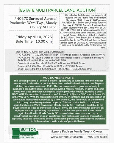
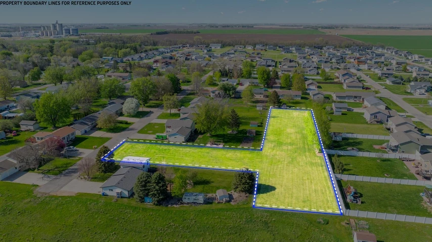
406.7 acres in Moody County, South Dakota
Ward, SD | Lat/Lng: 44.1190, -96.5181
Auction
406.7 ac.
03/05/2026
ACTIVE

Description
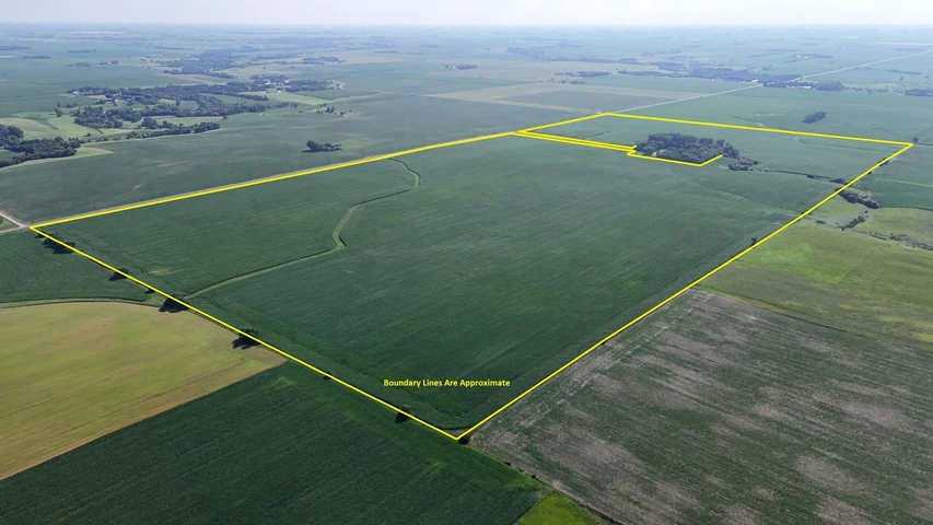
This +/-406.70 Acre Farm will be Offered As PARCEL #1 - +/-162.89 Acres of High Percentage Tillable Cropland in the NW ; PARCEL #2 +/- 162.52 Acres of High Percentage Tillable Cropland in the NE; and PARCEL #3 - +/-81.29 Acres in the W SE; and Combinations of Parcels #1 & #2 The N - +/- 325.41 Acres; Parcels #2 & #3 The NE & W SE - +/-243.81 Acres; or as Parcels #1, #2 & #3 Combined The Entire +/-406.70 Acre Unit.
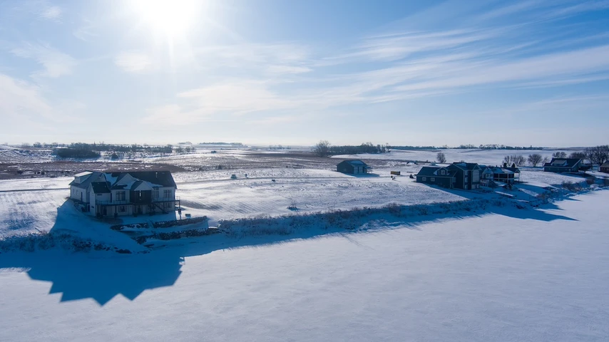
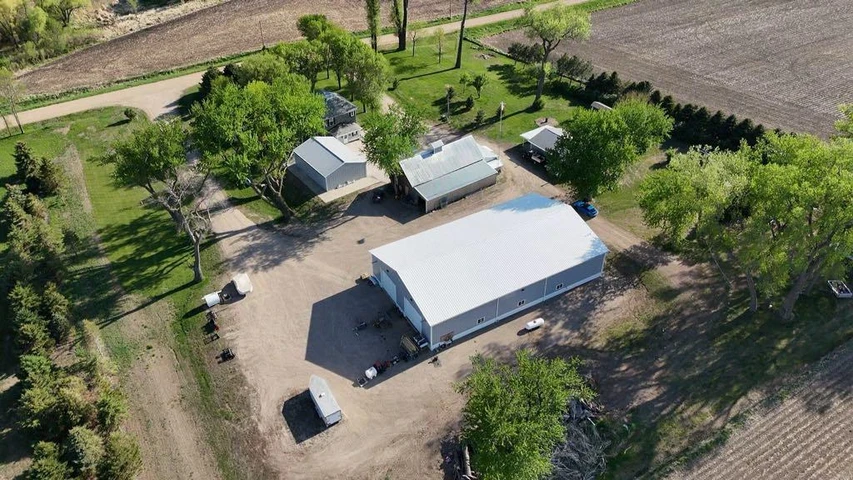
AUCTIONEERS NOTE: This auction presents a once in a lifetime opportunity to purchase land that has not been for sale for decades as portions have been in the Paulsen family for over 80 years dating back to acquisition in 1946. This auction presents a great opportunity to purchase a productive parcel of cropland/hayland, recently retired CRP acres and some areas with trees and other hunting and wildlife production habitat, including a small NRCS WRP Conservation Easement on +/-3.2 acres (Lot B) in the SE Corner of Parcel #3 in the W SE. With the recent retirement of the CRP contracts and implementation of some future management practices by a new owner(s), this farm could be transformed into a very desirable agricultural property. This land is situated in a prominent agricultural area in Ward Township in Moody County, SD. This land is available to the buyer to farm or lease as they desire in 2026. If you are in the market for quarters, an eighty or the rare opportunity to purchase a sizeable contiguous 406.7 acre unit of agricultural land in Moody County, SD as an addition to an area row crop or crop/livestock operation or as an investment, then make plans to attend this auction, especially since this land will be offered in individual parcels and combinations of parcels to fit the needs of a wide variety of potential buyers.
PARCEL #1 - +/-162.89 Surveyed Acres Legal Desc.: The NW of Sec. 31, T. 108N., R. 47W., (Ward Twp.), Moody County, SD
With the recent retirement/cancellation of the previous CRP contracts, Parcel #1 will have a very high percentage tillable, with the future non-tillable acres being comprised primarily of a +/-8 acre L shaped tree grove, waterways/drainage and roads. According to FSA information and the 156EZ the NW is indicated to have approx. 158.66 acres of Farmland and 158.66 acres of Cropland with a 62.20 acre corn base with a 108 bu. PLC yield and a 15 acre wheat base with a 29 bu. PLC yield. According to info. obtained from Surety Agri Data the land included in PARCEL 1 (NW ) has a Soil Productivity Index of 90.2, being comprised of Class II soils, with a gently rolling to rolling topography.
PARCEL #2 - +/-162.52 Surveyed Acres Legal Desc.: The NE of Sec. 31, T. 108N., R. 47W., (Ward Twp.), Moody County, SD
According to info. obtained from Surety Agri Data the land included in PARCEL 2 (NE ) has a Soil Productivity Index of 77.9, with the majority of the land considered as cropland being comprised of Class II soils with the lowland pasture/drainage/waterway (+/-19.65 acres as indicated by Surety) being Class VIw soil. The cropland acres have a generally gently rolling to rolling topography, with some lower lying land in the pasture/waterway/drainage. According to an FSA estimate, it appears that the NE currently has approx. 128.95 acres of cropland with the remainder being utilized has pasture/hayland, waterway and roads.
PARCEL #3 - +/-81.29 Acres LEGAL DESC.: The W SE, together with Lot B of L & L Paulsens First Addn., a subdivision of the of the SE , all in Sec. 31, 108N., R. 47W., Ward Twp., Moody County, SD.
According to FSA information and recent calculations, It appears that Parcel #3 (W SE) currently has approx. 68.71 acres considered to be cropland acres, with the non-tillable acres being comprised of +/-3.2 WRP acres, waterways/drainage and road. Previously it appears that all of the land considered as cropland was enrolled in the CRP program prior to the recent cancellation of the CRP contract in 2025. Additionally, there are some areas that may provide some hunting and recreational opportunities, especially in and near the perpetual NRCS Wetland Reserve Program Conservation Easement Area (WRP) situated in the SE Corner of the E SE designated as Lot B of L&L Paulsens 1st Addn containing 3.2 acres M/L. According to info. obtained from Surety Agri Data the land included in PARCEL 3 (E SE) has a Soil Productivity Index of 75.7, with the majority of the land considered as cropland being comprised of primarily Class II soils with the lowland pasture/drainage/waterway being comprised of Class VIw soil.
FSA INFORMATION FOR PARCEL #2 (NE ) and PARCEL #3 (W SE ) Presently FSA has both of these parcels combined into one operating unit as FSA Tract 1861, which together the FSA 156 EZ indicates has approx. 237.90 acres of Farmland with 197.66 acres of Cropland with a 78 acre corn base with a 108 bu. PLC yield, a 31.40 acre Wheat base with a 29 bu. PLC yield, a 25.80 acre soybean base with a 30 bu. PLC yield and a 4.80 acre oats base with a 62 bu. PLC yield.
TERMS: Cash - A 10% nonrefundable downpayment on the day of the sale with the remaining balance due and payable on or before May 29, 2026. Immediate Possession will be awarded to the buyer on sale day for preparation of the land and planting of the 2026 crops with full possession and marketable title to be conveyed at closing. Owners Title Insurance will be provided with the cost of the owners policy and the closing agents fee (Moody County Abstract and Title Company) to be divided 50-50 between the buyer(s) and seller. All of the 2025 RE taxes payable in 2026 which on the entire property including the N and the W of the SE, Exc. Lot B were $10,224.76 and on Lot B were $19.84, all of which will be paid by the sellers, with the buyer(s) to be responsible for all of the 2026 RE taxes due and payable in 2027. The total acres being sold are being sold in accordance with a survey as completed by Midwest Land Surveying, Inc., with the acres understood to be more or less. All survey costs will be paid by the estate/seller. The sellers do not guarantee that existing fences lie on the true and correct boundary and any new fencing, if any, will be the responsibility of the purchaser(s) pursuant to SD Law. FSA cropland acres, yields, bases, payments & other information are estimated and not guaranteed and likely will require an FSA reconstitution & County Committee Approval and also are subject to pending action and implementation of the New Farm Bill. A preliminary Title Commitment is available for review and buyers are encouraged to do their own investigation and due diligence, especially with regard to any perpetual easements or restrictions previously conveyed. Information contained herein is deemed to be correct but is not guaranteed. This property is sold in AS IS CONDITION and subject to any existing easements, restrictions, reservations or highways of record if any, as well as any or all Moody County Zoning Ordinances. The RE licensees in this transaction are acting as agents for the seller. Sold subject to confirmation of the Personal Representative/Trustee.
These individual parcels or this farm as a whole, are well suited to serve as an addition to an area row crop and/or crop/livestock operation(s) or as an investment.
Details
County: Moody
Zipcode: 57026
Property Type One: Farms
Property Type Two: Recreational Property
Property Type Three: Undeveloped Land
Brokerage: Sutton Auctioneers and Land Brokers, LLC
Brokerage Link: www.suttonauction.com
Apn: 1084731100

Sutton LLC
Sutton Auctioneers and Land Brokers, LLC
(605) 336-6315
By clicking the button, you agree to our Terms of Use and Privacy Policy.


Nearby Listings
Hamlin County, SD
$425,000 - 1 ac.
Lyon County, MN
$3,795,785 - 310 ac.
Minnehaha County, SD
$950,000 - 4 ac.
Hamlin County, SD
$807,500 - 2 ac.
Hamlin County, SD

$425,000 - 1 ac.
Minnehaha County, SD
$140,000 - 2 ac.
Minnehaha County, SD
$950,000 - 4 ac.
Minnehaha County, SD

$140,000 - 2 ac.
Minnehaha County, SD
$140,000 - 2 ac.
Brookings County, SD
$55,000 - 1 ac.