

10 Acres - With Power, Buildable Lot in Arizona City, Pinal County, AZ
W Shay Rd, Eloy, AZ | Lat/Lng: 32.7066, -111.6574
$134,999
10 ac.
07/03/2026
ACTIVE
Description
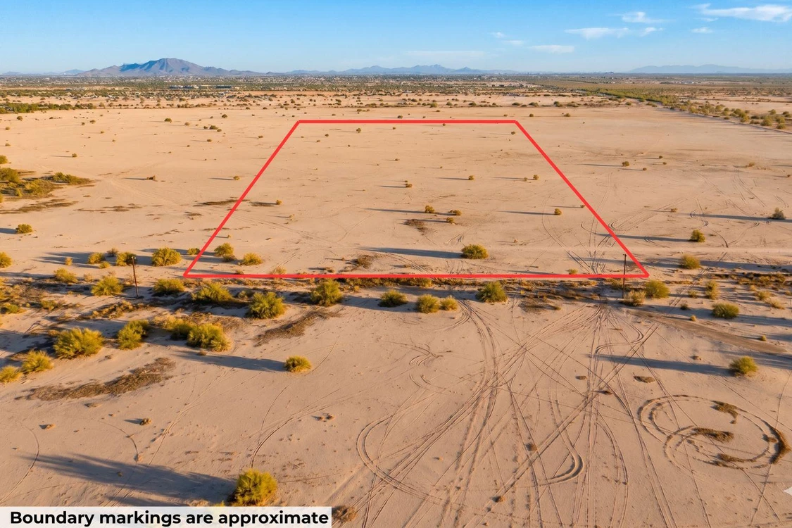
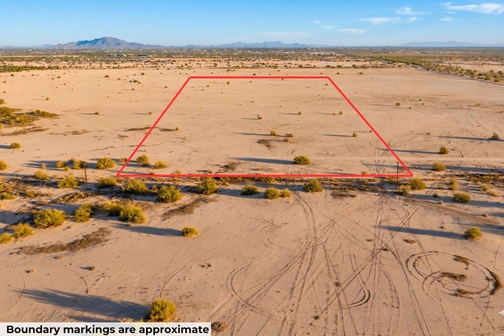
10 acres of flat Arizona desert in Eloy, with power running right along the south boundary. This lot sits on W Shay Rd at 1,546 feet, open and level with sparse desert scrub. No flood zone. No wetlands. No HOA. You get more than ten times the minimum lot size for the zoning here, so there is plenty of room to build and breathe.
Utilities are close, but plan for off-grid systems. Power runs along W Shay Rd on the south boundary, which is close. Water would be a well. The nearest city waterline is about 4.3 miles away, so connecting to city water is not realistic here. Most builders out here drill a well. Sewer would be septic, which is standard for parcels like this. Cell or satellite covers internet.
Getting there is on a dirt road. Access is a dirt road that the City of Eloy does not maintain. A 2WD vehicle handles it in normal weather. Walk it before you buy so you know the route.
Owner financing is available on this lot. No banks. No credit checks. No prepayment penalties. Call or text us at (313) 349-0434 and we will work out monthly terms that fit your budget. You can pay it off early anytime. Buying with cash? We cover your first year of property taxes.
This lot is zoned R1-43 Estate Residential under the City of Eloy. Single-family homes are the primary use. Mobile homes and manufactured homes are not permitted in this zone. For exact setback and square footage rules, call us and we will point you to Eloy City Code.
Or Choose Your Owner Financing Plan Starting From $20,249 down
To lock this property in your name, we need both a deposit and a signed purchase agreement. Call or text us anytime at (313) 349-0434 and we will walk through monthly payment options together.
Details
Address: W Shay Rd, Eloy, AZ 85193
Parcel Number: 408-01-0100
Legal Description: A parcel of land in and being a part of Lot fifteen (15), SUNLAND ESTATES, according to Book 2 of Maps, page 6, records of Pinal County, Arizona
County: Pinal
Size: 10 acre
Property Survey or Plat Map: Yes - refer to documents section
Access: Dirt road
Power: Along W Shay Rd on South boundary
Water: Would be well
Sewage: Would be septic
Phone: Cell or Satellite (coverage map)
Zoning: R1-43 Estate Residential (43,560 sq. ft.) (Pinal County Zoning Ordinance)
Camping and RV: No. (Pinal County Land Use Code)
Mobile Homes Allowed: No
Manufactured Homes Allowed: No
Site Built Homes Allowed: Yes
Minimum Square Footage: 200 sq ft
HOA: No specific requirement
Flood Zone: Zone X (minimal flood hazard) (Refer to Land id map on our web listing)
Wetlands: No (Refer to Land id map on our web listing)
Annual Property Taxes: $296
General Elevation: 1,546 feet
Terrain: Level
Dimensions: 335 x 1322 x 328 x 1325 feet
Conveyance: Warranty Deed
Title: Free and Clear
Google GPS Corner Coordinates (approximate)
NW: 32.7083, -111.6579
NE: 32.7083, -111.6568
SW: 32.7047, -111.6579
SE: 32.7047, -111.6568
Approximate Distance to Nearby Cities & Points of Interest
30 minutes to Casa Grande : Population 57,699
1 hour 15 minutes to Phoenix: Population 1,730,000
Points Of Interest
Get ready to explore the beauty of the desert at Peralta Regional Park in Arizona! With its rugged trails, stunning mountain views, and peaceful picnic areas, its the perfect spot for outdoor adventures with family and friends. Whether youre hiking, horseback riding, or simply enjoying a scenic sunset, Peralta Regional Park invites you to experience the magic of the Sonoran Desert in a friendly and welcoming environment.
1 hour 25 minutes to Peralta Regional Park
Activities at Peralta Regional Park: camping, hiking, walking, mountain and road biking, stargazing.
2 hours to Tonto National Forest
Activities at Tonto National Forest: camping/RVing, hiking, walking, mountain and road biking, boating, swimming.
Are you a hunter or fisherman? Property is bordering Game Management Unit 39 Yuma.
Nearby game includes: Bighorn sheep, mule deer, quail, dove.
Nearby fish includes: bass, catfish, crappie, trout.
Lots of nearby walking, hiking, and biking trails to choose from: Stanfield and Maricopa Trail, Casa Grande Mountain Trail, North Mountain Park East Loop, Table Top Mountain trail & Bolt Trail.
Call or Text us anytime for questions or to learn more about how to purchase this property.
Details
County: Pinal
Zipcode: 85193
Property Type One: Residential Property
Property Type Two: Undeveloped Land
Brokerage: Compass Land USA
Brokerage Link: www.compasslandusa.com/property
Apn: 408010100

Andrew Gaasenbeek
Compass Land USA
(313) 349-0434
By clicking the button, you agree to our Terms of Use and Privacy Policy.


Nearby Listings
Pinal County, AZ
$24,997 - 0 ac.
Pinal County, AZ

$49,999 - 2 ac.
Pinal County, AZ
$37,999 - 2 ac.
Pinal County, AZ

$65,000 - 1 ac.
Pinal County, AZ

$65,000 - 1 ac.
Pinal County, AZ

$49,999 - 1 ac.
Pinal County, AZ

$49,999 - 1 ac.
Pinal County, AZ
$27,999 - 2 ac.
Pinal County, AZ
$4,625,000 - 51 ac.
Pinal County, AZ

$110,000 - 9 ac.