
Webster Co.
TBD A RD, Guide Rock, NE | Lat/Lng: 40.0034, -98.3740
$661,500
160 ac.
02/19/2026
ACTIVE

Description
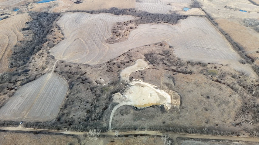
Located Southwest of Guide Rock, NE, on the Kansas state line, this 160+/- acre tract offers a combination of tillable acres and grass that has been utilized by cattle and wildlife. Additionally, this property offers income via a rock quarry that has been utilized by the county.
Land
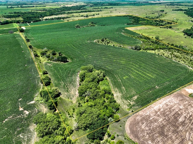
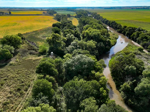
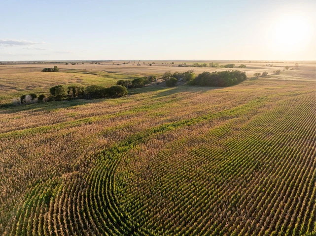
This farm is comprised of roughly 77 tillable acres featuring Holdrege Silt Loam soils with 37% slopes. Holdrege Silt Loam is known for its productivity and moisture-holding capacity, providing consistent crop performance. The cropland has been terraced to manage water flow and minimize erosion. Surface water runoff is directed into one of the natural timbered draws on the property, enhancing both conservation practices and long-term soil sustainability.
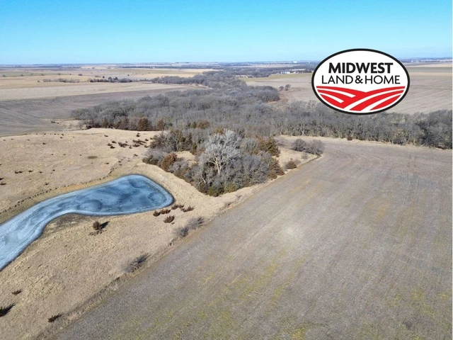
The balance of the property includes roughly 79 acres of grassland and timbered draws that provide natural shelter for livestock and create prime habitat for wildlife. This mix of open pasture and timber not only supports agricultural use but also offers recreational appeal.
In recent years, the tillable acres have been cash rented, providing a steady and predictable income stream. The pasture has been subleased for grazing, further contributing to the farm's annual return. This structure offers flexibility for a new owner to either continue the current leasing arrangements or transition the property to owner-operator use.
Recreation
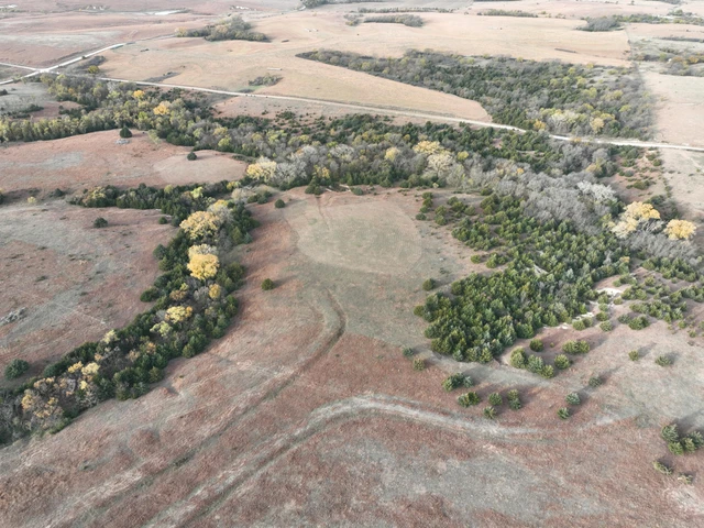
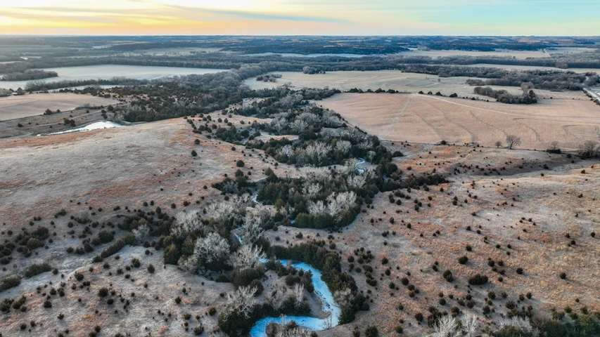
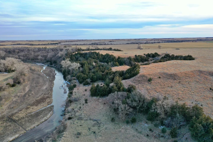
With its diverse topography and abundance of cover, this farm sets up exceptionally well as a wildlife haven. Several timbered draws and natural travel corridors weave throughout the property, creating ideal conditions for deer and other game to inhabit.
On the west side, a deep, rugged draw serves as the centerpiece of the habitat. This gnarly drainage appears to have been excluded from cattle grazing for several years, allowing it to grow thick and undisturbed. Clumps of sumac are scattered throughout a mix of brome and native grasses, while mature elm and ash trees stretch overhead, providing shade and vertical structure. The density of this cover, combined with the steep terrain, has created a natural bedding sanctuary with multiple escape routes that connect seamlessly to the rest of the property and neighboring tracts. It's the type of secluded environment mature whitetails gravitate toward.
The north and east boundaries further enhance the farm's wildlife appeal. Both fence lines are lined with established stands of elm, ash, and Osage orange trees, forming strong edge habitat and predictable travel corridors. Fingers of timber extend from these borders toward the center of the property, creating pinch points and natural crossing areas where wildlife can move between feeding and bedding areas while remaining concealed. These interior extensions offer strategic stand locations and multiple setup options depending on wind direction.
Along the south end, rolling and undulating pasture provides yet another natural travel route. This portion of the property also features two ponds and the rock quarry, adding both water sources and additional structural diversity. The combination of elevation changes, water, and nearby cover encourages consistent wildlife movement and supports year-round habitat needs.
Altogether, the blend of heavy bedding cover, defined travel corridors, edge habitat, water sources, and varied terrain makes this property exceptionally well-suited for recreational use and wildlife management.
Location
This property is accessible from many different directions and is located on a dirt road.
This route offers the most all-weather access to the property, with the last 3/4 mile to the property being dirt:
From Guide Rock, NE, travel South on NE HWY 78 for 6 miles, OR from Burr Oak, KS travel North on KS HWY 128 for 7 miles to the Northbranch corner.
Turn and go West 2.5 miles to East side of Northbranch
Turn North on RD 80 and go 2 miles to South side of property. /KS HWY 128 (This road will be dirt for the last 3/4 mile to the property)
Alternate Route which traverses more dirt roads:
From Guide Rock, NE travel South on NE HWY 78 4 miles
Turn West on Road A for 2 miles
Details
County: Webster
Zipcode: 68942
Property Type One: Farms
Property Type Two: Recreational Property
Property Type Three: Hunting Land
Brokerage: Hayden Outdoors Real Estate
Brokerage Link: https://www.haydenoutdoors.com/agents/aaron-baumann/
Apn: 001012800

Aaron Baumann
Hayden Outdoors Real Estate
(402) 984-1690
By clicking the button, you agree to our Terms of Use and Privacy Policy.


Nearby Listings
Jewell County, KS
$1,377,000 - 314 ac.
Jewell County, KS
$308,000 - 80 ac.
Jewell County, KS
$586,500 - 117 ac.
Franklin County, NE
$1,500,000 - 147 ac.
Jewell County, KS
$1,050,000 - 263 ac.
Republic County, KS
$1,150,000 - 48 ac.
Webster County, NE

$65,000 - 9 ac.
Jewell County, KS
$1,175,000 - 80 ac.
Jewell County, KS
$548,000 - 154 ac.
Nuckolls County, NE
$525,000 - 122 ac.