
Eastern Oregon Narrows Pivots
Sodhouse Lane, Princeton, OR | Lat/Lng: 43.2510, -118.9248
$1,700,000
760 ac.
05/21/2024
ACTIVE


Description
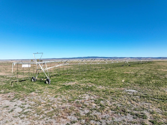
Narrows Pivots Princeton, OR
This Eastern Oregon farm is south of Burns Oregon nestled in a picturesque valley with a tapestry of the Steens Mountains & agricultural prosperity. The landscape consists of slight hillsides on the west & south portion of the deeded that overlook the valley floor where the irrigated rest. The farm has a total of 760 deeded acres with 340 acres in water rights under 3 pivots. The irrigation is done by 5 wells with 2 having hot water.
The property borders thousands of acres of public BLM ground as well as the Malhuer Wildlife Refuge. The irrigated fields are currently planted into a mixture of oats, peas, turnups, clover, & annual grasses. There is a bunk house on the property and a good set of steel working corrals set up with alleys from different grazing pastures to make it a swifter process of cattle handling facility.
This is truly a unique property with an amazing setting, plus it has its own private cinder pit for roads & pivot tracks.
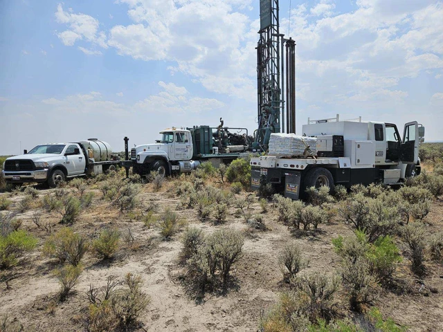
IRRIGATION
A total of 340 acres are irrigated by 3 pivots, 2 Reinke, 1 Zimmatic, one of which has a LESA system to optimize water evaporation. The pivots are all interconnected with the mainlines & tied into the 5 wells. The 3 pivots are all currently planted into a mixture of oats, peas, turnups, clover, & annual grasses.
This area has a longer growing season for hay & alfalfa due to the warmer climate compared to the other areas around Burns.
IMPROVEMENTS
The improvements on the premise are mostly storage with a couple of train carts. There is a bunk house that has been used during calving season for a close place to rest between the fields & pasture ground. A steel set of working corrals works great with alleys leading from different pasture fields to allow a working area to sort & load. The owner currently uses a portable loading chute.
The owners have a cinder pit on the deeded they use for their roads, pivot tracks, & more.
LOCATION: Approximately 28 miles South of Burns Oregon off of 205 on Sod House Lane
LEGAL: T27S R31E W.M. Tax Lots 503, 1200, 1300
ACREAGE:
760+/- Deeded Acres Per County Records
- 340+/- Acres Pivot Irrigated
- 418 +/- Acres Dryland Pasture
- 2 +/- Acres Improvements
WATER RIGHTS:
Certificate# #Acres Priority Date SOURCE
G-15355(Permit) 130 July, 1 2002 Well
92228 210 June 17, 2008 Well
FINANCING: Cash or Bank Financing
TAXES: $1,743.37 Per County Records (Farm deferral)
Details
County: Harney
Zipcode: 97721
Property Type One: Farms
Brokerage: Jett Blackburn Real Estate, Inc.
Brokerage Link: www.jettblackburn.com

Curt Blackburn
Jett Blackburn Real Estate, Inc.
(541) 413-5660
By clicking the button, you agree to our Terms of Use and Privacy Policy.


Nearby Listings
Harney County, OR
$185,000 - 160 ac.
Harney County, OR

$1,999,999 - 1778 ac.
Harney County, OR
$2,500,000 - 80 ac.
Harney County, OR
$715,000 - 16 ac.
Harney County, OR
$1,875,000 - 1920 ac.
Harney County, OR

$1,350,000 - 316 ac.
Harney County, OR

$3,700,000 - 1220 ac.
Harney County, OR

$2,130,000 - 454 ac.
Harney County, OR
$2,750,000 - 1161 ac.
Harney County, OR

$345,000 - 279 ac.