
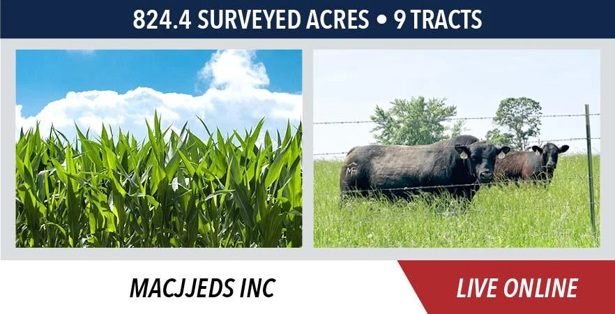
COOPER COUNTY, MO LAND AUCTION - MACJJEDS INC
Pilot Grove, MO | Lat/Lng: 38.8730, -92.9501
Auction
824.4 ac.
10/15/2025
ACTIVE

Description
LOCATION
Cooper County, Missouri
Land is located near Pilot Grove, Missouri (approximately 28 miles northeast of Sedalia, MO or 35 miles west of Columbia, MO). The land is further described as being in Section 1, T47N-R19W, Sections 31 & 33, T48N-R18W, Sections 3 & 4, T47N-R18W, Pilot Grove Township, Cooper County, Missouri.
SELLER
MACJJEDS INC
MANAGED BY
Arlyn Swartzentruber (660) 287-2079
Dan Sullivan (844) 847-2161
GENERAL INFORMATION
824.4 surveyed acres 9 tracts
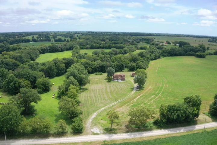
Start planning now to participate in this outstanding Cooper County, Missouri land auction! Land represents some of the most productive farmland in the area as well as combination pasture/recreational tracts and several attractive building sites. Some of this land has been in the Schuster Family for over 100 years, has been farmed and managed with conservation practices in mind and the fertility is second to none!
TRACT INFORMATION
Tract 1 54.0 surveyed acres
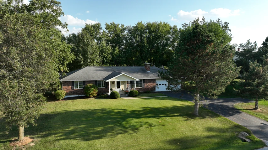
FSA records indicate approx. 19.04 HEL acres with the balance being pastureland and wooded acreage with outbuilding
NCCPI Overall Rating: 76.1
Soil types include Winfield and Weller
Access along the north from Ghost Holler Road
Tract 2 337.7 surveyed acres
FSA records indicate approx. 289.8 HEL acres with the balance being pastureland and some wooded areas
NCCPI Overall Rating: 76.8
Soil types include Leslie, Winfield, Cotton, Wrengart, Pershing, Clafork and Weller
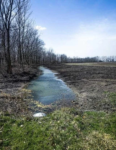
Pond located in the northern section
Choteau Creek runs through northeast portion of the property
Access along the north from Ghost Holler Road and Hwy N runs along the south boundary
Tract 3 43.6 surveyed acres
FSA records indicate approx. 29.78 NHEL acres and 3.31 HEL acres with the balance being pastureland, improved with pond on the east end and newer fencing
NCCPI Overall Rating: 65.4
Soil types include Wrengart, Pershing, Menfro, & Bluelick
Access along the east from Hwy HH and along the north from Ghost Holler Road
Tract 4 110.5 surveyed acres
FSA records indicate approx.106.93 NHEL acres
NCCPI Overall Rating: 84.4
Soil types include Leslie and Clafork
Katy Trail runs through northeast corner of property
Access along the south from Hwy 135
Tract 5 37.5 surveyed acres
FSA records indicate approx. 22.82 NHEL acres and 9.92 HEL acres with the balance being pastureland and scattered timber
NCCPI Overall Rating: 57.1
Soil types include Clafork, Eldon, Leslie, and Bunceton
Access along the north from Hwy 135
Tract 6 36.9 surveyed acres
FSA records indicate approx. 13.12 NHEL acres and 16.7 HEL acres with the balance being pastureland and wooded
NCCPI Overall Rating: 63.9
Soil types include Clafork, Eldon, and Bunceton
Access along the north from Hwy 135
Tract 7 44.7 surveyed acres
FSA records indicate approx. 32.56 NHEL acres and 7.75 HEL acres
NCCPI Overall Rating: 79.6
Soil types include Leslie, Bunceton, and Clafork
Access along the north from Mile Corner Road, just off Hwy 135
Tract 8 84.5 surveyed acres
FSA records indicate approx. 61.53 HEL acres with the balance being wooded
NCCPI Overall Rating: 72.6
Soil types include Wrengart, Goss, Pershing, Cotton, and Winfield
Improved with a pond near the center of property
Access along the north from Mile Corner Road
Tract 9 75.3 surveyed acres
FSA records indicate approx. 34.8 HEL acres with the balance being pastureland and wooded
NCCPI Overall Rating: 70.8
Soil types include Pershing, Wrengart, and Goss
Pond located in the northeast portion of property
Excellent wildlife habitat
Access along the north from Mile Corner Road
METHOD & TERMS
The MACJJEDS INC farm will be sold on a price per acre basis, based on surveyed acres. All tracts will be offered through the marketing method of Buyers Choice, whereas the high bidder can elect any of the tracts for their high bid. If the high bidder does not elect all offered tracts, then the remaining tract(s) will continue to be offered Buyers Choice until all tracts have been elected. The tracts will NOT be offered in their entirety at the conclusion of the auction.
Immediately following the auction, the successful buyer will be required to sign a real estate sales contract and pay ten percent (10%) of the purchase price as a non- refundable down payment, payable to Cooper County Land Title, which will be held in escrow until closing. The balance of the purchase price will be due at closing which will take place on or before December 12, 2025, at Cooper County Land Title.
The seller will provide title insurance in the full amount of the purchase price. The 2025 real estate taxes will be paid by the seller. All subsequent real estate taxes shall be paid by the buyer. Possession will be given at closing.
Bidding is NOT subject to any contingencies, including but not limited to financing, an appraisal or inspection of the property.
All announcements made sale day take precedence over prior advertising either written or oral. The information in our brochure, in our advertisements and on our website is believed to be accurate; however, no liability for its accuracy, errors or omissions is assumed. All lines drawn on maps, photographs, drone video, etc. are approximate.
Buyers should verify the information to their satisfaction. There are no expressed or implied warranties made by the seller or Sullivan Auctioneers pertaining to this property. Real estate is being sold AS IS.
Details
County: Cooper
Zipcode: 65276
Property Type One: Farms
Property Type Two: Recreational Property
Brokerage: Sullivan Auctioneers
Brokerage Link: www.sullivanauctioneers.com

Sullivan Auctioneers
Sullivan Auctioneers
(844) 847-2161
By clicking the button, you agree to our Terms of Use and Privacy Policy.


Nearby Listings
Cooper County, MO

$1,938,000 - 204 ac.
Cooper County, MO
$1,938,000 - 204 ac.
Cooper County, MO
$1,938,000 - 204 ac.
Cooper County, MO
$1,938,000 - 204 ac.
Cooper County, MO
$1,938,000 - 204 ac.
Saline County, MO
Auction - 1 ac.
Chariton County, MO
$796,500 - 81 ac.
Cooper County, MO

Auction - 824 ac.
Cooper County, MO
Auction - 824 ac.
Pettis County, MO
$215,000 - 3 ac.