
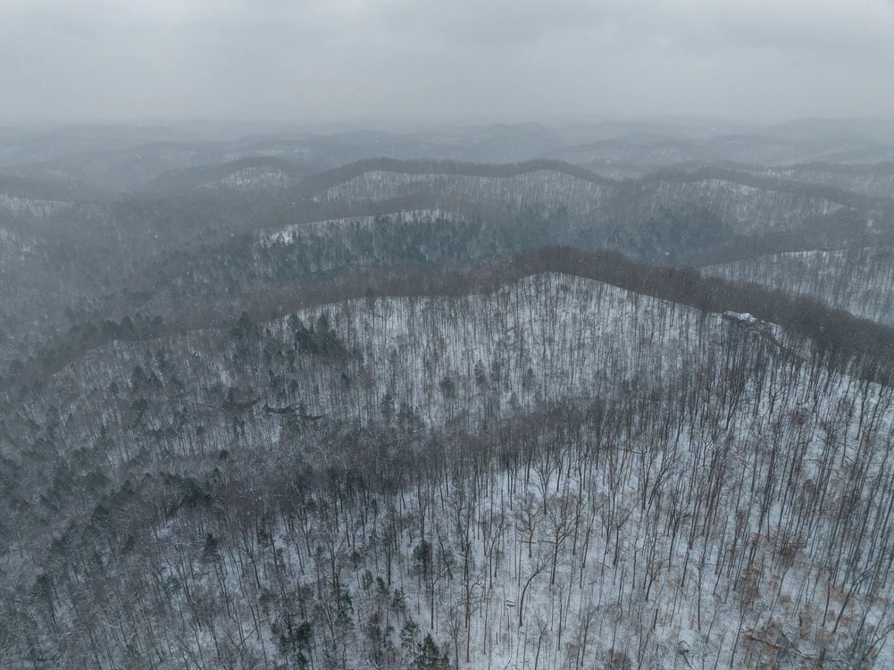
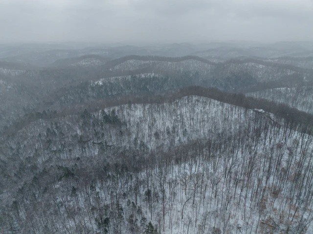
52 Acres For Sale in Wayne County West Virginia!
Perry Ridge Rd, Dunlow, WV | Lat/Lng: 37.9975, -82.3353
$89,900
52 ac.
02/20/2026
ACTIVE
Description
Interested in this property? Call, text, or email us today for more details!
(540) 824-3372
Feel free to visit the property any time, no need to set up an appointment, this property has no address.
Subscribe to email alerts by texting your e-mail address to (541) 375-0012 and be the first to know when we get a great deal in.
By texting (541) 375-0012 you authorize Country Land Group to send text messages with offers & other information, possibly using automated technology, to the number you provided. Message/data rates apply. Consent is not a condition of purchase. You may unsubscribe at any time.
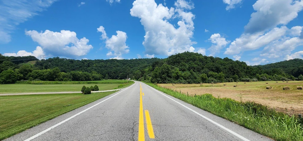
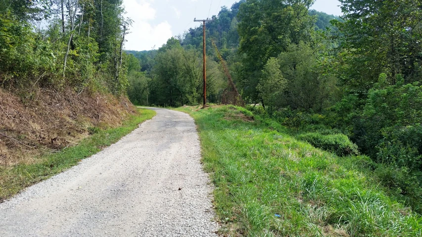
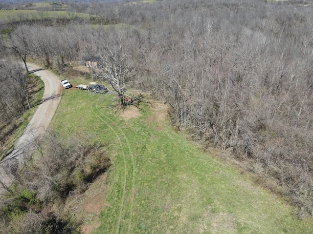
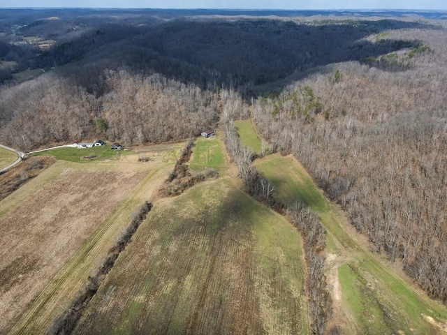
Discover freedom and flexibility with this unrestricted property on Perry Ridge Road! With no zoning, HOA, or deed restrictions, you have the freedom to build, place a mobile home, create a private getaway, or invest for the future. The parcel is subdividable, adding even more opportunity. A well and septic will be needed, allowing you to design utilities to fit your plans.
Enjoy peaceful rural surroundings while staying just 15 minutes to Dunlow and about 75 minutes to Huntington for major shopping, dining, and amenities. Outdoor lovers will appreciate being near Cabwaylingo State Forest and East Lynn Lake Wildlife Management Area for recreation and adventure.
The timber on this property has been sold.
Address: Perry Ridge Rd, Dunlow, WV, 25511
Cash Discount Price: $89,900.00
*There is a $1000 deposit required with all purchases. $500 is a non refundable transaction fee and the remaining $500 would be applied to the purchase price at time of closing.
Owner Financed Price: $89,900.00
Owner Financing Terms: $8,900.00 down and $1,621.73/month for 72 months.
*Applicable fees may apply including but not limited to $35/ month servicing fee and 12.9% interest for owner financing. Buyer is responsible for annual property tax. Contact Country Land Sellers for more details. Monthly payment subject to change based on down payment. Monthly payment shown is an estimate only.
County: Wayne
Acres: 52 Acres (Raw Land)
Coordinates: 37.9975, -82.3353
Parcel #: 09 50001100000000
Yearly Estimated Taxes: $120.22
Elevation: 1212 FT
Property Dimensions: 53.84 FT X 34.64 FT X 33.28 FT X 23.62 FT X 52.37 FT X 178.45 FT X 80.11 FT X 215.96 FT X 41.96 FT X 34.8 FT X 52.85 FT X 56.76 FT X 148.5 FT X 280.5 FT X 186.74 FT X 25.5 FT X 931.44 FT X 737.77 FT X 330 FT X 198 FT X 567.78 FT X 152.25 FT X 132 FT X 875.34 FT X 274.71 FT X 148.5 FT X 231.03 FT
Zoning: No Zoning
County Planning and zoning phone #: Building Permits
No zoning department.
If you are planning to build a new home, place a mobile/modular home or cause other development in Wayne County, you are required to obtain a Building Permit.
Stephen A. Brown
Building Permit Officer/Floodplain Coordinator
(304) 272-6350
Does this property have an HOA?: No
Does this property have a survey?: No
Elementary school: Dunlow Elementary School
Middle school: Crum Pre K-8 School
High school: Tolsia High School
Phone # for electric company: Appalachian Power Company (800) 956-4237
Legal Description: 54 Surf Williamson Road
If this property is not what you are looking for, go to our website and sign up for our deal alerts; you will be notified whenever we have a new property for sale! Or, e-mail, call or text us, and we may be able to find the property you are looking for.
Details
County: Wayne
Zipcode: 25511
Property Type One: Recreational Property
Property Type Two: Undeveloped Land
Brokerage: Country Land Sellers
Brokerage Link: countrylandsellers.com

Luke Harris
Country Land Sellers
(540) 824-3372
By clicking the button, you agree to our Terms of Use and Privacy Policy.


Nearby Listings
Putnam County, WV
$544,000 - 5 ac.
Putnam County, WV
$390,000 - 151 ac.
Putnam County, WV
$519,000 - 341 ac.
Putnam County, WV

$1,453,000 - 497 ac.
Lawrence County, KY
$500,000 - 5 ac.
Wayne County, WV
$139,000 - 188 ac.
Gallia County, OH
$219,900 - 42 ac.
Lincoln County, WV

$339,900 - 302 ac.
Logan County, WV

$235,000 - 148 ac.
Greenup County, KY
$849,000 - 407 ac.