
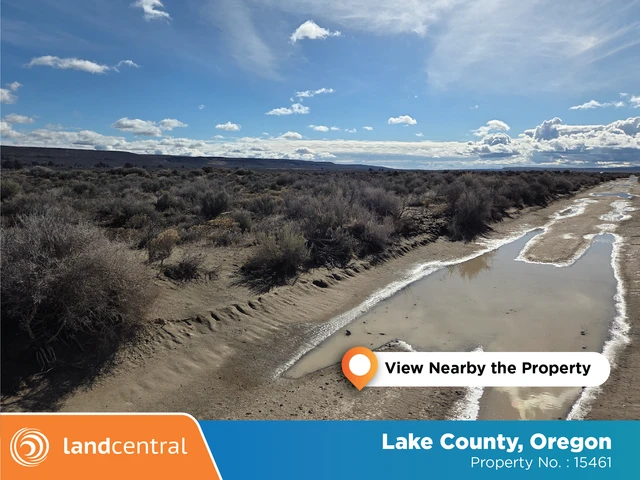
5 Acres For Sale Christmas Valley Oregon
Oster Farms Road, Christmas Valley, OR | Lat/Lng: 43.2436, -120.4719
$16,999
5 ac.
02/18/2026
ACTIVE

Description
CASH OR OWNER FINANCING......NO CREDIT CHECKS......
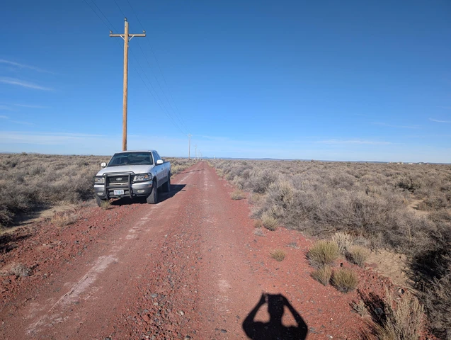
This 5-acre lot (Lot 600) is located just east of Christmas Valley Oregon on Oster Farms Road. It is a quiet and private lot that has fencing on the back north part of the lot. Access Is easy from Christmas Valley Highway and then onto Oster Farms Road. There is road frontage on the west side of this 5 acre lot and power is available as there are power poles going down Oster Farms Road.
There are mountain views from this 5 acre lot and Oster Farms Road is also a red cinder graveled road. This lot is quiet and private, yet not too far from town. This property would be great if someone was thinking about building a home or a cabin. Eventhough this lot located outside of town, it is less than a 1/2 mile off of paved Christmas Valley Highway. This lot is located in a quiet area of Christmas Valley with a few neighbors sprinkled in throughout the area.
Finding this lot is easy. From the Fast Break Market in Christmas Valley, Oregon (which is located on the corner of Christmas Tree Lane), From the corner of Christmas Valley Highway(CR5-14) and Christmas Tree Lane( Fastbreak Market), drive east on Christmas Valley Highway for 12.3 miles. Turn left onto Oster Farms Road ( no sign, power poles and red cinder road) and then head north for 0.37 miles. Lot 600 will be on the right side of the road ( from 0.37 miles 0.50 miles to the wire fence at the back of property with no trespassing signs).
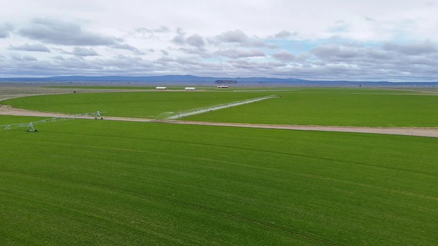
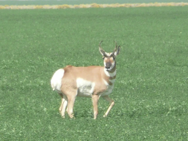
There is lots of wildlife in the area including antelope, wild deer, jackrabbits and coyotes. Ana Reservoir, which includes boating, fishing and water skiing is also near Christmas Valley, Oregon. Come and build your weekend cabin or homesite!
Property Facts:
Power: On Oster Farms Road ( New Owner Installs)
Phone: Cell phone accessible.
Water: By Well Or holding Tank (New Owner Installs)
Sewer: By septic. (New Owner Installs)
TV / Cable: Unknown.
Gas: Unknown.
Access: Dirt road frontage.
Zoning: A-2 ( To build a (CUP) conditional use permit will be required.
Time Limit to build: None.
Topo: Level.
Elevation: Roughly 4,500 ft above sea level.
Property Taxes: About $100.00 per year and current.
GPS Coordinates:43.2436, -120.4719
Conveyance: Special Warranty Deed
Parcel size: 5 Acres +/-
Legal Description: Township 27, Range 19E, Section 9 Lake County, Oregon. Tax Lot 600.
APN #: 7020
CASH PRICE: $16,999.00 OR Owner Financed Deals:
Owner Financed Deal: Price $19,999.00
$200.00 Down Payment/ At 8 % Interest
Monthly Payment: $165.61 For 20 Years
Fast Pay Option: Cash Price $16,999.00
Down Payment: $1,416.58 / 12 Months Same As Cash
Monthly Payment: $1,416.58 For 12 Months
Details
County: Lake
Zipcode: 97641
Property Type One: Recreational Property
Property Type Two: Residential Property
Property Type Three: Undeveloped Land
Brokerage: The Owner Terms Land Network LLC
Brokerage Link: www.OwnerFinancedLand.com
Apn: 7020

Jesse Ivy
The Owner Terms Land Network LLC
(541) 350-8606
By clicking the button, you agree to our Terms of Use and Privacy Policy.


Nearby Listings
Lake County, OR
$9,800,000 - 5956 ac.
Lake County, OR
$3,999,000 - 288 ac.
Lake County, OR

$12,999 - 5 ac.
Lake County, OR
$19,999 - 10 ac.
Lake County, OR

$9,999 - 0 ac.
Lake County, OR

$9,999 - 0 ac.
Lake County, OR
$9,999 - 0 ac.
Lake County, OR

$9,999 - 0 ac.
Lake County, OR
$127,500 - 80 ac.
Lake County, OR
$198,000 - 0 ac.