Old Grimmett Road 400
Old Grimmett Road, Tuskegee, AL | Lat/Lng: 32.4729, -85.7497
$1,072,500
400 ac.
08/05/2025
ACTIVE


Description
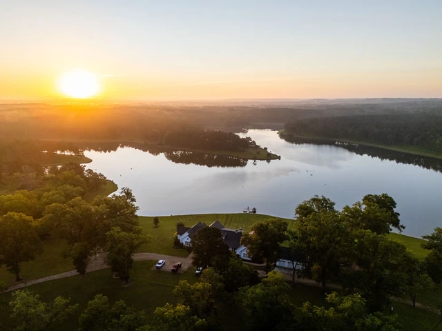
The Old Grimmett Road 400 tract is located in the East Gulf Coastal Plain region, characterized by gently rolling hills and plains that gradually slope toward river valleys. This area lacks significant mountainous features, creating a landscape well-suited for a variety of land uses. The tract is surrounded by timbered properties with varying age classes of timber, forming an unfragmented forest supporting diverse wildlife habitats. This environment is ideal for an abundance of species and helps sustain larger populations of those species.
The property is just a short 10-minute drive from Tuskegee, where youll find fuel, dining, convenience stores, hotels, local shops, and several historical attractions. Its also only 15 minutes from access to I-85, providing convenient connectivity.
Centrally situated between Montgomery and Auburn, Alabama, the Old Grimmett Road 400 Tract enjoys proximity to both cities, each offering a full range of amenities from lodging and dining to regional airports.
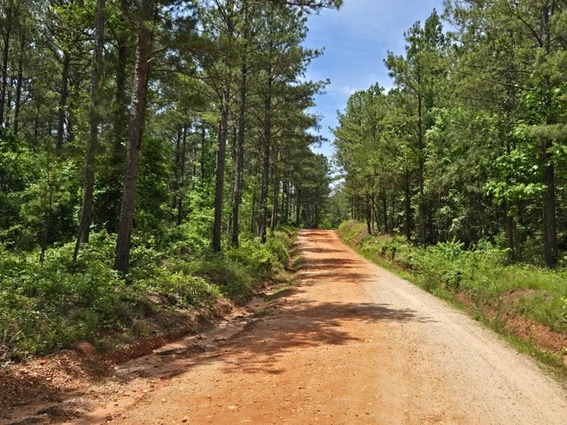
The Old Grimmett Road 400 tract is accessed from Old Grimmett Road, a low-traffic county dirt road that is periodically maintained. This road connects AL-199 to Macon County Road 36, offering convenient regional access. The property features approximately 0.9 miles of frontage along Old Grimmett Road.
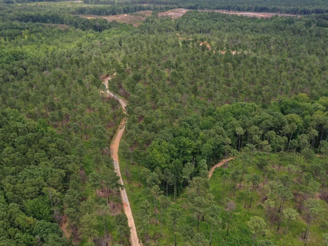
Within the tract, there are approximately 2 miles of internal roads that are navigable by most four-wheel-drive vehicles. The main internal road, constructed prior to the most recent logging operation, has held up well and remains in good condition, providing reliable access throughout the property.
The Old Grimmett Road 400 tract is well-suited for timber production and offers outstanding hunting opportunities. Elevation across the property ranges from approximately 240 to 420 feet above sea level. The higher elevations not associated with bottomlands feature well-drained, productive soils ideal for growing timber and excellent vantage points that offer scenic views of the property. While the lower upland areas do not have well-drained soils, they are still highly productive for timber growth. The bottomland areas, associated with streams and wet zones, retain water for much of the year and are not feasible for timber harvesting.
There are currently no structures on the property aside from hunting stands. The lessee will remove these stands if the lease is canceled. The nearest access to power and water is located approximately 2,000 feet south of the southernmost parcel. Several hilltop sites make ideal locations for a cabin or hunting camp.
The property is currently under a hunting lease and includes multiple established food plots. Located in Macon County, an area known for exceptional hunting, the tract supports white-tailed deer, turkey, and other small game populations. While feral hogs are common in the region, there is no current evidence of hog activity on the property. Streamside Management Zones (SMZs) retained during the last timber harvest serve as travel corridors for wildlife and enhance the propertys overall habitat quality. Abundant cover and well-maintained food plots support a healthy and sustainable wildlife population. Additionally, a network of mowed trails allows easy access throughout the property by UTV or ATV.
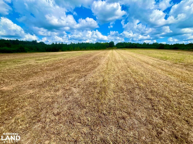
Approximately 293 acres of the property were clearcut in 2020 and have since re-established naturally. The upland areas have predominantly regenerated with Loblolly pine, along with some areas of oaks and soft hardwood species. Some partially harvested areas now consist of scrub oak species and Longleaf pine.
Portions of the tract not included in the 2020 clearcut are primarily lowland and bottomland areas that support stands of mature hardwoods. Notably, the northern section of the property features an extensive bottomland hardwood forest, where water is present at or near the surface during most months of the year.
Details
County: Macon
Zipcode: 36083
Property Type One: Recreational Property
Property Type Two: Timberland
Property Type Three: Hunting Land
Brokerage: Fountains Land
Brokerage Link: https://land.com


Nearby Listings
Bullock County, AL
$3,850,000 - 941 ac.
Coosa County, AL
$831,000 - 256 ac.
Coosa County, AL

$1,600,000 - 300 ac.
Bullock County, AL

$1,590,000 - 172 ac.
Tallapoosa County, AL
$935,656 - 288 ac.
Bullock County, AL
$2,490,000 - 352 ac.
Montgomery County, AL

$1,400,000 - 224 ac.
Bullock County, AL

$2,850,000 - 600 ac.
Coosa County, AL

$157,500 - 32 ac.
Bullock County, AL
$11,100,000 - 1579 ac.