
BURNSVILLE LAKE FOREST
Little Knawl Road, Napier, WV | Lat/Lng: 38.8111, -80.5470
$499,500
312 ac.
10/08/2024
ACTIVE


Description
HIGHLIGHTS
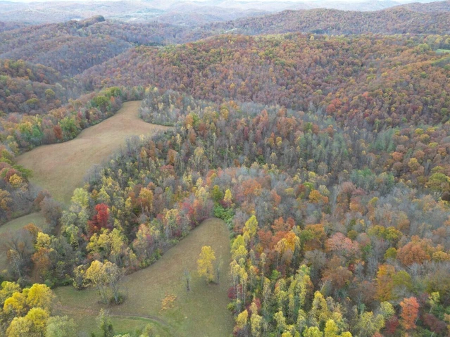
Contiguous 312 acres +/- multi-use parcel in the heart of a recreational powerhouse in the geographical center of West Virginia
Ten minutes to the 989-acre Burnsville Lake
Adjoins the 12,579-acre Burnsville Lake WMA for one and a half miles
Free natural gas available for residential use
Recreation at Burnsville Lake Forest offers outstanding onsite recreational opportunities
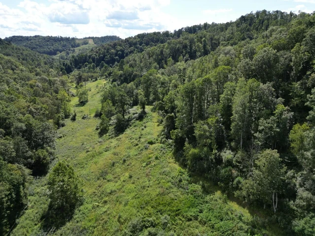
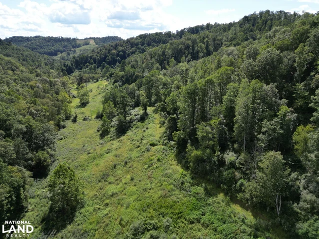
The property has many ridges, several major hollows, 1/2 mile long blueline stream, and several ephemeral creeks creating a diverse and interesting topography
Superb regional recreational opportunities
Ten rivers and six lakes are within an easy ten minutes to two hour drive
A blue line mountain stream flows through the property for 4/10 mile
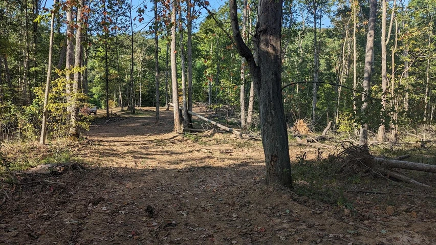
Miles of internal forest management roads, plus miles of forest trails, offer excellent access to a large portion of the forest
Perfect for shooting sports, ATV riding, horseback riding, hiking, camping, hunting and nature viewing
The town of Flatwoods is a 20-minute drive
High percentage of commercially operable ground supporting forestry, recreation and potential for numerous future cabin sites
Elevations range from 2147 ft. to 2455 ft. +/-
Potential conservation value
Low taxes, low population density, little or no light pollution
Great fishing is found in the Heartland's region with ten rivers and six lakes. Species include small and large mouth bass, crappie, catfish, muskie, walleye, pike and bluegill
The rivers and lakes are ideal for swimming, canoeing, fishing, kayaking, tubing, snorkeling, paddle boarding and windsurfing
Forest is a steady producer of life-giving Oxygen and silently works to sequester carbon
Several decades of professional forest and wildlife management
As the trees continue to grow, there will be very valuable hardwood timber available to harvest
Jet airports less than a sixty-minute drive
Potential for leasing carbon credits
Google Coordinates: 38.810494(N), -80.551211(W)
Address: Little Knawl Road, Napier, WV 26631. No 911 address is assigned to property without structures.
Elevation Range: 868 ft. to 1487 ft. +/-
Driving Times
Highways/Towns
I-79 at Flatwoods Exit 67: 30 minutes
I-79 at Burnsville-Glenville Exit 79: 30 Minutes
Buchannon: 55 minutes
Burnsville: 30 minutes
Clarksburg: 1 hour 10 minutes
Elkins: 1 hour 15 minutes
Flatwoods: 30 minutes
Glenville & Glenville State University: 55 minutes
Summersville: 1 hour
Weston: 50 minutes
Airports
Braxton County Airport (small), Sutton: 30 minutes
Elkins-Randolph County Regional Airport: 1 hour 30 minutes
Upshur County Regional Airport, Buchannon: 55 minutes
Recreation
Burnsville Lake Wildlife Management Area: 5 minutes
Elk River Wildlife Management Area, Sutton: 50 minutes
Golf Course, Stonewall Jackson Resort: 40 minutes
Lake - Burnsville Lake Bulltown Campground and boat ramp: 10 minutes
Lake - Sutton Lake: 35 minutes
Lake - Stonewall Jackson Lake & Resort: 40 minutes
Lake - Summersville Lake: 1 hour 10 minutes
Google Coordinates: 38.810494 (N), -80.551211 (W) on road in front of camper spot
WATER
A dashed blueline branch (intermittent water flow) of Little Knawl Creek begins on the property and travels on the property for about 1/2 mile. Little Knawl Creek, a blueline stream, is on the property periodically as it travels along the road and property boundary. The streams should have regular water flow, especially during snow melt and rain events.
MINERAL RESOURCES
West Virginia is one of the states in the US that has two ownership titles, those being SURFACE RIGHTS and MINERAL RIGHTS. This is a SURFACE ONLY conveyance as the mineral rights have been reserved in the owners deed.
BOUNDARIES AND SURVEY
Directly joins the Burnsville Lake Wildlife Management Area for about one and a quarter miles. The property is being sold by the boundary and not by the acre.
UTILITIES
Free Natural Gas
Water: Well could be drilled
Sewer: Private septic could be installed
Electricity: Currently Off Grid. Solar is very feasible
Telephone: Cell coverage is good
Internet: Starlink service is best option
Cellphone Coverage: good depending on carrier
ACCESS/FRONTAGE
The property is accessed by Little Knawl Road Rt. 4/4.
ZONING
Braxton County has no zoning regulations in effect other than those which are enacted and enforced within the municipalities. All prospective purchasers are encouraged to contact the Braxton County Health Department and the county commission regarding installation of septic systems, water wells, and flood insurance requirements.
PROPERTY TYPE/USE SUMMARY
This property currently is forestland containing an open-area natural gas line that runs through a portion of the property.
(This summary is an estimation of current property use as determined from aerial photography. It is made subject to the estimation of property boundaries and any errors in the interpretation of land use type from the aerial photography utilized.)
Details
County: Braxton
Zipcode: 26631
Property Type One: Recreational Property
Property Type Two: Residential Property
Property Type Three: Hunting Land
Brokerage: FoxFire Realty
Brokerage Link: www.foxfirenation.com

Richard Grist
FoxFire Realty
(304) 645-7674
By clicking the button, you agree to our Terms of Use and Privacy Policy.


Nearby Listings
Braxton County, WV
$375,000 - 163 ac.
Lewis County, WV
$368,800 - 184 ac.
Ritchie County, WV
$250,000 - 100 ac.
Lewis County, WV
$3,395,000 - 150 ac.
Lewis County, WV

$306,000 - 105 ac.
Greene County, PA

$499,000 - 43 ac.
Braxton County, WV

$4,199,000 - 2224 ac.
Ritchie County, WV

$614,900 - 120 ac.
Lewis County, WV
$368,800 - 184 ac.
Calhoun County, WV

$439,000 - 226 ac.