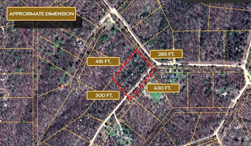
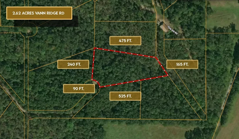
2.86 Acres, Lame Deer Ridge Rd, Watts OK 74964
Lame Deer Ridge Road, Watts, OK | Lat/Lng: 36.0889, -94.7918
$19,850
2.86 ac.
10/01/2025
ACTIVE

Description
October Special: Well match your down payment with a credit of up to $1,000! Mention October Discount at checkout. This limited-time offer wont last, act fast!
***Owner Financing Available - Own this property for as little as $400 down and $400 per month! No Credit Check, Everyone Qualifies!***
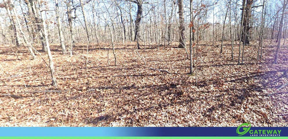
This large lot in the Illinois River Ranch subdivision gives you the freedom and flexibility youve been looking for. With 2.86 acres, RV living is allowed, and you can also place a mobile or manufactured homeplus, theres no HOA to limit your lifestyle. Whether youre planning a getaway retreat, a forever home, or simply want a smart land investment, this property delivers space, privacy, and potential.
Located in Adair County, Oklahoma, this land comes with utilities ready at the street: power through Ozarks Electric Cooperative and water service by Adair Co. RWS & SWMD #6. The Illinois River is just minutes away, offering fishing, kayaking, and outdoor recreation surrounded by the beauty of the Ozarks. With new homes being built nearby, the area is showing growth and increasing opportunity, making this a wise time to secure your own place here.
Flexible owner financing options are available with low down payments and manageable monthly plans, making it easy for you to start building your future. Dont wait give us a call today!
Cash Price: $19,850
Term Option 1: $400 down, $400 for 63 months, for a total price of $25,600
Term Option 2: $500 down, $500 for 47 months, for a total price of $24,000
Term Option 3: $600 down, $600 for 37 months, for a total price of $22,800
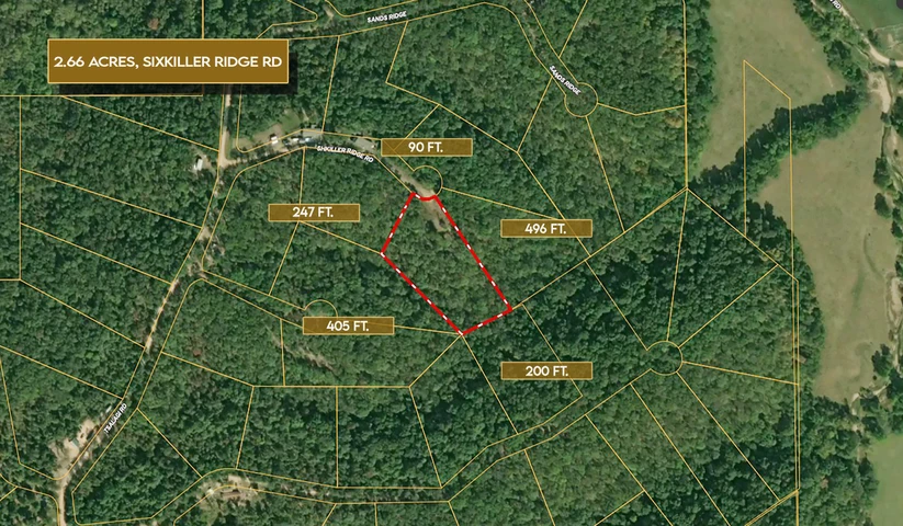
Parcel ID: 0480-00-002-200-0-000-00
Address: Lame Deer Ridge Rd, Watts OK 74964
GPS Coordinates (center) at the road: 36.0889,-94.7918
Northwest Corner: 36.089,-94.7929
Northeast Corner: 36.09,-94.7919
Southwest Corner: 36.0885,-94.7923
Southeast Corner: 36.0894,-94.7914
Legal Description: Block 2, Lot 200 Illinois River Ranch
Elevation: 1080'
Terrain: Sloping
Access: Dirt Road
Power: Power is provided by Ozarks Electric Cooperative (800-521-6144)
Water: Water is provided by Adair Co. RWS & SWMD #6 (918-397-6296)
Water Fees Per Year: Unknown (Contact County)
Sewer: Septic Needed
Zoning: Residential RV Living: Allowed
Mobile Home Living: Allowed
Manufactured Homes: Allowed
POA: None
Taxes Per Year: $26
Road Fee: Unknown (Contact County)
County Contact Information: Call Adair County Clerk (918) 696-7198
Conveyance: Warranty Deed
Details
County: Adair
Zipcode: 74464
Property Type One: Recreational Property
Property Type Two: Residential Property
Property Type Three: Undeveloped Land
Brokerage: Bubsland.com
Brokerage Link: www.bubsland.com/
Apn: 048000002200000000

Bubba Bubba
Bubsland.com
(573) 400-3020
By clicking the button, you agree to our Terms of Use and Privacy Policy.


Nearby Listings
Adair County, OK

$1,250,000 - 351 ac.
Adair County, OK

$1,500,000 - 600 ac.
Cherokee County, OK
$4,499,000 - 320 ac.
Washington County, AR
$1,675,000 - 19 ac.
Benton County, AR
$2,900,000 - 385 ac.
Adair County, OK
$1,475,000 - 486 ac.
Delaware County, OK
$6,000 - 0 ac.
Adair County, OK
$18,999 - 3 ac.
Delaware County, OK
$6,500 - 0 ac.
Adair County, OK
$15,500 - 3 ac.