
2.66 Acres in Ashe County, NC with Deeded, Walkable Access to the New River
Island Ford Rd, Laurel Springs, NC | Lat/Lng: 36.4387, -81.3804
$31,799
2.66 ac.
12/19/2025
ACTIVE

Description
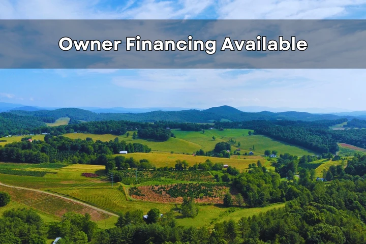
Owner Financing:
- $7799 down (plus the $0 doc fee)
- $7799 down $423.67/Mo for 84 months (plus prorated taxes and note maintenance fee)
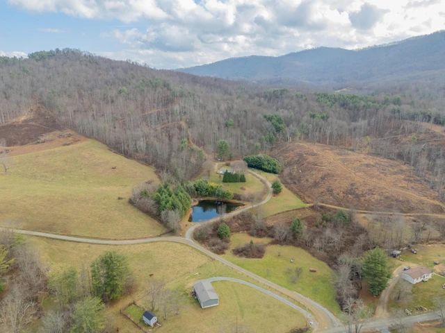
Tucked into the Appalachian Mountains of Ashe County, North Carolina, this 2.66-acre wooded parcel offers a setting that feels earned. The land sits quietly in the mountains, surrounded by trees and shaped by natural terrain, with a recorded right of way leading to walkable, deeded access to the New River. This is not river bottom farmland and not a crowded waterfront lot. It is mountain ground paired with one of the most iconic rivers in the region.
The property itself is fully wooded and naturally contoured, with rolling ground that reflects the true Appalachian landscape. Trees provide privacy, soften sound, and create natural separation from surrounding parcels. Wildlife moves through the area, and the land feels observed rather than altered. This is a place where nature sets the tone.
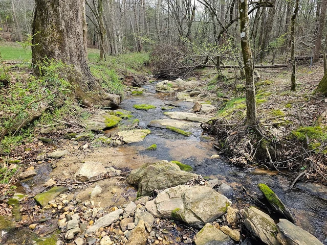
What makes this offering truly stand out is the recorded, deeded access to the New River, reached by walking down the internal right of way just down the road from the parcel. The river is not visible from the property, and that is part of its appeal. The walk down is intentional, quiet, and rewarding. The New River is well worth the hike.
This section of the New River is known for its beauty and calm presence. It is a river people return to in different seasons, whether that means fly fishing, wading, kayaking, or simply spending time along the bank. You do not have to use it every day for it to matter. Knowing you have secure, legal access adds depth and long-term value to ownership.
This property fits naturally into an outdoor-focused lifestyle without forcing a single use. For those who enjoy hunting, the wooded mountain setting aligns with how land in Ashe County has traditionally been used. Any hunting would be subject to local and state regulations, and buyers are encouraged to complete their own due diligence. For others, the land is simply a quiet mountain retreat where hiking, observing wildlife, and unplugging feel natural.
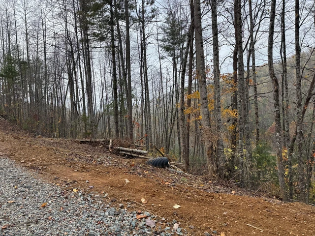
Access to the parcel is via a recorded dirt road right of way, which helps preserve the peaceful nature of the setting. The property is set back, quiet, and free from through traffic. You arrive to trees and stillness, not noise or development. This is the kind of access that matches the land rather than changing it.
There is no HOA and no property restrictions. Ownership remains straightforward and uncomplicated. Utilities are not positioned as a feature, keeping the focus where it belongs: on the land, the setting, and the connection to the New River.
Property Overview
Size: 2.66 acres
Location: Ashe County, North Carolina
Region: Appalachian Mountains
Water Feature: Deeded, walkable access to the New River via internal right of way
Terrain: Rolling mountain ground that follows the natural landscape
Setting: Fully wooded and private
Access: Recorded dirt road right of way
HOA: None
Restrictions: None
Financing: Owner financing secured by Deed of Trust
Closing: Attorney-guided closing with a licensed North Carolina real estate attorney
The size of the property strikes a thoughtful balance. It is large enough to feel private and grounded without becoming overwhelming. You can walk the land, learn its contours, and enjoy it as it already exists. There is no pressure to clear or reshape anything unless you choose to.
Financing Terms
Earnest Money: $2,000
Total Down Payment: $7,799
Monthly Payment: $423.67
Term: 84 months
Ashe County is known for its Appalachian character, slower pace, and deep connection to the outdoors. Properties with legal New River access are increasingly difficult to find, especially parcels that remain wooded, quiet, and mountain-based rather than developed or overused.
This is not a property built around constant activity or heavy use. It is a place where fishing days, hunting seasons, long walks, and quiet weekends can coexist naturally. A piece of land that fits into nature rather than trying to control it.
If you are looking for Ashe County mountain acreage that is honestly represented, thoughtfully positioned, and paired with secure New River access, this property deserves a closer look.
Reach out to learn more about the river access, financing structure, or ownership process. At Grounded Properties Land, we focus on clarity and transparency so you can move forward with confidence.
State: NC
County: Ashe
Zip: 28644
Size: 2.66 acres
Apn: 09334112031
Legal Description: Lot 31 as shown on a Plat of "The Sanctuary" which appears of record in the Ashe County Public Registry in Plat Book 5, at Page 146-A
Lat/Long Coordinates:
Nw: 36.439175, -81.380009
Ne: 36.438765, -81.379494
Sw: 36.438946, -81.380907
Se: 36.437794, -81.380728
Elevation: 2854 feet
Annual Taxes: Approx. $60 per year
Zoning: Residential Property, Recreational Property, Hunting Land
Flood Zone: No
HOA/POA: No
Improvements: No improvements done.
Access: Dirt Road
Water: Will need to install a Well
Sewer: Will need to install a Septic System
Utilities: Electric
Owner Financing:
- $7799 down (plus the non refundable doc fee of $0)
$7799 down $423.67/Mo for 84 months (plus prorated taxes and note maintenance fee)
We do not offer owner financing for residential use or full-time living on the property during the financing term.
Details
County: Ashe
Zipcode: 28644
Property Type One: Recreational Property
Property Type Two: Residential Property
Property Type Three: Hunting Land
Brokerage: Grounded Properties Land
Brokerage Link: www.groundedpropertiesland.com/
Apn: 09334112031

Chris Palsgrove
Grounded Properties Land
(919) 336-0864
By clicking the button, you agree to our Terms of Use and Privacy Policy.


Nearby Listings
Johnson County, TN
$59,900 - 12 ac.
Caldwell County, NC

$499,900 - 24 ac.
Ashe County, NC

$2,900,000 - 83 ac.
Wilkes County, NC

$13,900 - 4 ac.
Watauga County, NC

$199,900 - 10 ac.
Wilkes County, NC
$49,900 - 10 ac.
Grayson County, VA
$475,600 - 41 ac.
Avery County, NC
$69,900 - 4 ac.
Wilkes County, NC

$49,900 - 10 ac.
Wilkes County, NC

$39,900 - 2 ac.