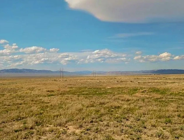
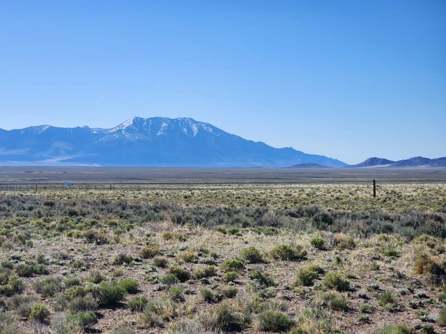
640 Acres- Elko County* Independence Valley NV- Road Access/BLM
Indepdendence Vally, Elko, NV | Lat/Lng: 40.8005, -114.6975
$119,995
640 ac.
04/03/2026
ACTIVE

Description
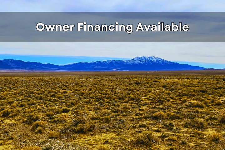
Gold Mining Special Land Special *640 Acres in Elko Nevada- Independence Valley* Power is Close* Road Access* $119,995.00 Sale Price * Reserve it for $2,500.00 Deposit to Reserve the Property *APN: 009100005
Untitled design 3
Property Description
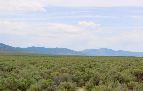
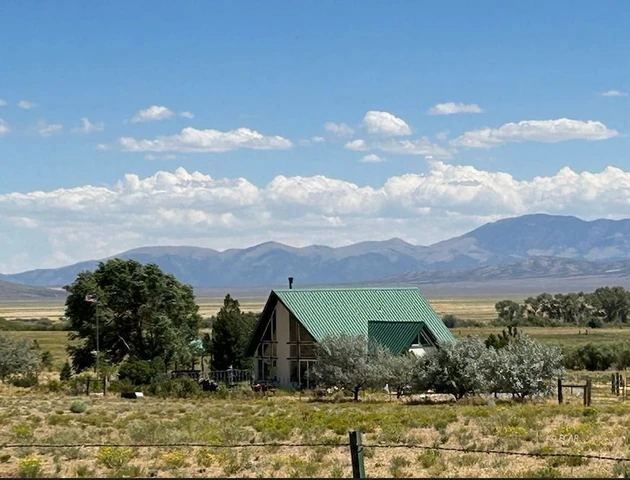
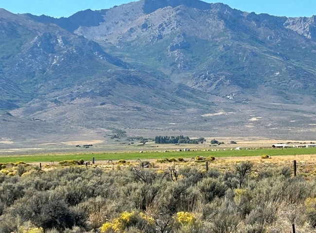
640 Acres in ELKO County NV Independence Valley NV Road Access, Power is Close Next to BLM- So great access Rare opportunity to own a large parcel in ELKO NV! Very nice and green property located in Independence Valley in Wells, NV! Located in Elko County, the area offers tons of outdoor opportunities. It’s pretty easy to get to this property as well via dirt roads. BLM borders the land to The south extending your area that will never have neighbors on it! We enjoyed the mountain views and peace and quiet in the area. There are a couple of neighbors about 1/2 mile away. It looks like someone used the lot just to the north of it for camping, but they have not been there for a while. Great mountain views so don’t waste time getting to be off the grid!
Untitled design 3
Property Pricing, Terms & Doc/Recording Information and Pricing
For Sale $119,995.00
Deposit Due upon acceptance $2,500.00
Transaction Accepted Wire Only
Untitled design 3
Property Legal information
009100005 APN
Parcel 009-100-005
Parcel Summary
Location TWP 35N RGE 64E MDB&M
NV
Use Code 100: Vacant – Unknown/Other
Tax District 1.0: County of Elko
Acreage 640.0000
Section 9
Township 35N
Range 64E
Plat Maps 009-100
Keyline Description
ALL;
SEC/LOT: 9 TWN/BLOCK: 35N RNG: 64E ACRES: 640.00
MDB&M
Due Date Penalty Date Status Original Total Penalty Interest Total
1 08/18/2025 08/28/2025 Paid $144.18 $5.77 $0.00 $144.18 $149.95
Untitled design 3
About the Area
Independence Valley, Elko County, Nevada
Gold Mining Heaven!
Overview
A rhyolite dome situated on the Independence Valley property in northeastern Nevada remains untested, and Peloton geophysical modeling of magnetic and CSAMT data has identified multiple structures within the dome complex that are recommended for drilling.
Independence Valley is situated on the Carlin Gold Trend and is also within the historical Spruce Mountain mining district, which has hosted many historic base and precious metals mines since the 1840’s. The Spruce Mountain deposits have typically been associated with rhyolitic and granitic intrusive rocks,, which Peloton believes are the “Smoking Gun” – indicating the location of the structural feeders for both granitic magmas and gold- and silver-bearing mineralized fluids.
The Independence Valley rhyolite dome and hypabyssal feeder dike is the largest untested rhyolite and hosting structure in the Spruce Mining District.
Description, Location & Access
Independence Valley consists of 21 mineral claims covering about 422 acres and is located about 39 miles (63 kilometers) southeast of Wells, Nevada. The property is 100% owned by Peloton, and there are no royalties outstanding. Access is via Highway 93 south from Wells, then the Tobar and Spruce Mountain Roads.
Geology
The stratigraphy of the Independence Valley property consists of at least several hundred meters of exposed Paleozoic sedimentary rocks that include, in stratigraphic order (oldest to youngest), Ely Limestone, Riepe Spring Limestone, and Pequop and Rib Hill Formation limestones. The base of the sedimentary section is not exposed on the property,, and the the overall stratigraphic thickness is uncertain. In the north-central part of the claim block, the Paleozoic sediments are overlain and intruded by a locally mineralized rhyolite flow-dome complex that includes rhyolite flow, hypabyssal intrusive, and associated phreatic surge tuffs. The hypabyssal intrusive contains rafted blocks of silicified and mineralized Paleozoic carbonate rocks, indicating subsurface mineralization.
A broad, northerly-striking anticline formed in the Paleozoic sedimentary rocks is central to the Independence Valley claims at depth. Tertiary northeast-, northwest-, and lesser east-west-striking high-angle normal faults cut and displace this anticline. Two of the most continuous northeast-striking normal faults form a northeast-striking graben within the central claim area. A mineralized rhyolite intrusive/extrusive dome complex intrudes both northeast- and northwest-striking mineralized normal faults in the northern Independence Valley property. Magnetic anomalies identified by the USGS and confirmed by Peloton are coincident with the rhyolite dome complex,, and the southeastern margin of an inferred shallow granitic pluton is coincident with both the dome and the magnetic anomalies (Raines, 1996). Rhyolite flows and tuffs unconformably overlie the Paleozoic rocks and conceal earlier normal faulting and mineralization. Several younger northwest-striking normal faults of small displacement cut the rhyolite.
Exploration Work Completed
Peloton has completed geologic mapping, soil geochemistry, and geophysical surveys, including magnetics, gravity, and CSAMT.
One reverse circulation angle hole (-50-degree, 235 Azimuth) was drilled on the property in 2019 to a length of 1,140 feet and a depth of about 873 feet. The hole was drilled away from the rhyolite dome structure and targeted a potential down-dropped east limb of an NNW-trending antiform. This hole encountered detectable gold mineralization in 125 of the 5-foot sampling intervals (625 total feet), including 235 feet of continuous gold, in a tuffaceous volcanic rock, fine-grained hypabyssal intrusive, and in the contact zone with adjacent Paleozoic carbonate sedimentary rocks. In addition, this hole intersected visible argillic hydrothermal alteration over a continuous core length of about 500 feet.
Geophysical Modelling
Modelling of the geophysical data, including magnetics, gravity and CSAMT, identified multiple structures within the rhyolite dome complex that are recommended for drill testing. Alteration zones are shown in blue.
Highlights
• Drill Ready Gold Target
• On the Carlin Trend and in the Spruce Mountain Mining District (SMMD)
• Rhyolitic intrusives are the “Smoking Gun” at SMMD
• The largest untested rhyolite dome in the SMDD
• Mapping, geochemistry and geophysics completed
• Only one hole has been drilled returning 625 total feet of detectible gold mineralization, including 235 feet of continuous gold mineralization, and 500 feet of continuous argillic hydrothermal alteration
• Multiple zones within identified within the rhyolite dome are recommended for drilling
Details
County: Elko
Zipcode: 89835
Property Type One: Farms
Property Type Two: Ranches
Property Type Three: Residential Property
Brokerage: COMMONLOTS LLC
Brokerage Link: www.commonlots.net


Nearby Listings
Elko County, NV

$8,500 - 2 ac.
Elko County, NV
$550,000 - 14 ac.
Elko County, NV
$1,200,000 - 243 ac.
Elko County, NV
$8,250 - 2 ac.
Elko County, NV

$11,493 - 10 ac.
Elko County, NV
$11,244 - 10 ac.
Elko County, NV

$1,100,000 - 587 ac.
Elko County, NV
$4,799 - 2 ac.
Elko County, NV
$6,495 - 2 ac.
Elko County, NV

$24,995 - 20 ac.