
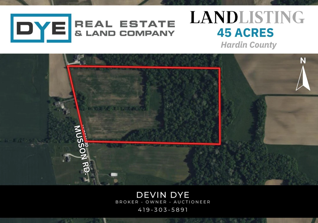
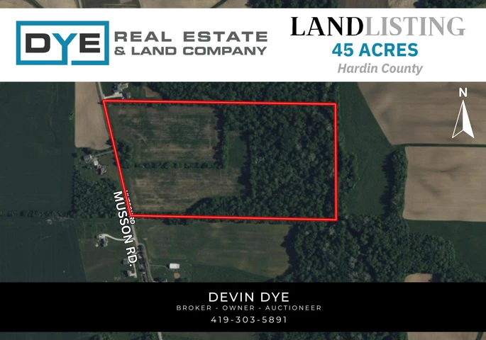
45 Acre Land Listing
Forest, OH | Lat/Lng: 40.8126, -83.5515
$440,000
45 ac.
09/12/2025
ACTIVE
Description
Seize the opportunity to own this versatile 45-acre property featuring 23 acres of productive tillable land and 21 acres of mature, wooded timber. Located along the boundary of the Blanchard River, this land offers abundant wildlife, making it ideal for recreation and outdoor activities. The mature timber provides added value to this property. With income generated from the tillable acreage, this property is perfect for both investment and personal use. Dont miss out on this exceptional combination of income potential and recreational appeal.
Location: Located 1 mile south of the intersection of US Route 30 and Township Road 186. Look for the signs.
County: Hardin
Township: Jackson
School District: Riverdale Local Schools
Parcel Number: 200100120000
Annual Real Estate Taxes: $698.60
Total Acres: 45.03
Tillable: 23.05
Wooded: 21.53
NCCPI: 67.19
Details
County: Hardin
Zipcode: 45843
Property Type One: Farms
Property Type Two: Recreational Property
Property Type Three: Hunting Land
Brokerage: Dye Real Estate & Land Company
Brokerage Link: www.dyerealestate.com/
Apn: 200100120000

Devin Dye
Dye Real Estate & Land Company
(419) 303-5891
By clicking the button, you agree to our Terms of Use and Privacy Policy.


Nearby Listings
Putnam County, OH
Auction - 112 ac.
Crawford County, OH
$545,000 - 64 ac.
Wyandot County, OH

$855,000 - 23 ac.
Hardin County, OH
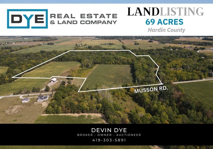
$574,000 - 69 ac.
Seneca County, OH

$376,285 - 40 ac.
Allen County, OH
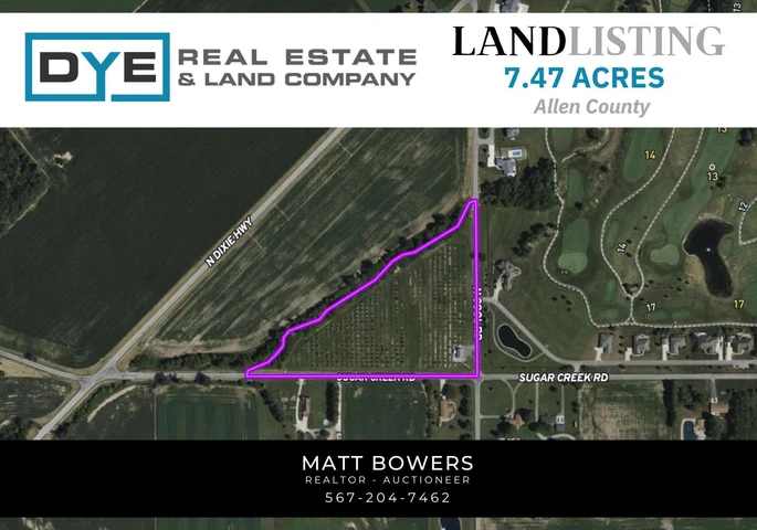
$277,900 - 7 ac.
Hardin County, OH
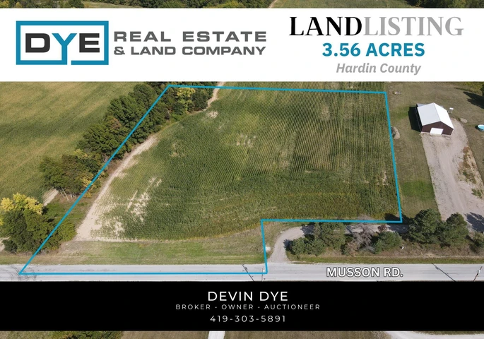
$70,000 - 4 ac.
Logan County, OH

$648,000 - 43 ac.
Seneca County, OH
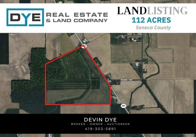
$2,027,880 - 112 ac.
Seneca County, OH
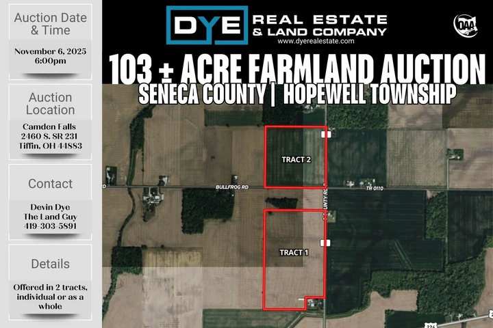
Auction - 103 ac.