

Upland Pine Trails
E/S CR 4117 S, Overton, TX | Lat/Lng: 32.1794, -94.9635
$300,000
63.52 ac.
07/08/2026
ACTIVE
Description
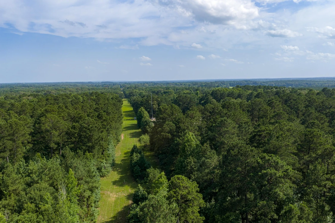
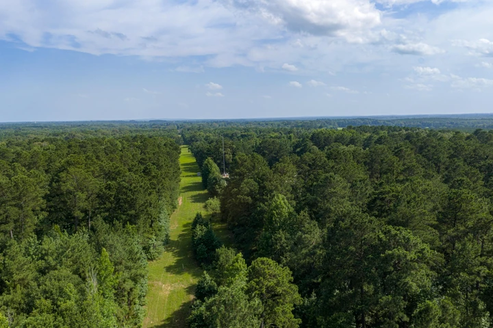
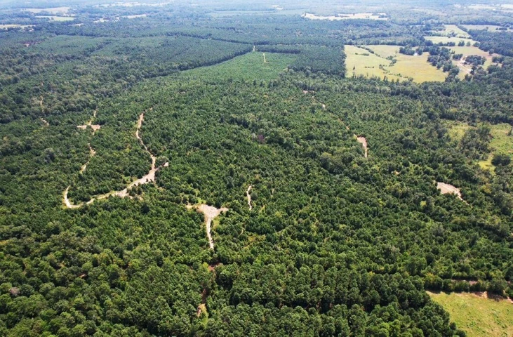
This wooded recreational tract offers a practical mix of timber, access, and usable interior travel corridors in a location convenient to several larger communities. The land is mostly wooded with rolling upland terrain, a pine component that has been managed over time, and a network of existing trails and openings that create useful movement through the property. With frontage along CR 4117, a main gate already in place, and quick access back to SH 64, the tract has a straightforward layout for weekend use, hunting setup, timber management, and general outdoor recreation.
Access and Location
Access is from the east side of CR 4117 S through the main gate. The gate is located roughly one mile south of SH 64, which gives the property a simple route back toward nearby towns and regional services. The setting is rural, but it remains close enough for day use or short weekend trips. The county road frontage, existing gate, and internal trails help make the tract usable without a buyer starting from a blank slate.
Land and Terrain
The property is all upland based on the information provided, with no floodzone area noted. Elevations are reported to range from approximately 390 feet above sea level to approximately 440 feet above sea level. That change in elevation gives the tract a gently rolling to rolling feel and creates some variety across the land. The terrain and existing access corridors should help with navigating the property, placing stands or blinds, and maintaining recreational access.
Timber and Vegetation
The timber is a mixture of older planted pine and areas of native regeneration, with small pockets of mixed native timber in various locations. The pine stand has reportedly been thinned a couple of times, which can benefit stand health, access, sunlight penetration, and wildlife edge when managed properly. A thinned pine stand may also allow a buyer to evaluate future timber-management options, including periodic thinning, stand improvement, or continued recreational use. Any timber income, timber volume, timing, and future harvest planning should be verified by a consulting forester or timber buyer.
Recreation and Hunting Setup
The existing trail system, openings, pipeline corridors, and edge cover create practical setup options for deer hunting and general recreation. These features can reduce the amount of initial clearing needed for access, stand placement, feeder locations, and travel routes through the property. The mix of pine timber, native regrowth, openings, and edge should provide a useful recreational layout, while still allowing a buyer to adjust the property to fit their own management goals.
Utilities and Surface Use
Electric distribution lines cross portions of the property. One line runs just inside and generally parallel to the CR frontage, while another crosses the southern portion of the property from east to west. Community water availability has not been confirmed. There is a gas compressor station on the southern portion of the property that reportedly encumbers approximately two acres and has its own access from the southern portion of the CR 4117 frontage. There is also an older oil or gas well site with limited surface equipment near the central portion of the tract. Multiple pipelines cross the property and connect to the compressor station. These surface-use items should be reviewed by a buyer as part of due diligence, including easement locations, widths, maintenance rights, access rights, and any limitations on surface use.
Survey, Minerals, and Buyer Review
A new survey is on hand, which should help a buyer evaluate boundary lines, road frontage, access points, and the location of visible surface-use improvements and easements. The property is being offered as surface only, with no minerals included. Buyers should review the survey, title commitment, recorded easements, utility availability, pipeline locations, compressor station area, and any oil or gas surface-use matters before closing.
DETAILS
- 63.516 acres located along the east side of CR 4117 S in western Rusk County.
- Address: E/S CR 4117 S, Overton, TX 75684
- Main gate is located at approximately 32.1789, -94.9663, about one mile south of SH 64.
- Mostly wooded with older thinned planted pine, native regeneration, and small pockets of mixed native timber.
- Rolling upland terrain with reported elevations from approximately 390 feet to 440 feet ASL.
- No floodzone area noted by seller.
- New survey on hand.
- Offered as surface only with no minerals included.
- All descriptions and exhibits are considered to be reliable but should be verified by buyer or buyer's agent.
The information contained herein is deemed reliable but is not warranted or guaranteed by the Broker, its Agents, or the Seller. Access to property, access to utilities, or any measurements including but not limited to, acreage, square footage, frontage, and mapping boundary lines shared herein has not been independently verified and is for purposes of marketing only. If exact measurements, access to property, or access to utilities is a concern, the property should be independently measured or investigated by the prospective buyer.
Details
County: Rusk
Zipcode: 75684
Property Type One: Recreational Property
Property Type Two: Timberland
Property Type Three: Hunting Land
Brokerage: Whitetail Properties Real Estate
Brokerage Link: www.whitetailproperties.com/agents/cody-robertson?utm_medium=affiliate&utm_source=landnetwork
Apn: 16806

Cody Robertson
Whitetail Properties Real Estate
(903) 681-0713
By clicking the button, you agree to our Terms of Use and Privacy Policy.


Nearby Listings
Smith County, TX

$129,900 - 12 ac.
Smith County, TX
$9,750,000 - 333 ac.
Smith County, TX
$2,850,000 - 168 ac.
Panola County, TX
$3,365,000 - 527 ac.
Rusk County, TX

$2,598,500 - 205 ac.
Cherokee County, TX
$535,550 - 51 ac.
Nacogdoches County, TX
$479,999 - 78 ac.
Cherokee County, TX

No Price - 600 ac.
Smith County, TX
$49,900 - 1 ac.
Rusk County, TX
$927,000 - 206 ac.