Chapman Ranch 315.1 - Tract 3 of 3 - 15+ Years Of Deer History, Tillable &
E Road 150 S, Grainfield, KS | Lat/Lng: 39.1444, -100.5073
$708,975
315.11 ac.
08/27/2025
ACTIVE
Description
Chapman Ranch Tract 3 of 3
315.1+/- Acres Located in Sheridan County, Kansas
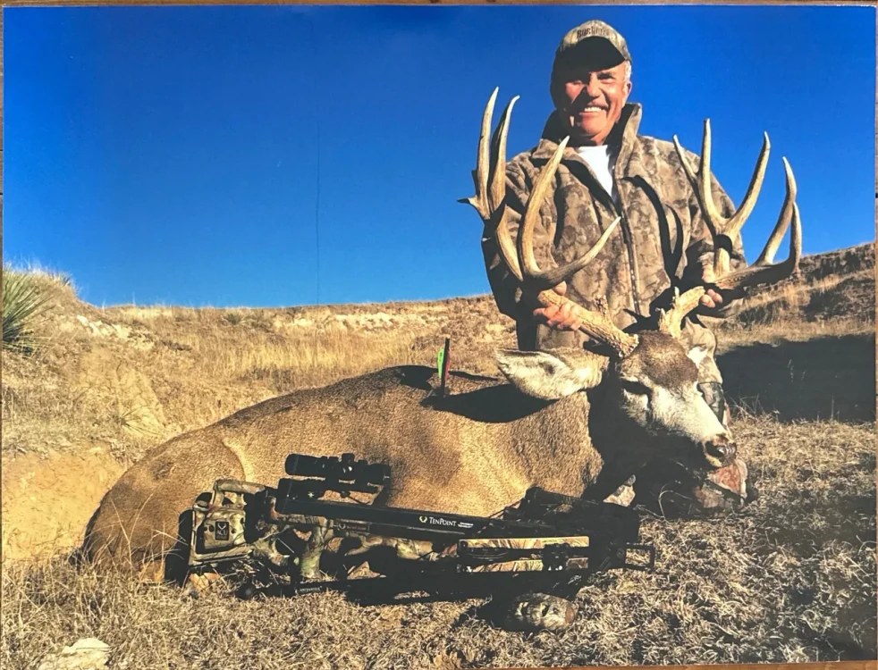
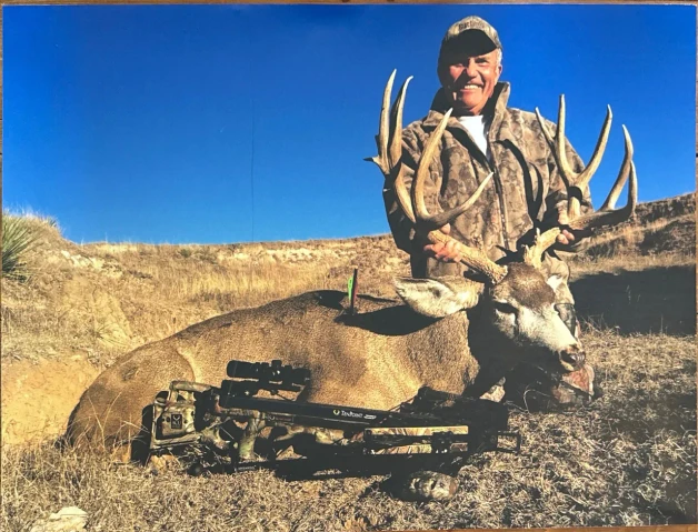
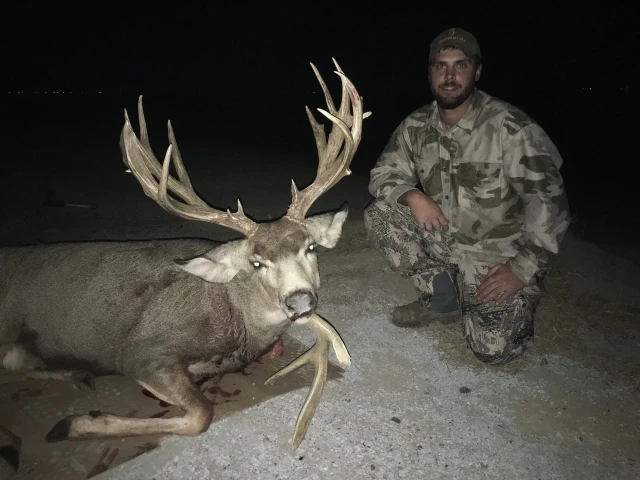
15+ Years of Proven Mule Deer & Whitetail Deer
Click Here! To View The Chapman Ranch 307-Tract 1-
Click Here! To View The Chapman Ranch 313.8-Tract 2- "The Camp" (Neighbors Tract 1 To The West)
Property Description:
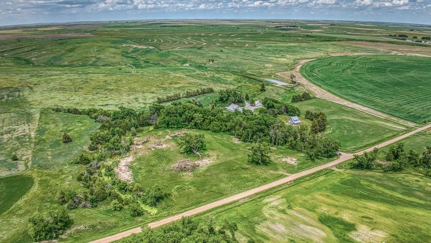
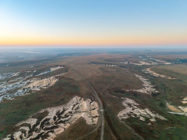
Situated in south-central Sheridan County within the High Plains region of northwest Kansas, Tract 3 of the Chapman Ranch offers over 15 years of verified mule deer and whitetail deer history. This property features fertile tillable acres, productive rangeland, and a well-established wildlife habitat, making it an excellent income-producing hunting opportunity. The terrain provides varied topography, creating diverse hunting and viewing opportunities.
The landscape embodies everything typical of a true "western" hunting property with significant topography change, including rolling hills, deep draws, and bottom land fields. Surrounded by the Saline River, this property offers natural travel corridors, bedding areas, and prime habitat for deer and upland game, giving it that authentic big country feel.
Cover & Habitat:
Water Features: The Saline River with numerous spring pools historically holding water, meanders throughout the eastern half of the tract, providing reliable water sources and natural travel routes for wildlife.
Vegetation: Thanks to recent rains, dense native grasses and vegetation along the Saline River reach 4-6 feet, creating thick cover. Deep cutouts and draws throughout the property add additional cover and travel corridors for deer. Most of the eastern half of the property is covered with tall native grasses and sunflower species, providing ideal bedding and travel cover for mature deer.
Topography: Significant topographical variation, including rolling hills and deep draws, offers diverse hunting opportunities and natural funnels that attract and hold wildlife.
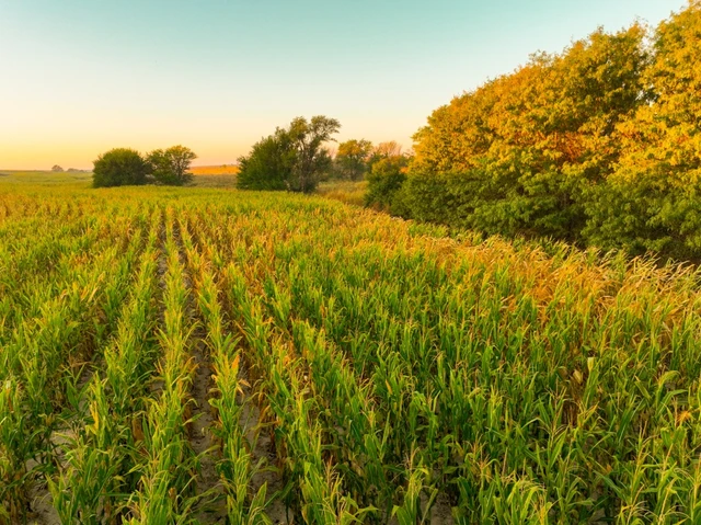
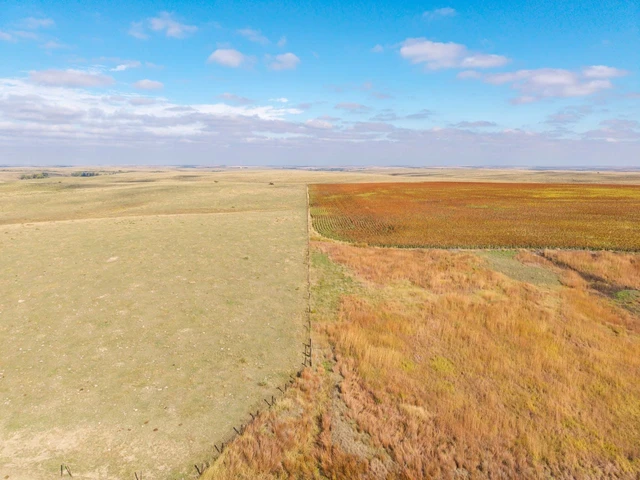
Food & Cropland: The two bottomland agricultural fields serve as ideal food sources and staging areas for deer. With highly secluded crops nestled along the Saline River, these provide deer with a safe haven for traveling and feeding.
Land & Water Details:
Tillable Acres:
32.2+/- acres of Milo/Sorghum (farmed into the bend of the Saline River)
20.2+/- acres of Alfalfa (located south and east of the Saline River)
Rangeland & Western Terrain:
262.7+/- acres outlined with top-quality barb wire fencing
Water Sources:
The Saline River with numerous spring pools, historically holding water, meandering throughout the eastern half of the tract
Mineral Rights:
All mineral rights owned by the seller will transfer to the buyer upon closing.
Possession:
The buyer will receive possession of the sorghum acres upon harvest of the current crop.
Immediate possession of all other acres will be granted at closing.
The seller is currently in a 1/3-2/3 crop share agreement with a tenant on all of the tillable acres.
The seller is open to negotiations regarding the seller's 1/3 share if closing occurs before the harvest of the current crop.
Location & Access:
Located just a few miles north of I-70, providing quick access to regional towns and airports.
Nearest Towns:
Oakley (~20 miles west) closest large town and airport
Hays (~65 miles east) regional hub
Goodland (~75 miles west)
Quinter (~14 miles east) hotel options in Quinter and Oakley
Showings are by appointment only. To schedule a private tour or for further questions, contact the listing agent:
Cody Crook
Phone: 620-617-7320
Key Features:
15+ Years of Deer & Wildlife
Top-Quality Cover & Habitat
Secluded & "Big Country" Atmosphere
Significant Topography & Bottom Land
Saline River System
Productive Tillable Acres
Mule Deer & Whitetail
Upland Game
Details
County: Sheridan
Zipcode: 67737
Property Type One: Ranches
Property Type Two: Recreational Property
Property Type Three: Hunting Land
Brokerage: Red Cedar Land Co.
Brokerage Link: https://redcedarland.com/cody-crook/
Apn: 0902473600000001000

Cody Crook
Red Cedar Land Co.
(620) 617-7320
By clicking the button, you agree to our Terms of Use and Privacy Policy.


Nearby Listings
Graham County, KS
$225,000 - 100 ac.
Decatur County, KS
$5,750,000 - 1320 ac.
Trego County, KS

$864,000 - 320 ac.
Gove County, KS
$1,755,369 - 1595 ac.
Graham County, KS
$207,965 - 145 ac.
Logan County, KS

$701,700 - 702 ac.
Logan County, KS
$149,000 - 0 ac.
Graham County, KS

$259,655 - 180 ac.
Sheridan County, KS
$936,350 - 307 ac.
Logan County, KS

$700,875 - 312 ac.