Chapman Ranch 307 - Tract 1 of 3 - 15+ Years Of Deer History, Tillable & Ra
E Road 130 S, Grainfield, KS | Lat/Lng: 39.1658, -100.4566
$936,350
307 ac.
08/27/2025
ACTIVE

Description
Chapman Ranch - Tract 1 of 3
307+/- Acres in Sheridan County, Kansas
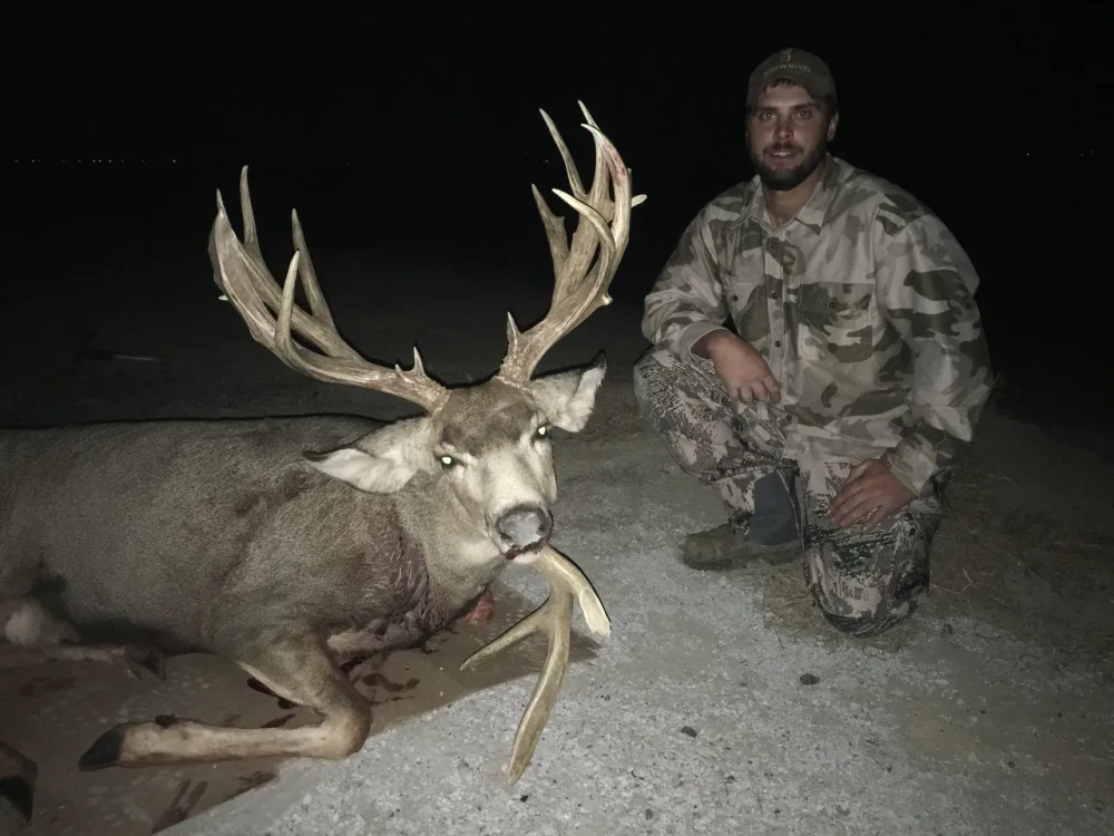
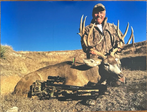
15+ Years of Exceptional Mule Deer & Whitetail History
Click Here! To View The Chapman Ranch 313.8-Tract 2- "The Camp" (Neighbors Tract 1 To The West)
Click Here! To View The Chapman Ranch 315.1-Tract 3-
Property Description:
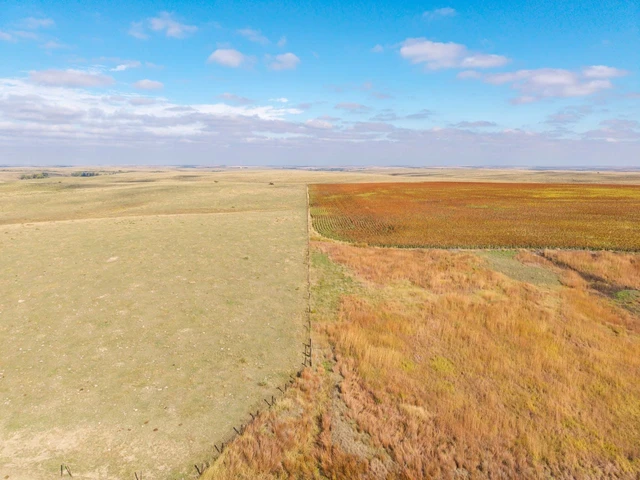
Situated in south central Sheridan County within the High Plains Region of northwest Kansas lies Tract 1 of the Chapman Ranch, offering over 15 years of proven mule deer and whitetail deer history. This property combines mature timber lining the Saline River, fertile tillable and pasture acres, and a well established track record of wildlife activity, making it an ideal income producing hunting property.
Cover & Habitat:
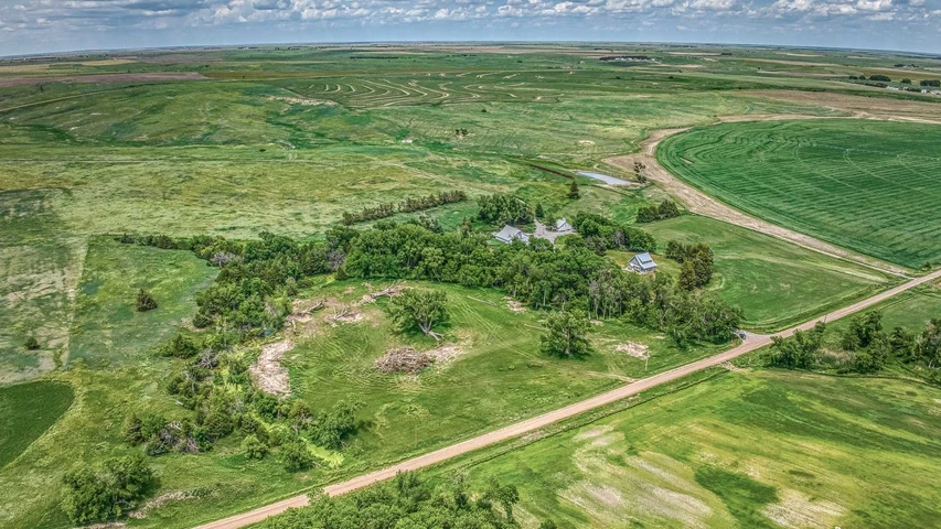
Mature Timber: Cottonwood, Elm, Locust, and Cedar, providing excellent cover/habitat for deer and turkeys both.
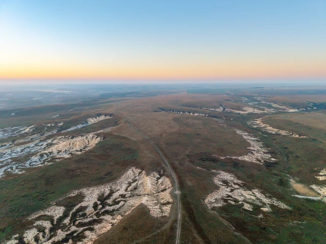
Water Features: The Saline River and Spring Brook Creek converge in the southwest corner, with the river flowing east to west, creating ideal travel corridors for wildlife.
Vegetation: Thanks to a wet season, vegetation along the Saline River reaches 8-10 feet tall, creating dense cover.
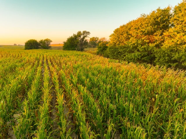
Food Plots & Cropland: An 11+/- acre alfalfa food plot located in the southeast corner along the Saline River. Currently, the northwestern part of the property features corn with deer trails indicating heavy usage along the field edges.
Water Sources: Spring pools along Spring Brook Creek and the Saline River, plus two separate stock tanksone near the river powered by utility fed electricity, another a solar powered well in the north central part of the property east of the cornfield.
Land Details:
Tillable Acres:
11+/- acre alfalfa food plot
4.3+/- acres of wheat stubble at the entrance
Approximately 150+/- acres of high yielding corn (benefiting from recent wet season)
Rangeland:
114+/- acres of open rangeland, outlined with excellent barb wire fencing
Mineral Rights:
All mineral rights owned by the seller will transfer to the buyer upon closing.
Possession:
The buyer will receive possession of the corn acres upon harvest of the current crop.
Immediate possession of all other acres will be granted at closing.
The seller is currently in a 1/3-2/3 crop share agreement with a tenant on all of the tillable acres.
The seller is open to negotiations regarding the seller's 1/3 share if closing occurs before the harvest of the current crop.
Location & Access:
Located just a few miles north of I-70, offering quick access to regional towns and airports.
Nearest towns:
Oakley (about 20 miles west) closest large town and airport
Hays (about 65 miles east) regional hub
Goodland (about 75 miles west)
Quinter (approximately 14 miles east) hotel options available in both Quinter and Oakley
Showings are by appointment only. To schedule a private tour or for further questions, contact the listing agent:
Cody Crook
Phone: 620-617-7320
Key Features:
15+ Years of Deer History
Mature Timber & Thick Cover
Saline River
Spring Brook Creek
Productive Tillable Acres
Mule Deer & Whitetail
Turkeys & Upland Game
Details
County: Sheridan
Zipcode: 67737
Property Type One: Farms
Property Type Two: Recreational Property
Property Type Three: Hunting Land
Brokerage: Red Cedar Land Co.
Brokerage Link: https://redcedarland.com/cody-crook/
Apn: 0902352100000002000

Cody Crook
Red Cedar Land Co.
(620) 617-7320
By clicking the button, you agree to our Terms of Use and Privacy Policy.


Nearby Listings
Graham County, KS
$225,000 - 100 ac.
Decatur County, KS
$5,750,000 - 1320 ac.
Trego County, KS

$864,000 - 320 ac.
Gove County, KS
$1,755,369 - 1595 ac.
Graham County, KS
$207,965 - 145 ac.
Logan County, KS
$149,000 - 0 ac.
Graham County, KS

$259,655 - 180 ac.
Sheridan County, KS
$708,975 - 315 ac.
Logan County, KS

$700,875 - 312 ac.
Logan County, KS
$499,000 - 1 ac.