
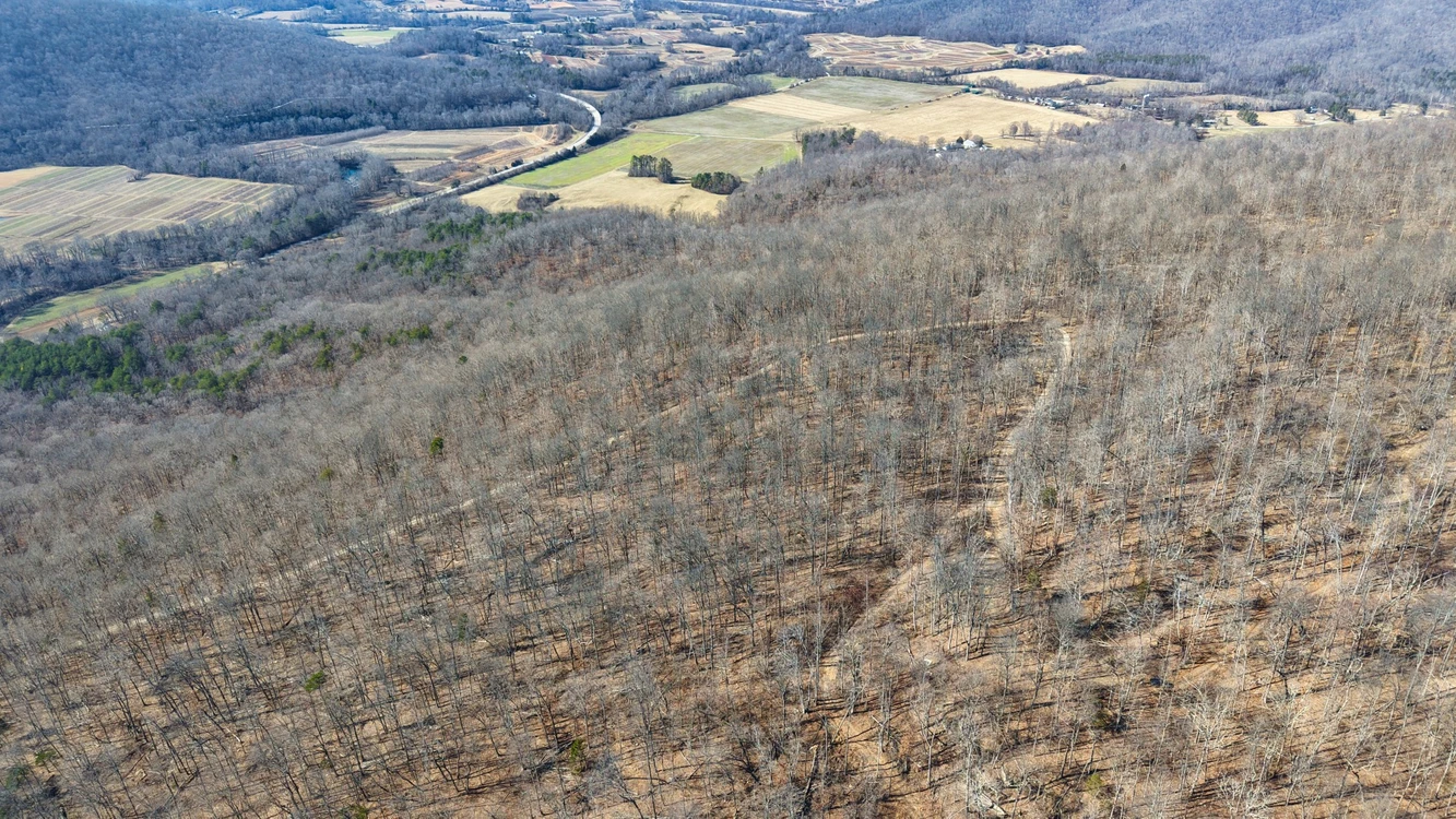
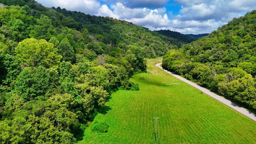
36 Acres Unrestricted Land with Seasonal Creek in Beersheba Springs, TN
Dykes Mountain Road, Beersheba Springs, TN | Lat/Lng: 35.5179, -85.6359
$209,000
36 ac.
02/04/2026
ACTIVE

Description
36 Acres Unrestricted Land with 720 ft Road Frontage and Seasonal Creek in Beersheba Springs, Tn
Cash Price: $209,000
Reservation Fee: $900 non-refundable reservation fee secures this property. Reservation fee will be counted toward purchase price or down payment.
With your Purchase You Get:
1. Clean Title with a Deed in Your Name
2. Build on your Land During the Financing Period
3. Live on your Land During the Financing Period (Not applicable to the 12 Months Same as Cash plan)
4. NO Closing Fees if you Close Directly In-House with our BBB A+ Rated Sales Team
BBB A+ Rating Business: We are Better Business Bureau Accredited Company with an A+ Gold Star Rating. We pride ourselves on giving our customers all of the history and results of our deep-dives on the properties they are interested in so that they can make the most informed purchasing decision. Our properties are hand-picked based on features that hold value. Call or Email us Today to Learn More about our streamlined buying experience.
Buyer Due Diligence: We do our best to ensure listing accuracy. However, buyer is responsible to perform their own due diligence and verify all information, contained herein or not, including access and utility accessibility and costs, and physically visit the property. Property is sold AS Is.
36 Acres Unrestricted Land in Beersheba Springs, Tn
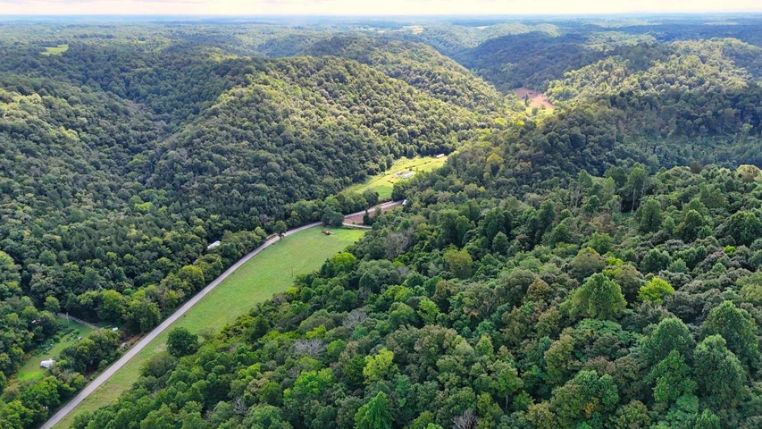
50 minutes to Beersheba Springs, Tn
58 minutes to Altamont, Tn
1 hour 3 minutes to Gruetli-Laager, Tn
1 hour 3 minutes to Palmer, Tn
1 hour 19 minutes to McMinnville, Tn
1 hour 19 minutes to Ascension Saint Thomas Hospital, Tn
1 hour 19 minutes to Irving College & Elementary School, Tn
1 hour 43 minutes to Chattanooga, Tn
2 Hour 44 minutes to Nashville, Tn
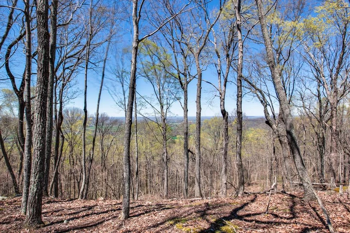
This 36-acre unrestricted land on Dykes Mountain Road offers private, wooded mountain living in Grundy County, Tennessee. At approximately 1,900 feet in elevation, it provides the space and seclusion ideal for a recreational retreat, hunting camp, or future mountain homesite. The land features mature hardwoods, rolling ridges, natural hollows, and a seasonal creek, with year-round access via paved road frontage.
The parcel is approximately 720 feet by 3,200 feet (about 36 acres). Topography varies across the tract, with elevation dropping from roughly 1,900 feet near the northern boundary along Dykes Mountain Road to about 1,780 feet at the southern end-over 100 feet of relief. The setting is set back from the road, offering a quiet, secluded feel while still maintaining convenient access.
Key Features
36 acres of rolling, wooded mountain terrain
Unrestricted with no deed restrictions and no HOA
Road frontage on Dykes Mountain Road
Seasonal creek running through the property
Low annual property taxes (approximately $61)
Elevations ranging from approximately 1,780 to 1,900 feet
Minutes from Savage Gulf State Park and South Cumberland State Park
Suitable for hunting, ATV riding, hiking, camping, and future homesite development
Unrestricted Freedom
This property is unrestricted. There are no deed restrictions or HOA rules governing how you use your land. Build a permanent home, set up a cabin, park an RV, place a mobile home or tiny home, or use the acreage for agricultural purposes. Camp on your own land, create trails, or develop at your own pace. No HOA dues and no recorded covenants give you full control over all 36 acres. This level of flexibility is uncommon and provides options for personal use, recreational enjoyment, or long-term investment.
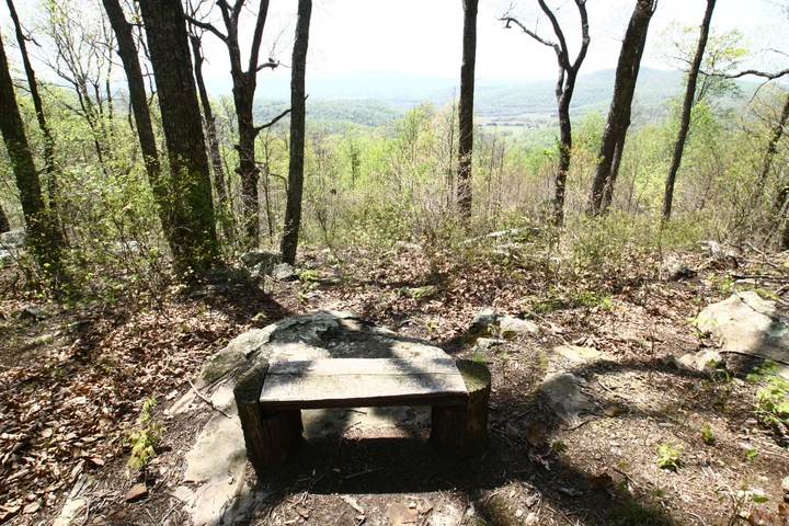
Recreation and Attractions
Beersheba Springs sits near Savage Gulf State Park, one of Tennessee's top hiking and waterfall destinations. The park features miles of trail through gorges, swinging bridges, and overlooks above the gulf. Other South Cumberland State Park units, including Fiery Gizzard Trail, Foster Falls, and Stone Door, are a short drive away.
On your own land, the wooded acreage supports hunting (deer, turkey, small game), ATV trails, and miles of walking through natural forest. Cooler summer temperatures at this elevation, with July highs averaging in the mid-80s, make Beersheba Springs a welcome escape from Tennessee's lowland heat.
The area also hosts an annual Arts and Crafts Festival, drawing visitors for handmade goods, music, and local food. The town's 19th-century resort heritage adds character and community to the mountain setting.
Utility & 911 Addressing Information:
Water Utility:
James Mills Well Drilling
423-881-3364
Address: 18 Well Water Lane, Pikeville, TN 37367
Sewer Utility:
J&B Construction (septic installer)
931-383-9665
Address: 200 Freemont Rd, Tracy City, TN 37387
Land Details:
Elegment ID: Llp_Tn_Grundy_Stockwell
Address: Dykes Mountain Rd, Beersheba Springs, Tennessee, 37305
Gps: 35.5179, -85.63594
Parcel Number: 006-007.11
Size: 36 Acres
Conveyance: Warranty Deed
Annual Taxes: $61 / Year (approximate)
Annual HOA / PO: None
Nearby Attractions:
The Great Stone Door:
The Great Stone Door at South Cumberland State Park is a must-see destination. The hike is moderate, with well-maintained paths and stunning overlooks. The door is an aperture with rock stairs, and the highlight is the bluff overlook with breathtaking views. The trail is easy, dog-friendly, and even has a color-blind viewer. A favorite among visitors, the hike is definitely worth it for the incredible view at the end.
Savage Gulf State Park:
Is a rugged wilderness on Tennessee's South Cumberland Plateau, famed for deep sandstone gorges, cliff overlooks, waterfalls, and backcountry hiking. Highlights include the Stone Door overlook and miles of trails through forests and rock formations. Ideal for day hikes, backpacking, and quiet nature escapes year-round.
Suter Falls:
Is a scenic waterfall in the Savage Gulf area of South Cumberland State Park near Beersheba Springs, Tennessee. A short hike from the Collins West Trailhead leads to a dramatic drop over layered rock, especially after rain. The trail can be rocky and slippery, so sturdy shoes help.
The Fiery Gizzard Trail:
Is a 13-mile hike with plenty of climbing and beautiful waterfalls to swim near. The trail is well-marked and has ample parking, but it's important to pack plenty of water and snacks. The path has several rugged sections with large rocks and hidden tree trunks and can be challenging for those out of shape or with weak ankles and knees. The scenery is stunning and it's a perfect full-day workout, but make sure to have sturdy boots with good traction. The trail can be muddy and sometimes slippery, so be prepared for that.
Details
County: Grundy
Zipcode: 37305
Property Type One: Recreational Property
Property Type Two: Residential Property
Property Type Three: Timberland
Brokerage: Elegment.com
Brokerage Link: land.elegment.com

Elegment Land
Elegment.com
(970) 420-2440
By clicking the button, you agree to our Terms of Use and Privacy Policy.


Nearby Listings
Franklin County, TN
$1,200,000 - 37 ac.
Marion County, TN
$74,900 - 2 ac.
Cumberland County, TN

$1,530,000 - 11 ac.
Cannon County, TN
$89,900 - 6 ac.
Cannon County, TN
$89,900 - 6 ac.
Hamilton County, TN

$1,950,000 - 152 ac.
Warren County, TN
$1,475,000 - 67 ac.
Coffee County, TN

$949,900 - 103 ac.
Warren County, TN
$159,500 - 4 ac.
Warren County, TN

$1,985,000 - 67 ac.