
Home, Cabins, Camping in No Flood Risk: 0.98 Acre at $125/mo
Custer Rd, Alturas, CA | Lat/Lng: 41.3237, -120.7492
$7,650
0.98 ac.
07/14/2025
ACTIVE

Description
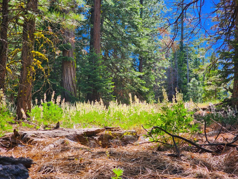
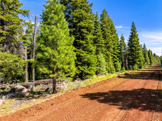
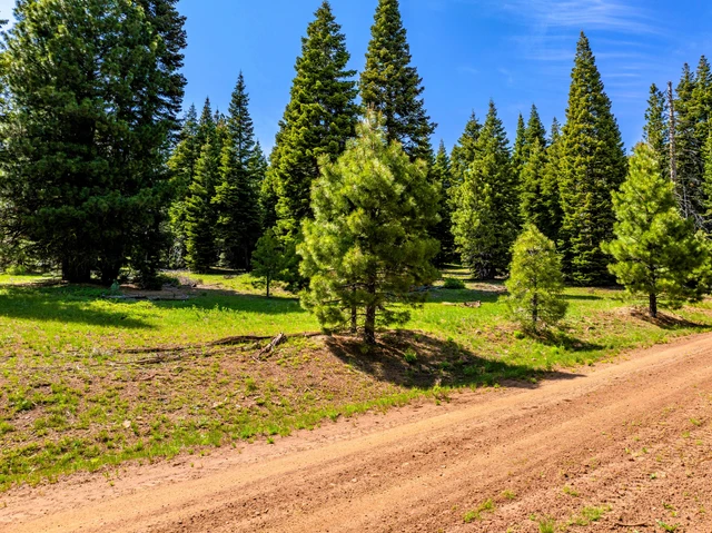
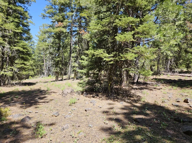
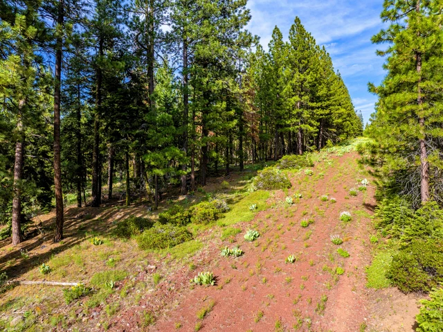
This 0.98-acre wooded parcel in California Pines, Modoc County, CA, offers a serene blend of nature, seclusion, and opportunity on Custer Rd in Alturas. This practical land features gentle slopes, evergreens, and no flood risk. It is ideal for a dream retreat, cozy cabin, modern tiny home (600+ sq ft), RV for a limited time, or profitable short-term rental under relaxed residential zoning and POA guidelines.
Enjoy easy dirt road access, proximity to power lines (with options for off-grid solar/generator), and the ability to install a private well and septic system. It's an attractive investment with incredibly low annual taxes of just $57. You'll be just 28 minutes from Alturas and a short drive to Modoc National Forest, Lava Beds National Monument, and Modoc Refuge, offering peace and adventure.
Don't let financing slow you down - we will finance it for you! Everyone is approved - Contact us immediately for details!
** ACTUAL PHOTOS OF THE PROPERTY **
Financing is available - no credit checks or banks are needed. Everyone is approved. Contact us at 470-517-3445, and we will show you how easy it is.
Financing available - no credit check or banks needed. Everyone approved. Contact us and we will show you how easy it is.
Property Details:
Property Address: Custer Rd, Alturas, CA, 96101
APN: 035-162-001-000
Size: 0.98 acre
Subdivision: California Pines Unit #1
Zoning: RESIDENTIAL-HIGH DENSITY ZONE (RH)
Taxes: $57
HOA & Covenants: Yes, California Pines POA, (530) 233-4801
Camping Allowed: Yes, 30 days per year.
Mobile Home Allowed: Yes, Must fulfill all requirements. Should not be older than 10 years.
RVs Allowed: Yes, 30 days per year.
Conveyance: Warranty Deed
Power: Would have to contact Surprise Valley Electric (530-233-3511) or use alternative power.
Water: Would require private well.
Septic: Would require septic system.
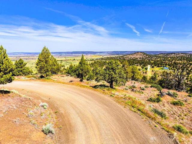
Road Access: Custer Rd
Terrain & Vegetation: Wooded, Slope
GPS Coordinates (4 corners): 41.3237, -120.7492
41.3239, -120.7487 NE
41.3235, -120.7487 SE
41.3235, -120.7497 SW
41.3240, -120.7497 NW
Approximate Distance to Nearby Cities & Points of Interest:
Closest Highways: US-395
Closest Major City: Redding, California, 2 hr 25 min (122 miles)
Closest Small Town: Alturas, California, 28 min (19.7 miles)
Closest Gas Station: Gils Gas And Grocery, 402 N Main St, Alturas, CA 96101, 29 min (19.3 miles)
Closest Recreation Site:
Modoc National Wildlife Refuge, Co Rd 115, Alturas, CA 96101, 29 min (19.7 miles)
Modoc National Forest, 225 West 8th Street, Alturas, CA 96101, 30 min (17.3 miles)
Lava Beds National Monument, 1 Indian Well, Tulelake, CA 96134, 1 hr 11 min (53.6 miles)
Bridge From "Stand By Me", 111 Bridge Way, Burney, CA 96013, 1 hr 36 min (71.1 miles)
- Guaranteed Financing
- No Credit Check
- No Bank or Broker fee
- 60-day money-back guarantee
- Warranty Deed
- Guaranteed free and clear title
We offer owner financing with multiple options that fit any budget. Contact us a call today and don't forget to ask about our 60-day money-back guarantee.
Purchase Options:
Owner Financing: $199 Down/$125 x 72 Months
Cash Price: $7,650.00
Doc Fee: $300 (due with a down payment)
Call us today for additional pricing options 470-517-3445
MO-030-Hauptman1-ja01
Details
County: Modoc
Zipcode: 96101
Property Type One: Recreational Property
Property Type Two: Residential Property
Property Type Three: Undeveloped Land
Brokerage: Creekside Developments, LLC
Brokerage Link: creeksidedevelopments.com
Apn: 035162001000

Landon Harris
Creekside Developments, LLC
(470) 517-3445
By clicking the button, you agree to our Terms of Use and Privacy Policy.


Nearby Listings
Modoc County, CA
$5,950 - 1 ac.
Modoc County, CA

$8,221 - 1 ac.
Modoc County, CA
$4,950 - 1 ac.
Modoc County, CA
$5,185 - 1 ac.
Lassen County, CA
$525,000 - 160 ac.
Modoc County, CA
$15,999 - 1 ac.
Modoc County, CA
$8,950 - 2 ac.
Modoc County, CA

$3,950 - 1 ac.
Modoc County, CA
$4,950 - 1 ac.
Modoc County, CA

$5,950 - 1 ac.