
1 Acre Lot in California Pines Hill Unit 1! Close to Town! $149 Monthly!
Comstock Rd, Alturas, CA | Lat/Lng: 41.3328, -120.7557
$7,997
1 ac.
04/21/2025
ACTIVE


Description
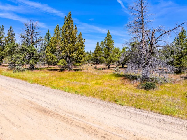
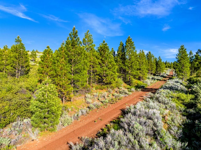
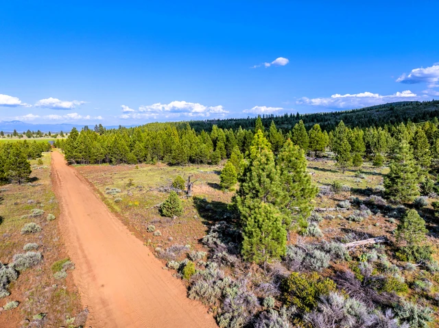
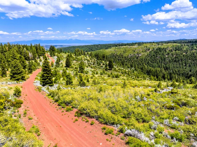
Absolutely beautiful lot in California Pines Hill Unit 1! Tall, mature pines and fir trees - heavily forested with some clearings! Where do I begin? It also is just 2 lots away frm the national forest! This is a lower elevation property in the hill units at 5,100 feet - so you will see less snow and a quicker melting that other areas. This property will be snow plowed if you live here full time - not available in Units 4 and 5.
There are several ponds that are stocked with fish in the area as well as the main reservoir up by the lodge. Rainbow Pond has absolutely amazing fishing any time of the day. The roads are maintained by the POA and are pretty nice for dirt roads. If you live there, they will also plow the road to your residence. This is a great and quiet neighborhood. You do need permission to cut down a pine over 4 in diameter and the minimum building size is 600 sq. ft. You can bring in a mobile, but it has to be new.
The POA fees are $105 per year and cover quite a few things- road maintenance, maintenance of the lodge (you get a discount) and stocking and maintaining the 3 ponds and main lake, playground, BBQ area and swimming pool. There is also an airport if you're a pilot!
This property is pretty level with some sloping areas, clearings and plenty of spots to build! The trees are beautiful and healthy!
Parcel Number: 035-077-003-000 (24019)
Property Description: 1.004 Acres in Modoc County, CA
Legal Description: Lot 70, Block 23, Unit 1
Street Name: Comstock Rd.
Size: 1.004 Acres
GPS Coordinates to Center: 41.332834, -120.755504
GPS NW Corner: 41.333287, -120.755736
GPS NE Corner: 41.333284, -120.755246
GPS SW Corner: 41.332383, -120.755758
GPS SE Corner: 41.332383, -120.755277
Elevation: 5152 feet
County and State: Modoc County, California
Views From Property: Beautiful Mountain and Forest Views!
Terrain: Flat to slightly sloped. Pines, natural grasses and clearings!
Land Use Code: 30 High Density Residential
Water: A well will be needed.
Sewer: A septic will be needed.
Power: Power is approx. 1000 feet away ($3-$5 ft). 1 Bar LTE Cell Service
Nearest Road: On Comstock Rd. Good 2WD all the way to property.
Nearest Major Freeway: 7.46 miles from HWY 139
Time Limit to Build: None
Tax Per Year: Approx. $60 POA Fees: $105.00/yr
8.67 miles from HWY 299, 11.56 miles from HWY 395, 6.14 miles from California
Pines, 9.70 miles from Canby, 14.45 miles from Alturas, 13.45 miles from Adin, 1.47
miles from Fitzhugh Creek, 1.23 miles from Canyon Creek, 2.47 miles from Jackson
Cabin Spring, 2.68 miles from White Reservoir, 4.63 miles from Ballard Reservoir,
5.32 miles from Graven Reservoir, 2.38 miles from Browns Pond, 3.52 miles from
Rainbow Pond, 1.35 miles from Hermit Butte, 4.38 miles from Manzanita Mountain.
As always, we guarantee everything to be up to date as far as taxes, POA fees and absolutely NO LIENS! GUARANTEED!
We have some great terms as well:
$299.00 Down (Includes non-refundable $299 document fee)
$149.00 per month (Plus property taxes and POA pro rated at 12 months)
9.99% Fixed Rate APR Fully Amortized
Total Purchase Price: $7,997.00
No pre-payment penalty
10% Discount off purchase price if paid off in 3 months!
30 day money back guarantee! (minus doc fee).
Property taxes will be calculated along with POA fees and will be impounded into the monthly payment. This will add about $15-20 per month to the payment.
Request your complimentary property report with high quality pictures by sending me an email! WE HAVE LOTS OF HIGH QUALITY PICTURES!!! EMAIL US!
(24019)
Details
County: Modoc
Zipcode: 96101
Property Type One: Recreational Property
Property Type Two: Residential Property
Property Type Three: Hunting Land
Brokerage: Western Outdoor Properties
Brokerage Link: www.westernoutdoorproperties.com
Apn: 035-077-003-000

Mark Fontaine
Western Outdoor Properties
(925) 978-6695
By clicking the button, you agree to our Terms of Use and Privacy Policy.


Nearby Listings
Modoc County, CA
$6,950 - 1 ac.
Modoc County, CA
$4,950 - 1 ac.
Modoc County, CA
$4,950 - 1 ac.
Lassen County, CA

$3,199,000 - 962 ac.
Modoc County, CA

$9,850 - 2 ac.
Modoc County, CA

$5,185 - 1 ac.
Shasta County, CA

$5,400,000 - 451 ac.
El Dorado County, CA

$5,900,000 - 381 ac.
Modoc County, CA
$5,950 - 1 ac.
Modoc County, CA

$3,950 - 1 ac.