
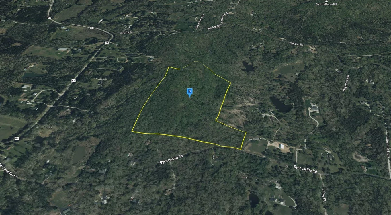
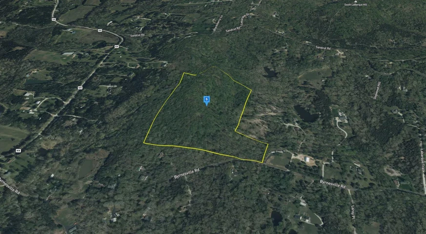
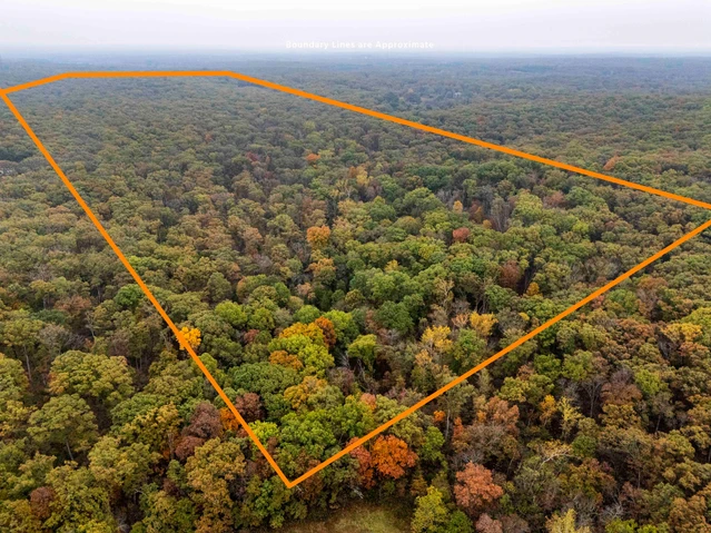
32.38 Acres For Sale in Jefferson County Missouri!
Byrnesville Rd, Cedar Hill, MO | Lat/Lng: 38.3821, -90.7112
$279,000
32.28 ac.
10/26/2025
ACTIVE
Description
Interested in this property? Call, text, or email us today for more details!
(540) 824-3372
Feel free to visit the property any time, no need to set up an appointment, this property has no address.
Subscribe to email alerts by texting your e-mail address to (541) 375-0012 and be the first to know when we get a great deal in.
By texting (541) 375-0012 you authorize Country Land Group to send text messages with offers & other information, possibly using automated technology, to the number you provided. Message/data rates apply. Consent is not a condition of purchase. You may unsubscribe at any time.
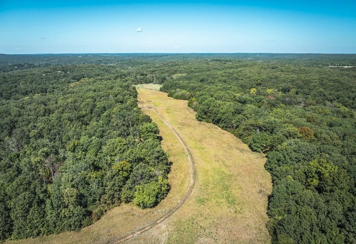
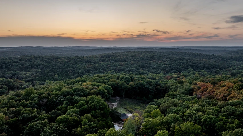
Embrace peaceful country living on Byrnesville Rd!
Zoned LR-2 (Large Lot Residential District), this property offers space, freedom, and opportunity. Build your dream home, start a small homestead, or invest for the futuretheres no HOA, no deed restrictions, and its subdividable. A well and septic are needed, with electricity available at the nearest street.
Enjoy the great outdoors just minutes from Don Robinson State Park and its Sandstone Canyon Trailhead, 13 minutes to Hilda J. Young Conservation Area. Close to Cedar Hill for daily conveniences, and only 50 minutes from downtown St. Louispeaceful living within reach of the city!
Address: Byrnesville Rd, Cedar Hill, MO, 63016
Cash Discount Price: $279,000.00
*There is a $1000 deposit required with all purchases. $500 is a non refundable transaction fee and the remaining $500 would be applied to the purchase price at time of closing.
Owner Financed Price: $279,000.00
Owner Financing Terms: $111,900.00 down and $4,474.59/month for 48 months.
*Applicable fees may apply including but not limited to $35/ month servicing fee and 12.9% interest for owner financing. Buyer is responsible for annual property tax. Contact Country Land Sellers for more details. Monthly payment subject to change based on down payment. Monthly payment shown is an estimate only.
County: Jefferson
Acres: 32.28 Acres (Raw Land)
Coordinates: 38.38207, -90.71119
Parcel #: 06401700000004
Yearly Estimated Taxes: $1,167.02
Elevation: 886 FT
Property Dimensions: 935.35 FT X 925.21 FT X 388.18 FT X 383.53 FT X 67.97 FT X 50.20 FT X 49.36 FT X 50.76 FT X 1104.34 FT X 1353.55 FT
Zoning: "LR-2" Large Lot Residential District
County Planning and zoning phone #: Planning & Zoning Commission (636) 797-5580
Does this property have an HOA?: No
Does this property have a survey?: Yes
Elementary school: Maple Grove Elementary School
Middle school: Northwest Valley School
High school: Northwest High School
Phone # for electric company: Ameren Missouri (800) 552-7583
Legal Description: Pt W1/2 Ne1/4
If this property is not what you are looking for, go to our website and sign up for our deal alerts; you will be notified whenever we have a new property for sale! Or, e-mail, call or text us, and we may be able to find the property you are looking for.
Details
County: Jefferson
Zipcode: 63016
Property Type One: Recreational Property
Property Type Two: Residential Property
Property Type Three: Undeveloped Land
Brokerage: Country Land Sellers
Brokerage Link: countrylandsellers.com
Apn: 06401700000004

Luke Harris
Country Land Sellers
(540) 824-3372
By clicking the button, you agree to our Terms of Use and Privacy Policy.


Nearby Listings
St. Louis County, MO
$3,750,000 - 9 ac.
Monroe County, IL
Auction - 319 ac.
Franklin County, MO
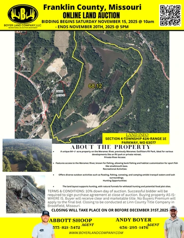
Auction - 64 ac.
St. Charles County, MO
$1,950,000 - 78 ac.
Franklin County, MO
$1,475,000 - 20 ac.
Franklin County, MO
$1,295,000 - 17 ac.
Franklin County, MO
$799,000 - 2 ac.
Franklin County, MO
Auction - 121 ac.
Jefferson County, MO
$619,700 - 110 ac.
St. Francois County, MO
$415,000 - 32 ac.