
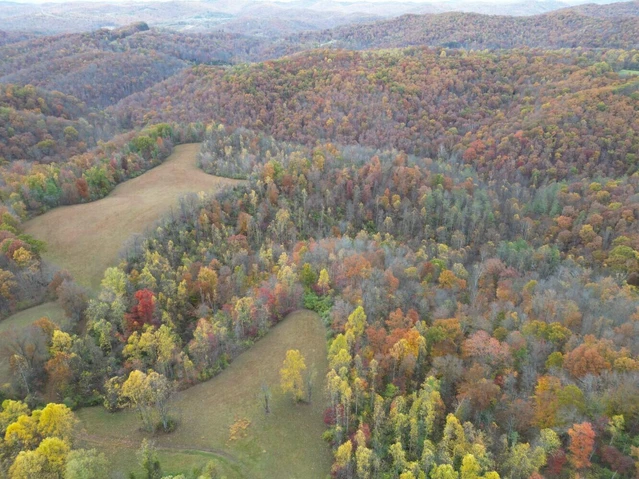
BAILES ROAD FOREST
Bailes Road, Nettie, WV | Lat/Lng: 38.2291, -80.6710
$159,000
77 ac.
02/08/2023
ACTIVE


Description
Bailes Road Forest is a 77-acre +/- multi-use property located in the heart of the New River Gorge recreational mecca, giving access to unlimited recreational opportunities.
HIGHLIGHTS
Contiguous 77 +/- acre multi-use parcel
Superb recreational opportunities in the heart of the New River Gorge water sports mecca
One million-acre Monongahela National Forest nearby
Proximity to 5 rivers and 3 lakes. These include the New River, Gauley River, Cherry River, Cranberry River, and Greenbrier River, and Summersville Lake, Summit Lake and Bluestone Lake
Plenty of forest trails that offer excellent access to a large portion of the forest
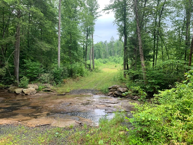
The headwaters of an un-named blue line stream runs through the property for about mile
Exceptional rock outcrops suitable for climbing
Perfect for shooting sports, ATV riding, horseback riding, hiking, camping, hunting and nature viewing
City of Summersville is a 15-minute drive
25 minutes to Summersville Airport
High percentage of commercially - operable ground supporting forestry, recreation and potential for numerous future cabin sites
Elevations range from 2218 ft. to 2585 ft. +/-
Potential conservation value
Low taxes, low population density, little or no light pollution
The rivers and lakes are ideal for swimming, canoeing, fishing, kayaking, tubing, snorkeling, paddle boarding and windsurfing
Forest is a steady producer of life-giving Oxygen and silently works to sequester carbon
Over 40 years of professional forest and wildlife management
Jet airports in Beckley, Charleston, and Lewisburg are a 90-minute drive
Potential for leasing carbon credits
DESCRIPTION
Bailes Road Forest, with 77 acres+/-, shares the regional area with several public lands' giving access to over one million acres of managed wilderness and parks.
Area National and State recreational properties include:
3,000-acre Summersville Lake
80,000-acre New River Gorge National Park and Preserve
One Million Acre Monongahela National Forest
25-mile-long Gauley River National Recreation Area
47,815-acre Cranberry Wilderness
11 mile long Cherry River
LOCATION
Google Coordinates: 38.228305(N), -80.676233(W)
Address: Bailes Road, Nettie, WV 77681. No 911 address is assigned to property without structures.
Elevation Range: 2218 ft. to 2585 ft. +/-
DIRECTIONS
From Nettie, WV: 0.7 mile +/- (5 minutes +/-)
From the Nettie Post Office, travel Rt. 39 East for 4/10 mile; turn left onto Bailes Road; travel 3/10 mile; property begins on the right
WATER
The headwaters of an un-named blue line stream runs through the property for about mile. It should have water flow during rain events and snow melt.
MINERAL RESOURCES
Various mineral rights have been either reserved or conveyed by prior deeds of record, and the property is being sold SURFACE ONLY.
BOUNDARIES AND SURVEY
The property will be surveyed for the sale deed to separate it from a large tract of land. The western boundary runs with Bailes Road, and the eastern boundary runs with Routes 39 & 20 and Panther Creek Road. The property is being sold by the boundary and not by the acre.
UTILITIES
Water: Public water nearby or a water well could be drilled
Sewer: Septic systems would need to be installed
Electricity: Available nearby
Telephone: Available nearby
Internet: May be available through cable, satellite or cell phone
Cellphone Coverage: Excellent with 5G
ACCESS/FRONTAGE
The property fronts on Bailes Road Rt. 39/7 for about 3/10 mile, and fronts on Rt. 39 E / Rt. 20 N and a very small portion with Panther Creek Road Rt. 39/15 for about 7/10 mile.
ZONING
Nicholas County has no zoning regulations in effect other than that which is enacted and enforced within the city limits of Summersville and Richwood. All prospective purchasers are encouraged to contact the Nicholas County Health Department and the Nicholas County Flood Zone Administrator regarding installation of septic systems, water wells, and flood insurance requirements.
PROPERTY TYPE/USE SUMMARY
The property has been used as forestland.
(This summary is an estimation of current property use as determined from aerial photography. It is made subject to the estimation of property boundaries and any errors in the interpretation of land use type from the aerial photography utilized.)
Details
County: Nicholas
Zipcode: 26681
Property Type One: Recreational Property
Property Type Two: Residential Property
Property Type Three: Timberland
Brokerage: FoxFire Realty
Brokerage Link: www.foxfirenation.com

Richard Grist
FoxFire Realty
(304) 645-7674
By clicking the button, you agree to our Terms of Use and Privacy Policy.


Nearby Listings
Greenbrier County, WV
$495,000 - 17 ac.
Fayette County, WV

$3,650,000 - 811 ac.
Greenbrier County, WV

$73,500 - 9 ac.
Greenbrier County, WV

$699,000 - 49 ac.
Fayette County, WV
$600,000 - 90 ac.
Fayette County, WV
$600,000 - 13 ac.
Braxton County, WV
$375,000 - 163 ac.
Fayette County, WV

$378,000 - 1 ac.
Fayette County, WV
$4,200,000 - 840 ac.
Nicholas County, WV

$219,000 - 73 ac.