
1.5 Acres Residential Land LA GRANGE, Ca. Mariposa COUNTY
9656 Hernandez Dr, La Grange, CA | Lat/Lng: 37.6365, -120.3515
$11,650
1.5 ac.
05/19/2025
ACTIVE

Description
1.5 Acres Residential Land
LA GRANGE, Ca.
Mariposa COUNTY
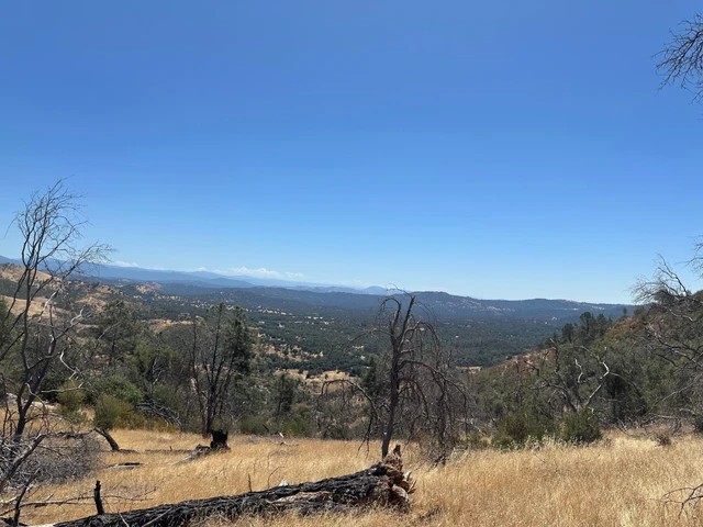
This land is in a small town called Hayward; it is an unincorporated community in Mariposa County. It is located 8.5 miles southwest of Penon Blanco Peak.
Hayward is part of the vicinity of La Grange, Ca. just a 10 minute-drive from this town.
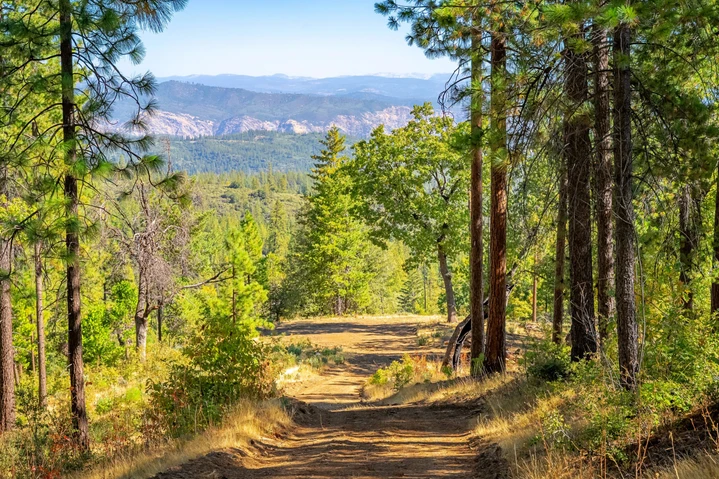
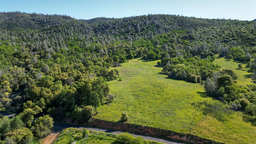
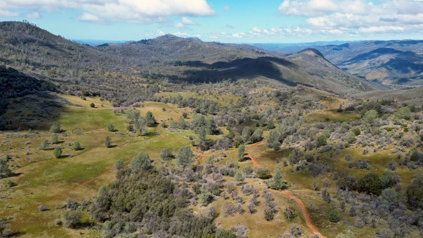
This is a VERY NICE land parcel that is quite beautiful and peaceful and is 1.5 acres
and is mostly level with a slight slope. This land parcel sits up nicely and
has potential views. Additionally, this land parcel has easy road access and is zoned
residential and is great for camping or to build your dream home on it whenever you are ready!
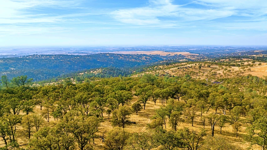
The surrounding area has hundreds of acres of huge old growth beautiful trees too. Being there feels just like being in a National Forest!
If you are an outdoor lover and like peace and quiet, seclusion, beauty and serenity, then this is the place for you.
You may also be excited to know that there are tons of outdoor areas to explore and to have adventures. Many great outdoor adventures are within minutes of your new property.
The lake is popular for water sports, including skiing, wake boarding, house boating, and fishing.
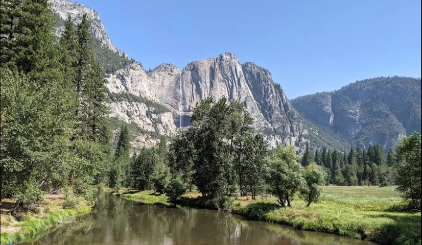
132 Hwy Yosemite Blvd runs right beside this precious land, this road will take you to the greatest Yosemite National Park in about one hour drive.
Build your own space and a dream home; get out of the city life and enjoy this community with quality of life.
And with just one hour drive you will be able to do your shopping to get everything you need to have a dream place with a nice homesite.
Property Profile:
APN: 021-170-012-0
Address: 9656 HERNANDEZ DR LA GRANGE CA 95329-9659
Lot Size: 1.5 Acres / 65,340 sq. ft.
Dimensions: 427 ft. frontage on Hernandez Dr. 186 ft. right side of property line. 365 ft. left side of property line. 250 ft. rear of property line.
State/Province: California
Zoning: RR/Rural Residential.This property is buildable up to 5 units: two homes and three additional small dwellings
Taxes: $ 210 per year
County: Mariposa
There is a $495 transfer fee in addition to the purchase price (which includes messenger fee, sub escrow fee, wire fee, transfer taxes and processing fee), which offsets the change of ownership fee with the county (closing cost). We will be providing you with a Grant Deed which will transfer title to your name once you record the document with the County Recordersoffice.
The assessor's parcel number to the property in Mariposa County is APN# 021-170-012-0
Here is a link (including the GPS coordinates) to view the location of the property on Google Maps:
37.636974,-120.352037
(You may have to copy and paste this to use it.) Once the map pops up, simply use the zoom tool on the left side of that screen to view the map in more detail. You can even view an aerial photo by clicking on the Satellite tab in the upper right portion of that screen.
All information we have on this property is disclosed within the content of the listing page. Any and all other information on this property should be directed toward the city or county of which the property is located in. Your due diligence should be performed, to ensure the property meets your needs and criteria.
Details
County: Mariposa
Zipcode: 95329
Property Type One: Recreational Property
Property Type Two: Residential Property
Property Type Three: Undeveloped Land
Brokerage: LandCo Investments
Brokerage Link: landcoinvestment.com/
Apn: 021-170-011-0

Javier Prodiz
LandCo Investments
6577931035
By clicking the button, you agree to our Terms of Use and Privacy Policy.


Nearby Listings
Mariposa County, CA
$345,000 - 159 ac.
Tuolumne County, CA

$590,000 - 40 ac.
Tuolumne County, CA
$250,000 - 41 ac.
Tuolumne County, CA
$885,000 - 473 ac.
Tuolumne County, CA
$895,000 - 440 ac.
Tuolumne County, CA

$2,100,000 - 480 ac.
Mariposa County, CA
$735,000 - 22 ac.
Mariposa County, CA
$725,000 - 150 ac.
Calaveras County, CA
$695,000 - 166 ac.
Stanislaus County, CA

$1,100,000 - 16 ac.