Cow Creek 81 - 81 +/- Tillable & Hunting Acres In Reno County, Kansas
8819 Sallee Rd, Nickerson, KS | Lat/Lng: 38.1534, -98.0096
$344,675
81.1 ac.
02/15/2026
ACTIVE
Description
Cow Creek 81
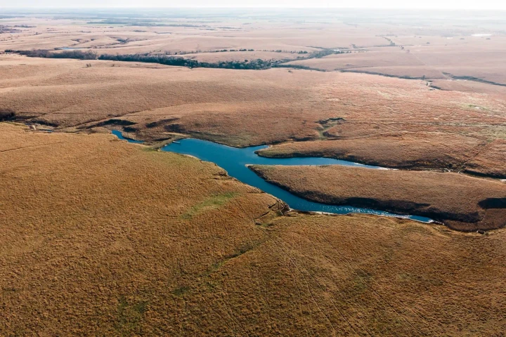
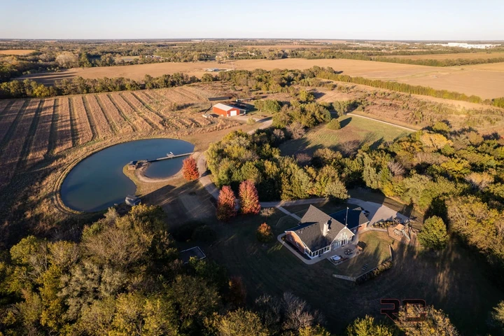
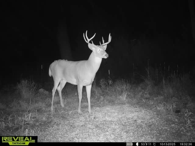
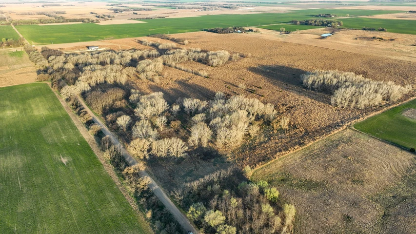
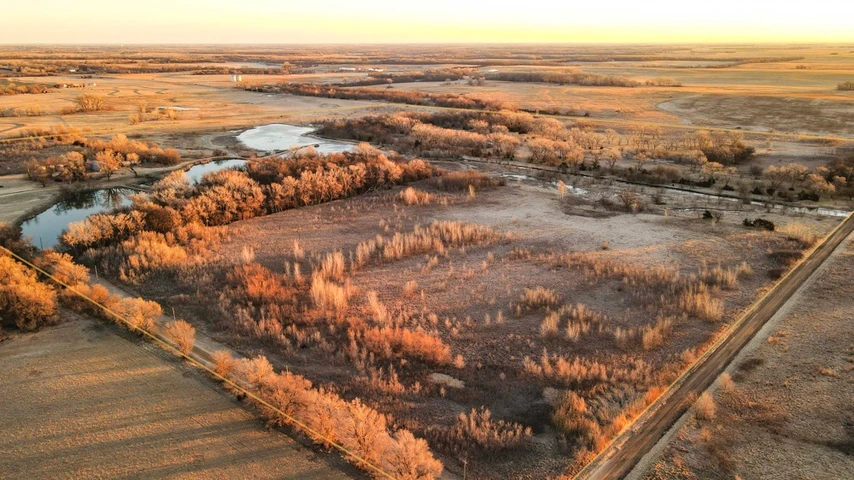
Located just inside Reno County on the break between the Sandhills and fertile creek-bottom tillable, this 81 +/- acre tract combines productive farmland with prime hunting and water resources. Cow Creek, a tributary of the Arkansas River, flows through the western half, supplying dependable water and excellent riparian cover for deer, turkey, and other wildlife. Productive Class II Buhler-Blazefork and Kaskan loams and easy access to local markets make this an attractive property for operators or investors. At roughly 81 acres, the parcel also meets the non-resident acreage requirement for a Kansas buck tag.
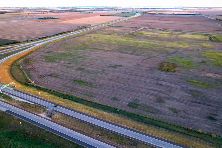
Tillable/Ag
Total Tillable Acres: 58 +/- (currently consisting of last years bean stubble- to be planted to corn this spring).
Soil: Class II Buhler-Blazefork & Kaskan Loams.
Topography: 0-1% slope. Other than the Cow Creek, this property lays extremely flat.
*** Water Well: The current owner/operator planned to put a small irrigation system on this tract. There was a test well drilled in March of 2015 (driller's log available upon request). Static water level is 9 ft below ground surface, with an impermeable shale layer at 64 ft - indicating roughly 55 ft of saturated aquifer. These conditions are typical for irrigation wells in the area and should support permitting for agricultural or recreational use; buyers should confirm permitting and capacity with local authorities.***
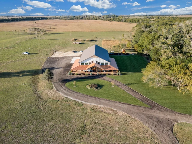
Cover & Habitat:
23 +/- acres of timber/creek.
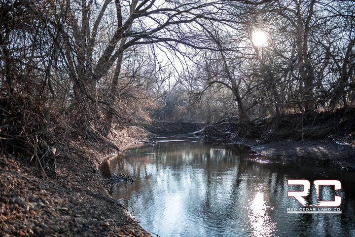
Mature Timber: Features Cottonwood, Locust, and Cedar trees, providing exceptional cover and habitat for deer, turkeys, and other wildlife.
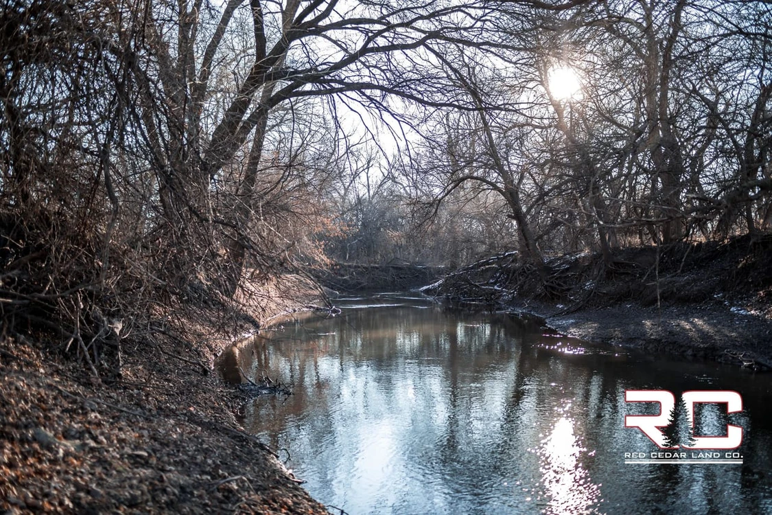
Water Features / Creek System: The Cow Creek, a tributary of the Arkansas River winds through the western half of this tract serving as a vital travel corridor for wildlife and enhancing habitat diversity.
Mineral Rights: All mineral rights held by the seller will convey to the buyer upon closing.
Possession: Possession of all acres will be given to the buyer upon closing.
Tenancy: Seller is the current tenant/operator on the land. No long term leases or agreement in place.
Showings: By appointment only. To schedule a private tour or for further inquiries, contact the listing agent:
Cody Crook
Phone: 620-617-7320
Key Feature
Cow Creek
Timber/Heavy Cover
Productive Tillable Acres
Agricultural/Recreational Water Well Potential
8 Miles To Hutchinson
45 Miles To Wichita
Details
County: Reno
Zipcode: 67561
Property Type One: Farms
Property Type Two: Recreational Property
Property Type Three: Hunting Land
Brokerage: Red Cedar Land Co.
Brokerage Link: https://redcedarland.com/cody-crook/
Apn: 0330800000004000

Cody Crook
Red Cedar Land Co.
(620) 617-7320
By clicking the button, you agree to our Terms of Use and Privacy Policy.


Nearby Listings
McPherson County, KS
Auction - 603 ac.
Harvey County, KS
$1,600,000 - 90 ac.
Rice County, KS

$362,400 - 151 ac.
Reno County, KS
$1,930,000 - 160 ac.
McPherson County, KS
$285,000 - 60 ac.
Reno County, KS
$840,000 - 240 ac.
Harvey County, KS
$2,900,000 - 91 ac.
Reno County, KS

$299,250 - 63 ac.
Reno County, KS
$279,000 - 60 ac.
Reno County, KS
$1,080,245 - 158 ac.