
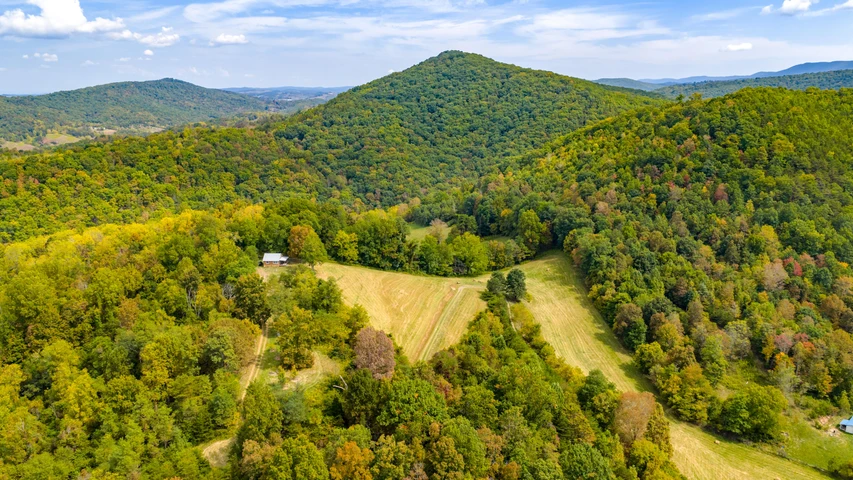
CORNBREAD RIDGE FOREST
4236 Cornbread Ridge Road, Princeton, WV | Lat/Lng: 37.4640, -81.0868
$119,900
17.02 ac.
09/02/2025
ACTIVE

Description
HIGHLIGHTS
17.01 acres +/- multi-use residential, farming, timber investment, and recreational property
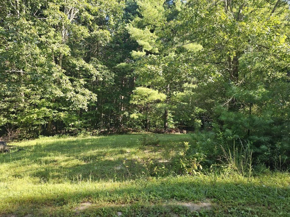
Numerous home or cabin sites including forested and fields
Electric, landline telephone, great cell coverage with 5G service
An easy drive to higher population areas of Princeton, Blacksburg, Roanoke, Beckley, Lewisburg and Charleston, 4 jet airports, and 4 major interstates
Bluestone National Scenic River is just a couple of miles away
18,000 acre Bluestone Wildlife Management Area in nearby
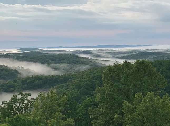
70,000 acre New River Gorge National Park and Preserve, America's newest national park is nearby
State-maintained Cornbread Ridge Road runs through the property
Perfectly sized to create a wonderful country retreat - private but not remote
City amenities nearby - 20 minutes to Princeton, 50 minutes to Beckley
1 hour 40 minute drive to Charleston - WV's State Capitol and largest metro area & jet service
Valuable timber is ready for immediate harvest producing cash flow to offset purchase and holding costs
Mature hardwood forest is comprised of Red Oak, White Oak, Hickory, Poplar, White Pine and Maples
ATV riding, hiking, camping, hunting star gazing and nature viewing
Perfect location to enjoy all water sport activities supported by the nearby New River, Greenbrier River, and the 2000-acre Bluestone Lake
Amazing resident wildlife population rich in diversity and ever changing
Area fur bearing wildlife - deer, black bear, squirrel, rabbit, bobcat, raccoon, coyote, fox, chipmunk, opossum
Area winged wildlife includes eagles, Neotropical songbirds, turkey, grouse, eagles, herons, hawks, owls, ravens, king fishers, ravens, crows, and hummingbirds
Forest soaks up tons of Carbon Dioxide and produces tons of life-giving oxygen
A rewarding off-grid permaculture lifestyle can be easily developed
Elevations range from about 2327 ft. to 2545 ft.
Low taxes, low population density
LOCATION
Google Coordinates: 37.463434(N), -81.087122(W)
Address: 4236 Cornbread Ridge Road, Princeton, WV 24740
Elevation Range: 2327 ft. to 2545 ft. +/-
FOREST/TIMBER RESOURCES
This property has highly desirable timber composed of high-quality Appalachian hardwoods and White Pine. This well-managed timber resource can provide a great deal of flexibility to the next ownership in terms of potential harvest revenue and can be managed to provide cash flow opportunities to offset holding costs and long-term asset appreciation.
AGRICULTURAL RESOURCES
The property has a field containing about 1.5 acres.
AREA WILDLIFE
The edge effect between woods and fields benefit all the resident wildlife. White tail deer, black bear, wild turkey, squirrel, rabbit, bobcat, fox, chipmunk, and many species of songbirds make up the resident wildlife population.
Of equal importance, there is the insect and microscopic world including butterflies, dragonflies, water skaters, water beetles, damselflies, hellgrammites, tadpoles and various insect larve.
Great fishing is found in the areas lakes and rivers with small and large mouth bass, crappie, catfish, muskie, walleye, pike and bluegill present in good numbers.
The hardwood forest of the surrounding mountains provides the essential nutrient source and produces tons of hard mast including acorns, hickory nuts, beech nuts and black walnuts. Soft mast includes stag horn sumac, black cherry, tulip poplar seeds, maple seeds, autumn olive berries and blackberries.
WATER
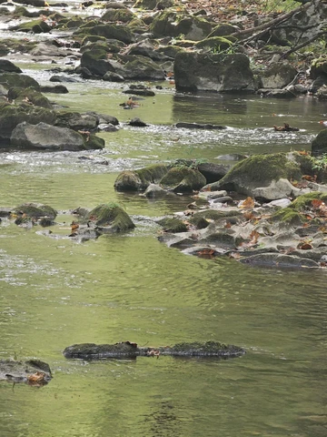
Tony Branch, a dashed blueline stream, is the northern boundary of the property for about 1/4 mile. The intermittent stream should have regular waterflow, especially during rain events and periods of snow melt.
MINERAL RESOURCES
All rights the owner has in title will convey with the property.
BOUNDARIES AND SURVEY
The property was surveyed in April 2003, and a plat prepared from that survey is recorded as Microfilm Plat 15018. A long portion of the northern property boundary runs with Tony Branch, and the southwestern property boundary runs with Cornbread Ridge Road. The property is being sold by the boundary and not by the acre.
UTILITIES
Water: well could be drilled
Sewer: private septic could be installed
Electricity: Onsite
Telephone: Cell phone coverage is good
Internet: Starlink is available
ACCESS/FRONTAGE
The southwestern boundary of the property fronts on Cornbread Ridge Road, a county road, for a little more than 1/4 mile. The property road connects directly to Cornbread Ridge Road.
ZONING
The county is subject to some zoning and subdivision regulations. All prospective buyers should consult the County Commission and the Health Department for details regarding zoning, building codes and installation of septic systems.
PROPERTY TYPE/USE SUMMARY
The property has some open areas while most of the tract is forestland.
(This is an estimation of current property use as determined from aerial photography. It is made subject to the estimation of property boundaries and any errors in the interpretation of land use type from the aerial photography utilized.)
Details
County: Mercer
Zipcode: 24740
Property Type One: Farms
Property Type Two: Recreational Property
Property Type Three: Residential Property
Brokerage: FoxFire Realty
Brokerage Link: www.foxfirenation.com

Richard Grist
FoxFire Realty
(304) 645-7674
By clicking the button, you agree to our Terms of Use and Privacy Policy.


Nearby Listings
Mercer County, WV
$1,750,000 - 994 ac.
Monroe County, WV
$365,000 - 82 ac.
Raleigh County, WV

$549,000 - 60 ac.
Raleigh County, WV
$2,600,000 - 408 ac.
Greenbrier County, WV
$699,000 - 49 ac.
Greenbrier County, WV

$349,000 - 114 ac.
Greenbrier County, WV
$240,000 - 1 ac.
Monroe County, WV
$345,000 - 32 ac.
Giles County, VA

$1,050,000 - 154 ac.
Raleigh County, WV

$569,900 - 38 ac.