
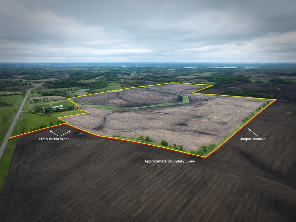
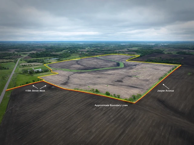
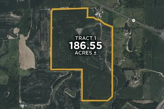
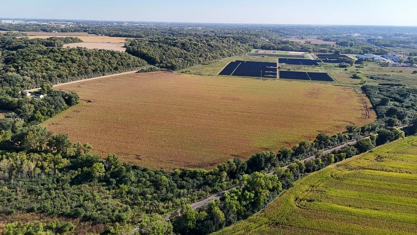
Rice County farmland featuring 186.55± deeded acres, 175± FSA tillable acre
115th Street West, Lonsdale, MN | Lat/Lng: 44.4142, -93.4811
No Price
186.55 ac.
06/13/2026
ACTIVE
Description
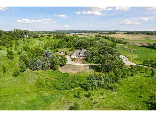
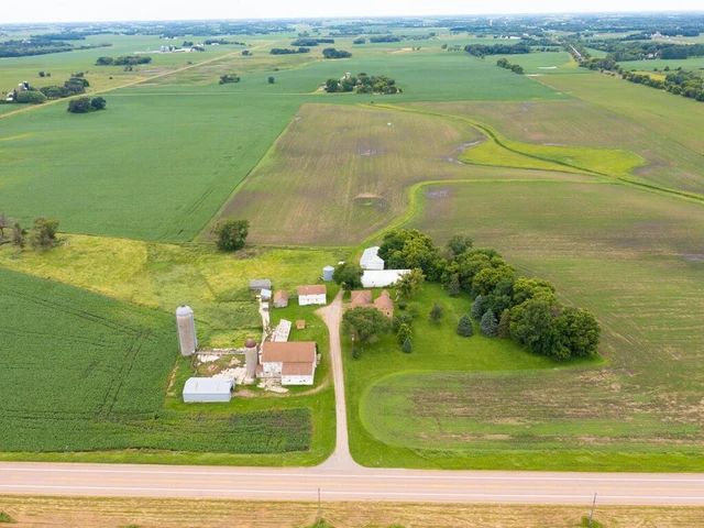
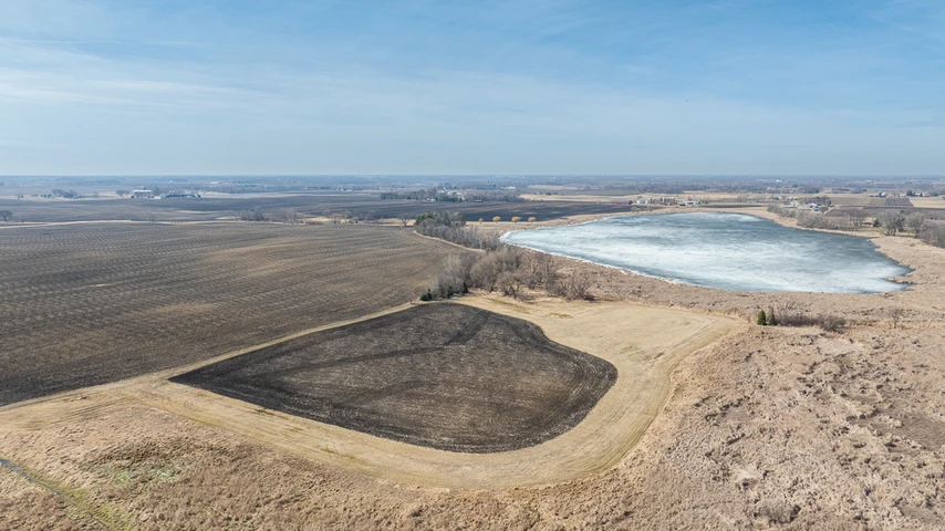
Live and Online at Auction Date: 08/21/26 Auction Time: 11:00 AM CTAuction Held At: The American Bar and Grill, 102 Elm Ave SW, Montgomery, MN 56069Entire Farm Description:Rice County farmland located in Sections 15, 16, and 22 of Erin Township. The property consists of 186.55 deeded acres with approximately 175 FSA tillable acres and a Crop Productivity Index (CPI) of 77.4. The property has public road access from 115th Street West, which serves as an access road coming south off of State Highway 21. 115th Street West borders the north side of the property and functions as a no-maintenance public road. Jasper Avenue borders the west side of the property and also serves as a no-maintenance public road, providing additional access for farming equipment during harvest and planting seasons. A waterway runs throughout the property and provides effective drainage for the farmland acres. The ditch system has recently been dredged to help ensure proper water flow and drainage performance across the farm. Along the ditch, there is a compliant 50-foot-wide grass buffer on each side of the waterway. There is a culvert and crossing in the northeast portion of the property for easy access to those acres east of the drainage ditch. All tile outlets along the ditch are marked with flags. In addition to the tillable value, this property has multiple building eligibilities. Those eligibilities may be transferred within the township. Building rights in this area can add significant value. All building eligibility and transfer eligibility should be established with the county prior to purchase. Deeded Acres: 186.55FSA Farmland Acres: 175Soil Types: Derrynane Loam, Houghton Muck, Lerdal Clay Loam, Kilkenny Clay Loam Soil PI/NCCPI/CSR2: 77.4CRP Acres/Payment: NoneTaxes: $9,956Lease Status: Open Tenancy for 2027 crop yearPossession: At the end of the 2026 crop year Survey Needed?: No survey neededBrief Legal: Pt W SW S15, E SE S16 and NW NW S22 T11N R22W Rice Co MNPIDs: 05.22.2.25.001 and 05.15.3.50.001 and 05.16.4.00.001 Lat/Lon: 44.4142 -93.4811Zip Code: 56069
Details
County: Rice
Zipcode: 55046
Property Type One: Farms
Property Type Two: Ranches
Brokerage: Whitetail Properties Real Estate
Brokerage Link: www.whitetailproperties.com/agents/bryce-mcvicker

Bryce McVicker
Whitetail Properties Real Estate
(507) 430-8518
By clicking the button, you agree to our Terms of Use and Privacy Policy.


Nearby Listings
Rice County, MN
$5,500,000 - 189 ac.
Steele County, MN
Auction - 10 ac.
Carver County, MN
$1,750,000 - 38 ac.
Carver County, MN
$975,000 - 8 ac.
Rice County, MN
Auction - 187 ac.
Carver County, MN

$16,300,000 - 754 ac.
Goodhue County, MN

$329,999 - 14 ac.
Carver County, MN
$712,880 - 38 ac.
Blue Earth County, MN
$2,644,092 - 61 ac.
Goodhue County, MN

$799,000 - 20 ac.