
Cocklebur Creek Pasture and Cropland
1 CO RD, Larned, KS | Lat/Lng: 38.3278, -99.4135
$563,000
312.77 ac.
11/25/2025
ACTIVE

Description
A productive blend of cropland, native pasture, and creek-lined cover creates an ideal mix of income and recreation on this 312.77 acre property. Exceptional whitetail activity, established habitat, and a tower blind already in place make it ready for your next season.
Land
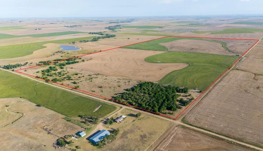
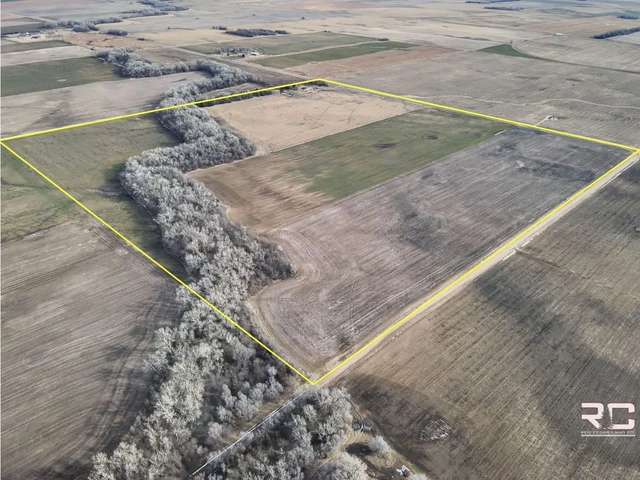
Discover 312.77 acres of highly versatile land in Pawnee County, Kansas, situated just 10 miles south of Nekoma and conveniently positioned within easy reach of Rush Center, Larned, and Ness City. Located in Kansas Deer Unit 5 and benefiting from an average annual rainfall of 30 inches, this property blends productive farm ground with exceptional wildlife habitat and turnkey hunting amenities as well as non resident landowner deer tags.
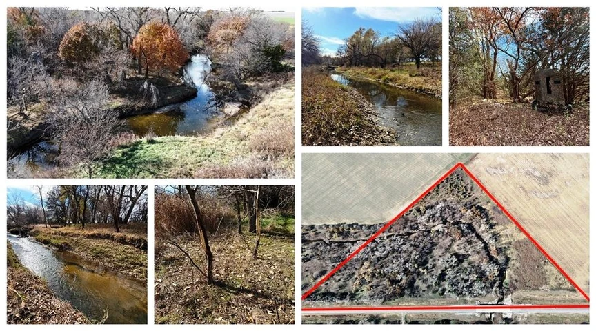
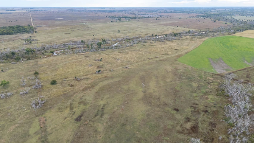
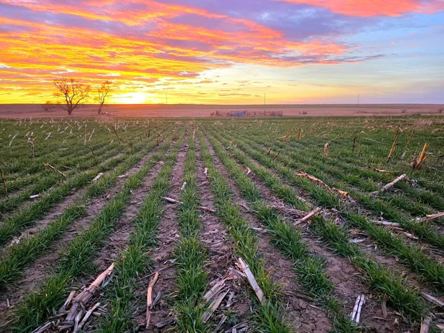
With approximately 265 acres of primarily Class II cropland on a favorable 75/25 crop-share agreementzero landowner expensesand additional pasture on cash rent, this tract offers consistent income and a reliable tenant willing to continue. Around 47 acres of trees and waterways add diversity to the landscape, including Cocklebur Creek winding through the northeast corner. The creek corridor and pasture showcase willows, cottonwoods, cedars, and osage trees, while the northwest corner features a 10-acre orchard of mature hedge apple (osage orange) trees producing heavily year after year.
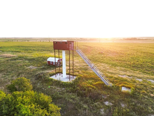
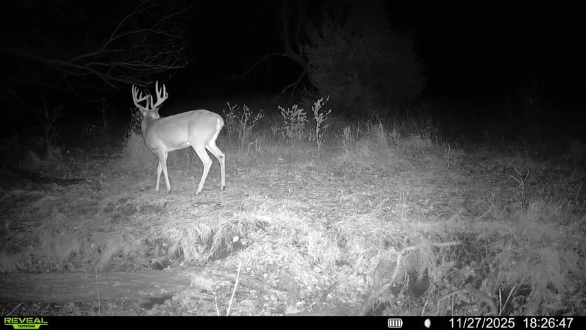
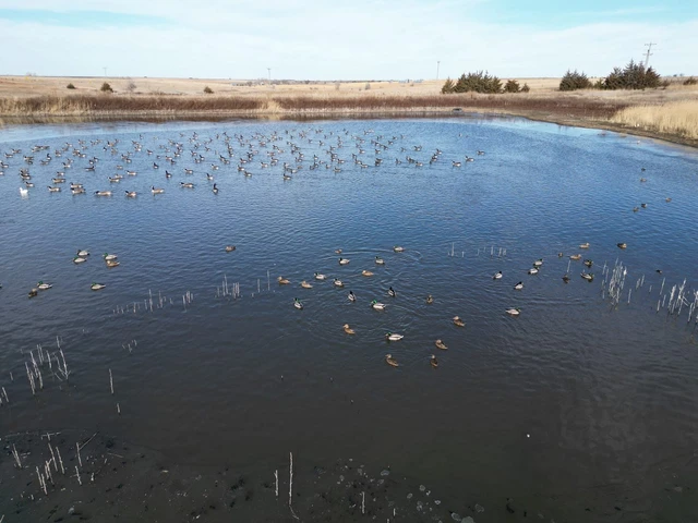
A non-producing oil well remains on site, and a pasture water well will need upgrading, though a large neighboring watershed and nearby water sources further enhance the property's value. A new Redneck tower blind set in the cropland conveys with the land, offering exceptional vantage for deer hunting. Trail camera history confirms strong whitetail genetics, with several impressive up-and-coming bucks and at least one notable trophy-class deer frequenting the property. Pheasants, quail, abundant cover, reliable food sources, and natural shelter further elevate the recreational appeal.
With 2024 taxes at just $1,551.04, this property provides a rare combination of agricultural return, strong habitat, and ready-to-hunt setupmaking it an outstanding opportunity for both investors and outdoor enthusiasts.
Please contact the listing agent for more information on this property or to schedule a private showing. (**Financial verification is required**)
Legal Description: W2 of S10, T20, R19 in Pawnee County
__________________________________________________
Crop Base Acres PLC Yield
Wheat 146.4 40
Grain Sorghum 36 53
Average NCCPI 67.48
__________________________________________________
Soils: Primarily Class 2 soils
Harney silt loam, 1 to 3 percent slopes: 213.44 Acres
Harney silty clay loam, 1 to 3 percent slopes, eroded: 50.52 Acres
Harney-Uly complex, 3 to 6 percent slopes, eroded: 27.84 Acres
Roxbury silt loam, occasionally flooded: 11.54 Acres
Harney silt loam, 0 to 1 percent slopes: 9.11 Acres
Details
County: Pawnee
Zipcode: 67550
Property Type One: Farms
Property Type Two: Ranches
Property Type Three: Hunting Land
Brokerage: Hayden Outdoors Real Estate
Brokerage Link: https://www.haydenoutdoors.com/agents/j-c-bosch/

JC Bosch
Hayden Outdoors Real Estate
(620) 282-9572
By clicking the button, you agree to our Terms of Use and Privacy Policy.


Nearby Listings
Pawnee County, KS
$1,100,000 - 626 ac.
Pawnee County, KS
Auction - 156 ac.
Pawnee County, KS
$183,000 - 21 ac.
Pawnee County, KS
$385,000 - 154 ac.
Rush County, KS

$632,000 - 301 ac.
Pawnee County, KS
$738,649 - 242 ac.
Barton County, KS
$513,300 - 174 ac.
Pawnee County, KS
$1,040,000 - 640 ac.
Ness County, KS

$395,800 - 160 ac.
Rush County, KS

$471,000 - 315 ac.