National Land For Sale (83357 results)
Want to post your listings on AcreValue? View Listing Plans
AcreValue offers multiple types of land for sale in every state in America, so if you’re looking for a new ranch, farm, recreational property, hunting ground, developmental property, or land investment you’ve come to the right place. Regardless of what your needs or objectives are for your land, we have a large inventory of available parcels that are updated regularly. Therefore, it’s very likely that we have the perfect parcel that meets all the search criteria & specifications that you’ve been searching for. Additionally, because our land for sale listings are always being updated due to the frequency of land being sold or new land listings being put on the market, make sure that you are checking back with AcreValue regularly for updates. When you find the perfect land parcel and you are ready to take the next steps you can easily connect directly with the listing agent to help you facilitate your land purchase. We wish you the best of luck in finding your next ranch, farm, recreational property, hunting ground, developmental property, or land investment.

09/15/2025
$6,995
0.22 ac.
ACTIVE
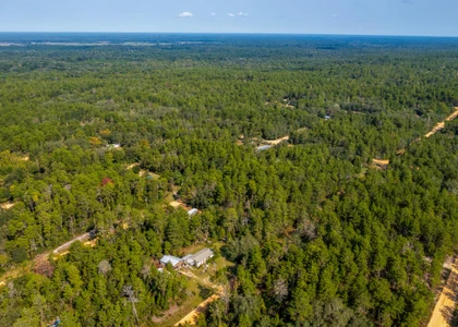
Putnam County - 0 Creager Ave, Interlachen, FL
*** 5-Day Become A Landowner Challenge: Start For Just $1 Down ***
Over 700 people have already done this, will you be next?
Here's the plan:
Day 1: Book Your Free Call to Join Our 5-Day Landowner Challenge
- Let's explore your land options together and unlock exclusive offers you won't find online. Go to: call.gokcap. com
Day 2: Place the Property on Hold
- Hold your property on our website so no one else can grab it, you're officially on the path to becoming a landowner.
Day 3: Explore Your Land
- Step onto your land, even virtually, do your homework, and imagine how you'll make it your own.
Day 4: Pick Your Path
- Choose the payment plan that's right for you, with 5% cash back rewards, 9 free bonuses, and a 365-Day Land Exchange Guarantee to keep you safe.
Day 5: Celebrate Ownership
- Sign your agreement and join the community of 700+ proud landowners.
Dear Land Buyer,
Are you looking for a place to call your own where you can enjoy peace and quiet without the stress of city life?
This 0.22-acre lot in Putnam County, Florida could be exactly what you've been searching for.
- Hold it now for just $50 on our website. Freedom Friday coupon available on our website.
Tucked along a simple dirt road, it gives you the freedom to build, place a mobile home, or simply hold as an investment without the burden of HOA fees or strict neighborhood rules.
Many homes are already nearby, which means access to power should be straightforward, but you'll want to confirm availability with the county.
The land itself is easy to work with: flat, with gentle 0-5% slopes, covered in mixed pine flatwoods and patches of open grassland.
It's outside the flood zone according to our research and the natural vegetation provides a peaceful, green backdrop.
Want to build a tiny home or bring in a mobile home? The R-2 zoning (per our research) allows both, as long as you add a well, septic system, and the right permits.
This is the kind of place where you can slow down, listen to the wind through the trees, and enjoy the Florida lifestyle without breaking the bank.
Whether you want a quiet spot to live, a mobile home retreat, or a smart land investment for the future, this property offers freedom and potential.
So if you've been waiting for the right place to build or invest, now's the time.
Note: A one-time document preparation fee is paid upfront at closing and covers deed preparation, recording, and administrative costs.
LOT BREAKDOWN: WHAT YOU'RE GETTING
Assessor's Parcel Number: 25-09-24-4075-0850-0270
Legal Description: Interlachen Lakes Estates, Frederick Town Unit 16 Mb5 P4, Blk 85 Lot 27
Elevation: 180
GPS Center Coordinates (Approx.): 29.67958, -81.84803
Annual Taxes: ~$85.25
Zoning: R-2
Time Limit To Build: None as far as we are aware
Access: Dirt Road
Power: We recommend that you contact Putnam County to confirm, but according to our research electricity is available for connection to the property
Water: A well would need to be installed
Sewer: A septic system would need to be installed
Official Contacts: Please contact Putnam County
RVs Allowed? We recommend that you contact Putnam County to confirm, but according to our research, you can get a temporary permit to live in an RV while building a home
Buildable? Because we do not know the specifics of what you may want to build on the property, we recommend that you contact the building and/or zoning department(s) for more information on the relevant zoning and building regulations and how to obtain a building permit
Survey Available? No, we have not had a survey commissioned, but if you would like to pay for a survey we would be happy to work with your chosen surveyor
In HOA? No HOA
Annual HOA Dues: ~$0.00

02/25/2026
$17,900
5.04 ac.
ACTIVE
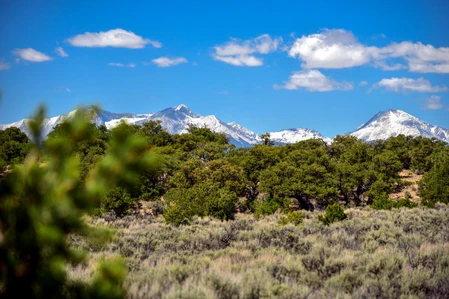
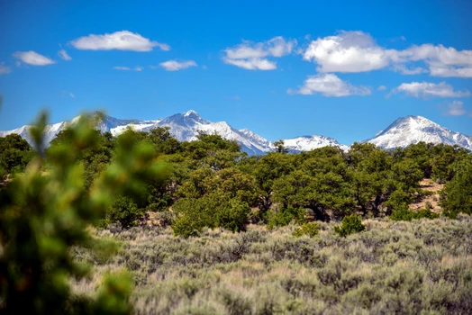
Costilla County - Luke Rd, Fort Garland, CO
Five acres of Colorado mountain land in the Sangre de Cristo Ranches doesn't come available every day and when it does, it doesn't last long. This property sits in Costilla County at over 7,000 feet elevation, where the air is clean, the nights are quiet, and the views stretch for miles. Tree coverage on the property gives you natural shade and privacy, while the wide-open Colorado sky makes it perfect for stargazing, solar power, or just unplugging from the noise of everyday life.
The Sangre de Cristo mountain range rises dramatically to the west, and Great Sand Dunes National Park is just a short drive away one of the most unique natural wonders in the country. The surrounding area is prime habitat for deer, elk, pronghorn, and a wide variety of birds, so if you love the outdoors, you'll feel right at home here. Whether you're hiking, hunting, or just sitting outside with a cup of coffee watching wildlife move through, this part of Colorado delivers.
This land is ready for whatever you have in mind bring your off-grid cabin plans, your camper, or just your lawn chair and start enjoying it now. Nearby property owners are already running solar setups successfully, so going off-grid here is a proven and practical option. With dirt road access, tree coverage for natural shelter, and five acres to spread out on, this is the kind of land that gives you real freedom.
We are open to owner financing as well - here is what that would look like:
- Total Money Down: $599($349 downpayment + $250 closing cost)
- Monthly: $275/month for 96 months
See Info below!
- Subdivision: Sangre de Cristo Ranches
- State: Colorado
- County: Costilla
- Zip:81133
- Size: 5.041 Acres
- Parcel: 70235720
- Legal Description: S.D.C.R. UNIT J BLK 113 LOT 1700 CONT. 5.041 AC
- Approximate Lat/Long Coordinates:
37.3674, -105.3437 NW
37.3669, -105.3421 NE
37.3657, -105.3422 SE
37.3657, -105.3433 SW
- Annual Taxes: Approximately 125/year
- Zoning: Estate Residential (ER)
--For a site-built home, you need a 600sqft minimum footprint.
--Mobile homes are allowed.
--You can camp for 14 days (every 3 months).
--Temporary RV Occupancy permit available ($250 fee - good for 90 days at a time while building, renewable).
--The zoning office is open Monday through Thursday and can be contacted at (719) 672-9109 to answer any questions.
- HOA/POA: Optional $25/year. Very minor covenants these can be viewed by clicking into our website.
- Improvements: None
- Access: Dirt Road
- Water: Would be by well or holding tank
- Sewer: Would be by Septic
- Utilities: Alternative Energy (Solar, wind, or generator), Phone would be cellular or Satellite. TV/Internet would be Satellite
**Note: Information presented on this page is deemed accurate, but is not guaranteed. Buyer is advised to do their own due diligence**


12/26/2024
$400,000
21.53 ac.
ACTIVE
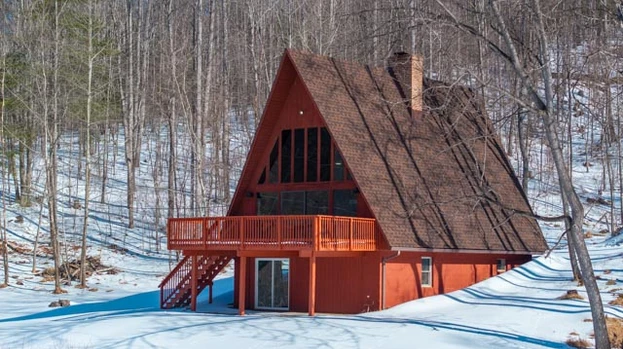
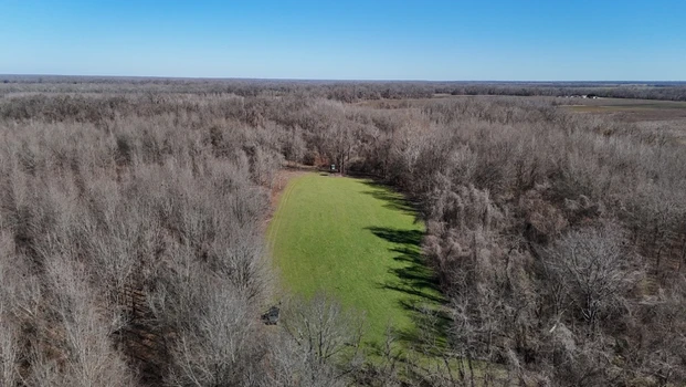
Amherst County - 225 Opus Lane, Amherst, VA
Looking for a vacation home or family getaway? This charming lakefront A-frame is nestled in the foothills of the Blue Ridge Mountains about 40 minutes from popular Lynchburg, Virginia. With 20 acres of forested land, it offers hunting, fishing, or just that perfect solitude you've been thinking of. Owner can finance this property on easy 30-year terms with a 10% down payment.
This home has been newly renovated including new roof and HVAC system, and is sparkling clean ready for move-in. A bedroom on the main level with a full bathroom across the hall offer convenience and rustic charm. The full kitchen has beautiful butcher-block countertops and brand new appliances. As you enter into the great room, you're greeted with astonishing lake views through the soaring chalet windows. A massive masonry fireplace completes the setting for those cozy winter nights in front of the fire.
Upstairs a comfy loft offers still more space for guests or family to spread out. All the finishes are rustic wood that's been newly stained with plenty of natural light. But that's not all! Downstairs is a full walkout basement with yet more room for accommodations. Another cute bathroom downstairs means this is a place you can stay as long as you want without cramping your style.
Finally, the wide deck on the front of the house has the most beautiful view overlooking the lake - your lake! - you've ever seen. It's a deep fishing lake with some granddaddy bass and a little pier on it. All around you are peaceful woods as far as the eye can see. Its time to go ahead and get that vacation place you've been thinking about. Agents are welcome, address is 225 Opus Lane, Amherst VA 24521, price is $400,000, Equal Housing Opportunity.
The home features 2 bedrooms, 2 bathrooms, and a loft overlooking the main living area. The living room includes a full wall of windows with views of the pond, filling the space with natural light and offering a beautiful backdrop year-round. The interior has been recently renovated, and a new roof was just installed.
The full walk-out basement includes a full bathroom and sliding glass doors that open to the backyard and pond are perfect for extra living space, guests, or storage.
This property is part of a quiet lakeside location with three homes and is offered with a shared well and road maintenance agreement. If you're looking for more space, there are up to three cabins available, with the potential to purchase as much as 93 total acres.
Call today to set up a private showing!
Equal Housing Opportunity.

02/27/2026
Auction
100 ac.
ACTIVE
Cleburne County - 59 Edgemont Road, Quitman, AR
This is a Fantastic Property with Great Future Potential. With its Prime location along High-Traffic Roads Near Greers Ferry Lake and the Red River, this Property has Many Potential Uses. In Addition to the Prime Highway Frontage Property, we Will Also Offer 120± Acres of Mineral Rights.
REAL ESTATE DESCRIPTION: 100± Acres with Prime Highway Frontage Near Heber Springs, Arkansas & Greers Ferry Lake ~ Offered in 5 Tracts & Any Combination of Tracts on Auction Day ~ Also Offering 120± Mineral Acres Separately ~ Drive by & Inspect this Tract at Any Time.
(TRACT 1) 12± Acres of Mostly Pasture on HWY 25 with 930± Ft. of Highway Frontage.
(TRACT 2) 23± Acres on Edgemont Road ~ Mostly Timber with 720± Ft. of Road Frontage.
(TRACT 3) 28± Acres of Mature Mixed Timber with Frontage on Edgemont Road & 1,800± Ft. Along Sartain Road.
(TRACT 4) 11± Acres on Edgemont Road with 680± Ft. of Highway Frontage.
(TRACT 5) 27± Acres on HWY 25 with 1,380± Ft. of Road Frontage & Access off Gresham Road, Mostly Timber.
Property Highlights
100± Acres Offered in 5 Tracts Located just Northeast of Quitman, Arkansas
Parcels Offer Frontage on Heber Springs Road W., Highway 16 (Edgemont Rd.) Gresham Road & Sartain Road
Tracts Range from 11± Acres to 28± Acres
Mature Timber with Areas Cleared for Future Development
Close to Greers Ferry Lake Cove Creek Access & Eden Isle
11 Miles to Little Red River Access
120± Acres of Mineral Rights Offered Separately
Offers Made Prior to Auction Day are Welcome!

09/10/2025
$19,500,000
7532 ac.
ACTIVE
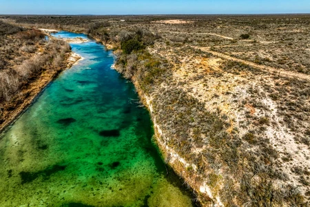
Uvalde County - Uvalde, TX
Nueces River Ranch: A Texas Oasis and Generational Legacy
Welcome to Nueces River Ranch, an unparalleled 7,530 acre estate that embodies the wild, untamed spirit of the Edwards Plateau. With approximately half a mile of private Nueces River frontage, this expansive property is a rare finda legacy-sized parcel offering exceptional privacy, boundless adventure, and an opportunity to create a generational family retreat. Conveniently situated just 20 miles from both the modern amenities of Uvalde and the rustic charm of Camp Wood, this ranch is your exclusive gateway to the heart of Texas. ******Motivated seller, offering 4.5% commission to the buyers agent! *******
Crystal Clear Waters and Natural Beauty
Water is a defining feature of this magnificent property. The crystal-clear Nueces River forms a portion of the western boundary, providing a tranquil and secluded retreat. The river's deep, blue-tinted channel is ideal for swimming, fishing, and kayaking. Anglers can expect to find native Guadalupe bass, largemouth bass, sunfish, and catfish. In addition to the river, the ranch has two reliable water wells that feed multiple watering holes, serving both wildlife and livestock. The propertys rich vegetationincluding majestic live oaks, mesquite, and sycamore treesenhances its scenic beauty. In the spring, the land transforms into a vibrant mosaic of wildflowers, including Texas bluebonnets, creating a stunning backdrop for outdoor activities.
Unrivaled Terrain and Panoramic Vistas
Spanning approximately five miles by five miles, the ranch features a diverse topography that transitions from rolling plateaus to rugged canyons carved by wet-weather creeks. Elevations climb from 1,160 feet to a breathtaking 1,664 feet on the highest plateau. This majestic summit offers sweeping 360-degree views of the surrounding Sycamore Mountain Range and the stunning landscape below. A network of well-maintained roads and UTV trails ensures easy access across the property, allowing you to explore every corner of this vast wilderness.
Ranch Improvements
Nueces River Ranch offers substantial existing improvements that enhance management and provide a foundation for immediate use. Water infrastructure is a key asset, with three reliable water wells one solar and one electric feeding an extensive network of buried water lines. These lines are supplied by three cisterns that provide water to multiple troughs strategically placed throughout the property for both wildlife and livestock. Electricity has been run well into the property, providing a critical utility for any future building. The ranch's accessibility is excellent, thanks to its great main roads and many miles of UTV trails that provide unparalleled access across the rugged terrain. The property is also secured by perimeter barbed wire fencing, ensuring clear boundaries. For the avid hunter, numerous tower hunting stands and feeders are already in place and will convey with the sale, making the ranch a true turnkey operation.
A True Hunter's Paradise
Nueces River Ranch is a premier hunting destination. The diverse terrain and rich native vegetation support a thriving population of both native and free-range exotic species. The ranch is home to a robust population of white-tailed deer, with the region consistently ranked among the top in the state. Hunters will also find Rio Grande turkey, blue quail, and dove, along with free-range axis deer, sable antelope, and aoudad that roam the landscape. Strategically placed elevated hunting blinds, feeders, and water troughs will convey with the sale, making this a turnkey hunting operation.
Native Plants and Grasses
The ranch supports a rich and diverse tapestry of native Texas vegetation, which enhances both its scenic beauty and ecological value. Majestic live oaks, Texas red oaks, and mesquite trees are found throughout the property, providing shade and visual appeal. Denser stands of sycamore trees flourish along the Nueces River and within the rugged canyons, marking the pathways of water and creating a lush, cool environment. The native brush species, including cenizo, prickly pear cactus, blackbrush acacia, and guajillo, provide essential cover and browse for the ranchs thriving wildlife population. In spring, the landscape transforms into a breathtaking mosaic of wildflowers, with vibrant patches of bluebonnets, Engelmann daisies, and Maximilian sunflowers complemented by native grasses like Indian blanket and prairie verbena that attract pollinators and enrich the land's biodiversity. This robust vegetation is not only a visual delight but is also fundamental to the health of the entire ecosystem, supporting the ranch's abundant game and livestock.
A Legacy Property for Generations to Come
Nueces River Ranch is far more than a simple acquisition; it is a true legacy propertya profound commitment to the future. This immense and untouched piece of the Texas Hill Country offers a rare opportunity to secure a sanctuary where a family can escape the modern world and establish a permanent, shared foundation. It is a place to pass down not just a name or an inheritance, but a way of life rooted in the timeless values of stewardship, conservation, and a deep appreciation for nature. In its vast acreage and unparalleled natural resources, the ranch provides an unwavering anchor in a changing world, promising to be a cherished source of enduring memories and a living testament to a family's heritage for generations to come.
Nearby Attractions
Garner State Park: Just a short drive away, this iconic state park is famous for its crystal-clear Frio River, making it a prime destination for swimming, tubing, and hiking. Its stunning scenic beauty and family-friendly atmosphere draw visitors from all over the state.
Lost Maples State Natural Area: Known for its breathtaking fall foliage, this natural area offers some of the best hiking and birding opportunities in Texas. The rugged trails and unique plant life make it a favorite for nature enthusiasts.
Nueces River Canyon: The ranch is located within this scenic region, known for its picturesque drives and dramatic landscape. The surrounding area is popular for kayaking, fishing, and simply enjoying the rugged beauty of the Hill Country.
Local Towns: The towns of Uvalde (20 miles south) and Camp Wood (20 miles north) provide a balance of amenities and local charm. Uvalde is home to grocery stores, restaurants, and the Garner Field Airport, while Camp Wood offers a quiet, small-town atmosphere with local cafes and shops.
Location and Accessibility
San Antonio: 100 miles
Del Rio: 61 miles
Austin: 192 miles
Houston: 295 miles
Fort Worth: 344 miles
Midland: 260 miles
Nearby Airports
Garner Field (UVA): 20 miles
Del Rio International Airport (DRT): 60 miles
San Antonio International Airport (SAT): 100 miles
Top Attributes:
Immense Acreage: Spanning an unparalleled 7,530 acres, the ranch offers a level of privacy, scale, and exclusivity that is truly rare.
Private River Frontage: The ranch features approximately half a mile of private frontage on the crystal-clear Nueces River, providing a unique and highly desirable recreational asset.
Legacy Property: This is more than land; it is a generational asset, a sanctuary where a family can build a lasting legacy and pass down a heritage of stewardship.
World-Class Hunting: The property is a premier hunting destination for both native species like white-tailed deer and free-range exotics including axis deer, sable antelope, and aoudad.
Unrivaled Terrain: The diverse topography includes dramatic canyons and a high plateau offering sweeping 360-degree views of the surrounding landscape.
Abundant Water Sources: In addition to the river, the ranch has two reliable water wells and multiple water troughs that serve both wildlife and livestock.
Excellent Accessibility: A vast network of well-maintained roads and UTV trails ensures easy access to every corner of the immense property.
Rich Native Vegetation: The land supports a wide variety of native plants, including majestic live oaks, mesquite, and a vibrant display of wildflowers in the spring.
Secluded Location: Situated along a state highway between two towns, the ranch offers the ideal balance of deep privacy and convenient access to amenities.
Turnkey Hunting Operation: The sale includes strategically placed elevated hunting blinds, feeders, and water troughs, making the ranch ready for immediate use.
All information in this advertisement & herein is considered reliable but not guaranteed. Buyer to verify all information in MLS, marketing or website including but not limited to schools, square footage, acres, taxes, easements & minerals.


03/10/2025
$23,500,000
3173 ac.
ACTIVE
Callahan County - 7985 FM 2228, Baird, TX
PROPERTY DESCRIPTION: Nestled among the high hilltops of the Callahan Divide, Spring Mesa Ranch is a true legacy property, offering breathtaking landscapes, first-class accommodations, and a rich frontier history. Named after the mountain peak that rises 2,182 feet within its borders, this ranch has been meticulously restored to reflect the look and feel of a Texas cattle ranch from the 1840s. A large-scale cedar removal and native grass restoration program has brought the owner's vision to life, creating some of the most scenic and productive wildlife habitats and rangelands in the region.
The land features 38 earthen stock tanks, the headwaters of Brushy and Cottonwood Creeks, seven miles of all-weather caliche roads, excellent fencing and cross-fencing, cattle pens, and nine pastures. Atop the hills, a skeet shooting pavilion and a sanctuary with a prominent cross offer breathtaking views. Upon entering through the main gate, a private all-weather rock road winds through the foothills, revealing the magnificent hilltop residence-an 8-bedroom, 8-bathroom home with 10,401 square feet of indoor living space, a swimming pool and outdoor entertainment area, all built with no expense spared.
East of the headquarters, the hill country style 'Happy House' sits in a majestic oak-covered setting, providing a serene retreat. Located on FM 2228, a ranch employee's manufactured home sits in a nice grove of oak trees. Both homes are in very good condition. Additional improvements include a 100' x 45' eight-stall horse barn with an office and a 60' x 60' shop with an apartment.
Once part of the historic 50,000-acre Cross Bar Ranch, Spring Mesa Ranch stands as a testament to vision, conservation, and Texas heritage. With its unparalleled natural beauty, modern amenities, and historical significance, this extraordinary property offers a rare opportunity for ranching, recreation, and the creation of a lasting family legacy.
LOCATION: Spring Mesa Ranch is located on the western edge of the Cross Timbers & Prairies Region of Texas, south of Interstate 20, between Putnam and Baird in east-central Callahan County, near the historic community of Admiral. It is approximately 2 hours and 30 minutes from Dallas and 2 hours from Fort Worth. Nearby towns include Cross Plains (12 miles south), Baird (16 miles northwest), Cisco (25 miles northeast), Abilene (37 miles northwest), and Midland (186 miles west).
Physical Address: 7985 FM-2228, Baird, Texas 79504
DIRECTIONS: From Dallas and Fort Worth, take I-20 west for approximately 120 miles to Putnam, Texas. Just past Putnam, take Exit 313 to FM-2228 and turn left onto FM-2228. Travel south for approximately 11 miles to the ranch entrance on the right.
ACCESS & ROADS: Ranch has 2 miles of FM 2228 frontage and access by a roadway easement off CR461 (no roadway easements run through Spring Mesa). The property features 7 miles of interior all-weather caliche roads in excellent condition. The main home one-half mile from the entrance and is surrounded by a hog-proof fence. Both perimeter and interior fencing are in excellent condition, with interior cattle guards allowing easy travel throughout the ranch. Two gravel pits provide a convenient source of road base for maintenance.
HISTORY: The current ownership acquired 441+/- acres in 2004, followed by additional land acquisitions, forming Spring Mesa #1 (the northern half of the ranch). Years later, an additional 1,587+/- acres were added, creating the southern half of the now 3,173+/- acre Spring Mesa Ranch. The land was originally heavily wooded with cedar, and native grasses were in poor condition. Under the vision of Texas oil and gas pioneer Dick Lowe and Dr. John Merrill, former head of TCU's Ranch Management program, the ranch underwent a careful transformation to restore and revitalize the ecosystem. Restoration efforts began with the end goal of "taking this ranch back to the 1800s." Through meticulous land management, invasive cedar trees were removed, revealing hidden springs, native grasses and hardwoods.
Once part of the vast 50,000-acre Cross Bar Ranch, Spring Mesa Ranch is steeped in history, with reminders of the past still scattered across the ranch. Notable historical features include:
Harper House Remnants: Built by a family who purchased land in the 1890s. The original fireplace, chimney, and cistern remain.
Old String Town Site: The original Cross Bar Ranch owner, Mr. Cordwendt, built 14 houses for his hired help. Though little remains, the old swimming hole/pond still exists.
Cordwendt's Hand-Dug Water Well: A well dug by Mr. Cordwendt during his ownership.
Hester Twins Gravesite (1895): The burial site of two young girls who succumbed to typhus while traveling by wagon.
MAIN HOUSE: The primary residence is a Texas Hill Country-style masterpiece, originally built in 2005 as a family retreat. It underwent significant additions in 2008 and 2010, expanding into a 16,770+/- square-foot compound with 10,401 square feet of HVAC-controlled interior space and 6,369 square feet of outdoor patio and entertainment area. Designed by David Lewis Builders, the home is ideal for entertaining and relaxation.
The 8 bedroom/ 8 bathroom residence consists of three interconnected buildings under the same roof being further described as:
East Building (2005): Features three bedrooms, three bathrooms, a full-size kitchen, a walk-in gun safe, a pool table, and an open living room with wood-burning fireplace. The upstairs includes a children's bunkroom, full bathroom, and loft-style living room.
Middle Building (2008): Houses two guest bedrooms with full bathrooms, two half baths, a large kitchen with an island, an impressive fireplace centerpiece open on four sides, and two open living/ entertainment areas. A crow's nest at the top provides 360-degree views. Outdoor amenities include a swimming pool, outdoor kitchen, propane fire pit, and a golf driving range.
West Building (2010): Serves as the master suite, featuring three bedrooms, three bathrooms, his-and-her full baths, large closets, a living area with a fireplace, a downstairs gun safe room, a sauna, and an outdoor elevator/lift.
The home water system is supplied by three wells with two buildings housing four large holding tanks and two top-tier reverse osmosis (RO) systems. There is also a 60,000 gallon in-ground cistern providing an additional source of water. Six generators provide backup power for the home. THE HAPPY HOUSE: Renovated in 2013 and a short drive from the main home, this two-story house features four bedrooms, three bathrooms, two porches, a balcony, and a wood-burning fireplace-all surrounded by mature oak trees. Nestled in a private and tranquil setting, the home is ideal for guests or a ranch manager and their family.
Combined with the main house, the property offers a total of 12 bedrooms, comfortably accommodating 25 guests. HOME FURNISHINGS: The main house and guest house are sold fully furnished, excluding select personal items. The furniture is high quality, appliances are top of the line and this property is ready to use day one.
EQUIPMENT: In order to keep the property operational, the owner is including the following items:
2010 F250 King Ranch flatbed 4x4 truck
Case backhoe
1984 Freightliner dump truck
John Deere Z930A & Z930M zero turn mowers
24' Galyean Gooseneck cattle trailer
16' HD utility trailer (black) & 16' utility trailer (green)
Protein feed trailer with delivery system
Bobcat T740 skid steer plus attachments
Bobcat E88 excavator plus attachments
TC33D New Holland small tractor
Mini van UTV
2021 Polaris Ranger 1000
12' four-wheeler trailer
BARN: Built in 2017, this 100' x 45' horse barn features eight stalls, a wash bay with hot water, a manager's office, and a tack room. The manager's office is equipped with central heat, air conditioning, and internet service. A round pen, conveniently located adjacent to the barn, provides an ideal space for horse training.
SHOP: Built in 2005, this 60' x 60' structure includes a spacious workshop, indoor/outdoor equipment storage, a one-bedroom apartment with a loft, a walk-in game cooler and 20,000 gallon in-ground cistern. Just behind the shop, a dedicated shooting range offers a great setup for both pistols and rifles. CATTLE PENS & CATTLE FENCING: The ranch is fully fenced and cross-fenced for cattle with two sets of steel cattle pens. Both perimeter and cross fencing are in excellent condition, with cattle guards allowing for easy travel between the nine primary pastures.
SKEET SHOOTING PAVILION: With stunning views, this pavilion is perfect for skeet shooting and/ or cooking out. The area is fenced separately and includes a covered grilling & picnic space. THE CROSS & REFLECTION AREA: Erected in 2014, a monumental cross sits on a high ridge, surrounded by stone seats engraved with the names of the disciples. Offering breathtaking views of the valley below, this area was designed for quiet reflection and prayer. SURFACE WATER: Spring Mesa Ranch boasts abundant water resources, including 38 earthen stock ponds, 15 of which are spring-fed and stocked with fish. The stock ponds provide excellent water sources for cattle and wildlife while offering opportunities for fishing and waterfowl hunting.
WATER WELLS: The ranch is equipped with twelve (12) water wells, ensuring reliable water access across the property. Average well depth is between 100-200 feet producing 3-12 gallons per minute. In total, the ranch features five (5) electric wells and seven (7) solar wells, creating a robust and sustainable water infrastructure.
At the main house, three (3) wells supply water to four (4) large holding tanks-two with 10,000-gallon capacities and two with 3,000-gallon capacities. Water from these tanks is filtered through a reverse osmosis (RO) system to ensure high-quality drinking water. Water tanks and equipment ar


03/17/2025
$18,495,000
480 ac.
ACTIVE
Mineral County - 2418 USFS Rd 526, Creede, CO
Imagine owning a secluded sanctuary where every corner of the landscape invites you to connect with the raw beauty of the San Juan Mountains. Red Mountain Ranch is just that, a 480 deeded acre one of a kind property, offering an opportunity to raw natural resources, recreational possibilities, and unmatched privacy and access.
The property features two 7-acre lakes, over 3 miles of improved trout streams, and Red Mountain Creek, which flows through the entire length of the property. Red Mountain Creek, along with the lakes and streams, creates a private fishery that is completely under your management, offering exclusive fishing opportunities in its pristine waters. Abundant with brown trout, cutthroat trout, and rainbow trout, this fishery ensures a consistent and rewarding fishing experience while allowing owners to maintain the health and sustainability of its aquatic ecosystem. With no public access or pressure from outside anglers, the property provides a rare opportunity to preserve and enjoy a thriving, unspoiled fishery.
Elevations ranging from 9,300 to 9,700 feet offer spectacular views of Rhoda's Arch, the surrounding landscapes, and nearby 12,000+ foot peaks, including Piedra Peak, located just four miles away. The land itself is a diverse mix of aspens, spruce, and willows, further contributing to the property's raw beauty and ecological richness.
The estate includes multiple well-appointed structures, including an Engelmann Spruce Log Cabin boasting 4,193 square feet of living space with extraordinary high ceilings, a floor-to-ceiling three-story fireplace, and expansive windows showcasing the properties breathtaking views. Additional structures on the ranch include a large barn with a caretaker's apartment above, a second log cabin, a fully equipped workshop, and a dedicated yoga/exercise room near the main house.
Red Mountain Ranch is located in Game Management Unit 76, a highly sought-after area for big game hunting that is home to trophy-class wildlife, including 330 to 380 class bull elk and moose. The property is enrolled in the Landowner Preference Program and historically receives one bull elk tag, three cow elk tags, and one application for mule deer. This unit is truly considered one of the best Game Management Units in the region for hunting moose and elk, making it a prime location for hunters.
Recreational opportunities abound at Red Mountain Ranch, including hunting, fishing, swimming, hiking, rock climbing, and ATV exploration. The land's remote nature, year-round accessibility, and raw, unspoiled beauty make it feel like stepping back into the 1800s. It is a place where the land has remained largely untouched and protected from the outside world, providing a private sanctuary for those who call it home.

12/29/2025
$7,750,000
3336 ac.
ACTIVE
Sweet Grass County - 858 Lower Sweet Grass Rd, Big Timber, MT
Hangmans Creek Ranch is a premier Montana offering located just 10 miles north of I-90 and only 12 miles from the town of Big Timber, in the heart of Sweet Grass County. Perfectly positioned between Billings and Bozeman - both within an easy one-hour drive - this ranch delivers an exceptional balance of privacy, recreation and convenience.The property consists of 2,341 deeded acres plus 995 additional leased acres, providing a strong and well-balanced land base for both livestock and recreation. The ranch is well-suited to sustain a 175-200 head cow/calf operation, supported by productive native rangeland, irrigated acreage to help through the winter months, reliable water resources and functional, well-maintained infrastructure.Improvements include a 3,300 square-foot renovated main residence (5 bed/4 bath), three additional guest housing units, a new barn with both interior and exterior stalls, an outdoor riding arena and a heated 40 x 80 shop, making the ranch highly efficient for day-to-day operations and year-round use.Approximately 28 acres are under irrigation, helping support seasonal feed production, while just under one mile of Sweet Grass Creek frontage provides both reliable water and outstanding brown and rainbow trout fishing. Additional seasonal spring creeks, including Sam's Creek and Crest Creek, further enhance grazing distribution, livestock efficiency and wildlife habitat.The current infrastructure also lends itself exceptionally well to hosting private retreats or gatherings - offering the ability to experience fishing, big-game hunting, working cattle and horseback riding by day, then unwind in the evenings with a cocktail, a well-prepared dinner and the relaxing sound of the creek flowing nearby.Wildlife is abundant, with frequent sightings of elk, antelope, whitetail and mule deer, turkeys, upland and migratory game birds and predators, making Hangmans Creek Ranch equally compelling as a sporting property. Elk have been proven to be consistent in both archery and rifle seasons. Adding to its appeal are sweeping panoramic views of the Beartooth and Crazy Mountain Ranges, creating a truly iconic Montana view.Hangmans Creek Ranch offers a rare combination of a productive cattle operation, exceptional hunting and fishing, guest-ready infrastructure and outstanding access - making it an ideal legacy ranch, recreational retreat or investment opportunity in one of south-central Montanas most desirable regions.


06/02/2025
$3,499,000
562 ac.
ACTIVE
Le Flore County - Pocohontas Rd, Wister, OK
BUZZARD ROOST RESORT
An Exceptional Southeast Oklahoma Retreat: Luxury, Adventure & Natural Beauty
This remarkable property has been transformed into a premier resort-style getaway designed to showcase the breathtaking scenery of Southeast Oklahoma. Set along the north shores of Wister Lake, the estate offers endless opportunities for recreation and relaxation. With two immaculate mini cabins nestled away from the main residence and a private 15-acre lake at your doorstep, this destination is ideal for homesteading, VRBO income, fishing, hunting, hiking, ATV/UTV riding, horseback adventuresyou name it, this place delivers.
LOCATION: Located in LeFlore County, Southeast Oklahoma. Less than 4 hours from DFW, 2 hours from Tulsa, and less than an hour drive from Ft. Smith, Ark.. Approximately 2 miles Southeast of Wister, a rural community with a K-12 school, several retail businesses, 2 livestock sale barns, restaurants, and community services. Less than 700 feet north of the waters of Wister Lake and actually adjoins the Wister Lake Corp land. Numerous other lakes are in the area including Cedar, Kerr, Eufaula, Tenkiller and Broken Bow. The Cedar Lake and Blackfork riding trails are only miles to the south. The Ouachita National Forrest is just miles to the south with all the perks that it provides.
SITE: 562 acres featuring wooded areas, open meadows, and scattered timber. The southern section rises to Buzzard Roost Ridge, offering incredible views of Wister Lake and the surrounding mountain ranges to the north and south. Topography ranges from level to moderately sloping, allowing for exceptional potential homesites, particularly along Buzzard Ridge and the north boundary near Pocahontas Road.
IMPROVEMENTS: The 3,000+ sq ft main residence has been completely remodeled with exceptional craftsmanship and top-tier materials. Features include: 3 bedrooms, 3 bathrooms, Fireplace, Carport, Full-height glass windows overlooking the private lake, A spacious deck capturing panoramic vistas, Two high-end mini cabins sit adjacent to a beautifully crafted rock patio with a fire pitperfect for gatherings or VRBO guests. A large Quonset-style barn provides ample equipment storage. Infrastructure includes: Four gated entrances (two electric), New fencing with painted pipe bracing and corners, A functional chicken coopcomplete with chickens.
ACCESS: Convenient access via county-maintained blacktop frontage on the north side and gravel road on the west. Only 2 miles southwest of Wister and SH-271.
UTILITIES: Electric, rural water, propane, and phone services are available.
USAGE: Perfect for: Homestead VRBO Cabin sites Camping Hunting Hiking ATV/UTV Horseback Riding Recreation
COVER: A blend of hardwoods, pine, scattered openings, and selectively planted pine stands in varying stages of growth. The property features an excellent trail system suitable for UTV/ATV use, horseback riding, or hiking. Strategic thinning has enhanced both aesthetics and usability.
WILDLIFE: Bordering a state-managed wildlife area, the property hosts abundant deer and turkey populations, along with diverse small game. Several feeders and hunting stands are already in place, ensuring exceptional hunting opportunities.
WATER: A stunning 15 acre private lake is the centerpiece of the property, accompanied by two additional pondsone fully groomedsituated in the valley on each end.
COMMENTS: This is truly a rare offering. The improvements are exceptional, the views are unmatched, and the recreational potential is limitless. Surrounded by the Ouachita, Sugarloaf, Cavanal, and East Sans Bois mountain rangeswith a full view of Wister Lake from the southern ridgethis estate captures the essence of Southeast Oklahomas natural beauty.
Whether you're seeking a premier homestead, a high-performing VRBO investment, or the ultimate private retreat, Buzzard Ridge Resort sets a new standard.
Call today to experience it for yourself!

02/25/2026
$170,000
20.79 ac.
ACTIVE
Hardy County - 356 ASHTON WOODS, Moorefield, WV
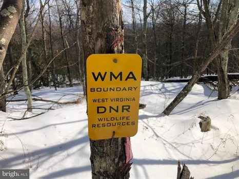
ENDANGERED SPECIES....PROPERTIES LIKE THIS ARE NEARLY EXTINCT......20 GENTLE ACRES ELEVATED AT 3000 FT ATOP SOUTH BRANCH MOUNTAIN AND SURROUNDED BY NATHANIEL MOUNTAIN WILDLIFE MANAGEMENT AREA, WHICH IS 10,000 ACRES OF PUBLIC HUNTING LAND OWNED BY THE STATE OF WV. 100% USABLE LAND, NOT ROUGH & RUGGED....EASY...AND THERE ARE SEVERAL HUNDRED ACRES OF GENTLE STATE LAND ON TOP OF THE MOUNTAIN TO ROAM & HUNT THAT'S FAR FROM ANY PUBLIC ACCESS.....YOU'LL PRACTICALLY HAVE IT ALL TO YOURSELF. EASY TO BUILD ON, POWER & PERKED, WON'T REQUIRE LONG STEEP DRIVEWAY, LOWER INFRASTRUCTURE COSTS THAN MOST LOTS. GREAT VIEWS TO THE SOUTHEAST. THE PROPERTY BORDERS A HIGH TENSION POWER LINE ON THE WEST SIDE BUT BUILDING SITE IS FAR AWAY FROM POWER LINE AND THE LINES ARE NOT IN THE VIEWSHED. THE POWER LINE IS A BONUS, IT PROVIDES A GREAT PLACE TO HUNT AND RIDE YOUR ATV. LONG RANGE SHOOTER? EASILY SHOOT TO 400 YARDS AND BEYOND....THE POWER LINE ALSO PROVIDES 12,000 KWH OF FREE ELECTRICTY PER YEAR TO THIS LOT. IT'S WILD ON TOP OF THIS MOUNTAIN; BUCKS, BEARS & BOBCATS....OH MY! LOCATED IN THE PRESTIGIOUS 10,000 ACRE GATED COMMUNITY ASHTON WOODS, A ONE OF A KIND PLACE, WHERE YOU CAN ESCAPE THE WORK & WORRY OF THE BIG CITY AND TICKLE ALL YOUR OUTDOOR FANCIES....20 MINUTES FROM WAL MART, RESTAURANTS, 4 LANE SUPER HIGHWAY AND MULTIPLE PUBLIC ACCESS POINTS ON THE SOUTH BRANCH OF THE POTOMAC RIVER, 45 MINUTES FROM SKI RESORTS AND AN EASY 2 HOUR DRIVE FROM NORTHERN VIRGINIA. IF YOU LIKE THE OUTDOORS, YOU'LL NEVER GET BORED. TO SAY PROPERTIES LIKE THIS ARE RARE, WOULD BE A GROSS UNDERSTATEMENT....YOU MAY NEVER GET ANOTHER OPPORTUNITY TO PURCHASE A LOT AS UNIQUE AS THIS ONE....THE TYPE OF PROPERTY MANY WANT BUT ONLY FEW CAN HAVE.


08/12/2025
$1,140,338
196.61 ac.
ACTIVE
Tattnall County - 0 Henry Moxley Road, Cobbtown, GA
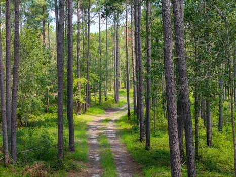
Moxley Farm 197 Acres | Tattnall County, Georgia
Property Overview
Moxley Farm is a rare opportunity to own 197 acres of prime recreational land in Tattnall County, Georgia. This exceptional property combines well-managed timber stands, diverse wildlife habitat, year-round water, and convenient access making it an ideal investment for hunters, outdoor enthusiasts, and timberland investors alike. With established power and water, multiple gated entrances, and outstanding aesthetics, Moxley Farm is truly turn-key.
_______________________________________________________________________________________________
Timber Resource
For generations, the owners of Moxley Farm have carefully managed the timber to maintain a healthy forest, enhance wildlife habitat, and preserve its visual appeal. Periodic thinnings and prescribed burns have produced vigorous stands with strong growth potential and high value.
- 2007 Planted Longleaf Pine: 28.8 acres approaching its first thinning, offering near-term income potential.
- Mature Loblolly Pine Plantation: 119.8 acres groomed for quality sawtimber. Ready for immediate harvest if desired, with excellent reforestation potential.
- Hardwood Stands: Approximately 34 acres of upland and bottomland hardwoods along Beaver Creek, adding diversity, nutrition, and water-quality protection.
________________________________________
Wildlife & Habitat
Moxley Farm proves that top-tier timber management can go hand-in-hand with exceptional wildlife habitat.
- Deer & Turkey: The mix of mature pines, hardwoods, creek bottoms, and strategically placed food plots creates a paradise for whitetail and turkey hunters.
- Creek & Corridors: Beaver Creek and its tributaries provide natural travel corridors, water sources, and habitat diversity.
- Transmission Line Right-of-Way: 8 acres of open corridor offer long-range shooting opportunities and additional food plot potential.
- Understory Growth: Thinned loblolly stands allow sunlight to fuel a lush understory, improving browse and cover.
________________________________________
Improvements
The property includes a 1-acre campsite with water and power already in place. Designed for two campers, the site can easily accommodate more RVs, mobile homes, or additional structures. Underground power is available along Henry Moxley Road.
________________________________________
Water Features
Beaver Creek: A perennial stream running north to south, providing year-round water and excellent habitat.
Three Seasonal Tributaries Additional wildlife value and water diversity.
________________________________________
Soils & Topography
A diverse mix of upland, moderately sloped, and low-lying soils supports both timber production and wildlife habitat.
- High Site Index: Excellent potential for loblolly pine growth.
- Terrain: Gently level to gently sloping (05%), with elevations from 180 at the campsite to 160 along Beaver Creek.
________________________________________
Access
- Road Frontage: 5,200 feet along Henry Moxley Road (1,150 paved, remainder maintained dirt road) plus 1,100 feet along County Road 99.
- Four Gated Entrances: Two on each road, allowing easy access to all areas of the property.
- Convenient Location: Only five minutes from I-16, providing quick access to nearby cities.
Approximate Travel Times:
- Statesboro 35 minutes
- Macon 1 hr 30 min
- Savannah 1 hr 10 min
- Atlanta 2 hrs 45 min
- Jacksonville 2 hrs 40 min
- Orlando 4 hrs 45 min
________________________________________
Summary
Moxley Farm is a premier recreational and timberland tract offering a blend of investment-grade timber, outstanding wildlife habitat, and turn-key hunting amenities. With established utilities, multiple gated entrances, and excellent access to major cities, it's ready for years of outdoor enjoyment and long-term growth.


02/23/2026
$5,250,000
1050 ac.
ACTIVE
Tensas Parish - Highway 888 Lot # WP001, Newellton, LA
Welcome to an exceptional 1,050 acre turnkey hunting property with a 4,650 sq ft lodge in the heart of Tensas Parish, Louisianaan area widely recognized for producing trophy whitetails and unforgettable waterfowl seasons. Located just one-quarter mile from the renowned Tensas National Wildlife Refuge and only a quarter mile from the Tensas River, this property sits in a prime big buck corridor within a proven duck flyway. Surrounded by rich agricultural ground, the combination of habitat diversity and neighboring food sources creates ideal conditions for growing and holding mature whitetails, attracting migrating waterfowl, and supporting a strong turkey population. A majority of the property is in WRE and has a great stand of 28-year-old planted hardwoods, with most in a variety of Oak trees. The lodge has been recently updated and is designed for both comfort and entertaining. Featuring 7 bedrooms and 5.5 bathrooms, it offers ample space for family, friends, or corporate guests. A screened-in outdoor cooking area provides the perfect setting to gather after the hunt and enjoy the peaceful surroundings. Supporting improvements include a large metal equipment shed with a walk-in cooler, allowing you to store machinery and properly care for harvested game easily. For the deer hunter, the property is fully equipped with 10 elevated Redneck fiberglass blinds strategically positioned over 10 established food plots, offering turnkey setups and excellent visibility. The area is known for producing quality, mature bucks, and this tract is no exception. This area is known for killing deer over 150 inches. For waterfowl enthusiasts, the improved duck holes feature new levees and water-control structures, along with approximately 150 acres of potential low-water areas that can be managed to create optimal duck habitat. The thoughtful water management infrastructure provides flexibility to plant, flood, and hold ducks throughout the season. The internal road system is top-notch and truck-ready when things are dry. With convenient highway frontage, premier improvements, and a location surrounded by agriculture in one of Louisianas most sought-after hunting regions, this property is a rare opportunity to own a fully developed recreational tract offering outstanding deer, duck, and turkey hunting all in one package.


07/22/2025
$63,618,090
10692 ac.
ACTIVE
Zavala County - La Pryor, TX
As a result, North Ranch is home to exceptional white-tailed deer and some of the best bird huntingBobwhite quail, dove and Rio Grande turkeysin the state. While the deer have been managed under an MLDP-3 since 2017, the hunting has been limited to the owner's family, friends and invited business associates. Mature whitetails measuring 160" 190" have been harvested over the past three years. In addition, the ranch boasts oryx, axis deer and feral hogs as well as a host of non-game species.
The Land and the Water
The deep, rich blackland found in the river bottom transitions into strong red clay which gives way to sandy loam. Towering pecans, Mexican sycamore and oaks stand sentry along the river, while guajillo, black brush, white brush, mesquite, guayacan and other protein-rich brush species provide food and shelter for wildlife in the uplands.
As part of the brush management plan, the land has been strategically cleared to increase edge preferred by wildlife and strategically roller chopped to increase the diversity of grasses and forbs that are essential to upland birds. Native grasses have been replanted on suitable sites.
The Nueces runs clear and turquoise-hued through the ranch. The river is pocked with deep, blue holes that hold water and allow for swimming and fishing even in the dry years. The North Ranch possesses water rights from the Nueces.
In addition to the river, the North Ranch has approximately 1.5 miles of surface water that measures about one-quarter mile wide. The surface water catchment is a collection of various creeks and ponds that is fed by runoff and irrigation water.
To ensure that water is easily accessible in all quadrants of the ranch, more than 7.5 miles of 2-inch poly water line and an additional 7.5 miles of 4-inch poly water line have been laid and buried. The water distribution system also includes eight cement water troughs that are 8-feet in diameter encircled by 8-foot cement skirts and two cement water troughs, 20-feet in diameter with 8-foot cement skirts.
There are four irrigation wells (one = 120 gal./min.; one = 300 gal./min.; two = 110 gal./min.) The irrigation wells are used, in part, to supply a 40-acre Reinke pivot and a 36-acre Reinke pivot. The pivots water food plots that have traditionally been planted in sunflowers to enhance dove hunting.
To meet domestic water needs, the ranch has two solar wells, six electric submersible wells and another well (60 gal./min.) connected to a 60,000-gallon storage tank that supplies the headquarters compound.
The Living
Thanks to the attention to detail, living is comfortable and easy. The style, as befitting a Brush Country ranch, is rustically elegant.
Working in a style reminiscent of Mexico and the Southwest, artisans combined adobe, stone, hammered metal and wood to create spaces that are inviting, warm and reflective of the region's history, culture and lifestyle. Strategically placed courtyards and gathering areas ensure that family and guests can spend their days and nights soaking up the peace, quiet and textured beauty of South Texas.
The two-bedroom/two-bath Farm House encompasses 1,600 square feet of updated, beautifully appointed living space. Currently used as the owners' home, the open floor plan residence features a kitchen with an eating area and living room.
With four bedrooms and four baths, the 2,500 square foot Dog Trot, situated across the courtyard from the Farm House, serves as a guest house. As the name implies, its architectural design reflects the dog trot cabins favored by early Texas pioneers.
The two-story Chef House, which currently serves as lodging for visiting chefs, features two bedrooms, one full bath and one half bath.
Set away from the main compound, the Cowboy Cabins measure about 1,000 square feet. The lodge, built in a u-shape around a central courtyard, features six bedrooms each with a private bath.
The River House sits near the Nueces. It's currently used as a place to store fishing rods, inner tubes and other gear for water fun, but it could be updated and upgraded to living quarters.
Arguably, the ranch's focal point is the 11,600 square foot Barndominium. The front one-third has been finished as functionally beautiful living space, while the remaining two-thirds is used as storage for hunting vehicles and other equipment.
The living space includes a top-of-the-line commercial kitchen with an attached utility area, a dining area, living room and bathroom. In addition, the Barndominium has four bedrooms each with a private bath. The bedrooms are accessed by a split staircase that is easily reached from the barndo's storage area. This practical configuration allows hunters to wash off the evidence of the day's excursion without passing through the rest of the living space.
In addition to the residences, the North Ranch has a 700 square foot high-capacity laundry and a 500 square foot secure, self-contained gun room.
The Infrastructure
To ensure that both rifle shooters and shotgunners are in top form, the North Ranch has a shooting range and a skeet range. The shooting range, which has a two-story, covered shooting deck, extends 700 yards, with targets at 100, 200, 300, 400, 500 and 700 yards. The skeet range features five stations and an elevated shooting pavilion.
The North Ranch's perimeter is high-fenced and there is also a 3,000 acre high-fenced "enclosure" within the ranch that holds the oryx herd and some axis. In recent years, approximately 7 miles of five-wire cedar post fences have been installed as cross fences.
While the ranch hasn't been grazed in the past three years, it is outfitted to handle cattle with a functional set of working pens. The ranch roads provide easy access to the entire ranch.
In addition to the storage space within the barndominium, there are two equipment barns. One is 2,000 square feet and the other is 4,000 square feet
All furnishings and the 29 Atascosa deer blinds, 31 Atascosa 500-pound corn feeders and 32 2,000-lb. protein feeders convey with the sale.
The Opportunity
For anyone looking for the ultimate recreation destination, the North Ranch has it all. Abundant water. Exceptional habitat. Plentiful wildlife. Well-designed lodging. New infrastructure. And each piece is already in place, so you can begin to enjoy one of the premier hunting and recreation ranches in the country immediately.
Seize this rare opportunity before it disappears as quickly as a wily muy grande into the brush. . .
Existing hunting and grazing leases create an income-producing opportunity for a new owner, if desired.
.
To experience the opportunity of the North Ranch for yourself, call Howard W. Hood at (830) 739-3815 with Hood Real Estate, Inc. The ranch is listed for $5,950/acre.


07/25/2024
$4,150,000
1280 ac.
ACTIVE
Sweet Grass County - Big Timber, MT
The Stagecoach Trail Ranch was once a corridor in the old west providing passage to travelers from Billings to Bozeman. Today this hunters paradise also serves as a major corridor for wildlife between two large land holdings that harbor herds of Elk, Mule Deer and Antelope. Not only does it offer the aforementioned species but, also, it offers black bear, turkey, upland birds, and mountain lion.
The two parcel property consists of 1,280 +/- acres in total. Of this contiguous two section ranch, there is 160+/- acres of dryland hay acreage with the remainder being lightly timbered filled draws and hills. The property gains elevation from east to west with spring fed tributaries carving out draws to the center of the property where the stagecoach trail was once located.
The old stagecoach trail is now part of the county road where the two seasonal tributaries flow towards until meeting the Deadmans Creek that flows west to east throughout the main property.
In its current capacity it is a working ranch maintaining a balance of smaller ruminants and cattle. The headquarters of the ranch features the main 16x80 3B/2B modular home on a foundation, homestead, barn, 7 additional outbuildings, and corrals. Additionally, there is 2023 16x80 3B/2B modular home on a foundation at the eastern border of the property.


02/14/2026
$4,094
0.75 ac.
ACTIVE
Valencia County - Belen, NM
Discover land youll love for only $94/month on 0.75 acres in Belen, featuring a peaceful seasonal creek, dirt road access, and majestic mountains nearby. Private, off-grid, and full of outdoor possibilities, its your perfect retreat.
OWNER FINANCING: $194 down payment + One-time/non-refundable $249 doc fee, then $94/Month for 48 Months
Build your dream life on 0.75 acres in Belen, Valencia County- three side-by-side residential lots offering space, privacy, and endless possibilities.
Wake up to mountain views and a seasonal creek nearby, enjoy your morning coffee as nature surrounds you, and spend evenings around a fire pit or under starry New Mexico skies. This is your chance to embrace a lifestyle of freedom, adventure, and outdoor living.
Property Highlights & Features:
- HOA Fees: No HOA
- Remote & Private Location - perfect for off-grid living
- Three Adjacent Lots - create your dream retreat or future expansion
- Slight Southern Slope - ideal for building or gardening
- Seasonal Creek - adds charm and natural ambiance
- Mountain-Base Location - stunning scenery and hiking opportunities
- Dirt Road Access via Progress Blvd - 4X4 may be required to cross creek
- RV-Friendly - one RV allowed alongside main dwelling with county permit
- Mobile Home Permitted - 840+ sq ft with county approval
- Camping Allowed - immerse yourself in nature with proper permits
- Garden & Outdoor Living Potential - grow vegetables, flowers, or enjoy open space
- Flexible Lifestyle Options - weekend retreat, permanent home, or investment
Whether its a weekend getaway, a permanent retreat, or a smart land investment, this property blends privacy, nature, and convenience. Dont miss your chance to claim this mountain-adjacent paradise for just $94/month!
Here at Lifetime Land USA we pride ourselves in making sure the process is simple, quick and stress-free for you! We also offer easy financing as well as a discounted cash price.
To learn more about us and to view our other listings visit our website today!
PROPERTY DETAILS
APN: 1-020-024-452-425-100110 & 1-020-024-452-425-100120 & 1-020-024-452-425-100130
Size: 0.75
County, State: Valencia County New Mexico
Closest Town: 14 miles to Rio Communities. 16 miles to Belen. 22 miles to Los Chavez. 27 miles to Los Lunas. 1 hr drive to Alburquerque.
Closest Shopping: 14 miles to gas station and grocery store, 16 miles to hardware store, 19 miles to walmart
HOA: No HOA
Highlights: Tucked away in a remote location, great for off-grid living! Composed of 3 adjacent lots. The southern part has a slight slope, and theres seasonal creek nearby. Located at the base of the mountains. Dirt road access on Progress Blvd. A 4X4 vehicle may be required to cross a seasonal creek.
Utility Options
Power: Contact the local power provider for availability. Solar panel, wind, and propane generation are all great alternatives.
Water: Water well or cistern would be required.
Septic: Septic system would be required.
Additional Zoning Notes
Camping/RV: Allowed 6 months with a permit from the County.
Mobile Homes: Allowed, minimum 840 sq.ft.
Custom Homes: No minimum sq.ft. Tiny Homes allowed! Any structure 120 sq.ft or larger requires county review.
Get in touch with one of our representatives today by visiting our website or reaching us by phone/email so we can help you find your perfect fit!


07/18/2024
$10,873,800
1726 ac.
ACTIVE
Hyde County - 416 Firetower Rd, Scranton, NC
KEY POINTS:
* Over 6.00 +/- Miles of Waterfrontage on the Pungo River and Intracoastal Waterway
* Over .75 +/- Miles of Waterfrontage on the Intracoastal Waterway
* 2.00 +/- Miles of Paved Road Frontage, Most on US Highway 264
* 4.30 +/- Miles of Interior Rock-Based Road System
* 10 Acre Lake for Great Duck Hunting and Fresh Water Fishing
POTENTIAL USES:
1. World Class Hunting Preserve
2. Corporative Retreat
3. 20+ Acres Per Lot Residential Subdivision Based on Using Existing Road System
4. RV Park on ICW
5. Mini Home or Park Model Rental Development on ICW and Lake
6. Great Long Term Timber Investment
7. A Wonderful Private Estate
What a GREAT property with so many potential uses. This is truly a One-of-a-Kind property. With a large amount of waterfrontage and highway frontage, the possibilities are endless. The tract has a lot of Bear on it which in return creates World Class Hyde County Bear Hunting. As most people know, hunters come from all over the world to hunt Bear in Hyde County. With the tract being in the Atlantic Flyway, the Duck Hunting will be great, and as we all know, the fishing in the Pungo River and Pamlico Sound is "Off the Hook"! If you want a large private estate to build a large house on beside the ICW and sit on your deck and watch the Mult-Million-Dollar yachts go by going from the Northern States to the Caribbean, then this is your tract. The 10-acre lake will be a great addition for any project you choose. The high land on part of the ICW beautiful waterfrontage would be great to develop a RV Park on or develop a Mini Home Park Model rental subdivision project on. Overall, most of this tract is well drained and for Hyde County, the elevation of most of the tract is good. The property is located just 13 miles from Belhaven where there are good restaurants to eat fresh seafood. This tract is a GREAT TIMBER INVESTMENT property. Remember, the beautiful, planted pines are growing while you sleep. Regarding airports, Warren Field in Washington, NC, and in the opposite direction, the Hyde County Airport located in Englehard, NC are both just 40 miles away, and you can land a private jet at both locations. The property is located 156 miles from Raleigh, NC and 151 miles from Norfolk, VA. This is a rare find; do not let it pass you by. Once it is sold, it becomes someone else's dream. This property is shown by private showings only. Only serious inquires please.


03/07/2025
$229,999
20.95 ac.
ACTIVE
Coconino County - 5823 Cattle Guard Rd, Williams, AZ
20.95 Acres Cabin Property Mobile Homes & RV Allowed! In Williams, Coconino County AZ (3 of 3 Adjoining Parcels)
Discounted Cash Price: $229,999
Or Choose Your Owner Financing Plan:
$45,999 down, $3,439/month for 84 months
$34,499 down, $3,279/month for 102 months
$22,999 down, $3,199/month for 120 months
Do you want your own custom plan? call or text us today to discuss how much you'd like to put down.
There are NO Credit Checks. There is NO Prepayment Penalty, you can pay off the property at any time. Title is Free and Clear.
Don't miss this 20.95 Acres property in Arizona featuring a Cabin, beautiful mountain views, solar power, mobile homes and RV is allowed. This perfectly situated property in Coconino County is ideal for manufactured/modular homes, mobile homes, site built homes, hobby farms and livestock, recreation (dirt bikes, ATVs), or a tool shed/barn.
Elevation: The property elevation is around 6,224 feet and is pretty flat.
There are wells in the area, with depths ranging from 140 feet - 3000 feet.
Property Uses: There are some neighbors that have built on or started to use their property. Some neighbors use RV, sheds or barns, manufactured homes and site built homes.
Camping & RV: Do you want to immediately start enjoying this property and drop your 5th wheel? Go for it. RV is allowed with a temporary use permit for 120 consecutive days per year. RV is allowed temporarily while construction.
Amenities: The property is located off AZ-64 (4.6 miles away). The town of Williams is about 51 minutes South and Chino Valley is about 1 hour 37 minutes south. Chino Valley and Williams offers you a wide range of necessities and services - including grocery stores, gas stations, Safe Ways, Circle K, Family Dollar, Subway, Walgreens, ACE Hardware, O'Reilly Auto Parts, pharmacies, medical clinics, and regional airports.
In the area you will have access to schools for kids of all ages, regional airports, hospitals, and medical clinics.
International Airport: You will find an international airport in Laughlin, 3 hours 4 minutes from the property.
BLM Lands Nearby: You can also enjoy nearby access to over 2 million acres of BLM lands, and tens of thousands of acres of publicly accessible state trust lands.
Outdoor Recreation: If you want to get out for some adventures, you can check out nearby Grand Canyon National Park, or Coconino National Forest. Both are within 1 hour 27 minutes drive. You'll find lots of scenic landscapes to hike through, diverse terrain, and amazing camping spots. You could also take the opportunity to fish, or go mountain biking, horseback riding, or off-roading.
You can easily secure this property today to start enjoying everything that Arizona has to offer. Call or Text us anytime to get started or learn more.
Details
Gate controls access at the SW corner. Code is 2319.
Address: 5823 N Cattle Guard Rd, Williams, AZ, 86046
Parcel Number: 502-26-024C
Legal Description: A portion of Lot 108 of Woodland Ranch, as recorded in Book 3, Page 98-K of the Records of Coconino County, Arizona, more particularly described as follows: The Southerly half of Lot 108 of Woodland Ranch, as recorded in Book 3, Page 98-K of the Records of Coconino County, Arizona.
County: Coconino
Size: 20.95 Acres
Property Survey or Plat Map: Yes click the link
Appraisal Report: Valuing the Property at $270,000 in March 2024
Structure: Off Grid Cabin
Bedrooms: 1
Bathrooms: 1
Square footage above grade: 766 sq ft
Power: Solar panel array in place
Gas: Propane tank
Water: Collection tanks in place, Water can be Delivered, or Drill a Well
Sewage: Septic tank installed
Amenities: Wood stove, Wall Heaters, Covered Deck, Barbecue, Wire fence, 2 Outdoor Shipping Containers for Storage
Phone: Cell or Satellite (coverage map)
Zoning: G General-10AC min (Coconino County Zoning Ordinance)
Camping and RV: RV is allowed temporarily for 120 consecutive days per calendar year. RV is allowed for up to 6 months while construction, upon issuance of a building permit (Coconino County Land Use Code)
Mobile Homes Allowed?: Yes
Manufactured Homes Allowed? Yes
Site Built Homes Allowed?: Yes
Minimum Square Footage: No minimum
HOA: None
Flood Zone: No (Refer to Land id map above)
Wetlands: No (Refer to Land id map above)
Access: Gravel Road
Annual Property Taxes: $541
General Elevation: 6,224 feet
Terrain: Level
Dimensions: 1323 x 735 x 1325 x 673 feet
Conveyance: Warranty Deed
Title: Free and Clear
Google GPS Corner Coordinates
NW: 35.7431, -112.0666
NE: 35.743, -112.0621
SW: 35.7412, -112.0666
SE: 35.741, -112.0621
Approximate Distance to Nearby Cities & Points of Interest
16 minutes to AZ 64
Welcome to the charming town of Williams, Arizona, where a blend of small-town warmth and scenic beauty create the perfect backdrop for your new home. Nestled amidst the Ponderosa pines and with the historic Route 66 running through, Williams offers a friendly community atmosphere with easy access to outdoor adventures and local attractions. Embrace the spirit of the Southwest and make Williams your gateway to a relaxed and picturesque lifestyle.
51 minutes to Williams: Population 3,234
1 hour 37 minutes to Chino Valley: Population 13,100
43 minutes to Grand Canyon Village: Population 2,064
1 hour 13 minutes to Flagstaff: Population 78,000
3 hours 4 minutes to Laughlin/ Bullhead International Airport
Points Of Interest
Embark on an awe-inspiring adventure at Grand Canyon National Park in Arizona, where nature flaunts its most magnificent masterpiece. Marvel at the colossal beauty of the canyons vast, breathtaking landscapes, and let the friendly whispers of the Colorado River below remind you of the timeless wonders carved by Mother Nature. Its not just a canyon; its a friendly invitation to stand on the edge of wonder and soak in the grandeur.
37 minutes to Grand Canyon National Park
Activities at Grand Canyon National Park: hiking, mountain biking, fishing, camping & RV and boating.
1 hour 27 minutes to Coconino National Forest
Activities at Coconino National Forest: camping, fishing, hiking, walking, mountain and road biking.
Lots of nearby walking, hiking, and biking trails to choose from: Buckskinner Trail, Sycamore Rim Trail, Dogtown Lake Trail, Secret Mountain Trail, Gold Digger Trail.
Call or Text us anytime for questions or to learn more about how to purchase this property.


03/14/2024
$169,900
35.67 ac.
ACTIVE
Fremont County - County Road 69, Canon City, CO
BRADLEY HOMESTEAD RANCH LOT 3 - 35.67 ACRES IN SCENIC VALLEY WITH TOTAL PRIVACY
This 35.6 acre lot borders BLM lands for over 2600' and also has over 3000' of county road frontage. No shared roads and no maintenance costs. This lot has an abundance of usable land providing you with multiple locations to place a scenic driveway to a private building site, directly off the county road. You will discover that the gentle rolling hills combined with the gently sloping meadows would make this lot ideal for an equestrian property. There are multiple existing trails on this lot with one trail providing direct private access to thousands of acres of BLM lands. The elevation is a comfortable 6000 near the elevated building sites, and drops to 5940 along the county road.. This lot provides an ideal mix of cedar and pinyon pines lining scenic drainage areas which are ideal for hiking and exploring. The rolling mountain meadows provide spectacular views of the picturesque valley.
BRADLEY HOMESTEAD RANCH - CANON CITY, COLORADO
Bradley Homestead Ranch is a new offering of some of the more desirable and accessible low elevation ranch parcels remaining along the Front Range. This 35.6 acre ranch offers great privacy and seclusion with a perfect mix of meadows, rocks and rolling pine covered hillside. The land also benefits greatly from being located in a very mild temperate climate. Access to the ranch is via Fremont County Road 69, a year round county maintained road. The views from this ranch are very soothing of the scenic mountain valley in which it is located, and of the surrounding mountains and red rock covered hillsides. An overhead electric line runs through the lot providing you electric service anywhere on the Lot.
BRADLEY HOMESTEAD RANCH - CANON CITY, COLORADO
Bradley Homestead Ranch is a 250 acre ranch carefully designed into 4 private Lots, all bordering thousands of acres of BLM Lands. The land is framed by inspiring red rock buttes and scenic red rock formations towering above the hillsides in the adjacent BLM land. The land is covered with juniper and pinyon trees with generous meadow space for endless recreational activities or horse facilities. The seasonal creek bottoms are lined with some majestic cottonwood trees providing some summer shade. At 6000 feet elevation, enjoy year around comfort with the low humidity in this comfortable semi-arid climate. You can enjoy an average of 260 days of sunshine per year with average July high temperatures around 86 degrees, and January high temperatures averaging in the mid- 40's. With only 74 days of precipitation,13 inches of average annual rainfall, and 43 inches of annual snowfall, this ranch will provide you with comfortable year round living. The property is easily accessible year round by a county maintained road, with the roads lying inside Shaws Park Ranches being private.
LOCATION - 1 HOUR FROM COLORADO SPRINGS
Bradley Homestead Ranch is conveniently located just 1 hour southwest of Colorado Springs and just 3 miles north of State Highway 50, on Fremont County Road 69. The ranch is only 10 minutes from Canon City, 2 hours from Denver, 1 hours to Monarch ski resort, and approximately 2 hours to world class skiing in Breckenridge. Canon City offers all the essential amenities you might need including a hospital, BLM land offices, and all of the major big box retail stores.
RECREATIONAL OPPORTUNITIES
Ideal for year-around outdoor activities, Bradley Homestead Ranch offers trophy mule deer hunting, hiking, horseback riding, ATV-ing, dirt biking and more on this private 35.6 acre property. Nearby recreation venues include the Royal Gorge and Royal Gorge train ride for an amazing scenic and dining experience. You can also enjoy rafting and fly fishing trips in the nearby Arkansas River which is less than 10 minutes from the ranch. The adjacent BLM lands include thousands of acres with trails for ATV and horse riding, and miles of hiking trails, and trout fishing in Four Mile Creek. This ranch provides unlimited recreational opportunities.
WATER RIGHTS
Bradley Homestead Ranch does not own any water rights. Colorado law does allow an owner to drill a domestic well on Lots greater than 35 acres in size which would allow for irrigating up to one acre of land, and filling of stock tanks along with all household uses.
AGRICULTURAL ZONING
Bradley Homestead Ranch is zoned agricultural resulting in low property taxes. The rancher may run cattle on the land thru 2025. Fremont County also has reasonable building requirements, especially for agricultural buildings.
MAP
The map is a a representation of approximate property lines with all Lots having been newly surveyed and staked, with the Plat recorded in Fremont County.


10/27/2025
$9,997
5.36 ac.
ACTIVE
Costilla County - 0 Sauder Road, Fort Garland, CO
*** 5-Day Become A Landowner Challenge: Start For Just $1 Down ***
Over 700 people have already done this, will you be next?
Here's the plan:
Day 1: Book Your Free Call to Join Our 5-Day Landowner Challenge
- Let's explore your land options together and unlock exclusive offers you won't find online. Go to: call.gokcap. com
Day 2: Place the Property on Hold
- Hold your property on our website so no one else can grab it, you're officially on the path to becoming a landowner.
Day 3: Explore Your Land
- Step onto your land, even virtually, do your homework, and imagine how you'll make it your own.
Day 4: Pick Your Path
- Choose the payment plan that's right for you, with 5% cash back rewards, 9 free bonuses, and a 365-Day Land Exchange Guarantee to keep you safe.
Day 5: Celebrate Ownership
- Sign your agreement and join the community of 700+ proud landowners.
Dear Land Buyer,
Are you looking for wide-open space, fresh mountain air, and a place where you can finally live life on your own terms?
This 5.36-acre property in Costilla County, Colorado could be your escape.
- Hold it now for just $50 on our website. Make-It-Yours Monday coupon available on our website.
With gentle 2-6% slopes and sparse grassland dotted with native shrubs, it's easy to imagine building your dream cabin, setting up an off-grid retreat, or simply investing in land you can hold for the future.
There is no special hazard flood zone, and the property sits on a quiet dirt road, providing peaceful seclusion without feeling completely isolated.
The lot is zoned Residential, which means you can build a single-family home, cabin, or manufactured home.
Since there's no HOA, you won't have to worry about unnecessary rules or fees.
Electricity here would likely come from solar or another renewable source, and you can install a well and septic system for full self-sufficiency.
Costilla County is becoming a popular choice for people looking to live closer to nature while staying within reach of amenities.
The area is known for its mountain views, wildlife, and outdoor recreation from hiking and fishing to stargazing under some of the darkest skies in Colorado.
As nearby towns like Fort Garland and San Luis continue to grow, properties like this are becoming harder to find at such an affordable price.
So if you've been waiting for the right place to build, camp, or invest, now's the time.
Note:
All information provided is based on our own research. We always recommend confirming details like zoning, access, and utilities directly with Costilla County before building or making plans.
A one-time document preparation fee is paid upfront at closing and covers deed preparation, recording, and administrative costs.
LOT BREAKDOWN: WHAT YOU'RE GETTING
Assessor's Parcel Number: 70264330
Legal Description: S.D.C.R Unit U Blk 164 Lot 2930 Cont. 5.366 Ac.
Elevation: 8160
GPS Center Coordinates (Approx.): 37.44676, -105.36397
Annual Taxes: ~$151.20
Zoning: Estate Residential
Time Limit To Build: None as far as we are aware
Access: Dirt Road
Power: Electricity would likely to have to be solar or another alternative system
Water: A well would need to be installed
Sewer: A septic system would need to be installed
Official Contacts: Please contact Costilla County
RVs Allowed? We recommend that you contact Costilla County to confirm but, according to our research, camping is allowed for up to 14 days every 3 months, or apply for a permit if you'd like longer stays
Buildable? Because we do not know the specifics of what you may want to build on the property, we recommend that you contact the building and/or zoning department(s) for more information on the relevant zoning and building regulations and how to obtain a building permit
Survey Available? No, we have not had a survey commissioned, but we do have a copy of a plat. If you would like to pay for a survey we would be happy to work with your chosen surveyor
In HOA? No HOA
Annual HOA Dues: ~$0.00
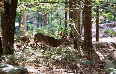

10/07/2025
$34,900
5 ac.
ACTIVE
Le Flore County - Honobia, OK
Lot #34 Secluded 5-Acre Wilderness Tract in The Preserve at Boktuklo Mountain
Property Summary Lot #34 is a beautiful 5-acre tract priced at just $37,500 in the gated Preserve at Boktuklo Mountain. With a blend of mature hardwoods and pine, gentle slopes, and multiple potential cabin sites, this lot offers a secluded way to invest in southeastern Oklahomas most scenic mountain development. A completed survey is included, and owner financing is available with flexible terms.
While taking listing photos of Lot #34, we spotted a beautiful, mature 10-point buck a true testament to the area's thriving wildlife population.
This 5-acre parcel offers privacy, natural beauty, and ease of access with gravel road frontage connected directly to Highway 144. Ideal for a cabin or off-grid retreat, the land features wooded cover, gently rolling terrain, and multiple buildable spots.
Topography and Features The land is wooded and moderately sloped, offering shade, seclusion, and wildlife habitat. It's well-suited for solar, well, and septic systems for those looking to live off-grid.
Potential Uses Perfect for a hunting base-camp, weekend cabin, tiny home site, or RV setup. With no build timeline, you can purchase now and develop lateror simply hold as a long-term investment.
Outdoor Recreation and Surroundings Located near the Three Rivers Wildlife Management Area and surrounded by undeveloped timberland, Lot #34 provides quick access to public lands for hunting, hiking, fishing, and ATV riding.
Location Details Just 5 minutes from Honobia, 25 minutes north of Hochatown, and 3 hours from the Dallas-Fort Worth Metroplex. All roads are gravel-maintained and accessible year-round by 2WD vehicles.
Community Covenants The Preserve uses light-use covenants to protect the lands character and value. Cabins, RVs, off-grid homes, and barndominiums are allowed. Mobile homes and disruptive commercial uses are prohibited. There is no HOA.
Conservation and Development Ethos Previously a state-managed wildlife area, The Preserve is now a 1,229-acre development focused on privacy, sustainability, and habitat preservation. With over 12 miles of gravel roads and trails, this community is ideal for nature lovers.
Owner Financing Terms Purchase for $37,500 with owner financing available: 10% down, 10-year term, and 12% fixed interest. Lower interest rates may be available with a larger down payment.
Why Choose Lot #34? Lot #34 is a secluded entry point into one of Oklahomas premier mountain developments. With privacy, natural beauty, a completed survey, and flexible financing, its a perfect place to begin your landownership journey.
Call or text Blue River Realty at 539-426-1374 today to schedule your tour or learn more about Lot #34!

03/07/2025
$1,075,000
162 ac.
ACTIVE
Edwards County - SD 45015, Rocksprings, TX
This ranch has it all! With excellent access, first-class accommodations, exceptional hunting opportunities, and breathtaking Hill Country terrain and views, it truly offers the best of everything. Whether you're seeking a luxurious family hunting retreat or a serene place to hang your hat, this ranch is a must-see. Check out the details below.
Located in western Edwards County just over a mile off the highway via excellent maintained road
Less than 25 minutes from Rocksprings
The terrain offers a perfect blend, from level valleys with minimal rock and large live oaks and mesquite, to hilltops that offer up spectacular 30 mile views
Great private ranch roads
Completely perimeter fenced
Stunning custom pipe custom entrance with electric gate
The luxurious accommodations feature a custom-built main house spanning approximately 860sqft, complete with a spacious master bedroom, expansive sleeping loft, vaulted ceilings, custom cedar woodwork, custom cabinetry, top-of-the-line appliances, a striking floor-to-ceiling rock fireplace,
+/-306sqft of front and rear porches, along with a beautifully crafted rock walkway leading to the cozy rock fire pit
The 720sqft metal building on a slab offers ample space for storing equipment and also boasts a bunkroom for overflow guests
There is also an outbuilding with a retractable roof that houses a Meade LX 200GPS telescope for viewing the stars
Private water well with large storage tank, electricity, licensed septic
Other extras that convey are:
Custom built well shed
3 hunting blinds, 5 corn/protein feeders, 3 hay feeders, 4 watering troughs - 3 with storage tanks, one tied directly to the water well
The hunting on this ranch has been meticulously managed
Areas have been left undisturbed and currently are home to abundant axis
The other game includes turkey, hogs and aoudad with great quality whitetail for this part of the hill country
Wildlife exempt taxes
This ranch is turnkey, plush and game rich. Give us a call to schedule a showing soon!!
Western Hill Country Realty Listing #145
***Please Note: The "County Road" shown on the interactive map is a mapping error by Google and does not exist. There are no easements through this ranch.
The 5 H Ranch is a remarkable +/-162-acre property that truly has it all -- excellent access, first-class accommodations, exceptional hunting opportunities, and breathtaking Hill Country views. Whether you're seeking a luxurious family hunting retreat or a peaceful place to relax and enjoy nature, this ranch offers the very best of everything.
Located in western Edwards County, Texas, the ranch sits just over a mile off the highway via a well-maintained road and is less than 25 minutes from Rocksprings. The terrain is a perfect mix, with level valleys boasting minimal rock and dotted with large live oaks and mesquite, as well as hilltops that provide spectacular 30-mile views. Well-developed private ranch roads make navigating the property a breeze, and the perimeter is completely fenced. The entrance is nothing short of stunning -- a custom pipe gateway with an electric gate sets the tone for the quality found throughout the ranch.
The main residence is a beautifully designed custom-built home of approximately 860 square feet. Inside, you'll find a spacious master bedroom, an expansive sleeping loft, vaulted ceilings, custom cedar woodwork, handcrafted cabinetry, and top-of-the-line appliances. A striking floor-to-ceiling rock fireplace creates a warm centerpiece for the living space. Outdoor living is equally inviting, with +/-306 square feet of covered front and rear porches, a rock walkway, and a cozy rock fire pit.
Additional structures include a 720-square-foot metal building on a slab-ideal for equipment storage and featuring a bunkroom for extra guests, and a unique outbuilding with a retractable roof housing a Meade LX 200GPS telescope for stargazing under the clear Texas skies. The property is fully equipped with a private water well, large storage tank, electricity, and licensed septic system. Extras that convey with the sale include a custom-built well shed, two hunting blinds, one corn feeder, three hay feeders, and four watering troughs (three with storage tanks and one tied directly to the well).
The hunting on 5 H Ranch has been carefully managed to ensure a healthy, thriving game population. Certain areas have been intentionally left undisturbed, creating prime habitat for abundant axis deer. Other wildlife on the ranch includes turkey, hogs, aoudad, and high-quality whitetail deer for this part of the Hill Country. Wildlife exemption in place.
This turnkey, game-rich property is plush, well-maintained, and ready for its next steward. Listing #145 5H Ranch with Western Hill Country Realty is sure to impress.
Please note: The County Road shown on the interactive map is a mapping error by Google--there are no easements through this ranch.


02/24/2026
$237,465
17.59 ac.
ACTIVE
McCulloch County - 5470 US Highway 283, Brady, TX
Tract 25 Lohn Hollow Ranch with Cow Creek Running through it.
Lohn Hollow Ranch is located just 9 miles north of Brady, Texas in the heart of McCulloch County. This area is known as the geographic center of Texas and sits within the western edge of the Hill Country transition zone, offering a beautiful blend of rolling terrain, productive native pasture, and classic Central Texas character. The ranch features gently rolling hills, scenic draws, and hardwood-lined hollows that give the property its name. The terrain varies from open native grass pastures ideal for livestock and wildlife to brush-covered ridges providing excellent cover and habitat. Native vegetation includes live oak, post oak, mesquite, elm, hackberry, and cedar, along with seasonal wildflowers and native grasses that thrive in this well-balanced ecosystem. Lohn Hollow supports an excellent population of native wildlife including whitetail deer, Rio Grande turkey, dove, quail, and feral hogs. The diverse mix of open pasture and thicker cover creates prime hunting opportunities while also making the property equally attractive as a recreational ranch, weekend getaway, or long-term investment hold. Convenient access to Brady provides nearby amenities while still offering privacy and seclusion. The property’s topography, views, and native beauty make it an outstanding candidate for a homesite, family ranch, or legacy property in a highly desirable and central Texas location. Lohn Hollow Ranch represents a rare opportunity to own a scenic, well-rounded ranch property in one of the most authentic ranching regions of Texas.


05/01/2023
$26,500,000
1899.83 ac.
ACTIVE
Bandera County - Bandera, TX
Major Price Improvement! Was $16,000 per acre, now $13,950 per acre. Sitting on the headwaters of Myrtle Creek in a ruggedly beautiful box canyon in Bandera County BW Ranch offers live water and some of the most magnificent views in the country. The 1899.83-acre ranch, which fronts FM 2828, is just 12 miles from Bandera, 17 miles from Kerrville (and its airport with two runways up to 6,000 feet), and 42 miles to San Antonio.
Land, Wildlife and Water
In Texas, it is rare for a ranch to include an expansive stunning viewshed as a primary asset. The BW Ranch showcases 24 peaks, expansive valleys and views that stretch to Bandera, Kerrville and Medina.
The ever-changing landscape is enhanced by diverse vegetation. Cypress trees surround the main lake. Pecan trees shade the valley. Live oaks and Spanish oaks dot the native grasslands. A lone bull mesquite shades the pavilion. Cedar has been aggressively cleared and prescribed burns have been used to clear and reinvigorate the land. As a result, desirable native Hill Country browse provides a nutritious buffet for wildlife.
Whitetails that benefit from enhanced genetics, Rio Grande turkeys, dove and bobwhite quail are native to the ranch. A herd of bison, numbering upwards of 50, graze the flats and hillsides. Auodad sheep along with blackbuck antelope, axis, fallow and sika deer also call the ranch home. Other wild denizens include coyotes, bobcats, mountain lions and a host of other non-game species and songbirds.
Two Longhorns also roam the ranch. Ones horns measured 13.5 feet the last time a tape was put to them. Those numbers place him in world-record territory.
Year-round Myrtle Creek brings life-giving crystalline water to the property. It feeds nine dammed ponds, making water for wildlife easily accessible throughout the ranch.
An 8-acre spring-fed lake, stocked with largemouth bass enhanced by Florida bass genetics, blue cats, blue gills and sun perch is arguably the recreational focal point. Anglers have landed some bass that tipped the scales at more than 14 pounds. A boat house, with a bathroom, a fish cleaning station and a pontoon boat, ensures that family and friends can make the most of the clear, inviting water.
The ranch boasts second spring-fed lake, which is smaller. It, too, is stocked with desirable fish for additional angling fun.
Living
The three-bedroom/two-bath ranch house reflects its setting. Native limestone defines the exterior and interior flourishes including the impressive fireplace. Built with an eye to simple, comfortable elegance, the bright airy home combines soaring ceilings, shiplap, warm wood accents, Saltillo tiles and oversized windows. In the sunroom, which overlooks a pond surrounded by a bounty of native vegetation, the line between outside and inside is seemingly invisible.
In addition, the homes open floor plan includes a well-appointed kitchen, living room and trophy room. It's aesthetic and design invite gathering.
Building sites, with exceptional views, abound. The possibilities for creating a livable masterpiece built to the new owner's taste and specifications are limitless.
A nearby open-air pavilion, reminiscent of old-time Hill Country dance halls, takes the party outside. The pavilion, which follows the architectural theme of the main house, includes a full kitchen and large fireplace.
The comfortable three-bedroom/two-bathroom caretaker's quarters with a full kitchen and large porches, front and back, is situated nearby. Currently, it is used for employee housing, but could host overflow guests.
Infrastructure
More than 25 miles of improved roads stretch to the highest peaks and most far flung corners providing complete, easy access.
The main barn (approximately 40 x 60), which is constructed from metal and insulated, features four horse stalls, an office with a shower, a tack room and a tool room. Twelve-foot-tall doors on both ends keep equipment access simple.
An equipment barn (approximately 20 x 45) with a game cleaning station that includes winches, running water and a walk-in cooler rounds out the infrastructure.
The Opportunity
The Hill Country is known for its live water and breathtaking scenery, but its rare to find a ranch that has both with plenty of elbow room. The fact that BW Ranch is also conveniently located to small towns and San Antonio makes it one of one.
To experience the natural beauty of the BW Ranch for yourself, call Howard W. Hood with Hood Real Estate Inc. at (830) 739-3815. The ranch was listed for $16,000 per acre. Now just $13,950/acre.
11/27/2025
$895,000
31.69 ac.
ACTIVE
Carroll County - 3140 Rowland Mill Rd, Buena Vista, TN
31.7 Acres New Barndominium Modern Comfort Buena Vista, TN
If privacy, space, and modern living are at the top of your list, this newly built barndominium on 31.7 acres in Buena Vista, TN checks every box. Featuring 4,785 sq. ft. of heated & cooled living space plus 1,265 sq. ft. of timber-framed, vaulted porches, this property blends luxury with the West Tennessee lifestyle.
Step inside to an open and inviting floor plan with: 3 Bedrooms / 2.5 Baths
Granite Countertops & Large Pantry
Soaring Vaulted Ceilings
Concrete Floors (left unstained for the buyer to choose their finish!)
Brand-new systems throughout Well, Septic, HVAC & Spray-Foam Insulation
The attached 43' x 48' garage is a standout feature, offering 16-ft ceilings and oversized doors ideal for vehicles, equipment, boats, RV storage, a workshop, or hobby space.
Outside, the possibilities are endless. The acreage provides a quiet and private setting, room to roam, homestead, hunt, ride trails, or develop into your own personal retreat. Acreage combined with new construction and modern comfort is becoming harder to find and this rare offering delivers it all.
Buena Vista, West Tennessee
New Construction + Acreage + Privacy
Move-in ready and designed for the lifestyle youve been searching for


05/01/2024
$2,837,200
333.8 ac.
ACTIVE
Wise County - FM1810, Chico, TX
LAND / TERRAIN
This exceptional property showcases a captivating expanse of rolling to heavily rolling native Texas terrain, offering both beauty and character across every acre. The landscape is adorned with a rich and varied canopy of native hardwoods and evergreens, including post oak, live oak, red oak, elm, juniper, Texas ash, and mesquite. This diverse tree cover provides superb natural habitat and thermal cover for an abundance of wildlife. The understory is equally rich, with an abundance of deer browsewoody shrubs and forbscreating ideal foraging conditions for native game, particularly white-tailed deer.
The land is graced with dramatic sandstone outcroppings and surface stone that cover over 90% of the acreage, adding texture and rugged charm to the scenery. Throughout the seasons, vibrant wildflowers dot the landscape, enhancing the natural beauty with bursts of color and native charm.
IMPROVEMENTS
The property features high fencing along two of its boundaries, enhancing wildlife management potential and offering flexibility for future improvements or operations.
WATER
Water features are a highlight of this tract, with the scenic Elm Creek meandering through the land, offering both visual appeal and a vital water source for wildlife. A natural spring and two serene ponds further enhance the water profile. Additionally, a newly drilled water well provides a reliable source of groundwater, supporting potential residential or agricultural use.
WILDLIFE
This land is a haven for wildlife, with frequent sightings of white-tailed deer, wild turkey, feral hogs, and various other native species. The diverse ecosystem and abundant natural resources support a thriving wildlife population year-round.
MINERALS
No mineral rights are currently owned with the sale of the property. There is one active pumping unit located on the tract.
PROPERTY TAXES
Ad valorem taxes for the year 2023 amounted to a modest $191.64, indicating potential agricultural valuation or wildlife exemption in place.
COMMENTS
This is truly a remarkable offeringa scenic, wildlife-rich property with rolling terrain, numerous ideal building sites, and convenient paved frontage along a Farm-to-Market road. The presence of multiple water features, nearby utilities, and excellent access further enhance its appeal. Several pipeline easements are present.
PRICE
Now offered at a reduced price of $8,500 per acre, down from the original listing price of $9,750 per acre, presenting an exceptional value for a property of this caliber.


1
2
3
4
5
6
7

